 Use Marker Groups
 Wolf 2002
Piru 2003
Day 2006
Zaca 2007
Gap 2008
La Brea 2009

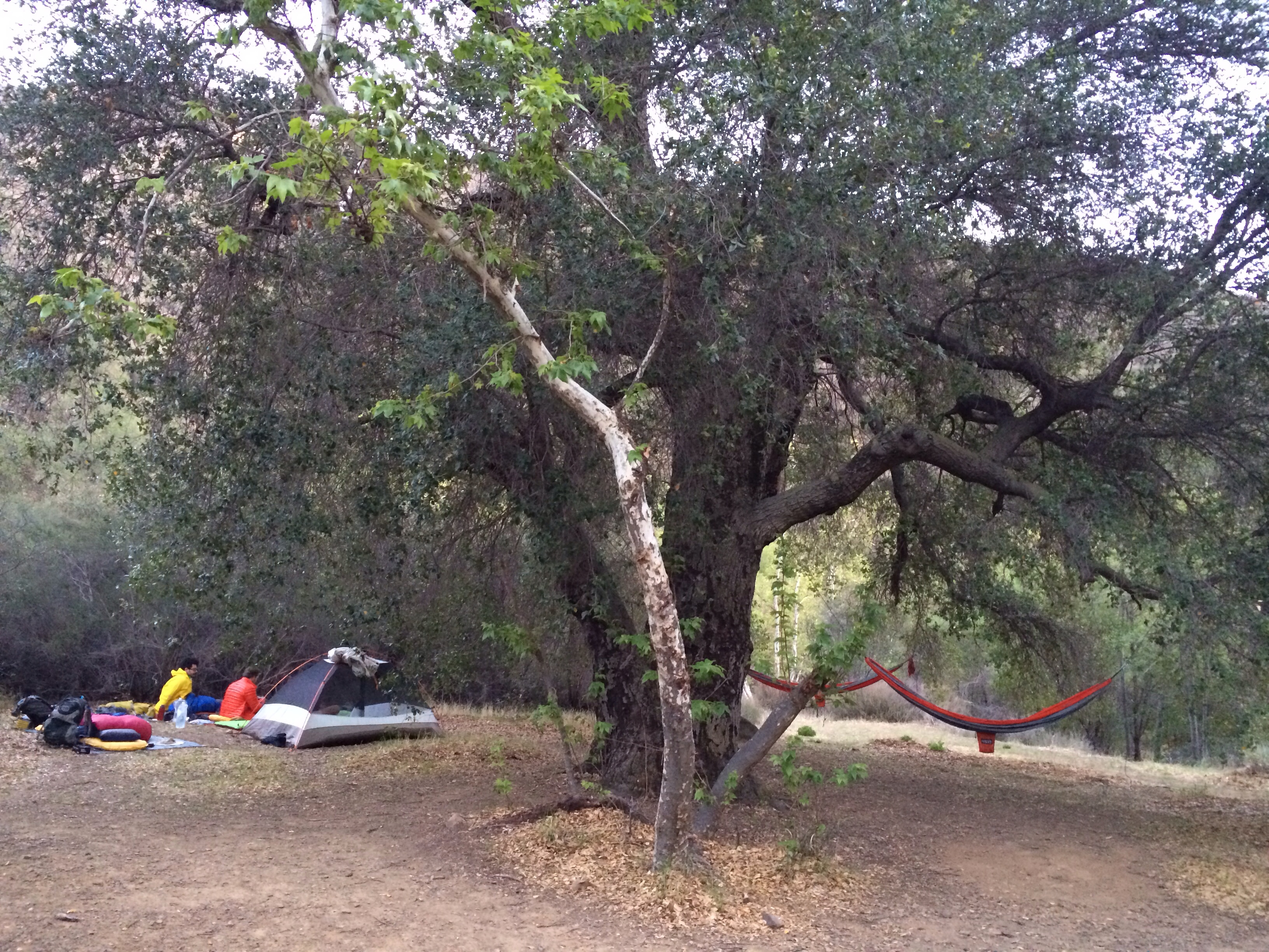
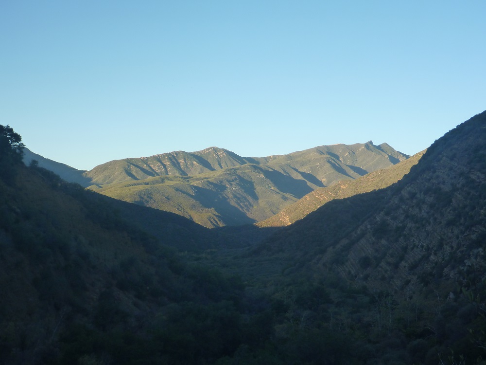
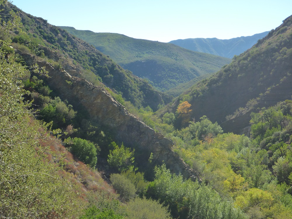
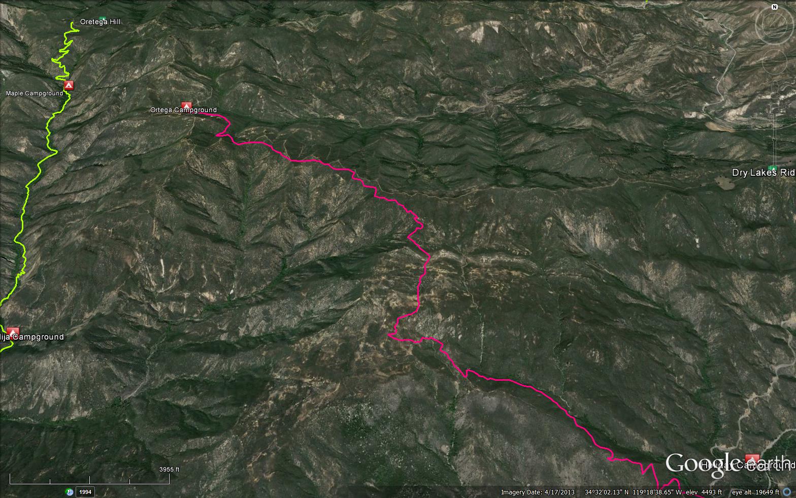
Southern access point is the same trailhead as the Murietta Trail (24W07). Leading off to the right after the second stream crossing, the trail enters the wilderness and follows the year-round creek. From the gate you'll reach Matilija Camp after 1.48 miles. Further up the canyon are three more camps: Middle Matilija (4.1 miles), Upper Matilija (5.7 miles) and Maple (7.5 miles). All four camps offer shaded stream-side sites. After another 1.6 miles, the trail ends at a seasonally open dirt road that leads north down Cherry Canyon to Highway 33. For the northern access point, go 27.4 miles north of Ojai on Highway 33 and turn left on rough dirt road up Cherry Canyon. Travel 3.0 miles to the trailhead at the ridge top. Please check with the Ojai Ranger District before your visit.


 North Fork Matilija Trail Survey - 10-12-2024 - by Forest
| Link: | North Fork Matilija Trail |
| Date: | 10-12-2024 |
| Surveyor Name: | Forest |
| Trail description: | I lost the trail about a quarter mile from the trailhead off the road. I spent some time wandering around looking for it (following the downloaded Alltrails map) but was never able to get back on track. The creek is not too deep and it wouldn't be very hard to just creek walk the whole thing, but I had a friend meeting me later and didn't want them to get lost, so I bailed. Not sure if it's overgrown that much since the last trail report, or if I was just way off track. |
| Mode of transport: | Hike |
| Trail condition: | Hard to follow |
| Condition details: | Couldn't find trail |
North Fork Matilija Trail Survey - 07-14-2024 - by Andy| Link: | North Fork Matilija Trail |
| Date: | 07-14-2024 |
| Surveyor Name: | Andy |
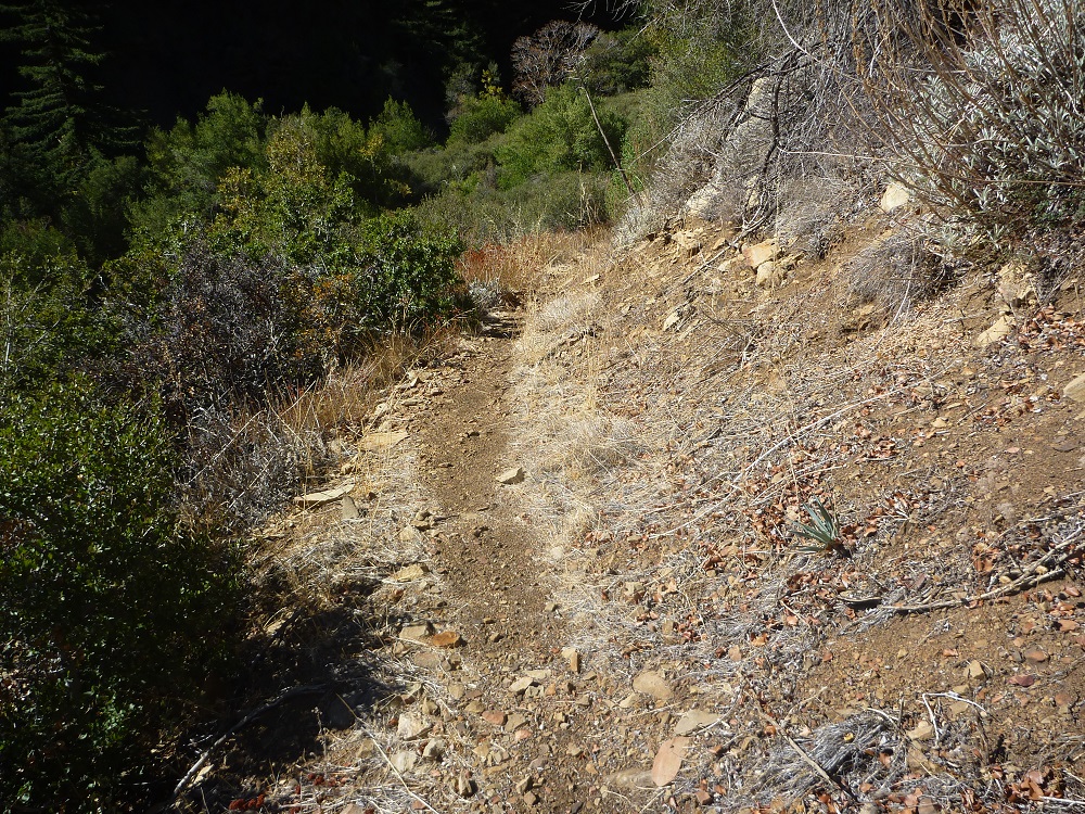
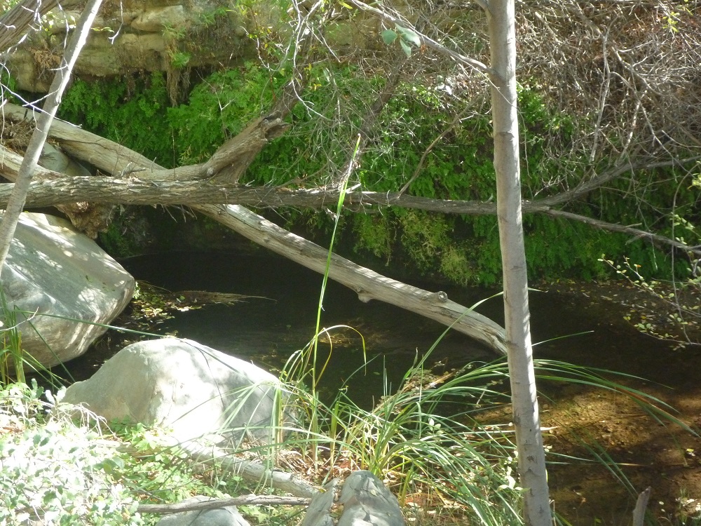
| Trail description: | Hiked out/back attempting to reach Maple Camp, had to turn back around mile 6. The trail is good and easy to follow through the southern-most Matilija Camp - thank you LPFA trail team! Shortly afterwards the trail is meant to side-hill to the east of the creek, but it is badly washed out. From that point forward the trail is easy to lose between brush and deadfall. I think we were the first party to go this way for some time. We averaged 1.5 miles per hour or less, and it was a full-body workout. |
| Mode of transport: | Hike |
| Trail condition: | Hard to follow |
| Images: | Side-hilling - there is a flat trail under all this chaparral. Significant wash-out above Matilija Camp |
North Fork Matilija Trail Survey - 01-02-2024 - by Andy| Link: | North Fork Matilija Trail |
| Date: | 01-02-2024 |
| Surveyor Name: | Andy |
| Trail description: | Hiked from Ortega Trail/Cherry Creek down to Maple Camp then back up out of sheer masochism. The trail on the slope is either fully lost or brushed in. Expect to bushwhack down. Plenty of water in the creek at Maple Camp. |
| Mode of transport: | Hike |
| Trail condition: | Non existent |
North Fork Matilija Trail Survey - 12-19-2022 - by Bongo Hiker| Link: | North Fork Matilija Trail |
| Date: | 12-19-2022 |
| Surveyor Name: | Bongo Hiker |
| Trail description: | Hiked from Matilija TH to Maple Camp. The closer I got to Maple Camp, the more downed trees I encountered, Most above Upper Matilija Camp. There were many. Most were small, from 3" to 6" in diameter, but multiple shoots crossing the trail. Plenty of stooping under, climbing over, sometimes both, once crawled on hands and knees. Definitely slows the pace. Maple Camp looks a bit neglected, but still a nice area to camp. |
| Mode of transport: | Hike |
| Trail condition: | Needs some work |
| Condition details: | The closer to Maple Camp the more downed trees. |
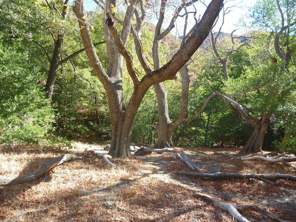
| Images: | Late December Colors About 4.8 miles from Matilija road parking |
North Fork Matilija Trail Survey - 10-22-2022 - by Jon Bain| Link: | North Fork Matilija Trail |
| Date: | 10-22-2022 |
| Surveyor Name: | Jon Bain |
| Trail description: | Only went about 1.7 miles, around the bend, then back to the main lower camp. Trail was easy to follow -- some places long grass brushed up against you, but otherwise pretty clear. Some poison oak, but avoidable. I hadn't noticed this last time I was here, but there is now a trail sign where the trail departs from 5N13.1 with clearly marked mileages to the various camps. The barbed wire is broken about 50 ft before the sign, and I think many people think the trail starts there. Biting flies were pretty relentless, starting around starting around noon, until dusk, and seemed unperturbed by repellant... Long sleeves are a good idea! |
| Mode of transport: | Hike |
| Trail condition: | Good shape and easy to follow |
North Fork Matilija Trail Survey - 06-12-2022 - by Anonymous Surveyor| Link: | North Fork Matilija Trail |
| Date: | 06-12-2022 |
| Surveyor Name: | Anonymous Surveyor |
| Trail description: | |
| Mode of transport: | Hike |
| Trail condition: | Needs some work |
| Condition details: | Needs lots of work, and Hard to follow in a few places, from Matilija Camp to Middle Matilija Camp |
North Fork Matilija Trail Survey - 03-15-2022 - by Los Padres Forest Association| Link: | North Fork Matilija Trail |
| Date: | 03-15-2022 |
| Surveyor Name: | Los Padres Forest Association |
| Trail description: | LPFA volunteer day spent repairing the slides between Matilija Camp and Middle Matilija Camp. More work is needed specifically on the stairs leading up from the creek crossing but both of the gnarly slides have been repaired. Check it out here and come join us next time for some volunteer help: https://www.instagram.com/p/CbONyRbPIYM/ |
| Mode of transport: | Array |
| Trail condition: | Needs some work |
North Fork Matilija Trail Survey - 03-19-2022 - by Jon Bain| Link: | North Fork Matilija Trail |
| Date: | 03-19-2022 |
| Surveyor Name: | Jon Bain |
| Trail description: | The trail to Middle Matijila was easy to follow. A few "false trails" have been marked with logs crossing the path. A few areas get rather brushy, but trail was easy to follow. The section at about 3mi as it climbs after the creek crossing seems to have been repaired -- there are some stone steps for the short steep section. We stopped at Middle Matijila. We spoke to another backpacker who said they couldn't make it all the way to Upper. We saw two baby rattlesnakes. Another hiker said he saw several. |
| Mode of transport: | Hike |
| Trail condition: | Good shape and easy to follow |
| Images: | Steep section after creek crossing seems to be fixed now Rainbow at middle Matijila after a little rain |
North Fork Matilija Trail Survey - 02-26-2022 - by Adam Donald| Link: | North Fork Matilija Trail |
| Date: | 02-26-2022 |
| Surveyor Name: | Adam Donald |
| Trail description: | Tons of pretty early spring flowers along the trail. Lots of water in the creek. From half a mile past Matilija Camp to Middle Matilija Camp there was a fair amount of brush in the trail and several large burned deadfalls creating trail bypasses. One section where the trail climbs the hill away from the creek has been washed out by rockslides and the footing is pretty sketchy above a long drop, although folks have cut some steps into the hillside. I only went as far as Middle Matilija. |
| Mode of transport: | Hike |
| Trail condition: | Needs some work |
| Images: | Rockslide through trail |
North Fork Matilija Trail Survey - 03-14-2021 - by Los Padres Forest Association| Link: | North Fork Matilija Trail |
| Date: | 03-14-2021 |
| Surveyor Name: | Los Padres Forest Association |
| Trail description: | Nice article about the North Fork Matilija Trail compliments of Noozhawk and Mr Dan McCaslin: https://www.noozhawk.com/article/dan_mccaslin_matilija_wilderness_north_fork_trail_20210314 |
| Mode of transport: | Hike |
| Trail condition: | Needs some work |
North Fork Matilija Trail Survey - 04-19-2021 - by Ryan Freeman| Link: | North Fork Matilija Trail |
| Date: | 04-19-2021 |
| Surveyor Name: | Ryan Freeman |
| Trail description: | Hiked from the trail head to Middle Matilija Camp. The first section is on a private service/fire road that goes through ranch style neighborhood. Please stay on the trail and respect private property and driveways. The trail then tee's to the right and crosses a creek. From there to Matilija camp is nice and shady, for the most part flat. After that, the trail gets less forgiving. But overall, the trail was in great shape and easy to follow. The connection to the ridge section before Middle Matilija camp, could use some trail markers. The creek had a great flow. Very popular trail with day hikers. Watch for poison oak! |
| Mode of transport: | Hike |
| Trail condition: | Good shape and easy to follow |
| Images: | Ridge Section Trail Sign |
North Fork Matilija Trail Survey - 03-03-2021 - by Daniel J. Hall| Link: | North Fork Matilija Trail |
| Date: | 03-03-2021 |
| Surveyor Name: | Daniel J. Hall |
| Trail description: | Many blowdowns across the trail, lots of brush and a few small slides. Hard to follow at times, and especially finding the trail, about half way between the camps, through the thick riparian brush in order to get on the switchbacks that take you up to a high trail above the creek. Details in captioned photos at https://tinyurl.com/yd3fk56m |
| Mode of transport: | Hike |
| Trail condition: | Hard to follow |
| Condition details: | From Middle Matilija Camp to (almost) Upper Matilija Camp |
North Fork Matilija Trail Survey - 03-01-2021 - by bardley| Link: | North Fork Matilija Trail |
| Date: | 03-01-2021 |
| Surveyor Name: | bardley |
| Trail description: | Temps in the 60s - 70s. Trail easy to follow to Matilija Camp. Between there and Middle Matilija the trail becomes less used and slightly more difficult to follow in places - especially at the numerous creek crossings. Look for the flagging and rocks on rocks to guide the way. There are two 12"+ downed trees close to Middle Matilija Camp than can be readily passed. The camp is in good shape. Water flowing along the whole trail in great amounts. Mileage is about 4.0 miles. |
| Mode of transport: | Hike |
| Trail condition: | Needs some work |
| Condition details: | From the end of Matilija Canyon Road to Middle Matilija Camp |
North Fork Matilija Trail Survey - 01-17-2021 - by Anonymous Backpacker| Link: | North Fork Matilija Trail |
| Date: | 01-17-2021 |
| Surveyor Name: | Anonymous Backpacker |
| Trail description: | First part of the trail is in good conditions, with lots of cool camp sites along the creek. Plenty of water flowing. |
| Mode of transport: | Hike |
| Trail condition: | Hard to follow |
North Fork Matilija Trail Survey - 11-16-2019 - by Los Padres Forest Association| Link: | North Fork Matilija Trail |
| Date: | 11-16-2019 |
| Surveyor Name: | Los Padres Forest Association |
| Trail description: | LPFA volunteer project focused on brushing the half mile or so between Maple Camp up to where the trail leaves the canyon. This part of the trail had not been worked since the Thomas Fire and was basically impossible to follow. People were headed in all directions once they got down off the hillside. We marked the correct trail, brushed the trail and repaired some of the damaged trail at the creek crossing. There was water in the creek and at Maple Camp. More work is needed from the upper trailhead at Ortega down to the crossing and we hope to come back soon and continue that work. |
| Mode of transport: | Hike |
| Trail condition: | Needs some work |
| Images: | |
North Fork Matilija Trail Survey - 03-07-2020 - by Los Padres Forest Association| Link: | North Fork Matilija Trail |
| Date: | 03-07-2020 |
| Surveyor Name: | Los Padres Forest Association |
| Trail description: | As part of the Ojai First Saturday series of trail projects, the LPFA worked the North Fork Matilija Trail in March 2020. Our focus was primarily on the high section of trail on the east side of the canyon about 60% of the way up to Middle Matilija Camp. We repaired some of the rockwork and did some quick retreading. Lots to do and more coming in 2020-2021. |
| Mode of transport: | Hike |
| Trail condition: | Needs some work |
| Images: | |
North Fork Matilija Trail Survey - 12-29-2019 - by Christopher P. Lord| Link: | North Fork Matilija Trail |
| Date: | 12-29-2019 |
| Surveyor Name: | Christopher P. Lord |
| Trail description: | Hiked up the North Fork from Matilija Trailhead to Maple Camp and back out on Sunday 12/29/19. Besides 2 minor downed trees the trail is for the most part in great shape by Los Padres Standards and easy to follow until just before Middle Matilija Camp. After that the next 1.5 to 2 miles is washed out, very overgrown and difficult to follow. The switchbacks are holding up and still a viable option if you can find them. After approximately this waypoint N34° 32' 38.9" W119° 21' 21.8" the trail opens up again and is easy to follow all the way to Maple Camp. When in doubt follow all the pink flagging. Water was flowing along the whole route. A more detailed write can be found on my blog at the link below. |
| Mode of transport: | Hike |
| Trail condition: | Needs some work |
| Images: | South view of the Trail Sign (Coordinates N34° 31' 20.5" W119° 21' 07.2") North view of the trail sign Good water flow The switchbacks winter wonderland |
North Fork Matilija Trail Survey - 10-12-2019 - by RJWean| Link: | North Fork Matilija Trail |
| Date: | 10-12-2019 |
| Surveyor Name: | RJWean |
| Trail description: | OOPS, forgot to mention there is still good water flow! |
| Mode of transport: | Hike |
| Trail condition: | Needs some work |
North Fork Matilija Trail Survey - 10-10-2019 - by RJWean| Link: | North Fork Matilija Trail |
| Date: | 10-10-2019 |
| Surveyor Name: | RJWean |
| Trail description: | This survey is for the trail from Matilija Rd. to Middle Matilija camp.There is no signage at the junction where the trail cuts off from the road only a small cairn marks the spot.Trail can be difficult to find in some places where it crosses the creek.Take time and look for the cairns marking the way.If you are walking up the creek you are off of the path! Â The trail itself is in pretty good shape,a little brushy in spots and plenty of beautiful poison oak along the way.There are a couple of washout areas at the beginning after the trail crosses creek and heads up the hillside but they are easily handled.Both Matilija and Middle Matilija camps are in excellent condition! |
| Mode of transport: | Hike |
| Trail condition: | Needs some work |
North Fork Matilija Trail Survey - 05-04-2019 - by Los Padres Forest Association| Link: | North Fork Matilija Trail |
| Date: | 05-04-2019 |
| Surveyor Name: | Los Padres Forest Association |
| Trail description: | MAY THE FOURTH BE WITH YOU LPFA
First Saturday on North Fork Matilija Trail - Crew of 8 volunteers worked 2
miles of trail starting at the southern trailhead. Storm damage changed the
entire drainage making the trail corridor difficult to follow, especially at
creek crossings. Overgrown brush was cut out and grass
was grubbed out in sections where it was blocking line-of-sight for hikers.
Creek crossings were brushed out to restore what is left of the original
crossings. Ramps in an out of the crossings were fixed where they were washed
out. We saw about 20 people out on the trail, and
even more people at the trailhead. We had to redirect many of the hikers onto
the trail and out of the creek bed. Hopefully, hikers will have an easier time
navigating the crossings with the help from the volunteers. Thanks
everyone! |
| Mode of transport: | Hike |
| Trail condition: | Needs some work |
North Fork Matilija Trail Survey - 02-16-2019 - by Los Padres Forest Association| Link: | North Fork Matilija Trail |
| Date: | 02-16-2019 |
| Surveyor Name: | Los Padres Forest Association |
| Trail description: | Thanks to a grant from REI the LPFA will be investing some serious time on this trail over the next year. We hiked the trail from the lower trailhead to Maple to assess current conditions and flag the trail. TH to MATILIJA CAMP: Other than the crazy creek crossings, the trail was in good shape and easy to follow. No obstacles to report. MATILIJA to MIDDLE MATILIJA: Hard to follow heading upstream in the flat section, the trail was washed out and is not a small creek bed. Follow the creekbed and look for pink flagging leading you onto the trail. Trail needs to be adjusted here. Once on the correct trail it's pretty easy to follow to Middle Matilija. Some of the crossings are hard to find, look for flagging. Some sketchy slides on the high exposed section. MIDDLE to UPPER MATILIJA: The trail becomes much harder to follow above Middle Matilija but there are fresh flags connecting the sections of trail across the blowouts. Trail, no trail, trail, no trail - repeat. Some downed trees and other obstacles. Look for the switchback section, it's in good shape due to some recent BAER work. UPPER to MAPLE: Tons of flags places along this section of trail, obnoxious flagging. Lots of downed trees, rock falls and other obstacles but the path and trail are followable. MAPLE to ORTEGA: LPFA flagged this section in November 2017, didn't share on HLP. Tread is easy enough to follow, some rogue work has been done. Trail is gone once in the canyon, look for flags. |
| Mode of transport: | Hike |
| Trail condition: | Hard to follow |
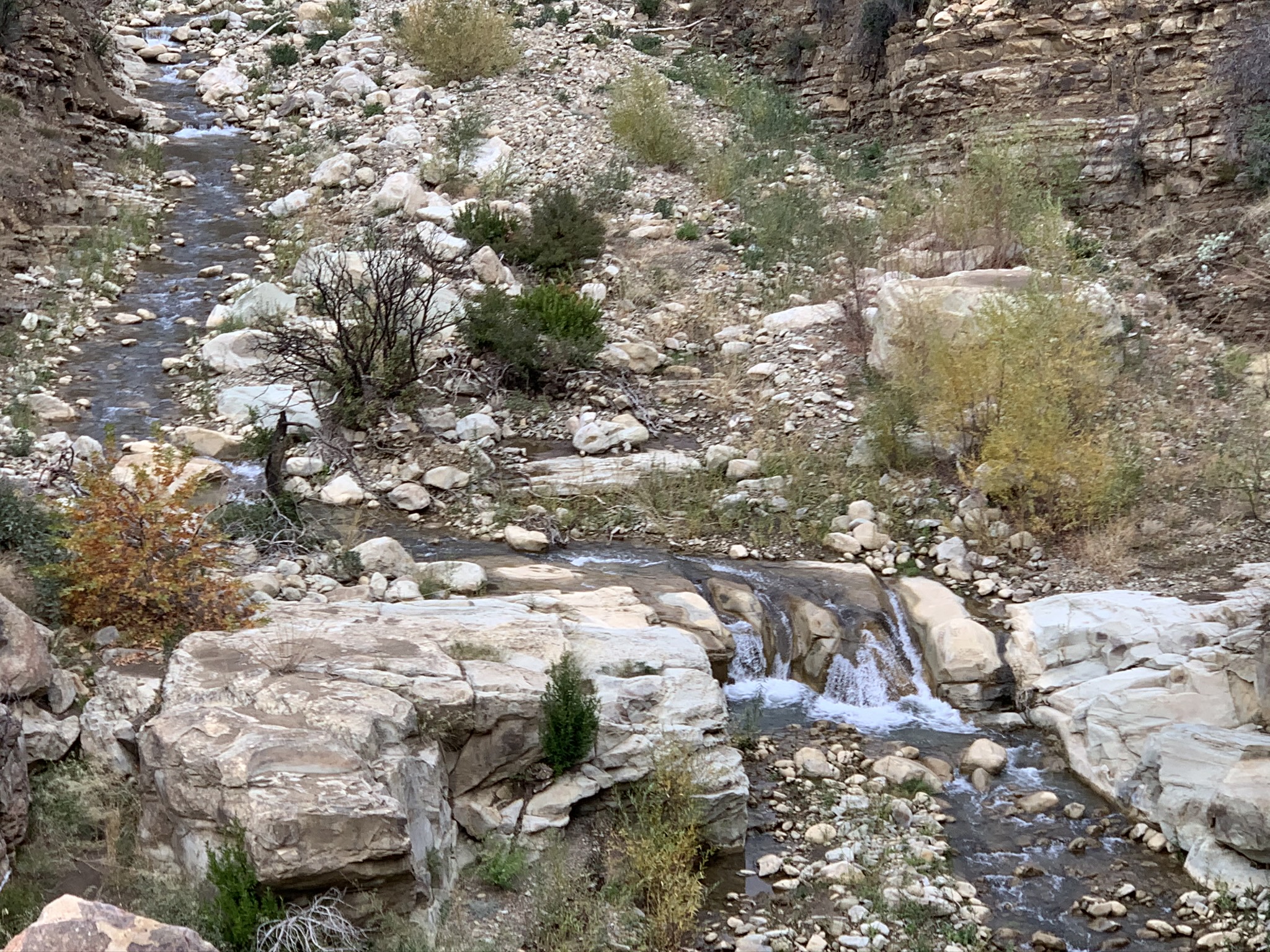
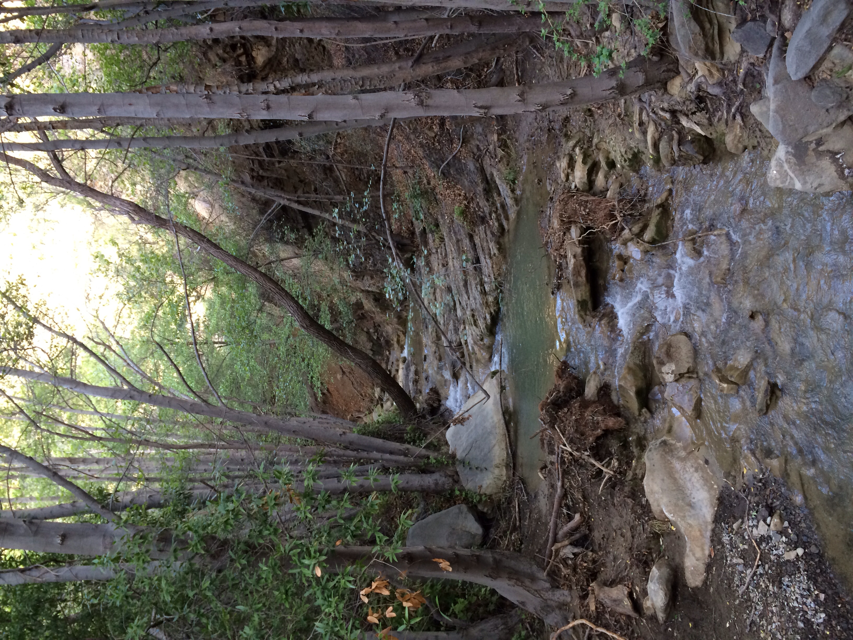
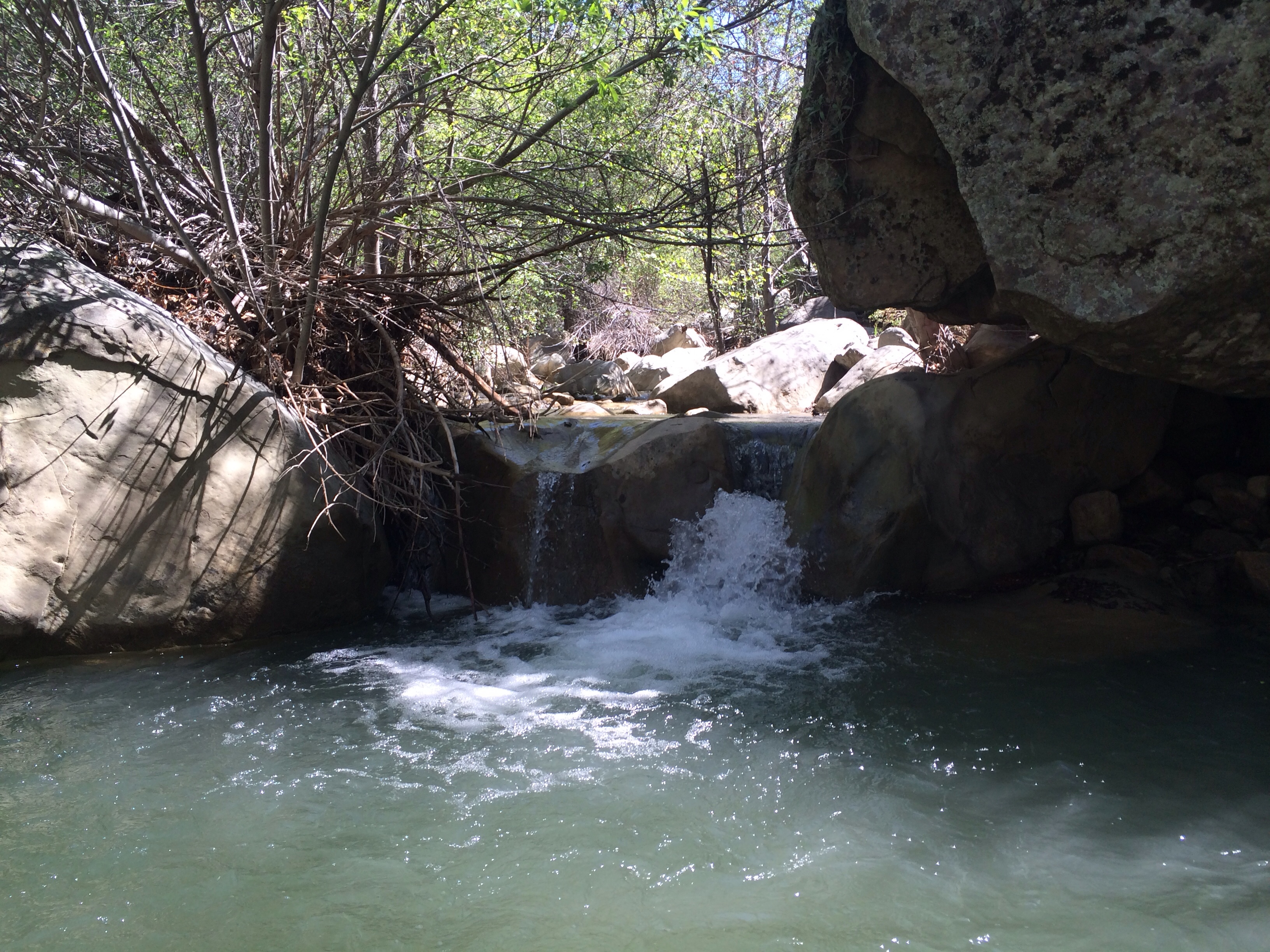
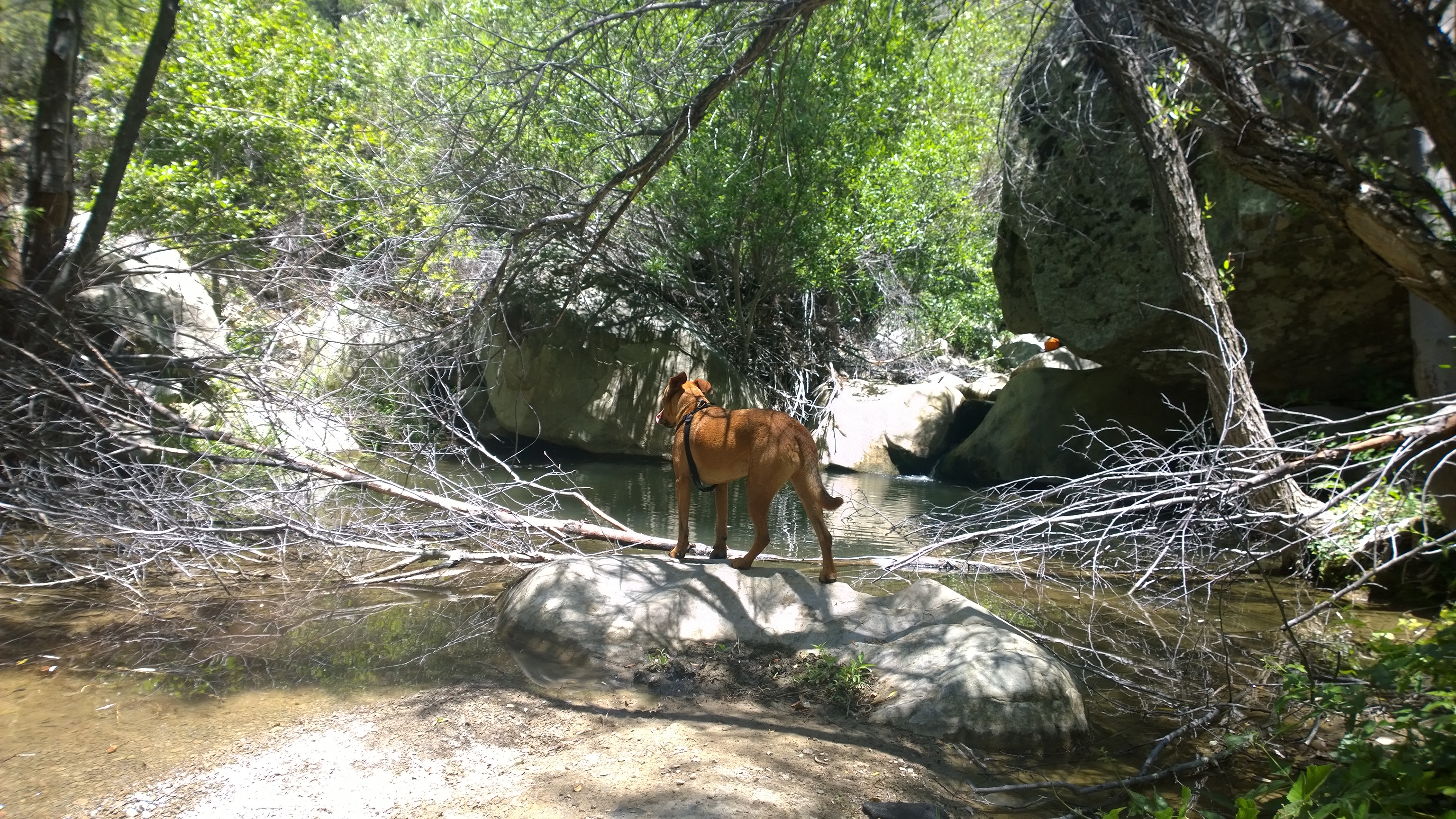
| Images: | Backside of the switchback section, yes, that's the trail. Easier to follow than the photo indicates. Crossing of Matilija Creek just above the Wildlife Preserve. Nearly waste deep, hold onto your pooch. Creek from the high exposed section between Matilija and Middle. Lots of water. |
North Fork Matilija Trail Survey - 01-30-2019 - by Michelle Macgilfrey| Link: | North Fork Matilija Trail |
| Date: | 01-30-2019 |
| Surveyor Name: | Michelle Macgilfrey |
| Trail description: | Hiked 2.5 miles up the North Fork Trail. Trail to Lower Matilija Camp was mostly easy to follow. Less defined at creek crossings. Water depth ankle to knee deep. Could not cross without getting wet. Trail was harder to follow between Lower Matilija Camp and Middle Matilija Camp. Many sections of trail washed out. There are cairns marking the trail in the washed out sections. Trees still coming down in the really burned section between Lower Matilija Camp and the 2.5 mile mark. Large tree came down approx 50 feet from me, so be aware of your surroundings and use caution. Lower Matilija Camp in good shape. Did not go all the way to Middle Matilija Camp as I was short on time. |
| Mode of transport: | Hike |
| Trail condition: | Needs some work |
| Images: | |
North Fork Matilija Trail Survey - 06-02-2018 - by Los Padres Forest Association| Link: | North Fork Matilija Trail |
| Date: | 06-02-2018 |
| Surveyor Name: | Los Padres Forest Association |
| Trail description: | LPFA led a trail project as part of National Trails day and Ojai First Saturday to work on the Matilija Trail. You can see photos and read details at the Facebook post here. We cleared and worked the trail from the lower trailhead up to the crossing above Matilija Camp. That section is passable and in good shape now. Do pay attention to cairns at the washed out creek crossings. We also got another report of the entire trail coming from the upper trailhead at Ortega down. Here is the gist of that report: • The trail was terribly washed out/overgrown all the way down to Maple Camp. • From Maple Camp (which is quite inundated with mostly small diameter downed trees) all the way down to Matilija Camp the trail was almost impossible to find. We stopped even trying shortly after Maple, realizing it was relatively easy to just go straight down the creek, hopping the 1-2 yards across it to keep finding the best route. We would have spent way more time just looking for the trail and going through the many downed trees. Poison oak throughout was prevalent, but sparse and low. And a writeup from ValHikes: http://valhikes.blogspot.com/2018/06/matilija-upper-north-fork-trail-work.html?utm_source=feedburner&utm_medium=email&utm_campaign=Feed%3A+MomentsInDirtAndInk+%28Moments+in+Dirt+and+Ink%29 |
| Mode of transport: | Hike |
| Trail condition: | Hard to follow |
| Images: | Trail Crew Work |
North Fork Matilija Trail Survey - 05-26-2018 - by Michelle Macgilfrey| Link: | North Fork Matilija Trail |
| Date: | 05-26-2018 |
| Surveyor Name: | Michelle Macgilfrey |
| Trail description: | North Fork Trail is non existent due to the Thomas Fire and the proceeding floods. North Fork is flowing, approximately ankle deep on this day. Watercourse has diverted in many areas from its previous course of flow. Many downed trees made for trying to locate sections of the old trail unsafe. Followed the water course upstream for about 3 miles. |
| Mode of transport: | Hike |
| Trail condition: | Non existent |
| Images: | |
North Fork Matilija Trail Survey - 11-10-2017 - by Oh Three| Link: | North Fork Matilija Trail |
| Date: | 11-10-2017 |
| Surveyor Name: | Oh Three |
| Trail description: | The trail is overgrown, washed out, wild and scenic. Beautiful. Hiking this route teaches young hikers trail finding skills. We saw no one else for the first 8 miles. Lots of bear scat. As you get within a couple miles of the south end, you start running into day trippers. Individual reports will be submitted for the various trail camps, all of which were in good condition, and all are with water. There's 100's of good Eagle projects in rebuilding steps, retaining walls, etc, at any number of places on this route! |
| Mode of transport: | Hike |
| Trail condition: | Needs some work |
| Images: | |
North Fork Matilija Trail Survey - 03-05-2017 - by Craig R. Carey| Link: | North Fork Matilija Trail |
| Date: | 03-05-2017 |
| Surveyor Name: | Craig R. Carey |
| Trail description: | The intrepid mountain men of Boy Scout Troop 111 (Ventura) backpacked the length of the Upper North Fork (from Cherry Creek Road at Hwy 33 to lower Matilija TH) Friday 3/3 to Sunday 3/5. Trail overall is still very navigable, though there are sloughs, debris, wash-outs, gullying, and storm damage, as well as a few trees down both on Cherry Creek Road and on the wilderness trail. Survey report will be filed with ORD shortly. Water ABUNDANT – very few of the crossings are manageable with dry feet. There was much wading (and joy!). ;-) |
| Mode of transport: | Hike |
| Trail condition: | Needs some work |
| Images: | |
North Fork Matilija Trail Survey - 02-13-2017 - by Anonymous Surveyor| Link: | North Fork Matilija Trail |
| Date: | 02-13-2017 |
| Surveyor Name: | Anonymous Surveyor |
| Trail description: | I did a quick overnight solo backpacking trip to Middle Matilija Campground. It was my first solo trip and my first time camping in Los Padres. The hike itself was easy, however due to recent rains, the stream was deep and flowing rapidly which made stream crossings challenging. Most stream crossings were impossible to cross without getting your feet wet. Adding to that, there are many stream crossings (I didn't count but there were at least 10). Also, there were two small rockfalls and a fallen tree on the trail around the last mile before the campground but they were easily passable. The bugs were not too bad, mostly small flies and very few mosquitoes. I did see a few ticks, one on my socks after I removed them and one on my pants after going through some bushes around the campsite, so watch out for those. Overall, it was an enjoyable trip but I'd be wary of taking anyone not quite nimble enough to hop across stream rocks without beefing it. |
| Mode of transport: | Hike |
| Trail condition: | Needs some work |
| Condition details: | Easy hike to Middle Matilija apart from challenging stream crossings |
North Fork Matilija Trail Survey - 10-17-2016 - by Anonymous Surveyor| Link: | North Fork Matilija Trail |
| Date: | 10-17-2016 |
| Surveyor Name: | Anonymous Surveyor |
| Trail description: | spent two night on this trail. excellent trail and easy to follow up until middle matilija camp. after that trail is still obvious to follow but is slightly overgrown. water flowing up until middle matilija camp. upper matilija camp had water trickling, but still plenty to filter. |
| Mode of transport: | Hike |
| Trail condition: | Needs some work |
| Condition details: | Trail is in good shape up to middle matilija camp. after that minor bushwacking |
North Fork Matilija Trail Survey - 03-19-2016 - by Los Padres Forest Association| Link: | North Fork Matilija Trail |
| Date: | 03-19-2016 |
| Surveyor Name: | Los Padres Forest Association |
| Trail description: | A group of 52 Ventura County boy and girl scouts led by Craig Carey joined Ranger Heidi to clean up graffiti along the lower portions of the Matilija Trail. Â Great work everyone! Â Â |
| Mode of transport: | Array |
| Trail condition: | Good shape and easy to follow |
| Images: | Photo Ranger Heidi |
North Fork Matilija Trail Survey - 01-14-2016 - by Los Padres Forest Association| Link: | North Fork Matilija Trail |
| Date: | 01-14-2016 |
| Surveyor Name: | Los Padres Forest Association |
| Trail description: | A recent article in Noozhawk by Dan McCaslin from a hike he took along the Matilija Trail: http://www.noozhawk.com/homes_lifestyle/article/dan_mccaslin_hiking_north_fork_trail_to_middle_matilija_camp |
| Mode of transport: | Hike |
| Trail condition: | Good shape and easy to follow |
North Fork Matilija Trail Survey - 01-09-2016 - by Craig R. Carey| Link: | North Fork Matilija Trail |
| Date: | 01-09-2016 |
| Surveyor Name: | Craig R. Carey |
| Trail description: | The Cubs of Pack 3179 had a great (soggy) hike from Matilija TH to Middle Matilija, with an extended rock-hopping break at both camps and lunch at the crossing near the guerrilla camp. Cleared some fallen alders and mountain mahogany from the trail about 3/4 miles from MM. Tread in good shape; crossings manageable. Could use some light brushing but otherwise all good. Good flow in creek the entire way. |
| Mode of transport: | Hike |
| Trail condition: | Good shape and easy to follow |
| Images: | |
North Fork Matilija Trail Survey - 09-6-2015 - by Chester| Link: | North Fork Matilija Trail |
| Date: | 09-6-2015 |
| Surveyor Name: | Chester |
| Trail description: | easy to follow, I went as far as middle camp. lots of poison oak, plenty of water for filtering. |
| Mode of transport: | Hike |
| Trail condition: | Good shape and easy to follow |
| Images: | Muttilahound |
North Fork Matilija Trail Survey - 11-09-2014 - by JO| Link: | North Fork Matilija Trail |
| Date: | 11-09-2014 |
| Surveyor Name: | JO |
| Trail description: | At Middle and Upper
Matilija camps there is plenty of water. The water fall that is indicated
on the topo map above Middle Matilija where the trail leaves the creek and
switchbacks up the canyon hillside, has dried up. On our way to Upper Matilija
camp we found this note left on a rock just after a creek crossing. It
gave a warning of a bee's nest near the trail. It was dated
7/11/14. We left the note in place and decided to take extra
precautions. We put on our jackets and hoods and prepared for the worst.
 In the end there was no beehive that we encountered. We continued
up the canyon enchanted by the fall colors and beauty of the canyon's grottos
that presented themselves where the canyon narrowed. In one spot the
canyon makes a 90 degree turn with a rock wall on one side of the creek.Â
I imagined what storm conditions must be like with boulders, trees, and all
that water slamming directly into that rock wall. The wall itself
appeared to have pock marks in it where boulders may have hit. The lushness
of the area almost made me forget that we are in one of the worst
droughts. We continued past Upper Matilija in search of Maple camp.
 Above Upper Matilija the trail hadn't been worked on in some time.Â
Although the trail is detectable and easy to follow, it is very bushy and would
be unpleasant to hike with a backpack. Wearing shorts is strongly
discouraged. Â As I approached one of the many creek crossing, I spooked a
deer walking through the creek bottom. The deer bolted down the creek bed
at neck braking speed and was out of sight in an instant. It literally
covered 50 yards of rock strewn stream bed in less than 3 seconds. It was an
incredible sight. We arrived at Maple camp at 10:30 AM and ate our
lunches. Â While there is moving water at Maple, it emerges out of the
ground and is only a trickle. A cup is needed to gather the water and
poor it into larger vessels. I decided to hike up a bit further to get a
good view of the area. The trail leaving the canyon and heading up towards
Ortega Hill looked to be in very good condition. I found some
unidentified strange looking scat left right on the trail. I stepped in
it, on purpose, to see what it looked like below the dried surface. Â We
left Maple camp at 11 AM and hiked back to the car at Matilija Trailhead,
arriving there at 3PM. A very nice hike.​ |
| Mode of transport: | Hike |
| Trail condition: | Needs some work |
| Condition details: | Report covers up to Maple Camp |
| Images: | |
North Fork Matilija Trail Survey - 11-09-2014 - by Los Padres Forest Association| Link: | North Fork Matilija Trail |
| Date: | 11-09-2014 |
| Surveyor Name: | Los Padres Forest Association |
| Trail description: | At Middle and Upper Matilija camps there is plenty of water. The water fall that is indicated on the topo map above Middle Matilija where the trail leaves the creek and switchbacks up the canyon hillside, has dried up. On our way to Upper Matilija camp we found this note left on a rock just after a creek crossing. It gave a warning of a bee's nest near the trail. It was dated 7/11/14. We left the note in place and decided to take extra precautions. We put on our jackets and hoods and prepared for the worst.  In the end there was no beehive that we encountered. We continued up the canyon enchanted by the fall colors and beauty of the canyon's grottos that presented themselves where the canyon narrowed. In one spot the canyon makes a 90 degree turn with a rock wall on one side of the creek. I imagined what storm conditions must be like with boulders, trees, and all that water slamming directly into that rock wall. The wall itself appeared to have pock marks in it where boulders may have hit. The lushness of the area almost made me forget that we are in one of the worst droughts. We continued past Upper Matilija in search of Maple camp.  Above Upper Matilija the trail hadn't been worked on in some time. Although the trail is detectable and easy to follow, it is very bushy and would be unpleasant to hike with a backpack. Wearing shorts is strongly discouraged.  As I approached one of the many creek crossing, I spooked a deer walking through the creek bottom. The deer bolted down the creek bed at neck braking speed and was out of sight in an instant. It literally covered 50 yards of rock strewn stream bed in less than 3 seconds. It was an incredible sight. We arrived at Maple camp at 10:30 AM and ate our lunches.  While there is moving water at Maple, it emerges out of the ground and is only a trickle. A cup is needed to gather the water and poor it into larger vessels. I decided to hike up a bit further to get a good view of the area. The trail leaving the canyon and heading up towards Ortega Hill looked to be in very good condition. I found some unidentified strange looking scat left right on the trail. I stepped in it, on purpose, to see what it looked like below the dried surface.  We left Maple camp at 11 AM and hiked back to the car at Matilija Trailhead, arriving there at 3PM. A very nice hike.​ |
| Mode of transport: | Hike |
| Trail condition: | Needs some work |
| Images: | |
North Fork Matilija Trail Survey - 07-31-2014 - by Los Padres Forest Association| Link: | North Fork Matilija Trail |
| Date: | 07-31-2014 |
| Surveyor Name: | Los Padres Forest Association |
| Trail description: | Water in the creek. Â Cool canyon in the shade, even with the temps over 100Ëš. Â GOOD SUMMER TIME DESTINATION. |
| Mode of transport: | Hike |
| Trail condition: | Needs some work |
| Condition details: | Trail needs brushing from Matilija to Middle Matilija |
North Fork Matilija Trail Survey - 03-22-2014 - by Sharalyn| Link: | North Fork Matilija Trail |
| Date: | 03-22-2014 |
| Surveyor Name: | Sharalyn |
| Trail description: | We backpacked this weekend to the Middle Matilija campground. Trail is easy to follow, but there were several Boy Scout troops in the area who stayed at the lower campsite. We shared Middle Matilija with a group of 4 people, but it was still a nice experience. Day hiked above the site for ~1.5 RT. Soil is loose on some of the switchbacks and the "waterfall" on the map was dry, although you could see it's site. Plenty of water the entire way. |
| Mode of transport: | Hike |
| Trail condition: | Good shape and easy to follow |
| Images: | |
 Survey / Report Form - Please click this box to open the form.