 Use Marker Groups
 Wolf 2002
Piru 2003
Day 2006
Zaca 2007
Gap 2008
La Brea 2009

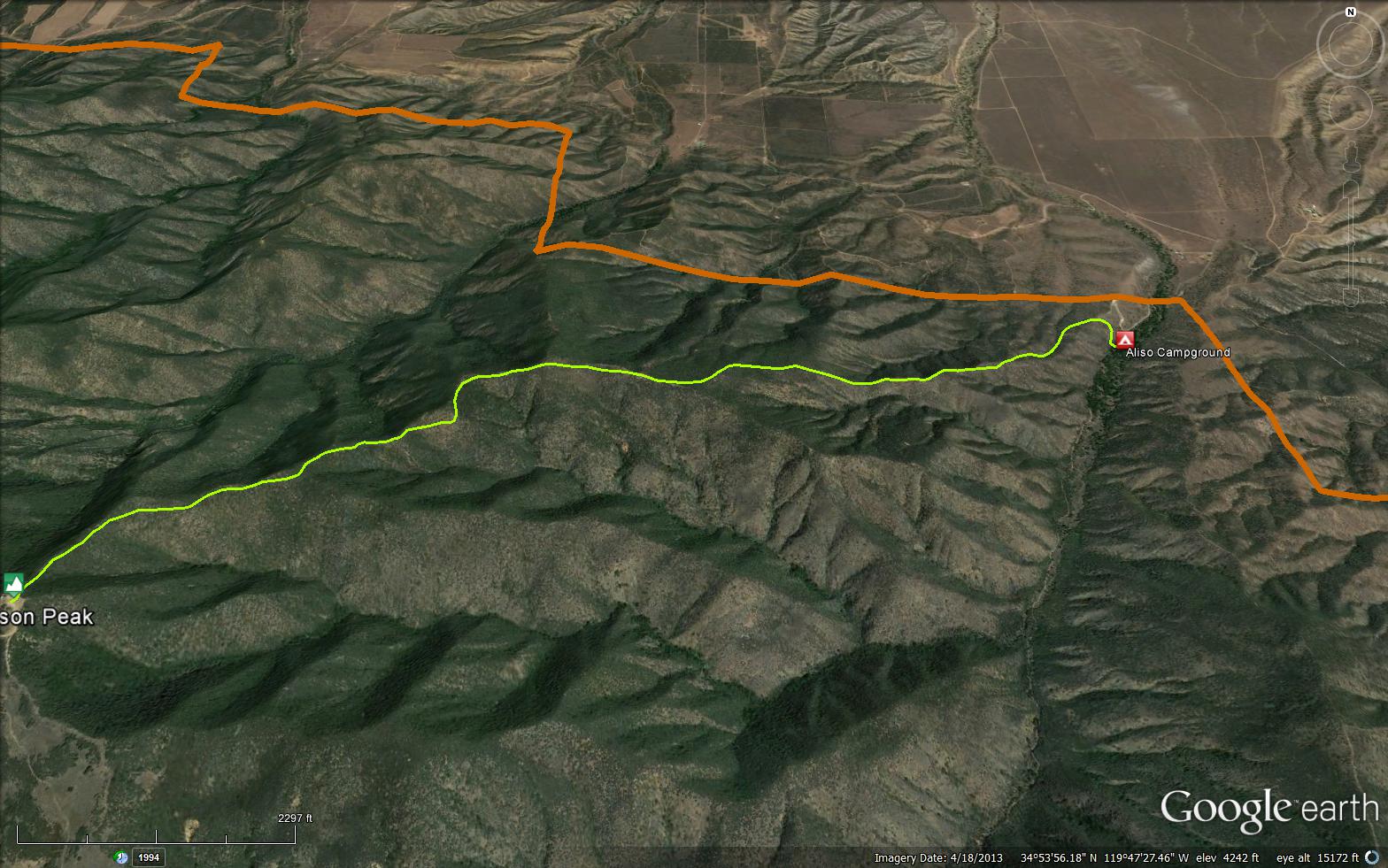
The Mcpherson Trail is a scenic 3.35 mile trail in Santa Barbara County. The trail connects the Lost Valley Trail – Ventana Wilderness (4E08) and the North Coast Ridge Trail (3E10). The mountain was named for a pioneer family of several members who homesteaded in the area at a early date. A communication facility is located on top of the peak. Years ago the Forest Service maintained a fire lookout on the peak but now all that is left of the facility is a large concrete tank used to catch rain water for use at the Lookout. The facility was built August 22, 1934 and burned April 7, 1987. Excellent views from the peaks are, to the north the Cuyama Valley, to the east the Mt. Pinos area and to the south the Sisquoc River Valley. Please let us know if you have explored this trail recently.

 Mcpherson Trail Survey - 03-27-2021 - by Kathy W
| Link: | Mcpherson Trail |
| Date: | 03-27-2021 |
| Surveyor Name: | Kathy W |
| Trail description: | The trail is in great shape all the way to just before the summit when there are a couple bushes that you need to push through to get to the top. Shooting Stars and Star Lilies were blooming on the lower part of the trail. I only noticed one tick on me but that was probably because I sprayed my clothes with Permethrin. |
| Mode of transport: | Hike |
| Trail condition: | Good shape and easy to follow |
| Images: | Star Lily |
Mcpherson Trail Survey - 01-04-2020 - by Valerie Norton| Link: | Mcpherson Trail |
| Date: | 01-04-2020 |
| Surveyor Name: | Valerie Norton |
| Trail description: | Finding the start is hard. There are some rocks crossings in the creek that lead to it, but no sign of any sort to mark the trail and who is allowed to use it. Once past the first few feet, the trail is well beaten in and easy to follow for miles. Even the old trail following the ridge line top is easy to follow, but the switchbacks are nicer. As the chaparral changes to bring in chamise, it is still okay. As it changes to bring in scrub oak, it starts to fail. But it isn't the oak that makes it vanish on this side. It actually vanishes on south facing bare area. Once back into the little oaks, there's multiple possible. I stepped over some still sharp yucca, so didn't find the most popular route. Maybe it was closer to the ridge top? The loss of trail in a bare spot means there's plenty of choices for where to start through the oaks. I definitely got back on the trail eventually. It's about 0.6 miles that is hard to follow. I found a second old junction with splintered sign on the way up. The trail it signed was long gone. I didn't find the one I found before just above the hard to follow bit. I expect I was just on a different route at least a few feet from it instead. |
| Mode of transport: | Hike |
| Trail condition: | Needs some work |
| Condition details: | missing over a short area |
Mcpherson Trail Survey - 01-11-2018 - by Valerie Norton| Link: | Mcpherson Trail |
| Date: | 01-11-2018 |
| Surveyor Name: | Valerie Norton |
| Trail description: | Came down the top part at the end of the day. Certainly got as far as the old sign post (ah, so that is a sign post) before wandering off down the wrong ridge line following hunter trail instead of proper trail. The very top was quite easy to follow although far steeper and more directly downhill than good trail building dictates. Once it gets out of being surrounded by scrub oak, though, there are options for directions to go (slight braiding) and thin hunter trails compete with the more proper trail. |
| Mode of transport: | Hike |
| Trail condition: | Hard to follow |
| Condition details: | Well, I certainly failed to follow it. |
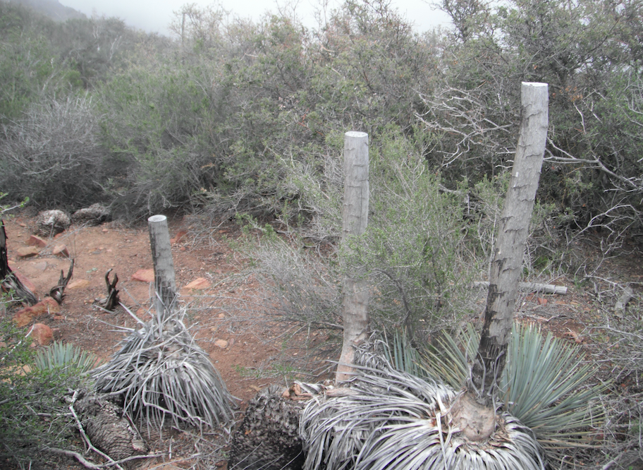
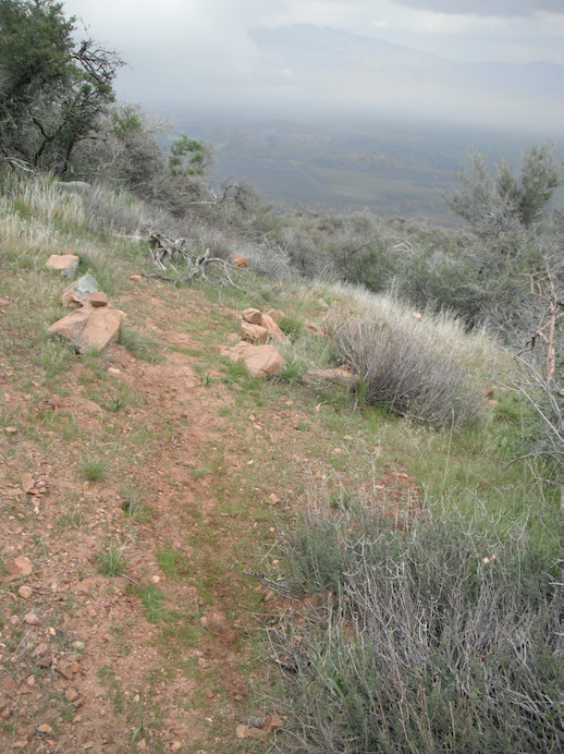
Mcpherson Trail Survey - 02-27-2015 - by Los Padres Forest Association| Link: | Mcpherson Trail |
| Date: | 02-27-2015 |
| Surveyor Name: | Los Padres Forest Association |
| Trail description: | The trail was in better shape than expected. Â The first half of the trail from Aliso Park Campground was in great shape. Â It gradually got worse the farther up towards McPherson Peak. Â We got lost a few times but were quickly able to re-find the trail. Â It's mostly scrub oak that is closing in on the trail. Â The top 200 yards are in perfect shape as well. |
| Mode of transport: | Hike |
| Trail condition: | Needs some work |
| Images: | Someone really hated yuccas. All the yuccas were cut off halfway up their stalks. Nice views north into the Cuyama Valley. |
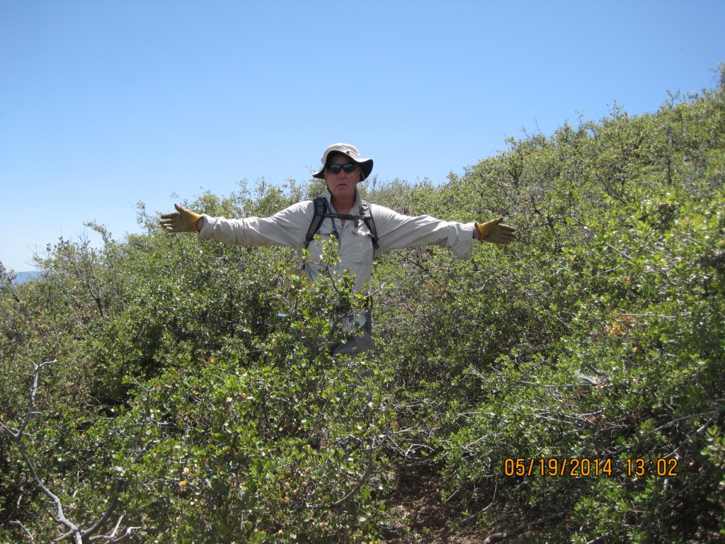
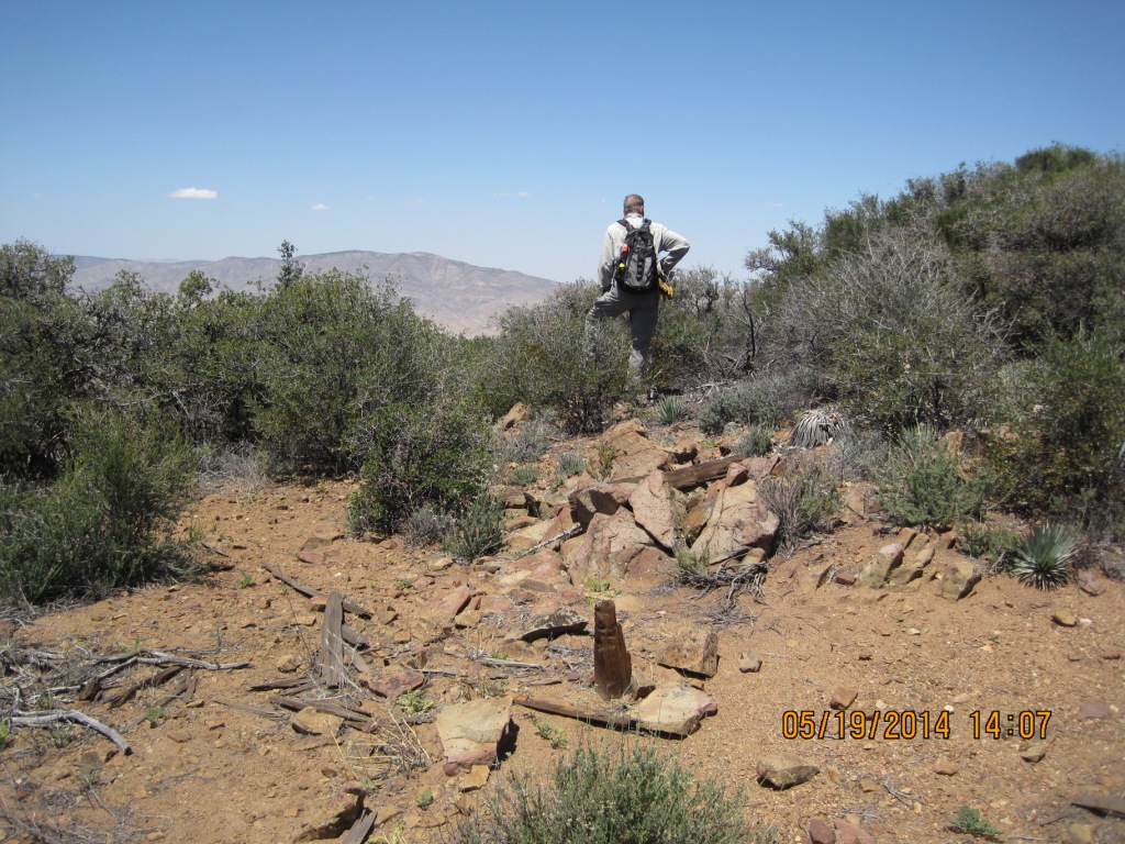
Mcpherson Trail Survey - 05-19-2014 - by Subbotin| Link: | Mcpherson Trail |
| Date: | 05-19-2014 |
| Surveyor Name: | Subbotin |
| Trail description: | Upper portion of trail below peak needs brushing and tread work. Â Remnant wooden sign post still remains at Messenger Cyn. old trail junction. |
| Mode of transport: | Hike |
| Trail condition: | Needs some work |
| Condition details: | very brushy below peak, then opens up; lower 1.5 mi well maintained |
| Number of trees down: | 0 |
| People Seen: | 0 |
| Images: | |
 Survey / Report Form - Please click this box to open the form.