 Use Marker Groups
 Wolf 2002
Piru 2003
Day 2006
Zaca 2007
Gap 2008
La Brea 2009

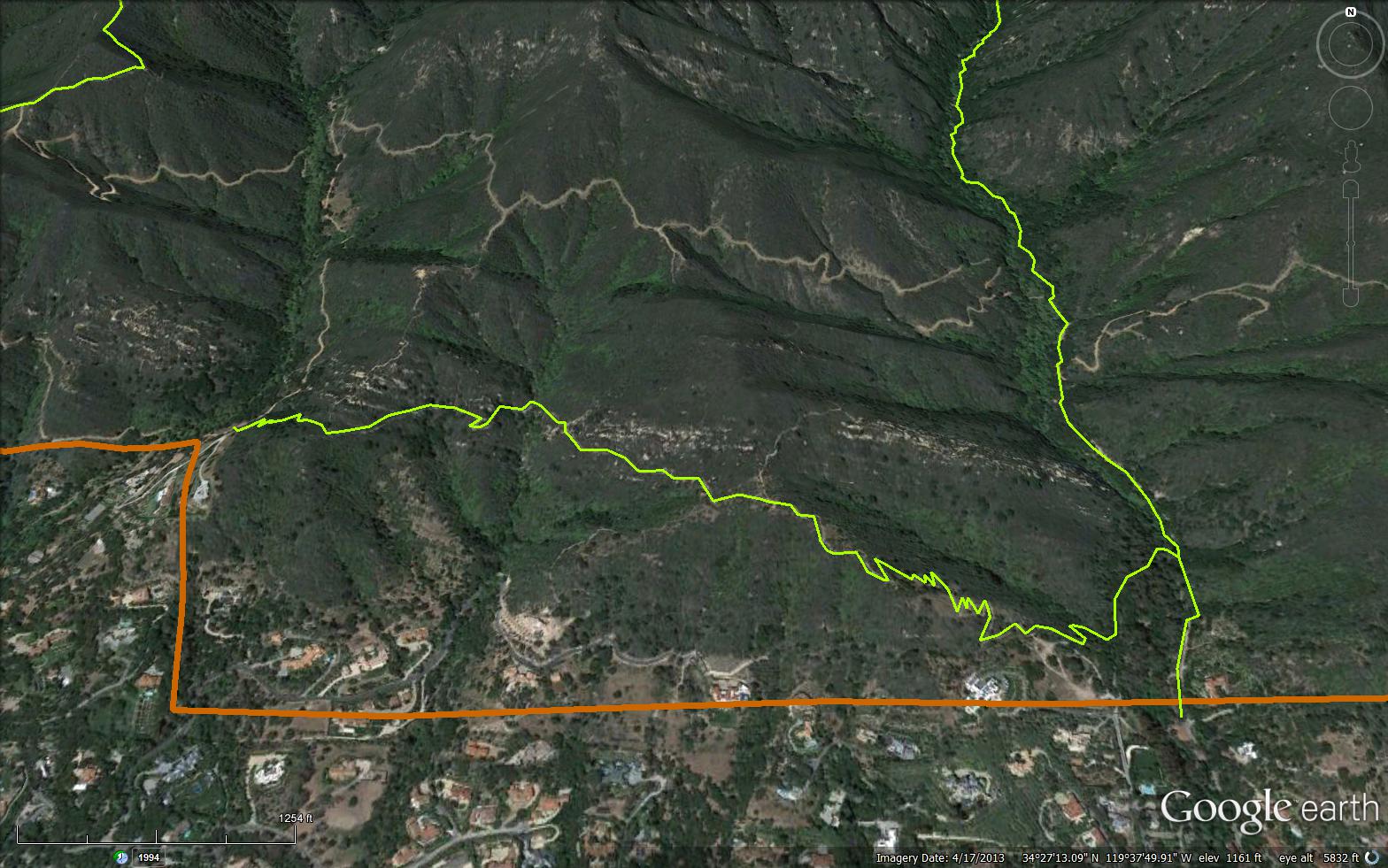
The hike up to the McMenemy Bench for the morning or evening views is one of the great short hikes in the Santa Barbara area, but what I like most about this trail is the variety of 2-3 hour long loops you can do by combining it with other sections of trail. Now that the Girard Trail is almost complete there will be even more possibilities. Hiking over to Saddle Rock and back is another great trip.
To reach the start of the McMenemy Trail walk up San Ysidro Canyon for a half mile. It leads left across the creek and then through a wonderful eucalyptus forest before starting you up a series of switchbacks winding back and forth through grass meadows and chaparral to the bench. It is a 500’ elevation gain and definitely will get your heart pumping, but once you reach the shoulder on which the stone bench is located you will marvel at the views; they are spectacular.
For many, the hike up to this viewpoint will be enough, but if you would like to extend your hike for another hour or two there are several other possibilities. The McMenemy Trail continues west, dropping several hundred feet into a small canyon and then climbing back up to the far ridgeline where the Saddle Rock Trail is located. At the bottom of the small canyon look for a short path leading a few yards out onto the top of a 40’ high waterfall. It is a perfect place to sit for a spell.
From here it is a quarter mile of gradual uphill to the Saddle Rock ridge. The McMenemy Trail continues over the saddle and ends a short distance later in Hot Springs Canyon. You will want to turn right and head up the ridge trail, even if only a short distance to Saddle Rock, which is the perfect place to sit and watch the sunset. From here you can return via the McMenemy Trail or continue up the ridge to make this a loop trip. Along the way you will find loads of impressive views and, just before the catway intersection, a flat hilltop where past visitors have created the outline a huge heart out of rocks.
Once you reach the catway turn right and continue slightly uphill for several hundred yards to a high point. Here, the catway begins to drop precipitously down into San Ysidro Canyon. The drop is short and sweet and the walk back down along the creek is a very nice way to complete the loop.
Near the high point, the Girard Trail—if completed— will take you back to the bench. As of publication the trail has been roughed out and it is possible to hike along it but the hiking isn’t easy.
Have you hiked this trail in the past? Please share. Be the first one to add a quick report below.
 Survey / Report Form - Please click this box to open the form.