 Use Marker Groups
 Wolf 2002
Piru 2003
Day 2006
Zaca 2007
Gap 2008
La Brea 2009

| Date | Surveyor | Water Report |
| 05-09-2022 | Anonymous Surveyor | Dry |
| 02-27-2021 | Oh Three | Dry |
| 06-20-2014 | Anonymous Surveyor | Dry |
A small camp with Big Views, this camp is located on Brush Mountain in Southern California's Kern County, a little north of Ventura County. It's located a few miles west northwest of San Emigdio Mountain. The mountain is in the Los Padres National Forest.


 Marian Campground Survey - 05-09-2022 - by Anonymous Surveyor
| Link: | Marian Campground |
| Date: | 05-09-2022 |
| Surveyor Name: | Anonymous Surveyor |
| Camp Description: | Gate was locked. Hiked up and nothing was wrong, any cars could make it up. There was a very small patch of snow in the camp on May 6th, don’t know how it was there when everything else was green. Nice hiking trails leading up both sides of the ridge, would be nice to spend a night or two when the road opens. |
| Water Source: | Dry |
| Water Source Details: | |
| Weather Conditions: | Mid 40’s, extremely windy. |
Marian Campground Survey - 02-27-2021 - by Oh Three| Link: | Marian Campground |
| Date: | 02-27-2021 |
| Surveyor Name: | Oh Three |
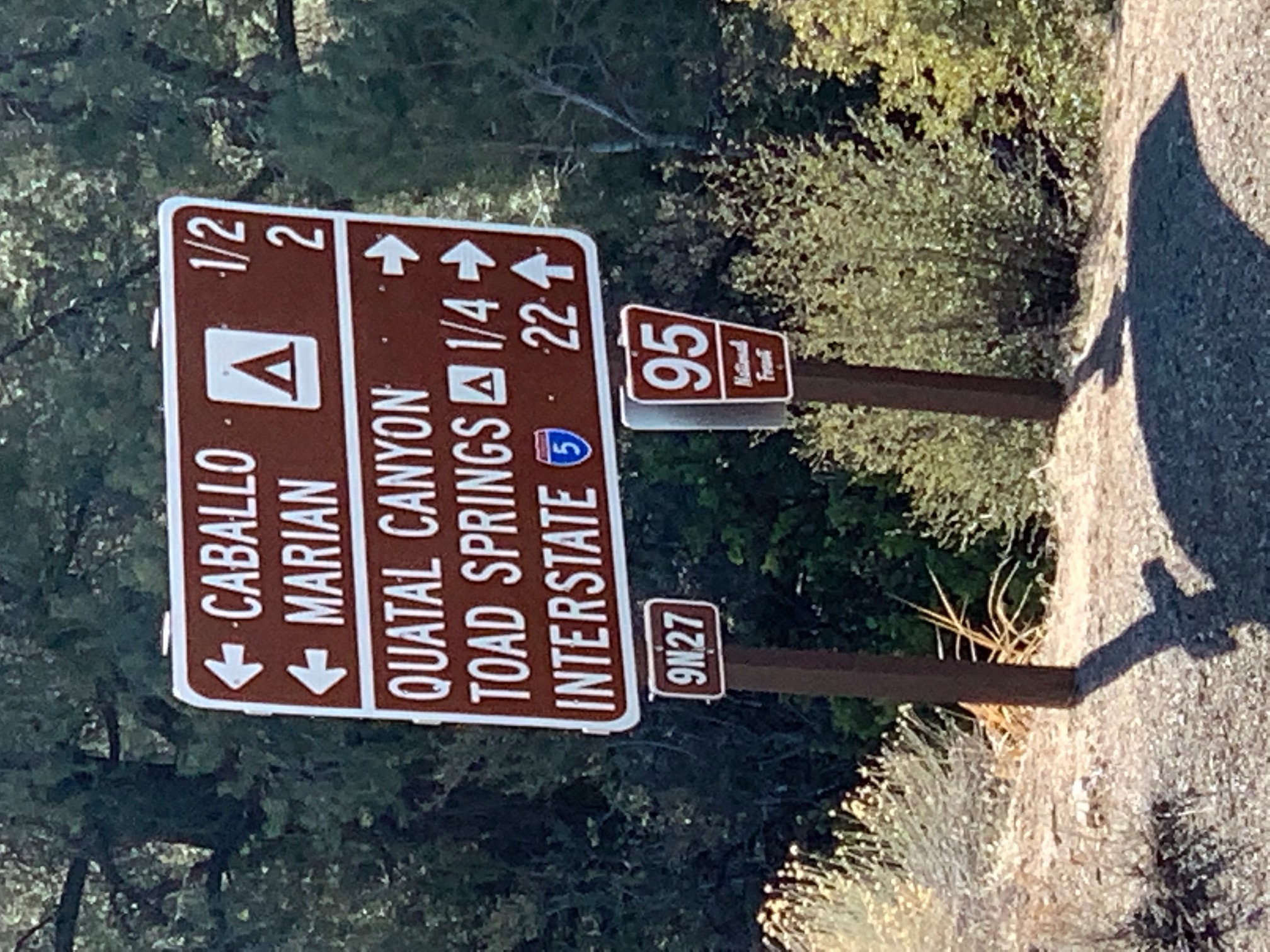
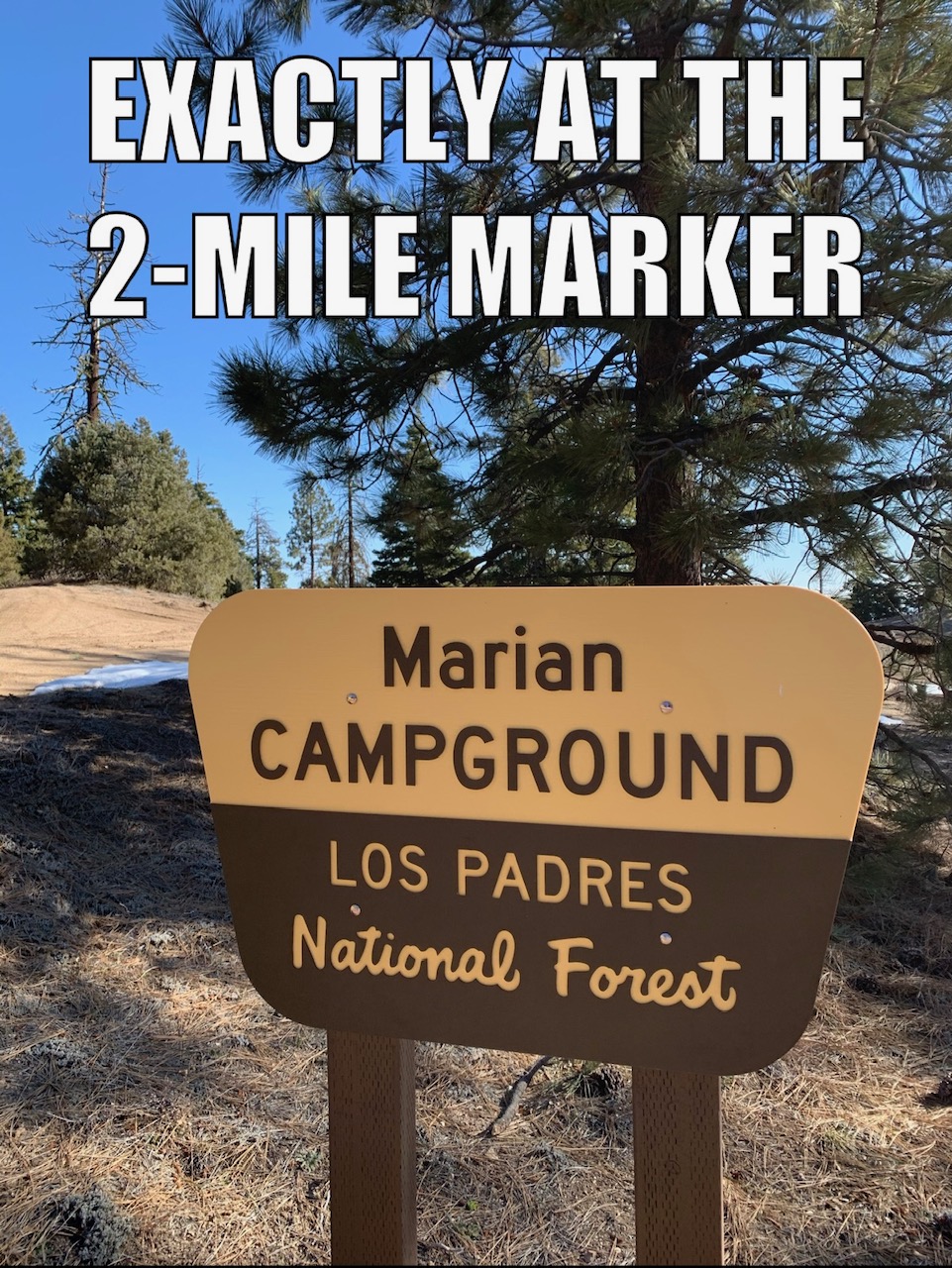
| Camp Description: | Located 2 miles and 900 feet above the gate at 9N27 and 95 aka Hudson Ranch Road, which is 30 minutes west of Frazier Park and the I-5. 9N27 is at the moment a smooth graded dirt road, and will remain smooth so long as the drought continues. Campground has 5 sites, each with picnic table and a firepit. No outhouse. No vegetation in the campground so the campsites are all visible to each other but at least are located some distance apart. Center site has the pine throne. Campground is in a bowl just short of the north ridge so you lack the infinity views of Valle Vista but you also lack the direct wind. For the views, just walk 100 feet north. Motorcycle trail 107 goes east west along the ridge and would make a great day hike using Marian as a base camp. |
| Water Source: | Dry |
| Water Source Details: | |
| Weather Conditions: | Cold and windy. Patches of Snow. |
| Images: | View North View North Cool Pine Throne |
Marian Campground Survey - 06-20-2014 - by Anonymous Surveyor| Link: | Marian Campground |
| Date: | 06-20-2014 |
| Surveyor Name: | Anonymous Surveyor |
| Camp Description: | Nice camp sights over looking San Joaquin Valley |
| Water Source: | Dry |
| Water Source Details: | |
| Weather Conditions: |
 Survey / Report Form