 Use Marker Groups
 Wolf 2002
Piru 2003
Day 2006
Zaca 2007
Gap 2008
La Brea 2009

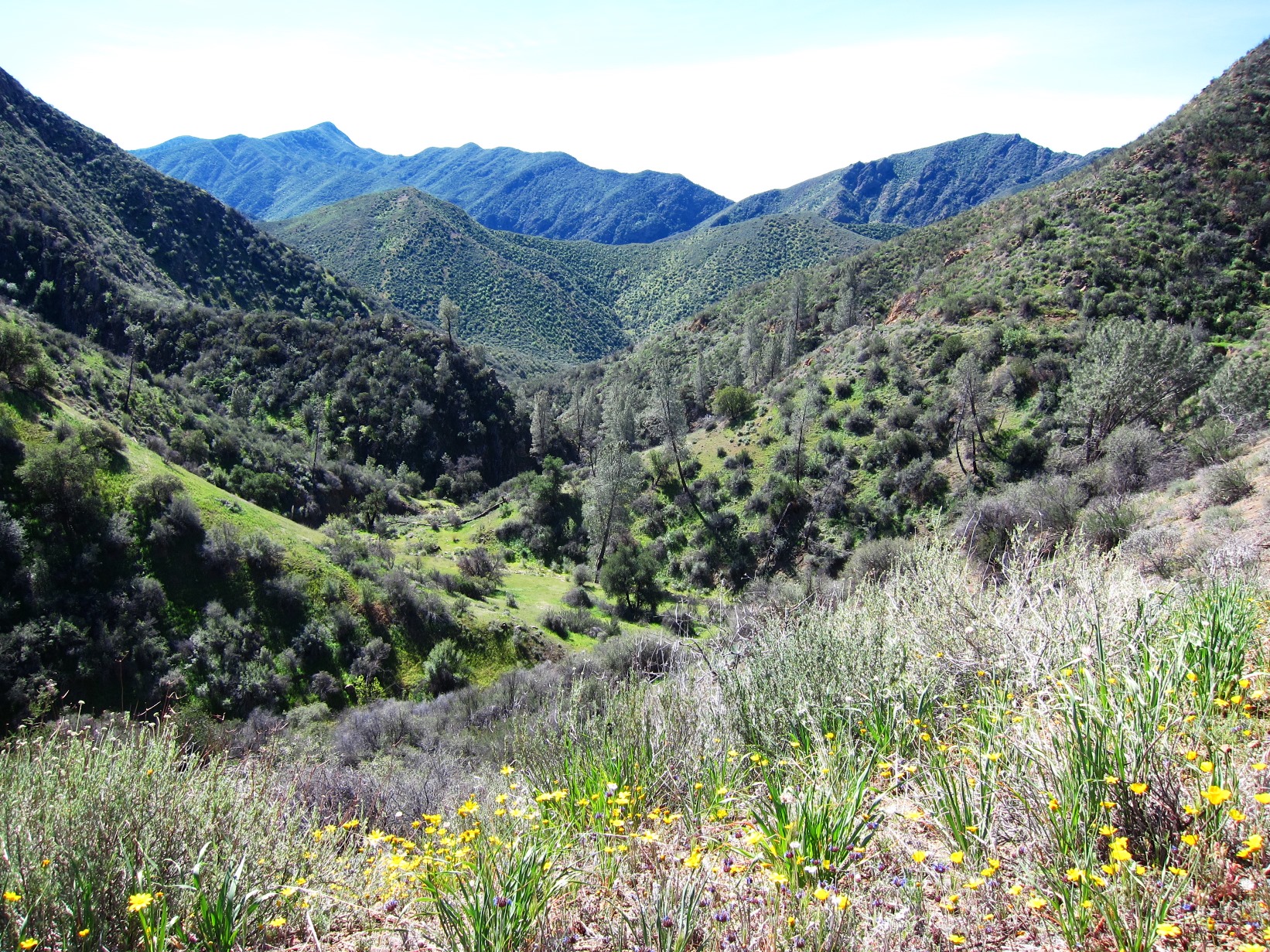
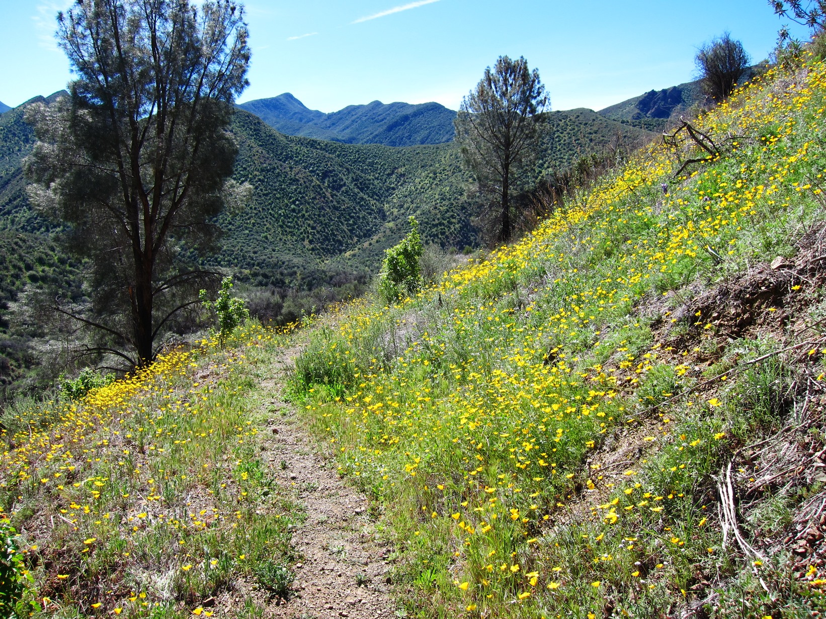
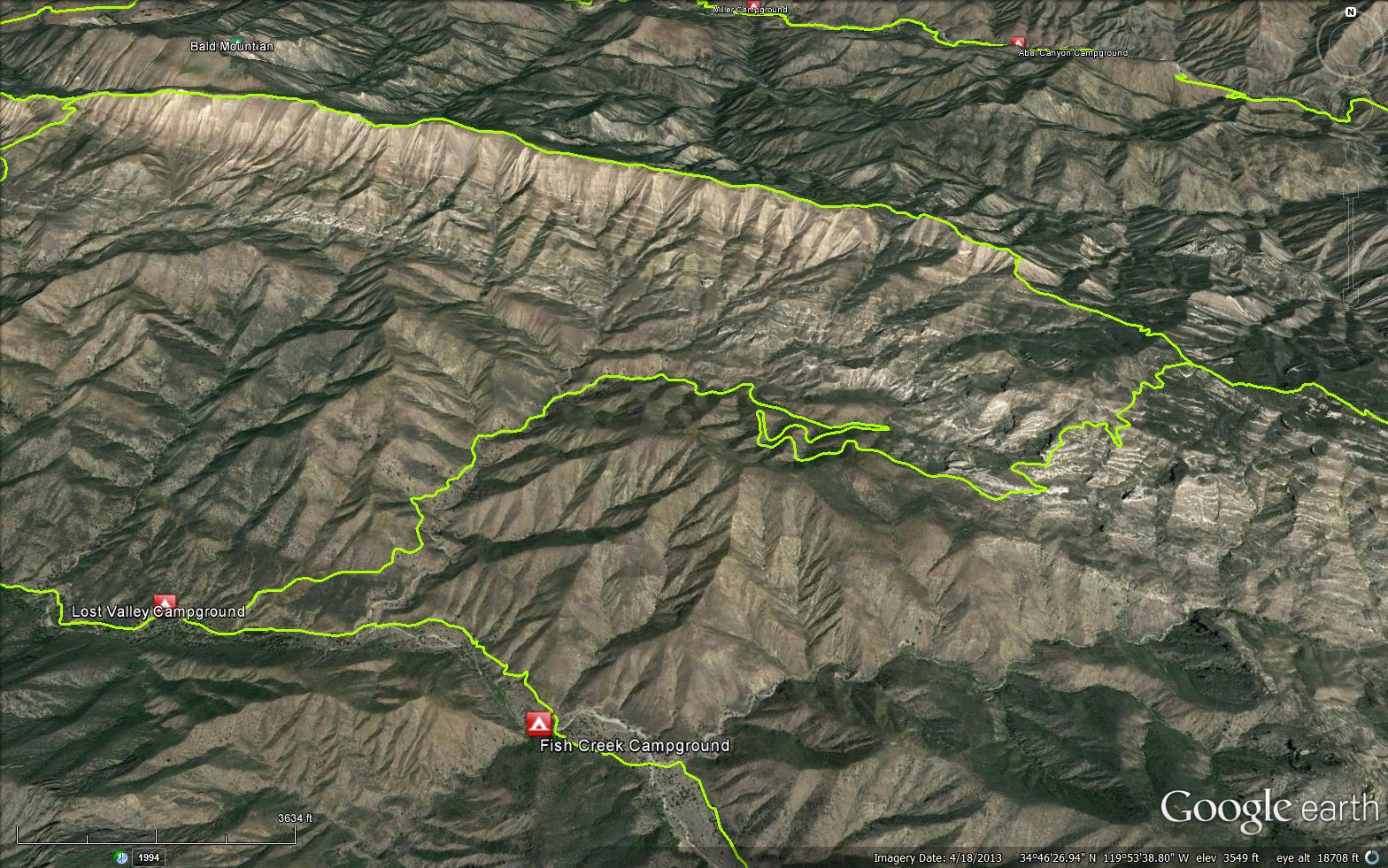
The Lost Valley Trail connects Manzana Creek with the Hurricane Deck Trail. The trail is used by day hikers looking to explore the secrets of Lost Valley as well as a connection for backpackers heading towards the Sisquoc.
In the early 20th century there were plans to build a road that bisected the forest from NIRA out to the Sierra Madre. The road was planned to go up Lost Valley to the Deck, head west along the Deck, drop down Big Bend Canyon, cross the Sisquoc and then head up to the Sierra Madre. Fortunately the road was never completed but the majority of the Lost Valley Trail follows the old roadbed that went from the Manzana Trail almost to the junction of the Hurricane Deck Trail. Since it is mostly following an old road, the tread is very easy to follow up the canyon.
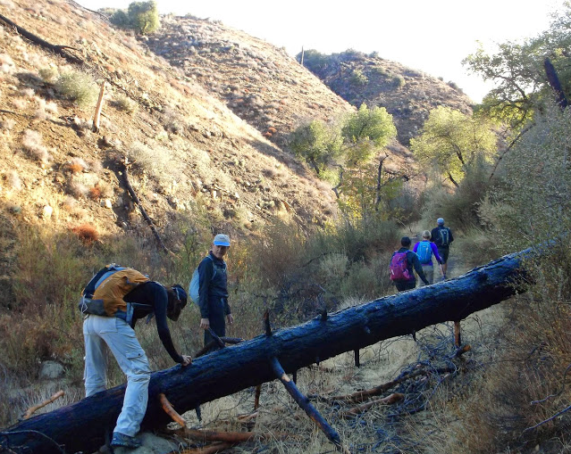
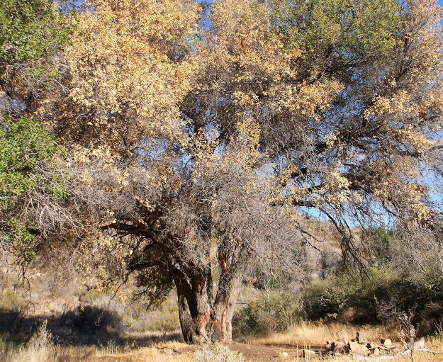
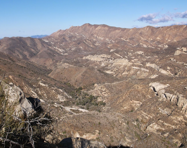
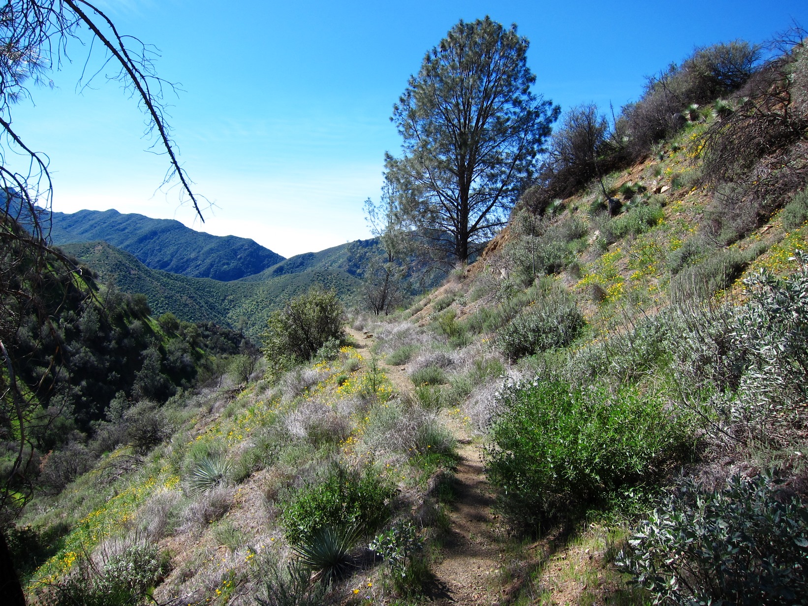
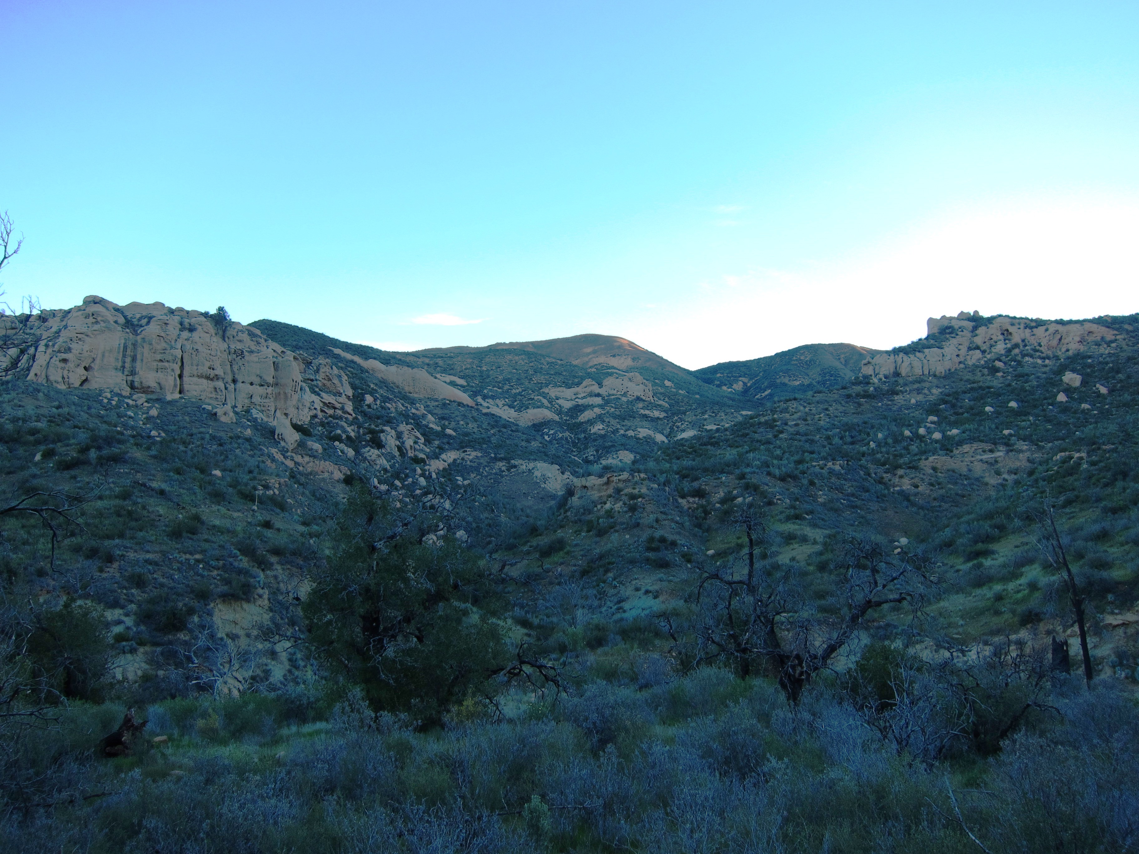
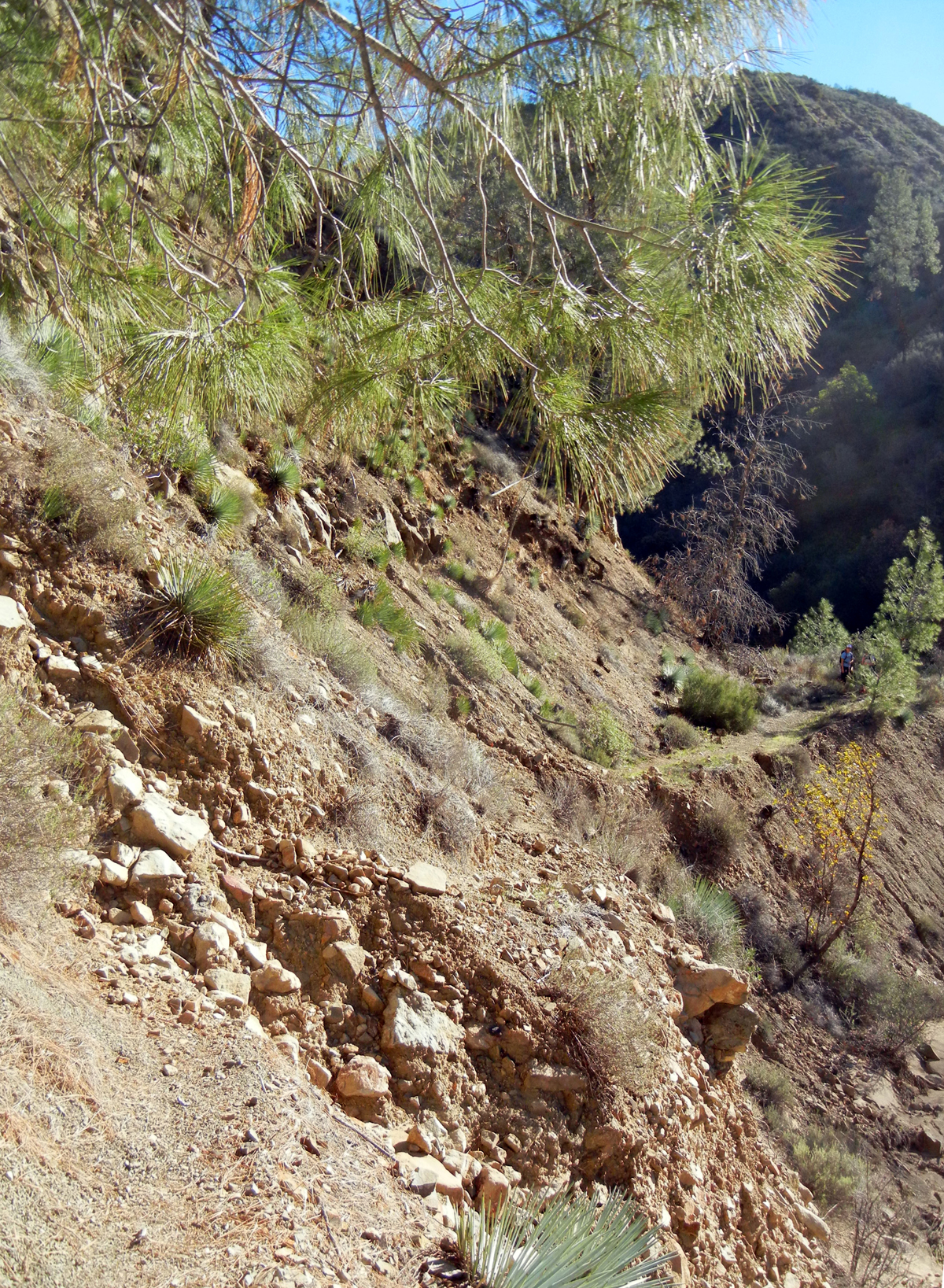
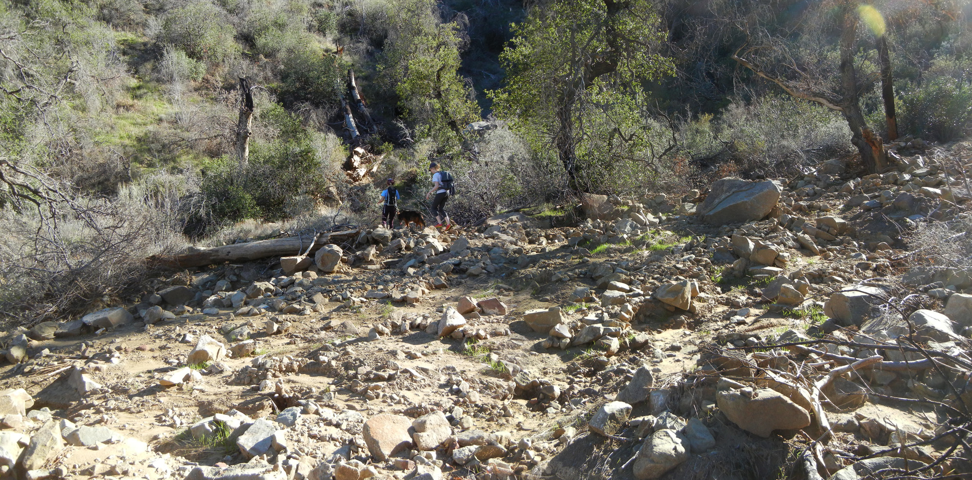
The trail starts from Lost Valley Camp, which is along the Manzana, and wanders up the canyon darting across the creek every now and then until reaching the base of the Lost Valley switchbacks. At the base is a Forest Service Camp called Twin Oaks. Twin Oaks was established in 2010. From here the trail switches back past Vulture Spring to a ridge line that provides epic views across to the spine of Hurricane Deck and down into the rock gardens of Sulpher Spring Canyon. Above this the trail hits an old camp that is now referred to as the âCowboy Campâ, which is also the end of the road construction. The final mile or so is along single track to its junction with the Hurricane Deck Trail.
The LPFA hosted two working projects in 2012 to clear the trail from Lost Valley Camp to the Deck. Â The majority of the work was done along the switchbacks and through the main canyon. Â The trail is very followable but expect to find the occasional downed tree or have to push through brush here or there. Â The final stretch above the roadbed needs tread work and is quite narrow. Â All in all the trail is in adequate shape and should pose no substantial problems. Â Lost Valley is in reference to the hidden nature of the canyon and it's east-west direction, not a suggestion that you'll get lost along the trail. Â That being said, there are some secrets within the canyon that one can only find by getting lost. Â


.JPG)


 Lost Valley Trail San Rafael Wilderness Survey - 01-01-2025 - by Kevin w
| Link: | Lost Valley Trail San Rafael Wilderness |
| Date: | 01-01-2025 |
| Surveyor Name: | Kevin w |
| Trail description: | Hiked to the view of Sulphur Spring Canyon, 15 miles round-trip from NIRA. Took 7 hours at a decent pace for young folks. A lot of the trail is shaded this time of year, otherwise it would already be a little hot. Views are some of the best in the forest. Vulture spring has good flow. Once you get on the ridge the trail didn't seem so bad. Picked off 300+ ticks from the dogs. |
| Mode of transport: | Hike |
| Trail condition: | Hard to follow |
| Condition details: | past twin oaks the brush gets even thicker but it's difficult to get lost. a few slide outs on the way to the ridge, but if you made it that far you're ok |
Lost Valley Trail San Rafael Wilderness Survey - 11-09-2024 - by Charlie A.| Link: | Lost Valley Trail San Rafael Wilderness |
| Date: | 11-09-2024 |
| Surveyor Name: | Charlie A. |
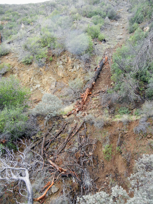
| Trail description: | Hiked from Nira to Twin Oaks camp. Trail was in solid condition if not a tad overgrown for the first two miles. Very quickly it becomes difficult to follow and as some points dangerous, with sections of the trail completely washed out on the hillside making it incredibly easy to slip and fall from quite a distance onto the riverbed below. The safer option for those sections is to climb down and follow the river bed until you can meet back up with the trail once it flattens out again. Beyond that there are a few riverbed crossings in which it is difficult to find the trail had it not been for some kind rock stacks leading the way. No water in the majority of the riverbed, there were a few small puddles here and there on the hike. Twin Oaks was dry. Twin Oaks camp is surprisingly well maintained, little overgrowth, the bench looks good and there is a shovel for the fire pit. |
| Mode of transport: | Hike |
| Trail condition: | Hard to follow |
| Images: | Flat spot at Twin Oaks camp Fallen out section of trail, better to go down to creek for this section late Hollyleaf Cherry (Prunus ilicifolia) for a fun trail snack |
Lost Valley Trail San Rafael Wilderness Survey - 11-09-2024 - by Erin C| Link: | Lost Valley Trail San Rafael Wilderness |
| Date: | 11-09-2024 |
| Surveyor Name: | Erin C |
| Trail description: | I remember this trail being pretty good back in 2018 which was the last time I did it. Not anymore! Trail is overgrown in quite a few sections, although there are also still a few sections that are just fine. There is one very dangerous section that is located about 1.8 miles from the junction of Manzana Trail. I didn't have a heavy backpack on and it was still very sketchy because there is only a very small area to put your feet and there is nothing solid to hold onto on the uphill side, so there is a high potential to fall into the creek and injure yourself (or worse). This trail should probably be closed right now for public safety until this area is fixed. The good news is there is a small amount flowing water in the creek in a few areas where the trail crosses the creek. I didn't even make it to Vulture Springs, so I am not sure if there is water there.d |
| Mode of transport: | Hike |
| Trail condition: | Needs some work |
| Images: | Lots of brushing work needed This is the very sketchy section. Very little area to place your feet and nothing solid to hold onto on the uphill side. Downed Oak tree after you pass the trail camp, but before you reach Vulture Springs Still beautiful out here! |
Lost Valley Trail San Rafael Wilderness Survey - 05-17-2024 - by Adam Donald| Link: | Lost Valley Trail San Rafael Wilderness |
| Date: | 05-17-2024 |
| Surveyor Name: | Adam Donald |
| Trail description: | Same as my previous survey from late 2023 I hiked about half of the trail, from the south junction with the
Manzana trail to Twin Oaks camp. I REALLY should have worn gaiters, the dry grass seeds destroyed my trail runners. Good flow in the creek until the trail splits away toward Twin Oaks camp. A trickle from the spring near Twin Oaks is enough to filter in a pinch but it's close to stagnant. About half of the creek crossings in this section still have fading pink flagging tape. Stay in the creek to bypass the first large slide, the second you can climb through without too much trouble. Two fallen trees need to be
crosscut out of the trail within 1/2 mile of Twin Oaks Camp. Quite a bit of brush in the
trail especially approaching Twin Oaks. To whoever used a machete to chop some ceonothus out of the trail: please don't. It just left a bunch of razor sharp dead branches sticking into the trail. Twin Oaks camp is not in great shape due to long grass and possibly even more large tree limbs have fallen directly into the camp. For some reason the picnic table seems to be a haven for ticks.  |
| Mode of transport: | Hike |
| Trail condition: | Hard to follow |
| Images: | Twin Oaks camp Twin Oaks camp (other oak) |
Lost Valley Trail San Rafael Wilderness Survey - 04-22-2024 - by Ian Evans| Link: | Lost Valley Trail San Rafael Wilderness |
| Date: | 04-22-2024 |
| Surveyor Name: | Ian Evans |
| Trail description: | I spent probably a quarter of the trail pushing through overgrown sections of the trail, coming from the east section of Hurricane Deck down the canyon. Chest to overheard high branches from both sides made it hard to navigate through, and it was particularly bad in rocky sections where you could stumble on unseen large rocks on the ground. There are some extremely sketchy, steep bypasses around eroded trail sections in the lower canyon. Loose rocks, loose dirt, bad news if you misstep. I was wearing long sleeves and pants with shoe gaiters, which made it bearable, if not fun. Vulture Spring was flowing at both the upper crossing (mind the poison oak) and lower down where the trail cuts back. Lost Valley Creek had decent flow at Twin Oaks, and all along the lower sections. |
| Mode of transport: | Hike |
| Trail condition: | Needs some work |
| Condition details: | Significant bushwhacking required in many sections |
Lost Valley Trail San Rafael Wilderness Survey - 01-28-2024 - by Anonymous Surveyor| Link: | Lost Valley Trail San Rafael Wilderness |
| Date: | 01-28-2024 |
| Surveyor Name: | Anonymous Surveyor |
| Trail description: | Trail condition the same as Adam Donald's report. Twin Oaks camp is dry. Lost Valley Creek is flowing at each crossing. Last water is about 1 mile from Twin Oaks Camp. |
| Mode of transport: | Hike |
| Trail condition: | Needs some work |
Lost Valley Trail San Rafael Wilderness Survey - 12-08-2023 - by Adam Donald| Link: | Lost Valley Trail San Rafael Wilderness |
| Date: | 12-08-2023 |
| Surveyor Name: | Adam Donald |
| Trail description: | I hiked about half of the trail, from the south junction with the Manzana trail to Twin Oaks camp. Intermittent water in the creek, but it's really a trickle even in places where it is above ground. Closest surface water downstream of Twin Oaks is about half a mile. Almost all of the creek crossings in the section I hiked are flagged with fading pink tape. Without the flags you could definitely spend some time looking for the right path. There are two big slides thanks to the January 2023 storms. I climbed over the one closer to Manzana, but that is definitely not the recommended solution - just go down to the creekbed and bypass a couple hundred yards of trail. The other one is rocky but fine to pick your way over. Two fallen trees need to be
crosscut out of the trail within 1/2 mile of Twin Oaks Camp - too much for my small silky saw and the time I had. Quite a bit of brush in the trail especially approaching Twin Oaks. Beautiful views along the way and Twin Oaks camp is in great shape, although you would need to carry all your water to stay there. |
| Mode of transport: | Hike |
| Trail condition: | Hard to follow |
| Images: | Twin Oaks camp View from Twin Oaks camp |
Lost Valley Trail San Rafael Wilderness Survey - 04-20-2022 - by Stan Atchison| Link: | Lost Valley Trail San Rafael Wilderness |
| Date: | 04-20-2022 |
| Surveyor Name: | Stan Atchison |
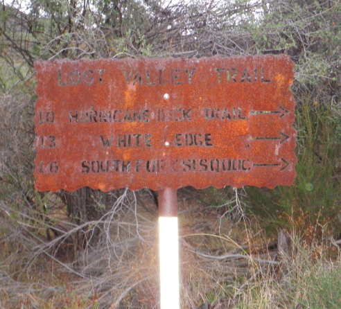
| Trail description: | Hiked as part of a loop from Nira - Potrero - Hurricane Deck - Lost Valley - Manzana - Nira. Lost Valley was overall in good shape and easy to follow. There was a trickle of clear water at Vulture Spring that the dog was able to get some water out of a small pool. The sign at the Hurricane Deck/Lost Valley junction is a bit misleading in its distance numbers. It shows 10 miles to the Manzana River but my GPS showed 7.3. Several trees across the trail and some small rockslides across the trail in several places. Saw a small Whip Snake. Long walk down from the Deck. |
| Mode of transport: | Hike |
| Trail condition: | Good shape and easy to follow |
Lost Valley Trail San Rafael Wilderness Survey - 04-15-2022 - by Diane Soini| Link: | Lost Valley Trail San Rafael Wilderness |
| Date: | 04-15-2022 |
| Surveyor Name: | Diane Soini |
| Trail description: | I forgot to mention that Vulture spring was only a single drip. I think if a hole was dug below the drip you could build a little pool of water for people who desperately need it. I would not rely on this spring for water. |
| Mode of transport: | Hike |
| Trail condition: | Good shape and easy to follow |
Lost Valley Trail San Rafael Wilderness Survey - 04-15-2022 - by Diane Soini| Link: | Lost Valley Trail San Rafael Wilderness |
| Date: | 04-15-2022 |
| Surveyor Name: | Diane Soini |
| Trail description: | Trail is in good shape after the road being closed for a year. The creek was drier than expected. There was still water in the creek about half mile SW of Oak tree camp. It's a little mossy but clear if you are careful and use a little scoop. |
| Mode of transport: | Hike |
| Trail condition: | Good shape and easy to follow |
Lost Valley Trail San Rafael Wilderness Survey - 04-26-2021 - by Ted Merrill| Link: | Lost Valley Trail San Rafael Wilderness |
| Date: | 04-26-2021 |
| Surveyor Name: | Ted Merrill |
| Trail description: | Basically most of this trail is in very good shape... most of it is an old road cut so excellent tread. We made rapid progress. There is one spot, not too long, a few miles above Twin Oaks Camp, where the ceanothis has regrown so that it is necessary to push through... could become difficult in 1 to 2 years. Twin Oaks Camp was a lovely place to camp, with a great view of the amazing rock formations and some nice trees. There is no water along the trail except there were still a few seeps/puddles in Vulture Spring ... we weren't that desperate. |
| Mode of transport: | Hike |
| Trail condition: | Needs some work |
| Condition details: | Ceanothis bad spot 2 miles above Twin Oaks |
Lost Valley Trail San Rafael Wilderness Survey - 04-04-2021 - by Quentin Williams| Link: | Lost Valley Trail San Rafael Wilderness |
| Date: | 04-04-2021 |
| Surveyor Name: | Quentin Williams |
| Trail description: | Really pretty right now in the San Rafael Wilderness. There was no water once you leave Manzana Creek. The trail was easy to follow. We stumbled across a rattlesnake on the trail. Super lovely trail, will definitely go back to this one. I connected this trail back to Nira Campground from White Ledge campground. Recommend this trail as a long day hike or accessing hurricane deck. |
| Mode of transport: | Hike |
| Trail condition: | Good shape and easy to follow |
Lost Valley Trail San Rafael Wilderness Survey - 02-28-2020 - by Los Padres Forest Association| Link: | Lost Valley Trail San Rafael Wilderness |
| Date: | 02-28-2020 |
| Surveyor Name: | Los Padres Forest Association |
| Trail description: | Hiked Lost Valley Trail as part of a 6-day survey around the San Rafael Wilderness. Lost Valley was in good shape but did have 4+ downed trees that need to be cleared. The first is 1/4 mile above the Manzana Trail junction and the farthest up is beyond Vulture Spring. There was some water at Twin Oaks and a smaller puddle at Vulture Spring as per usual. The top 1/3 mile before the Deck could use some tread work. |
| Mode of transport: | Hike |
| Trail condition: | Needs some work |
| Images: | Lower downed tree, closer to Twin Oaks. Bit higher up downed tree. Biggest one up above Vulture Spring Vulture Spring |
Lost Valley Trail San Rafael Wilderness Survey - 12-13-2020 - by Paul Muhl| Link: | Lost Valley Trail San Rafael Wilderness |
| Date: | 12-13-2020 |
| Surveyor Name: | Paul Muhl |
| Trail description: | Beautiful cool overcast day for a hike. The trail is is mostly good shape as described at the top of this page. Creeks are dry, except for a few puddles. I brought all my own water. The views get better and better the whole way, and if you make it to the deck you get a great view north towards the sisquoc river valley. |
| Mode of transport: | Hike |
| Trail condition: | Needs some work |
| Images: | Fall colors just below Twin Oaks camp Looking east from the ridge line At the top; hurricane deck intersection looking north |
Lost Valley Trail San Rafael Wilderness Survey - 12-05-2020 - by Brent| Link: | Lost Valley Trail San Rafael Wilderness |
| Date: | 12-05-2020 |
| Surveyor Name: | Brent |
| Trail description: | As all things hiking are relative, by San Rafael Wilderness standards, this trail is in great shape. I'm trying to remember, but there are perhaps 3-5 downed trees across the trail (all easily traversed). Some spots are slightly overgrown, but if you're wearing pants it's really nothing to whine much about. Just before the Hurricane Deck junction, the trail is considerably more narrow and steep; this area is still passable without issue, however. Water is quite scarce on the trail at present. Vulture Spring is only a trickle with one or two tiny puddles to pump from. Overall, had a wonderful hike and SO appreciate everyone's efforts to keep the trail in shape. |
| Mode of transport: | Hike |
| Trail condition: | Good shape and easy to follow |
Lost Valley Trail San Rafael Wilderness Survey - 08-29-2020 - by Alexis Kubicki| Link: | Lost Valley Trail San Rafael Wilderness |
| Date: | 08-29-2020 |
| Surveyor Name: | Alexis Kubicki |
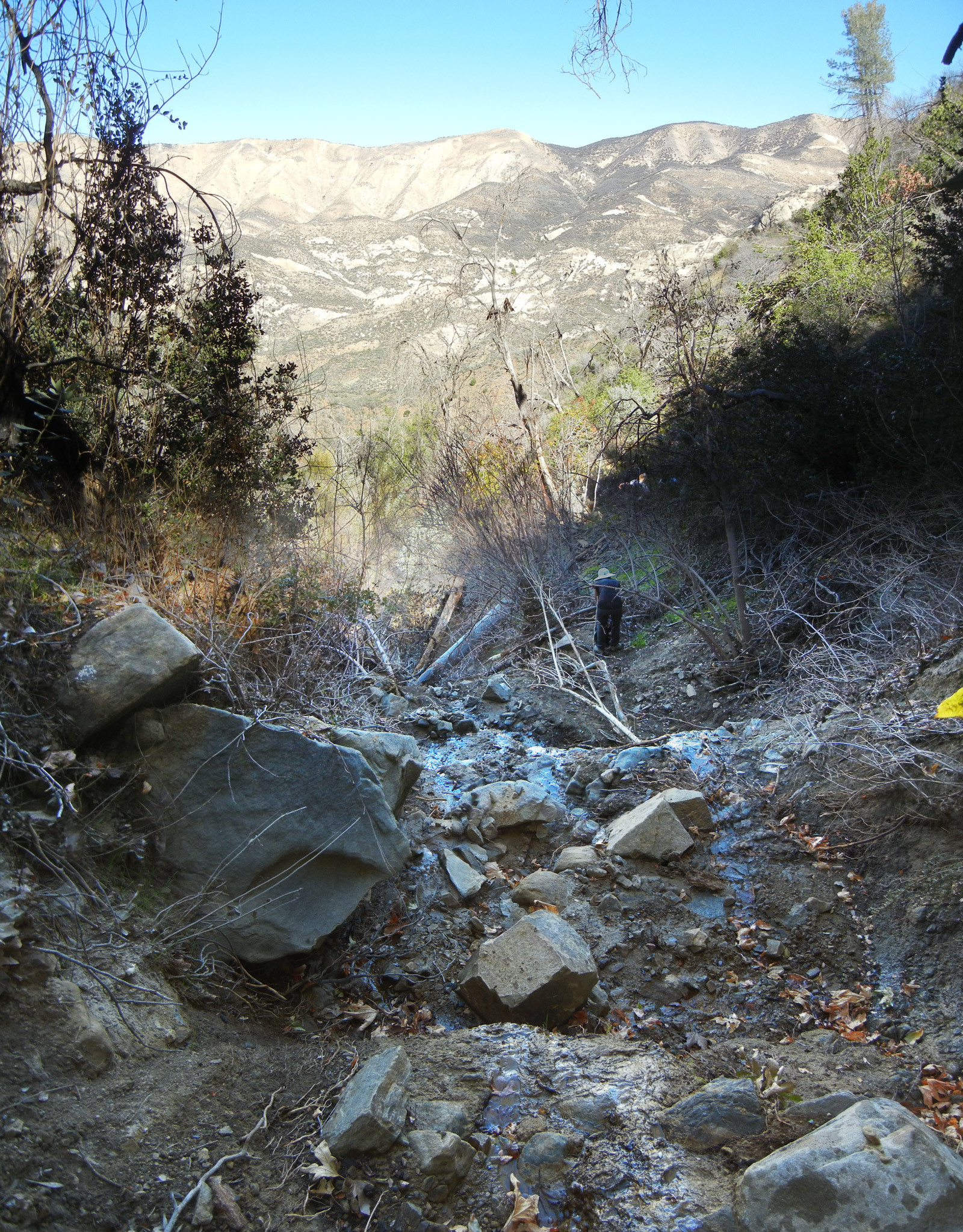
| Trail description: | Spent the weekend camping at Nira, and decided to take an afternoon trek up Lost Valley Trail. Weather was mid-80's, quite pleasant for the first couple miles of dappled shade. Some spotty and stagnant water in Manzana Creek. Once the trail split away from the creek it becomes hotter and is quite exposed, with only the dried husk of a former stream at the bottom of the valley the entire way. We spent the rest of the hike hopping between the meager shade the sparse pines had to offer. The trail was surprisingly well-maintained and easy to follow. After the 2nd "creek" crossing there were several sketchy pines looming at 45 degree angles over the trail, which we brusquely hurried past. There was a single downed pine around ~4.25 miles in, which had fallen parallel along the trail, but it was easy to step around. There is a nice spot to rest near a "Trail ->" sign, approx 1.25 miles before you hit Twin Oaks Camp, where there is good shade and a great cross-breeze. Someone had set up a small fire-ring and a circle of sitting rocks below a tree. I regret that we did not disassemble the fire-ring, as it was very foolishly placed with regards to safety (though of course you shouldn't have any campfires in the backcountry, right now). Had there been water in the creek it might be a nice spot to camp. We continued until the valley began opening up to views of Hurricane Deck, about 0.5 miles out from Twin Oaks Camp, where we realized we had gone through more than half of the 3L of water we had brought per person. Did I mention it was hot and dry? Not wanting to push our luck, we decided to end our hike here. Would love to revisit this after it cools off a bit! |
| Mode of transport: | Hike |
| Trail condition: | Good shape and easy to follow |
| Images: | Sneaking a peak at Hurricane Deck and alien rock formations |
Lost Valley Trail San Rafael Wilderness Survey - 06-07-2020 - by Murray Ruben| Link: | Lost Valley Trail San Rafael Wilderness |
| Date: | 06-07-2020 |
| Surveyor Name: | Murray Ruben |
| Trail description: | Very nice trail with almost imperceptible grade, even up the switchbacks, but needs some brushing as many bushes have begun to grow out into the main tread way. Great views from the ridge. Easy to follow. Water running in main creek and most side creeks down in valley floor, all the way to the campsite at the base of the switchbacks. Rather surprised since its early June, but probably due to late spring storms. |
| Mode of transport: | Hike |
| Trail condition: | Needs some work |
| Condition details: | Day hike up 6.5 mi |
Lost Valley Trail San Rafael Wilderness Survey - 05-14-2020 - by Los Padres Forest Association| Link: | Lost Valley Trail San Rafael Wilderness |
| Date: | 05-14-2020 |
| Surveyor Name: | Los Padres Forest Association |
| Trail description: | Dan McCaslin article about Lost Valley and Twin Oaks Camp, have at it! |
| Mode of transport: | Hike |
| Trail condition: | Good shape and easy to follow |
Lost Valley Trail San Rafael Wilderness Survey - 05-12-2020 - by Anonymous Surveyor| Link: | Lost Valley Trail San Rafael Wilderness |
| Date: | 05-12-2020 |
| Surveyor Name: | Anonymous Surveyor |
| Trail description: | No water at Twin Oaks. Vulture Spring has the smallest of a trickle.ÃÂ Foxtails are out.ÃÂ |
| Mode of transport: | Hike |
| Trail condition: | Good shape and easy to follow |
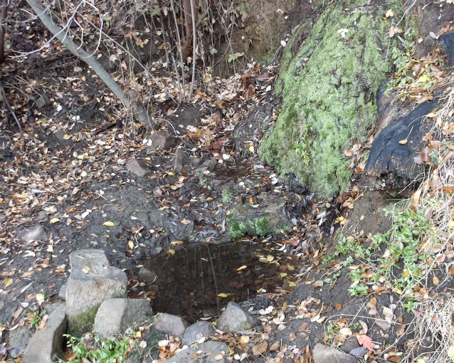
| Images: | Vulture Spring |
Lost Valley Trail San Rafael Wilderness Survey - 04-22-2020 - by Jeff Wheelwright| Link: | Lost Valley Trail San Rafael Wilderness |
| Date: | 04-22-2020 |
| Surveyor Name: | Jeff Wheelwright |
| Trail description: | The middle third has some rough spots. Water at the Twin Oaks camp was OK but perhaps not for long. Higher up on the trail, Vulture Spring still flowing, but again, perhaps not for long. |
| Mode of transport: | Hike |
| Trail condition: | Good shape and easy to follow |
Lost Valley Trail San Rafael Wilderness Survey - 01-01-2020 - by Duane Waite| Link: | Lost Valley Trail San Rafael Wilderness |
| Date: | 01-01-2020 |
| Surveyor Name: | Duane Waite |
| Trail description: | Ten mile total trail run (5 miles each out and back) up Lost Valley trail from Nira on New Year's Day. There is a small camp about two miles up the trail near a "Trail" sign that looks like it may be fun to set up a tent at. A trickle of water along most of the trail, but it looks like it may dry up soon. Definitely want to make it all the way to Hurricane Deck next time! |
| Mode of transport: | Array |
| Trail condition: | Good shape and easy to follow |
Lost Valley Trail San Rafael Wilderness Survey - 11-23-2019 - by Paul Cronshaw| Link: | Lost Valley Trail San Rafael Wilderness |
| Date: | 11-23-2019 |
| Surveyor Name: | Paul Cronshaw |
| Trail description: | I camped at the stealth camp with the trail sign and firering located 1/2 mile from Twin Oaks Camp.ÃÂ I filled up with water at the creekcrossing that has a weeping bend in the trail and an old metal road sign. See my 11/11/19 report for additional information. |
| Mode of transport: | Hike |
| Trail condition: | Good shape and easy to follow |
| Images: | Twin Oaks Camp Old Sign |
Lost Valley Trail San Rafael Wilderness Survey - 11-11-2019 - by Paul "The Beeman" Cronshaw| Link: | Lost Valley Trail San Rafael Wilderness |
| Date: | 11-11-2019 |
| Surveyor Name: | Paul "The Beeman" Cronshaw |
| Trail description: | I camped at Cowboy Camp located half mile from the junction with the Eastern section of the Hurricane Deck trail, and continued down the trail to Los Valley Camp. This trail is in great condition, easy to follow. A couple downed trees are located about a mile above Twin Oaks Camp. There is water at Vulture Springs and at a creek crossing a mile below Twin Oaks. |
| Mode of transport: | Hike |
| Trail condition: | Good shape and easy to follow |
| Images: | Cowboy camp is located 1/2 mile from Eastern Hurricane junction Autumn colors at Vulture Springs Downed tree located about 1/2 mile above Twin Oaks Camp. Water at creek crossing about 1/2 mile below Twin Oaks Camp |
Lost Valley Trail San Rafael Wilderness Survey - 06-18-2019 - by Los Padres Forest Association| Link: | Lost Valley Trail San Rafael Wilderness |
| Date: | 06-18-2019 |
| Surveyor Name: | Los Padres Forest Association |
| Trail description: | The LPFA spent a few weeks working the Lost Valley Trail in early 2019, mostly the upper most section near the junction with the Hurricane Deck Trail.ÃÂ The Lost Valley Trail is in good shape for the most part but we have received reports of a few downed trees along the trail that we are hoping to clear in the near future. |
| Mode of transport: | Array |
| Trail condition: | Needs some work |
| Images: | Tree #1 is at the first crossing of the Lost Valley Creek |
Lost Valley Trail San Rafael Wilderness Survey - 06-03-2019 - by Anonymous Surveyor| Link: | Lost Valley Trail San Rafael Wilderness |
| Date: | 06-03-2019 |
| Surveyor Name: | Anonymous Surveyor |
| Trail description: | Made it to the top of Hurricane Deck to all the new recent clearing done by the preservationists.. but the only sign up there is pointed back to manzana river and nira.ÃÂ Nothing pointing the direction to the next trails back to White Ledge or Sisqouk river.ÃÂ Complete BS!!ÃÂ ÃÂ They obviously trimmed brush back and mad a fire break, but after walking the fire break trail for a mile and a half.... we had to turn around and go back a few miles to vulture springs so we didnt die.ÃÂ ÃÂ |
| Mode of transport: | Hike |
| Trail condition: | Needs some work |
Lost Valley Trail San Rafael Wilderness Survey - 03-24-2019 - by Los Padres Forest Association| Link: | Lost Valley Trail San Rafael Wilderness |
| Date: | 03-24-2019 |
| Surveyor Name: | Los Padres Forest Association |
| Trail description: | Dan McCaslin article from Noozhawk about a hike he did in March 2019 along the Lost Valley Trail, enjoy: |
| Mode of transport: | Hike |
| Trail condition: | Needs some work |
Lost Valley Trail San Rafael Wilderness Survey - 04-27-2019 - by Tony G.| Link: | Lost Valley Trail San Rafael Wilderness |
| Date: | 04-27-2019 |
| Surveyor Name: | Tony G. |
| Trail description: | Water along the creek all the way to Twin Oak camp where it is a trickle with some small pools, and a steady trickle coming from Vulture Spring. The water in the creek by Twin Oak camp won't be around for much longer. Trail is in good shape to the Hurricane Deck. Ran into some guys that made the loop over the Deck from White Ledge - they said the trail was in good shape. |
| Mode of transport: | Hike |
| Trail condition: | Good shape and easy to follow |
Lost Valley Trail San Rafael Wilderness Survey - 04-06-2019 - by Joshua Isaac| Link: | Lost Valley Trail San Rafael Wilderness |
| Date: | 04-06-2019 |
| Surveyor Name: | Joshua Isaac |
| Trail description: | Flowing water at Twin Oaks camp and Vulture Springs. Beautiful hike, easy to follow and relatively clear except for a couple of trees to climb over.ÃÂ |
| Mode of transport: | Hike |
| Trail condition: | Needs some work |
| Condition details: | 2 or 3 downed trees to climb over, otherwise perfect |
Lost Valley Trail San Rafael Wilderness Survey - 01-25-2019 - by Los Padres Forest Assocation| Link: | Lost Valley Trail San Rafael Wilderness |
| Date: | 01-25-2019 |
| Surveyor Name: | Los Padres Forest Assocation |
| Trail description: | Good Noozhawk read about a day hike on the Lost Valley trail headed toward Hurricane Deck. |
| Mode of transport: | Hike |
| Trail condition: | Good shape and easy to follow |
Lost Valley Trail San Rafael Wilderness Survey - 1-25-2019 - by Los Padres Forest Association| Link: | Lost Valley Trail San Rafael Wilderness |
| Date: | 1-25-2019 |
| Surveyor Name: | Los Padres Forest Association |
| Trail description: | Dan McCaslin article about a January 2019 hike up Lost Valley.....ÃÂ Enjoy! https://www.noozhawk.com/article/dan_mccaslin_on_the_lost_valley_trail_seeking_twin_oaks_camp_20190124 |
| Mode of transport: | Hike |
| Trail condition: | Good shape and easy to follow |
Lost Valley Trail San Rafael Wilderness Survey - 12-22-2018 - by Los Padres Forest Association| Link: | Lost Valley Trail San Rafael Wilderness |
| Date: | 12-22-2018 |
| Surveyor Name: | Los Padres Forest Association |
| Trail description: | LPFA Trail Crew and volunteers worked the Lost Valley for a week in December 2018.ÃÂ The trail is clear of all obstacles and 95% brushed from top to bottom.ÃÂ Go get some! Up next for the LPFA Trail Crew is the Hurricane Deck Trail...... |
| Mode of transport: | Stock |
| Trail condition: | Good shape and easy to follow |
Lost Valley Trail San Rafael Wilderness Survey - 12-27-2018 - by Erin C.| Link: | Lost Valley Trail San Rafael Wilderness |
| Date: | 12-27-2018 |
| Surveyor Name: | Erin C. |
| Trail description: | Vulture spring has a tiny bit of flow, enough to pump.ÃÂ This is a very scenic trail with amazing rock formations.ÃÂ Grandma and Cocobear loved it! Trail is in great shape.ÃÂ Props to LPFA! |
| Mode of transport: | Hike |
| Trail condition: | Good shape and easy to follow |
| Images: | |
Lost Valley Trail San Rafael Wilderness Survey - 11-20-2018 - by Paul Cronshaw| Link: | Lost Valley Trail San Rafael Wilderness |
| Date: | 11-20-2018 |
| Surveyor Name: | Paul Cronshaw |
| Trail description: | Hiked this trail from Hurricane Deck down to Lost Valley Camp.ÃÂ Trail has been worked by the LPFA and its wonderful volunteers so it is easy to follow with no encroaching brush. Vulture Springs has two small pools of water.ÃÂ ÃÂ Twin Oaks campsite is in good condition. Moved the table so that it would not be crushed by any of the dying oak limbs.ÃÂ ÃÂ ÃÂ ÃÂ There are two downed trees located between the camp and the trail sign.ÃÂ ÃÂ Slide areas are passable.ÃÂ ÃÂ |
| Mode of transport: | Hike |
| Trail condition: | Good shape and easy to follow |
| Images: | Vulture Springs |
Lost Valley Trail San Rafael Wilderness Survey - 05-26-2018 - by Tony G.| Link: | Lost Valley Trail San Rafael Wilderness |
| Date: | 05-26-2018 |
| Surveyor Name: | Tony G. |
| Trail description: | I hiked up to Twin Oaks Camp. Trail is in good shape and easy to follow. Water is a trickle with some decent pools in the creek but will disappear soon.ÃÂ |
| Mode of transport: | Hike |
| Trail condition: | Good shape and easy to follow |
Lost Valley Trail San Rafael Wilderness Survey - 01-12-2018 - by Los Padres Forest Association| Link: | Lost Valley Trail San Rafael Wilderness |
| Date: | 01-12-2018 |
| Surveyor Name: | Los Padres Forest Association |
| Trail description: | LPFA scouted the Lost Valley Trail for future work towards the top.ÃÂ Trail remains very followable but is in worse shape after the Jan 9 storms.ÃÂ A couple new downed trees and the slides we had cleared in December got a fresh coat of ravel thrown across the top.ÃÂ Still very good compared to how its been up there in recent years.ÃÂ Go get it! |
| Mode of transport: | Hike |
| Trail condition: | Good shape and easy to follow |
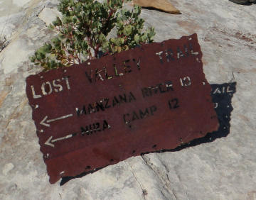
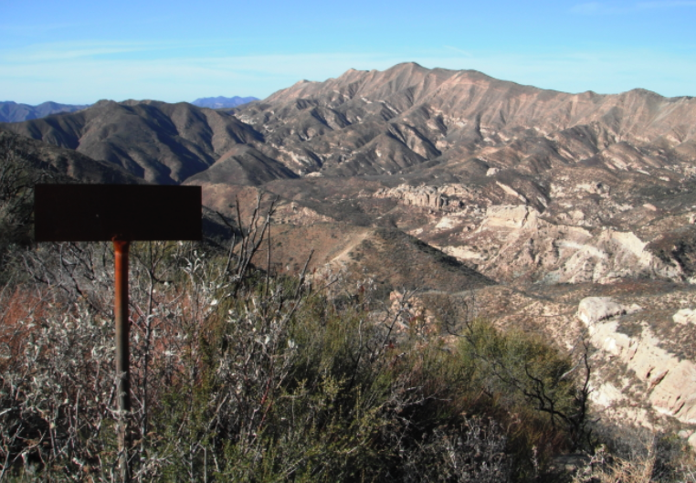
| Images: | One of two downed trees, both located below Twin Oaks Camp. Twin Oaks Camp, Sunrise The slide at Vulture Spring Sign at junction with Hurricane Deck Trail |
Lost Valley Trail San Rafael Wilderness Survey - 12-30-2017 - by Los Padres Forest Association| Link: | Lost Valley Trail San Rafael Wilderness |
| Date: | 12-30-2017 |
| Surveyor Name: | Los Padres Forest Association |
| Trail description: | LPFA hosted a multi-day trail project focused on clearing the Lost Valley Trail.ÃÂ We cleared all the trees and slides and brushed the trail from Lost Valley Camp up to the Sulphur Spring Canyon lookout.ÃÂ This includes the two infamous slides near Vulture Spring as well as the large "monkey tree" that was blocking the middle portion of the trail.ÃÂ There was water at Vulture Spring as well as the seep 20 mins below Twin Oaks Camp. Up next we'll be pushing up to the Deck junction and hopefully getting started on the East Hurricane Deck later this spring.ÃÂ Stay tuned..... |
| Mode of transport: | Hike |
| Trail condition: | Good shape and easy to follow |
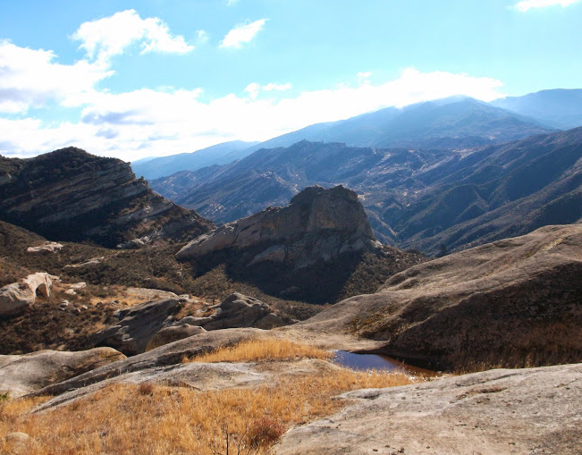
| Images: | The monkey tree, after. The slide just below Vulture Spring, this was nothing more than a goat trail. No hike along Lost Valley is complete without a view of Lost Valley and the Deck. And of course the view the other direction down Sulphur Spring Canyon. |
Lost Valley Trail San Rafael Wilderness Survey - 02-12-2018 - by Dan S| Link: | Lost Valley Trail San Rafael Wilderness |
| Date: | 02-12-2018 |
| Surveyor Name: | Dan S |
| Trail description: | There was recently some work done on the trail, so it isn't hard to follow until you reach the Deck - the whole Lost Valley is dry EXCEPT a very tiny trickle (I think Vulture Spring) a few miles from the Hurricane Deck Junction. |
| Mode of transport: | Hike |
| Trail condition: | Good shape and easy to follow |
Lost Valley Trail San Rafael Wilderness Survey - 01-15-2018 - by David Herrig| Link: | Lost Valley Trail San Rafael Wilderness |
| Date: | 01-15-2018 |
| Surveyor Name: | David Herrig |
| Trail description: | Bone dry except for a slight trickle feeding a pool on a switchback about 3 miles from Hurricane Deck junction |
| Mode of transport: | Hike |
| Trail condition: | Good shape and easy to follow |
Lost Valley Trail San Rafael Wilderness Survey - 01-07-2018 - by CaHikerChick| Link: | Lost Valley Trail San Rafael Wilderness |
| Date: | 01-07-2018 |
| Surveyor Name: | CaHikerChick |
| Trail description: | Took a day hike up Lost Valley Trail to Twin Oaks Camp, 5.25 miles from NIRA trailhead.ÃÂ Trail is in great shape due to very recent trailwork by LPFA, removing/cutting downed trees and fixing trail tread.ÃÂ Passed a couple of small pools of water, but basically dry. |
| Mode of transport: | Hike |
| Trail condition: | Good shape and easy to follow |
Lost Valley Trail San Rafael Wilderness Survey - 11-02-2017 - by Terry Jarrett| Link: | Lost Valley Trail San Rafael Wilderness |
| Date: | 11-02-2017 |
| Surveyor Name: | Terry Jarrett |
| Trail description: | There is some surface water in the creek bed on the way to Twin Oaks campsite. Vulture Spring has a usable trickle.ÃÂ |
| Mode of transport: | Hike |
| Trail condition: | Needs some work |
| Condition details: | Most of the obstructions reported on 03-10-2017 by the Los Padres Forest Association remain. |
Lost Valley Trail San Rafael Wilderness Survey - 04-21-2016 - by Los Padres Forest Association| Link: | Lost Valley Trail San Rafael Wilderness |
| Date: | 04-21-2016 |
| Surveyor Name: | Los Padres Forest Association |
| Trail description: | LPFA Working Vacation Spring 2016 along the Lost Valley Trail.ÃÂ You can read the full report below, here's the Cliff Notes: - Brushed, logged and performed tread work from Lost Valley Camp to past Vulture Springs - More work needed on last stretch up to Hurricane Deck - Trail was stock passable - No water on trail, lots of water coming from the sky http://lpforest.org/lost-valley-trail-maintenance-working-vacation/ |
| Mode of transport: | Hike |
| Trail condition: | Needs some work |
| Images: | Views of Sulphur Spring Canyon and San Rafael Mtn from Lost Valley Trail Some examples of great trail work accomplished on the Working Vacation Always great food when the stock can support the Working Vacations Crosscut sawing Before & After |
Lost Valley Trail San Rafael Wilderness Survey - 05-01-2017 - by Michel Giroux| Link: | Lost Valley Trail San Rafael Wilderness |
| Date: | 05-01-2017 |
| Surveyor Name: | Michel Giroux |
| Trail description: | Went up the trail for about a mile and a half to cut the first tree that was blocking the way. Trail is in good shape to that point besides a slide near the beginning of the trail, sorry no pictures or coordinates. |
| Mode of transport: | Hike |
| Trail condition: | Needs some work |
| Images: | Before After |
Lost Valley Trail San Rafael Wilderness Survey - 03-10-2017 - by Los Padres Forest Association| Link: | Lost Valley Trail San Rafael Wilderness |
| Date: | 03-10-2017 |
| Surveyor Name: | Los Padres Forest Association |
| Trail description: | The Lost Valley trail was extensively damaged by this winterââ¬â¢s storms
between where the trail first turns north into the canyon and
approximately the right edge of the map. Much of the degradation is
minor, scattered, but persistent throughout this portion of trail. It
consists of fallen branches and small trees, slumps and slides, and
rocks in the tread from baseball to microwave oven sized. In lower
portions of the trail the stream has cut downward leaving large steps or
in one case a several foot tall wall. àThere are a few smaller downed trees that are along the trail and not included in the photos. ABOVE VULTURE SPRING I didnââ¬â¢t take photos or coordinates, but between Vulture Spring and
eastern side of the next side canyon the road bends around, there are
two 8 inch pines crossing the trail and a large, dead manzanita bush
with an 8 in trunk making a more challenging obstruction. Report by Blakley |
| Mode of transport: | Hike |
| Trail condition: | Needs some work |
| Images: | Locations labelled on this map. 010, An approximately 18 inch pine, located as you start up LV. 009, An 18-24" pine trunk, located as the trail starts to turn east. 008, A major, difficult to circumvent combination pines and slide. Pines are 18 inches or less, located on Wallace slide section. Slide below Vulture Springs, same location as years past. |
Lost Valley Trail San Rafael Wilderness Survey - 11-25-2016 - by Erin C| Link: | Lost Valley Trail San Rafael Wilderness |
| Date: | 11-25-2016 |
| Surveyor Name: | Erin C |
| Trail description: | First time exploring this trail. For Los Padres Standards this trail is in good shape. The cut into the slope from the old road is still very visible. The slope of this trail is gentle and would be a very good MTB trail. Too bad it is wilderness so you can only walk it or horse it. The spring has just a trickle of water but it is flowing very slightly. |
| Mode of transport: | Hike |
| Trail condition: | Good shape and easy to follow |
| Images: | |
Lost Valley Trail San Rafael Wilderness Survey - 02-27-2016 - by Steve Cypher| Link: | Lost Valley Trail San Rafael Wilderness |
| Date: | 02-27-2016 |
| Surveyor Name: | Steve Cypher |
| Trail description: | The washouts have had quite a bit of traffic and are easily navigable. But the waist-high bushes and hundreds of rocks that have rolled onto the tread have become annoying and slow you down. Vulture spring is running but there are no pools from which to collect water - mostly just a wet spot in a washout. I hiked this as the last leg of a Middle Hurricane Deck loop. I thought the middle section of Hurricane Deck was in better shape. |
| Mode of transport: | Hike |
| Trail condition: | Needs some work |
| Condition details: | Rough & slow |
Lost Valley Trail San Rafael Wilderness Survey - 11-07-2015 - by Jeff Mahoney| Link: | Lost Valley Trail San Rafael Wilderness |
| Date: | 11-07-2015 |
| Surveyor Name: | Jeff Mahoney |
| Trail description: | Photos from the follow-up trip. |
| Mode of transport: | Hike |
| Trail condition: | Needs some work |
| Condition details: | Lost Valley storm damage - daylight survey |
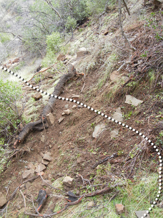
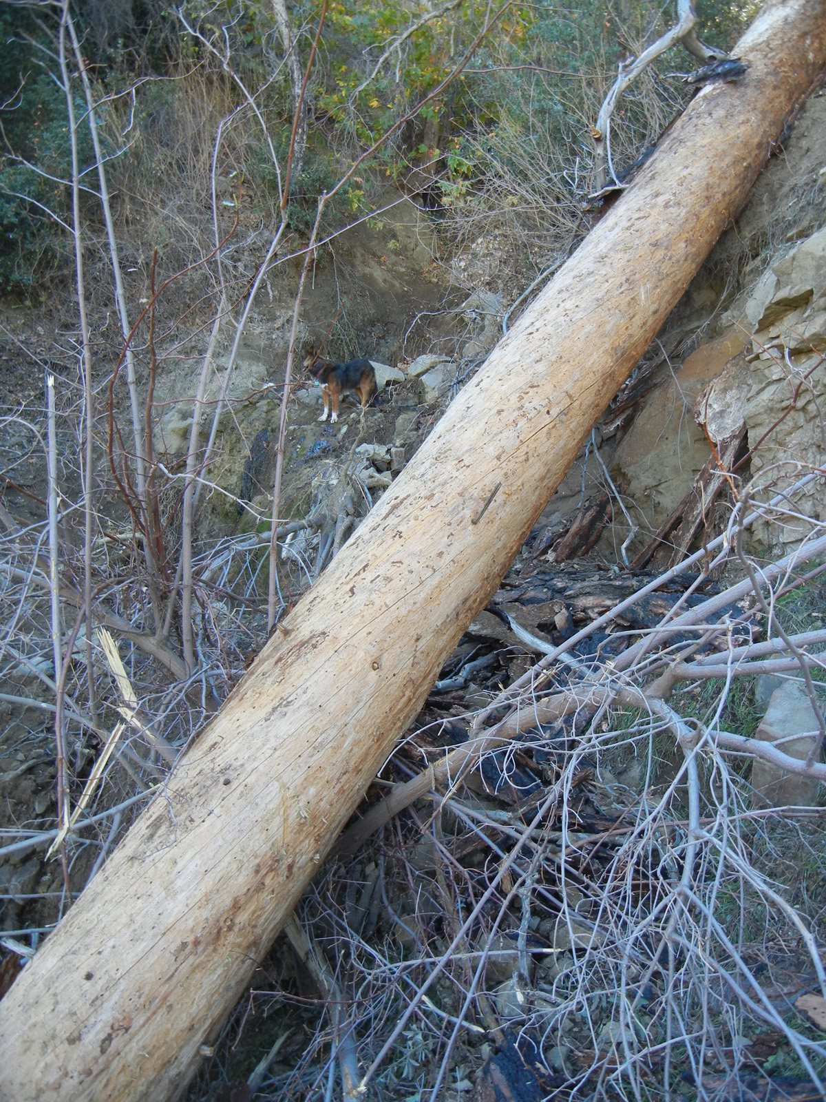
| Images: | Slide at 34.777962, -119.906432 Wash at 34.775174, -119.889575 Log crossing at 34.774575, -119.890133 Vulture Spring Looking down from the spring |
Lost Valley Trail San Rafael Wilderness Survey - 11-1-2015 - by Jeff Mahoney| Link: | Lost Valley Trail San Rafael Wilderness |
| Date: | 11-1-2015 |
| Surveyor Name: | Jeff Mahoney |
| Trail description: | Lost Valley trail was substantially hit by the storms two weeks ago. We
came down the trail from the Hurricane Deck intersection, and
unfortunately, there was a lot of damage starting just before Vulture Spring. Vulture Spring has been mostly
washed away. That draw funneled a huge amount of water and is basically
debris and a deep gash now. The trail on both sides is rubble, as is a number of the east-facing slopes down to Twin Oaks. The
other culverts/draws along the trail are also seriously damaged and
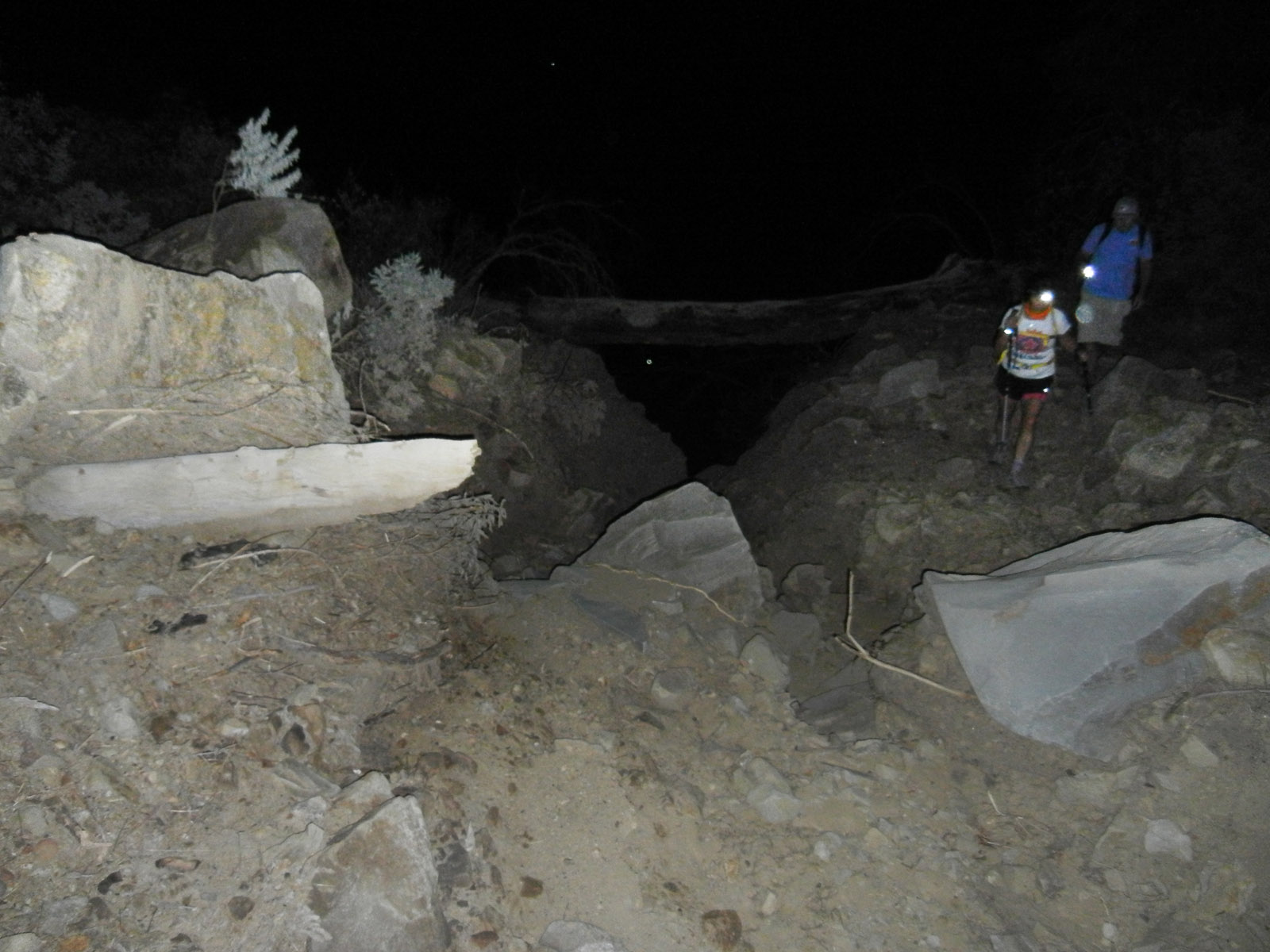
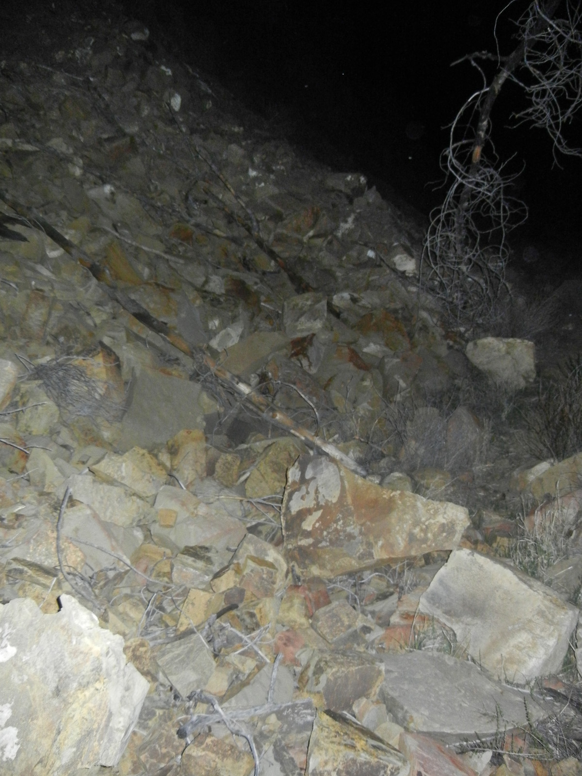
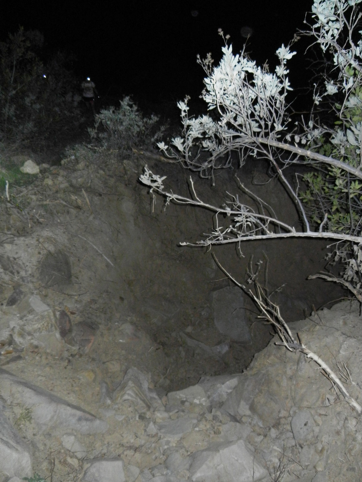
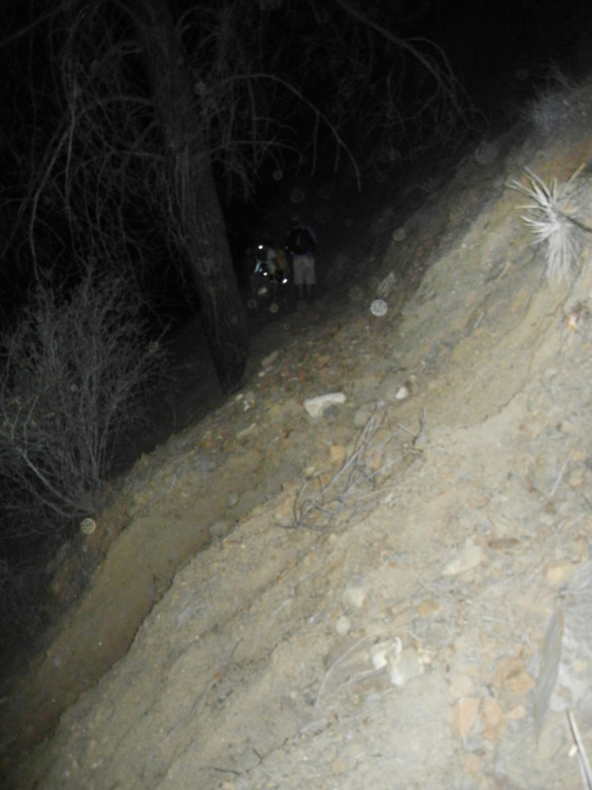
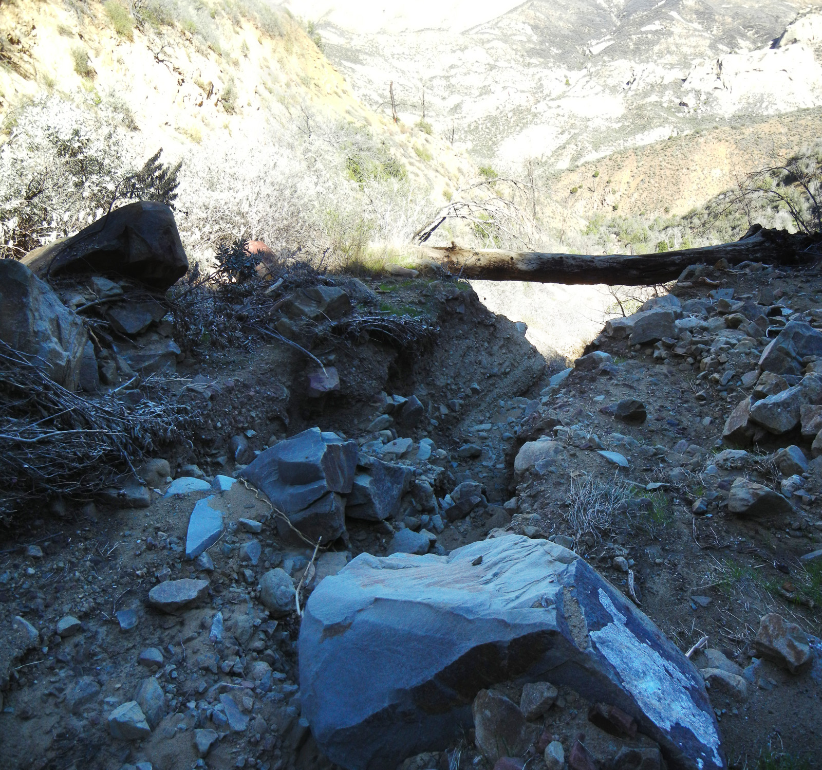
many sections along the slope are just rock & sand slides now. The last mile down to Twin Oaks camp is fine (as is the camp), but traveling on toward Manzana there are many large cuts and washes that have really really changed the topography. Unfortunately, winter hasnââ¬â¢t started yet. At this point even a moderately large storm will probably make Lost Valley impassable (and dangerous on the higher slopes) to most hikers. At the present state, it would be a mistake to take stock up there (with probably the exception of goats---no disrespect to the mules). Experienced hikers will not have too much trouble finding their way, but there are several dicey sections. Carrying a large pack would put you at quite a bit of risk if you slip or lose your balance. |
| Mode of transport: | Hike |
| Trail condition: | Hard to follow |
| Condition details: | Lost Valley damaged from recent major storms in the area |
| Images: | The "Log Crossing" below Vulture Spring Most of the east-facing sections two miles up from Twin Oaks are like this. Miles 2 through 4 have a few of these trail-less sections now |
Lost Valley Trail San Rafael Wilderness Survey - 05-23-2015 - by theejackalope| Link: | Lost Valley Trail San Rafael Wilderness |
| Date: | 05-23-2015 |
| Surveyor Name: | theejackalope |
| Trail description: | Three day loop hike Memorial Day weekend, 2015 Day 1: Nira to White Ledge via Lost Valley Trail and Hurricane Deck (East) (5/23/15) Day 2: White Ledge to Manzana Narrows, with out and back to South Fork (5/24/15) Day 3: Manzana Narrows to Nira (5/25/15) LV/HD Lost Valley Trail from Nira in great shape for the most part. Water near Nira, and generally around within first mile or so of trail. LVT generally easy to follow until it gets into the chaparral up near/on the Deck. Near the campsite at the big U turn, be sure to look for the blue tape on the tree across the creek to follow the trail. Once up on/near the Deck, you will also need to keep a keen eye on things to follow the trail in relatively open country. Once it gets into the thick scrub, though, markers are generally visible. There is pooled water throughout the first few miles of LVT; what we presume to be Vulture Spring (about 20 minutes up from the campsite at the big U turn) is flowing steadily but scantily. You could get water there but it will take a long time; suggest bringing all your water from Nira (or if in the other direction from White Ledge).ÃÂ No water, of course, on the Deck.ÃÂ Definitely had to do some chap-bashing, but no need for true bushwacking or machetes. We owe a BIG THANKS to the trail crews and others who have made the way across the deck clear; this is especially true the closer you get to White Ledge. THANK YOU FOR YOUR WORK!!! It wasn't an easy hike, but it certainly wasn't grueling or life-threatening either.ÃÂ A great balance. Ample pools of water at White Ledge, though not flowing and also ample horse poop.ÃÂ So bring your filters / treatement (!) if you want to use this water. Finally, as often noted, don't trust any estimates of mileage on these trails, especially the signage. Allow more time than you think.ÃÂ We're strong hikers, and at a moderate pace on a hot day it took about 8 hours from Nira to WL. We had expect 6 based on posted mileage and conditions. South Fork from White Ledge Clear trail all the way down to the Fork, and good flowing water around the Fork.ÃÂ Low levels, but steady and ample.ÃÂ Signs say it is two miles from WL to SF, but we're thinking more like 3. Didn't tightly validate with our map, though.ÃÂ Allow 1.5 hours to SF from WL, the same going back. WL to MN Good trail, easy to follow.ÃÂ Assuming a three hour hike from WL to MN, there is accessible water early on the trail, as well as apprx. halfway.ÃÂ Ample flowing water at Manzana Narrows; worth waiting for rather than pumping along the way (as long as you're not totally out, of course). MN to NIRA Good trail, easy to follow. Suggest filling water at MN or Nira, rather than counting on it on this stretch of the trail.ÃÂ There might be water along the way, but we didn't actively check; most things looked dry. About three hours from MN to NIRA. Beautiful loop!ÃÂ Lots of variety and challenge. Estimate of total miles (with side trip to/from SF): 30. ÃÂ |
| Mode of transport: | Hike |
| Trail condition: | Good shape and easy to follow |
Lost Valley Trail San Rafael Wilderness Survey - 03-14-2015 - by M. Jones| Link: | Lost Valley Trail San Rafael Wilderness |
| Date: | 03-14-2015 |
| Surveyor Name: | M. Jones |
| Trail description: | Lost Canyon trail on 03/14/15 was in excellent condition for the length of the trail. Spring has brought a profusion of wildflowers to Lost Canyon, California poppies, Bush poppies, Blue Dicks, Yurba Santa and sunflowers were all in bloom. |
| Mode of transport: | Hike |
| Trail condition: | Good shape and easy to follow |
| Images: | |
Lost Valley Trail San Rafael Wilderness Survey - 12-22-2014 - by Curt Cragg| Link: | Lost Valley Trail San Rafael Wilderness |
| Date: | 12-22-2014 |
| Surveyor Name: | Curt Cragg |
| Trail description: | Los Padres Forest Association Volunteer Rangers Report from Trail Project on Lost Valley Trail December 20-21, 2014 Project Objectives Accomplished: Cleared 20 fallen pine trees between Lost Valley Junction and Vulture Springs Cleared brush in several dense areas along the trail Repaired tread slides in several areas along the trail Installed picnic table at Twin Oaks camp Installed water basin at Vulture Springs Bolted trail sign to post and planted post at Hurricane Deck and Lost Valley Junction The Lost Valley Trail is in excellent hiking condition from the junction at the Manzana Trail to past Vulture Springs. ÃÂ We did get a report of another fallen pine and slide area just past Vulture Springs where we completed our work. This will need to be addressed for the wash out section to be safe for passage. |
| Mode of transport: | Hike |
| Trail condition: | Good shape and easy to follow |
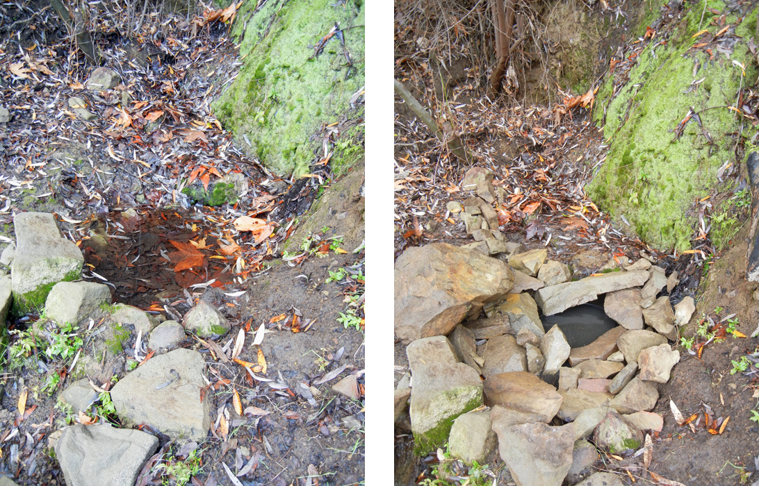
| Images: | This slide area is just above Vulture Springs and has not been repaired as of 12/22/14. Photo and report by Jeff Mahoney. This slide area is just above Vulture Springs and has not been repaired as of 12/22/14. Photo and report by Jeff Mahoney. Water basin installed at Vulture Springs for collecting water to filter New picnic table at Twin Oaks Camp |
Lost Valley Trail San Rafael Wilderness Survey - 11-01-2014 - by Los Padres Forest Association| Link: | Lost Valley Trail San Rafael Wilderness |
| Date: | 11-01-2014 |
| Surveyor Name: | Los Padres Forest Association |
| Trail description: | As reported by Curt Cragg There are about 10-12 pine deadfalls across the trail between where the trail hits the creek to where Twin Oaks Camp is located. ÃÂ There are a few more above it as well. ÃÂ There is water at Vulture Spring but the flow is really light. Photos by Toejam |
| Mode of transport: | Hike |
| Trail condition: | Needs some work |
| Images: | There are about 12 of these fallen trees from the Zaca Fire. Mostly along the lower half. Twin Oaks Camp. Or is it going to be Solo Oaks Camp? Water at Vulture Spring Hurricane Deck Views and Lost Valley. Sulphur Spring Canyon and the SB High Country. |
Lost Valley Trail San Rafael Wilderness Survey - 01-12-2012 - by Hike Los Padres| Link: | Lost Valley Trail San Rafael Wilderness |
| Date: | 01-12-2012 |
| Surveyor Name: | Hike Los Padres |
| Trail description: | The LPFA hosted two working projects in 2012 to clear the trail from Lost Valley Camp to the Deck. ÃÂ The majority of the work was done along the switchbacks and through the main canyon. ÃÂ The trail is very followable but do expect to find the occasional downed tree or have to push through brush here or there. ÃÂ The final stretch above the roadbed needs tread work and is quite narrow. ÃÂ All in all the trail is in adequate shape and should pose no problems as far as getting lost. |
| Mode of transport: | Hike |
| Trail condition: | Good shape and easy to follow |
Lost Valley Trail San Rafael Wilderness Survey - 04-28-2014 - by LPFA| Link: | Lost Valley Trail San Rafael Wilderness |
| Date: | 04-28-2014 |
| Surveyor Name: | LPFA |
| Trail description: | Water at Vulture Spring flowing nicely. |
| Mode of transport: | Hike |
| Trail condition: | Needs some work |
Lost Valley Trail San Rafael Wilderness Survey - 03-22-2014 - by Valerie Norton| Link: | Lost Valley Trail San Rafael Wilderness |
| Date: | 03-22-2014 |
| Surveyor Name: | Valerie Norton |
| Trail description: | Came down from the east section of Hurricane Deck while backpacking, staying overnight in the valley about 1 mile down from Vulture Spring (dribbling well). The tread of the trail coming down from the deck to the end of the old road is narrow and slipping in many places. Once on the road bed, it is generally good, but has many trees across it. |
| Mode of transport: | Hike |
| Trail condition: | Needs some work |
| Condition details: | Uppermost section is downright dangerous. |
| Number of trees down: | 11 |
| People Seen: | 0 |
 Survey / Report Form - Please click this box to open the form.