 Use Marker Groups
 Wolf 2002
Piru 2003
Day 2006
Zaca 2007
Gap 2008
La Brea 2009

| Date | Surveyor | Water Report |
| 11-05-2021 | Los Padres Forest Association | Dry |
| 06-10-2021 | Michael Sallwasser | Trickle |
| 06-20-2020 | Antonio Calderon | Flowing |
| 08-11-2019 | Christopher P. Lord | Flowing |
| 02-12-2014 | Steven Calkins | Flowing |
A small primative trail camp located on the Little Mutau Trail (20W10) in the Sespe Wilderness


 Little Mutau Camp Survey - 11-05-2021 - by Los Padres Forest Association
| Link: | Little Mutau Camp |
| Date: | 11-05-2021 |
| Surveyor Name: | Los Padres Forest Association |
| Camp Description: | No water at the camp. Some of the maps are wrong showing the location of Little Mutau Camp. Do your homework beforehand if you are planning on using this camp. Enjoy! |
| Water Source: | Dry |
| Water Source Details: | |
| Weather Conditions: |
Little Mutau Camp Survey - 06-10-2021 - by Michael Sallwasser| Link: | Little Mutau Camp |
| Date: | 06-10-2021 |
| Surveyor Name: | Michael Sallwasser |
| Camp Description: | Little Mutau Camp (as shown in the photo) is at 34.63499,
-118.99127. The location listed is what appears on the USGS map. There
is no campsite at that location today. If there ever was one at that site, it is gone
without a trace. Please update the coordinates to avoid causing problems for
the next hiker who relies on the HikeLosPadres website. |
| Water Source: | Trickle |
| Water Source Details: | The water was clear, but barely flowing in a handful of well-shaded spots. You should be looking for water as you approach camp. |
| Weather Conditions: |
Little Mutau Camp Survey - 06-20-2020 - by Antonio Calderon| Link: | Little Mutau Camp |
| Date: | 06-20-2020 |
| Surveyor Name: | Antonio Calderon |
| Camp Description: | Great site but it is exposed. Water was available right next to camp. An unofficial site about half mile downstream provides more shade and  water was available there as well. |
| Water Source: | Flowing |
| Water Source Details: | Good quality, great tasting and good flow |
| Weather Conditions: | Mid 80s, sunny |
| Images: | Little mutau camp Guerrilla site |
Little Mutau Camp Survey - 08-11-2019 - by Christopher P. Lord| Link: | Little Mutau Camp |
| Date: | 08-11-2019 |
| Surveyor Name: | Christopher P. Lord |
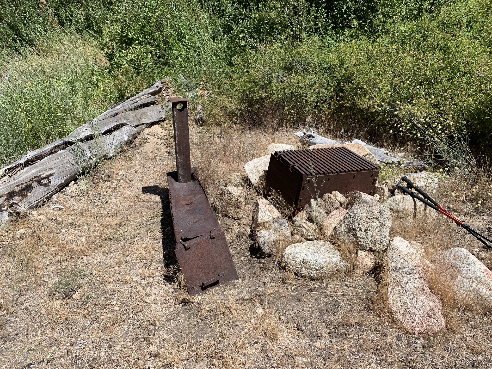
| Camp Description: | Dropped down from San Rafael Peak on Sunday into Little Mutau Trail Camp. Creek is dry directly adjacent to the site but water can be obtained approximately 450 further up the trail (East). Camp has rock fire ring with steel cooking grate and an old ice can stove. The flat is relatively small however you could possibly squeeze in two small tents if needed. Also A short distance further up the trail closer to the obtainable water is another flat that could serve as an overflow or help accommodate a small group. No trees shade the site but 50 feet adjacent the camp is a large tree providing good shade over the trail where one could hang out under. UNFORTUNATELY HIKE LOS PADRES AND A HANDFUL OF OTHER MAPS HAVE THE LOCATION OF THIS CAMP WRONG. Camp is here at - N34° 38' 06.2" W118° 59' 28.6" If you would like further details yo can check out the link below to my blog. |
| Water Source: | Flowing |
| Water Source Details: | |
| Weather Conditions: | Sunny with temps in the high 80's to low 90's |
| Images: | Little mutau Camp Little Mutau Camp Shade adjacent to the Camp Obtainable water approximately 450 feet east of Camp |
Little Mutau Camp Survey - 02-12-2014 - by Steven Calkins| Link: | Little Mutau Camp |
| Date: | 02-12-2014 |
| Surveyor Name: | Steven Calkins |
| Camp Description: | Nice campground right on the trail. Room for possibly 2 tents no more. No shade at all in the camp. |
| Water Source: | Flowing |
| Water Source Details: | Good water source about 1/4 mile east of campground. None by the campground. |
| Weather Conditions: | Hot coming down the canyon but with nice breezes. |
 Survey / Report Form