 Use Marker Groups
 Wolf 2002
Piru 2003
Day 2006
Zaca 2007
Gap 2008
La Brea 2009

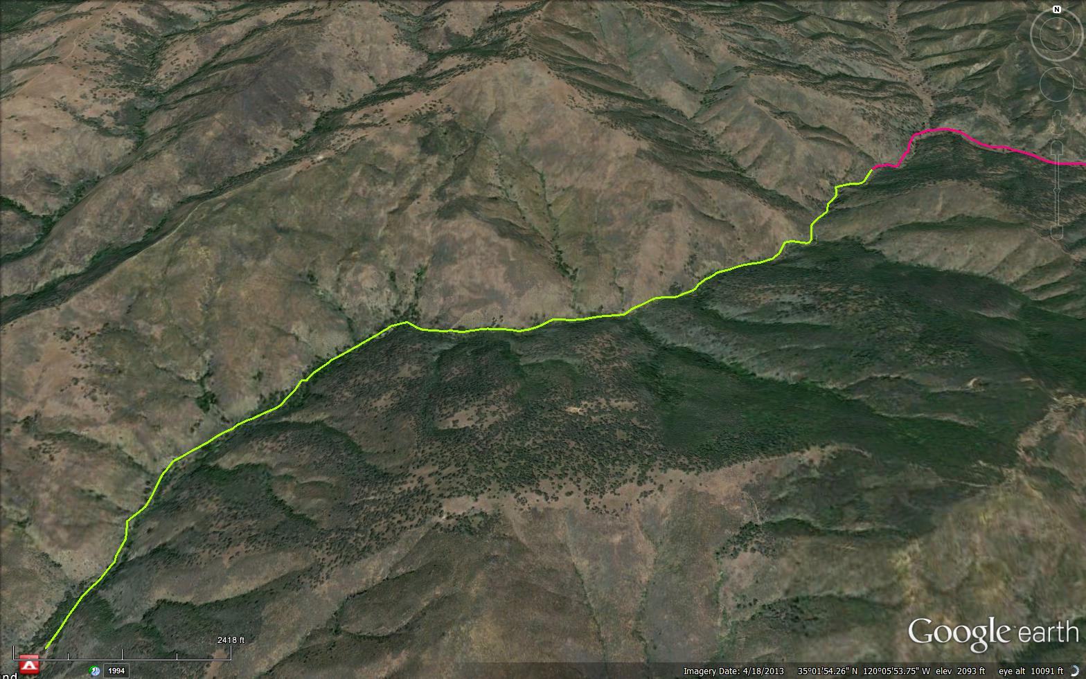
The Indian Trail is a 2.61 mile trail in San Luis Obispo County . The trail connects Brookshire Campground and the Kerry Canyon OHV Trail (30W02). This was an early Native American trail. It started in the Cuyama Valley and climbed up over the Sierra Madre Range to run down the Canyon to the Sisquoc River area and finally to the Santa Ynez Valley. It was a short cut between these two areas and was often used by natives from the San Joaquin Valley.


 Indian Trail Survey - 02-13-2026 - by Amelie
| Link: | Indian Trail |
| Date: | 02-13-2026 |
| Surveyor Name: | Amelie |
| Trail description: | Not the easiest trail to follow-- prepare for lots of wet feet, above meadow camp its mostly in the creek with occasionally sections of trail near the creek. beautiful! |
| Mode of transport: | Hike |
| Trail condition: | Hard to follow |
| Condition details: | hard to follow but passable. wet feet! |
Indian Trail Survey - 01-30-2026 - by Brian D'Amour| Link: | Indian Trail |
| Date: | 01-30-2026 |
| Surveyor Name: | Brian D'Amour |
| Trail description: | Trail was mostly easy to follow up to Indian Camp. Just some minor issues relocating trail at a couple of the many crossings. Creek was flowing strong so all crossings were wet. Picked a lot of ticks off my pants. Hike up to Maiden Falls from Indian Camp was the best part of the trip. |
| Mode of transport: | Hike |
| Trail condition: | Needs some work |
| Condition details: | Trail is mostly in great shape. A few minor washouts and some encroaching brush. |
| Images: | Crossing near start of trail Wide view of Indian Creek Crossing midway up trail Creek crossing closer to Indian Camp |
Indian Trail Survey - 01-12-2025 - by Robert| Link: | Indian Trail |
| Date: | 01-12-2025 |
| Surveyor Name: | Robert |
| Trail description: | I looked in the wrong place. I realized I was looking in the wrong place for this trail due to Brookshire Camp being in the wrong place on Gaia GPS map. Will try it again sometime soon I hope. |
| Mode of transport: | Hike |
| Trail condition: | Non existent |
| Condition details: | Disregard my prior post |
Indian Trail Survey - 01-12-2025 - by Anonymous Surveyor| Link: | Indian Trail |
| Date: | 01-12-2025 |
| Surveyor Name: | Anonymous Surveyor |
| Trail description: | I looked on both ends and couldn't really find a start or a finish to this trail. |
| Mode of transport: | Hike |
| Trail condition: | Non existent |
| Condition details: | No evidence of a trail |
Indian Trail Survey - 01-23-2023 - by Anonymous Surveyor| Link: | Indian Trail |
| Date: | 01-23-2023 |
| Surveyor Name: | Anonymous Surveyor |
| Trail description: | No access (private land ) pine canyon road need to go to Sierra Madre road off of 166 past rock front ranch . |
| Mode of transport: | Bicycle |
| Trail condition: | Needs some work |
Indian Trail Survey - 05-27-2017 - by Mike Maki| Link: | Indian Trail |
| Date: | 05-27-2017 |
| Surveyor Name: | Mike Maki |
| Trail description: | Hike southbound as part of a four day section hike of the Condor Trail. Saw three cows. Seems cows and game have helped maintain this trail. I found it fairly easy to follow. Creek crossing had a little poison oak to avoid. Was able to keep my feet dry at all crossings. Pics from this section of the Condor Trail. |
| Mode of transport: | Hike |
| Trail condition: | Needs some work |
| Condition details: | Mostly easy to follow because of cattle and game use. Could use some brushing. |
| Images: | Ice can stove and disappearing picnic table at northern end of trail Upper reaches of trail Easy travel. Some good shade. Typical section |
Indian Trail Survey - 01-19-2015 - by Los Padres Forest Association| Link: | Indian Trail |
| Date: | 01-19-2015 |
| Surveyor Name: | Los Padres Forest Association |
| Trail description: | This trail follows the creek until you get to Brook shire camp. Nice trail that meanders back and forth across the creek, we biked down from Miranda Pine area. We found small amounts of water flowing in creek, overall the trail is in great shape. The grass was green which is always a nice sight to see. |
| Mode of transport: | Bicycle |
| Trail condition: | Needs some work |
| Condition details: | Trail is followable but could use a small amount of work in places |
 Survey / Report Form - Please click this box to open the form.