 Use Marker Groups
 Wolf 2002
Piru 2003
Day 2006
Zaca 2007
Gap 2008
La Brea 2009

| Date | Surveyor | Water Report |
| 02-20-2022 | Heather R | Dry |
| 03-05-2021 | Anonymous | Dry |
| 05-03-2020 | Los Padres Forest Association | Dry |
| 04-28-2017 | Rod H | Trickle |
The trailhead for Horseshoe Springs Spur OHV Trail (31W12) is located here, expect OHV vehicles and take caution while hiking
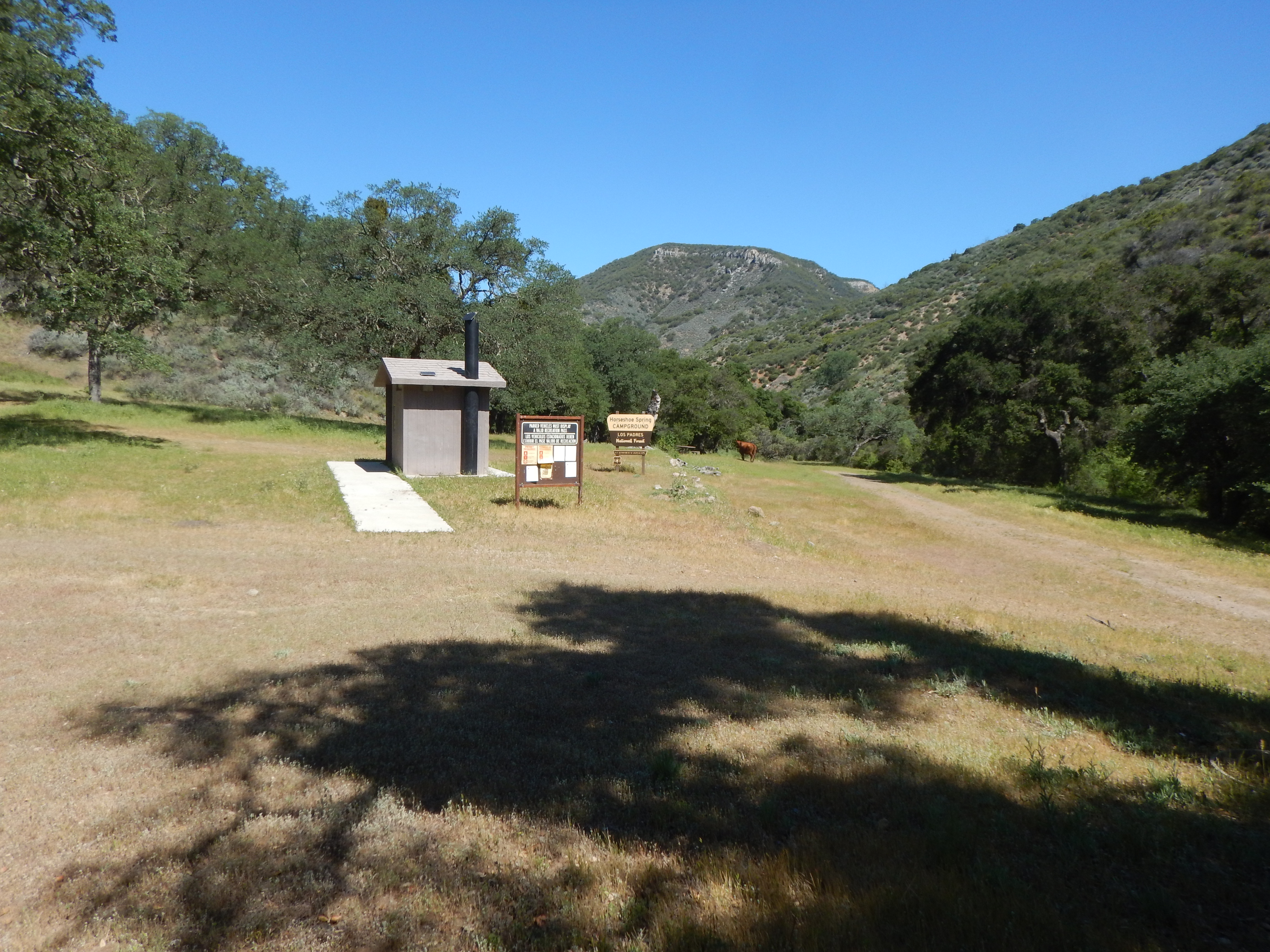
Nestled in large grove of oaks. Campground provides solitude for those seeking that type of experience.
| Operational Hours: | Quiet Hours: 10:00pm – 6:00am |
|---|---|
| Reservations: | None |
| Fees | The Adventure Pass or Annual Interagency Pass, Senior Interagency Pass, or Interagency Access Pass is required for Horseshoe Springs Campground. |
| Permit Info: | Adventure Pass ($5/day or $30/year), or Annual Interagency Pass, Senior Interagency Pass, or Interagency Access Pass. |
| Restrictions: | Pack out all trash. 14 day stay limit. |
| Closest Towns: | Santa Maria |
| Water: | None |
| Restroom: | Vault |
| Operated By: | Forest Service |
| Information Center: | Santa Lucia Ranger District 1616 No. Carlotti Drive Santa Maria, CA 93454 (805) 925-9538 |
Directions: From Santa Maria: Betteravia Rd. 7 miles east, Mesa Rd. 4.5 miles east, Tepusquet Canyon. Rd. 4.5 miles north, Colson Cyn. Rd. 17.5 miles northeast.


 Horseshoe Spring Campground Survey - 02-20-2022 - by Heather R
| Link: | Horseshoe Spring Campground |
| Date: | 02-20-2022 |
| Surveyor Name: | Heather R |
| Camp Description: | Camp is clean and in good shape. Bathroom is fairly clean. COLD low spot to sleep. Brr... but then the sun came out. |
| Water Source: | Dry |
| Water Source Details: | |
| Weather Conditions: |
Horseshoe Spring Campground Survey - 03-05-2021 - by Anonymous| Link: | Horseshoe Spring Campground |
| Date: | 03-05-2021 |
| Surveyor Name: | Anonymous |
| Camp Description: | |
| Water Source: | Dry |
| Water Source Details: | |
| Weather Conditions: | Clear, sunny, low 70's |
| Images: | Stairway to nowhere Campsite at Horseshoe Springs CG |
Horseshoe Spring Campground Survey - 05-03-2020 - by Los Padres Forest Association| Link: | Horseshoe Spring Campground |
| Date: | 05-03-2020 |
| Surveyor Name: | Los Padres Forest Association |
| Camp Description: | Camp was clean and in good shape. Three campsites scattered across the flat above the creek. Cattle were all over the area leaving plenty of patties as they moved along. |
| Water Source: | Dry |
| Water Source Details: | Didn't find any water, but didn't search too hard either..... |
| Weather Conditions: | Mid 70's and lovely! |
| Images: | Main view down-canyon of camp Campsite #2 Running with the bulls, and cows, and driving actually. |
Horseshoe Spring Campground Survey - 04-28-2017 - by Rod H| Link: | Horseshoe Spring Campground |
| Date: | 04-28-2017 |
| Surveyor Name: | Rod H |
| Camp Description: | Camp has not seen visitors in awhile due to road closure from the winter rains.  Visited the camp  as part of our backpack trip into Brookshire from the Willow Springs trail head on Hwy 166. |
| Water Source: | Trickle |
| Water Source Details: | Water in the trough up the road from camp. Trickle in the creek just up stream from camp. |
| Weather Conditions: | Sunny in the mid 70's |
| Images: | Horseshoe Springs Camp Shady campsite at Horseshoe Springs |
 Survey / Report Form