 Use Marker Groups
 Wolf 2002
Piru 2003
Day 2006
Zaca 2007
Gap 2008
La Brea 2009

| Date | Surveyor | Water Report |
| 04-18-2020 | Duane Waite | Flowing |
| 01-27-2020 | Duane Waite | Flowing |
| 08-28-2019 | MaldonadoRarara | Trickle |
| 03-31-2019 | Oh Three | Flowing |
| 08-09-2018 | Anonymous Surveyor | Stagnant |
| 03-05-2016 | Anonymous Surveyor | Flowing |
| 01-01-1994 | Oh Three | Flowing |
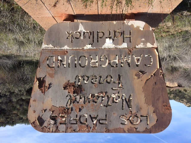
This campground is located near Pryamid Lake off Buck Creek Road but is CLOSED indefinitely. The closed gate is located here 34.705357, -118.821099 just beyond the Los Alamos Campground on Hard Luck Road. It is a 3.6 mile walk one way from the closed gate to Hardluck Campground.
Directions: Exit I-5 at Smoky Bear Road, south on the East Valley Road


 Hard Luck Campground Survey - 04-18-2020 - by Duane Waite
| Link: | Hard Luck Campground |
| Date: | 04-18-2020 |
| Surveyor Name: | Duane Waite |
| Camp Description: | Colder, cloudier and windier than my visit back in January. Unfortunately no photos, but believe me when I tell you that Piru Creek is raging. A tie tag wrapped around a tree near the creek, dated March 8th, reported a flow of 1,200 cubic feet per second. After the rain we had a few weeks ago, who knows what the flow is now. But it took several minutes for me to cross that slick Arizona crossing, with water at the center just touching the knee caps. BTW, that's my go-to running spot when the thought of making the schlep out to the Santa Barbara district just feels too daunting a task. |
| Water Source: | Flowing |
| Water Source Details: | Water crossing over the concrete bridge at least 12 inches, if not more. It's raging! |
| Weather Conditions: | Cloudy, Wind Approx 10mph, Temp mid-50's. |
Hard Luck Campground Survey - 01-27-2020 - by Duane Waite| Link: | Hard Luck Campground |
| Date: | 01-27-2020 |
| Surveyor Name: | Duane Waite |
| Camp Description: | Got in some hill training by running to this abandoned car camp. A haunting sight, but beautiful surroundings. It's not a wilderness area, so mountain bike tracks abound on the trail past the camp. First visit to the camp in over 3 and a half years, when I brought my own mountain bike! |
| Water Source: | Flowing |
| Water Source Details: | Flowing well. Six inches deep across the concrete crossing |
| Weather Conditions: | Cool afternoon, a little wind. |
| Images: | Hard luck campground Piru creek |
Hard Luck Campground Survey - 08-28-2019 - by MaldonadoRarara| Link: | Hard Luck Campground |
| Date: | 08-28-2019 |
| Surveyor Name: | MaldonadoRarara |
| Camp Description: | Nice medium level hike to the camp. Steep uphill and gradual downhills. |
| Water Source: | Trickle |
| Water Source Details: | Not much movement. Water was hardly moving making crossing a breeze. |
| Weather Conditions: | 80-90's |
Hard Luck Campground Survey - 03-31-2019 - by Oh Three| Link: | Hard Luck Campground |
| Date: | 03-31-2019 |
| Surveyor Name: | Oh Three |
| Camp Description: | See my review of Buck Creek trail same date. |
| Water Source: | Flowing |
| Water Source Details: | Flowing ankle deep over the ford, quite deep elsewhere |
| Weather Conditions: | |
| Images: | |
Hard Luck Campground Survey - 08-09-2018 - by Anonymous Surveyor| Link: | Hard Luck Campground |
| Date: | 08-09-2018 |
| Surveyor Name: | Anonymous Surveyor |
| Camp Description: | |
| Water Source: | Stagnant |
| Water Source Details: | Creek was only a few inches deep, not flowing. |
| Weather Conditions: | 103F at day, approx. 70F at night. |
| Images: | Creek NE of the campground View from NE of the campground |
Hard Luck Campground Survey - 03-05-2016 - by Anonymous Surveyor| Link: | Hard Luck Campground |
| Date: | 03-05-2016 |
| Surveyor Name: | Anonymous Surveyor |
| Camp Description: | Went in just to check it out after seeing that it was closed down. You have to park at the fence which is three miles away from the actual camp. The hike in is on a beaten/forgotten paved road and is about 3.2 miles. There was water flowing just before the camp and I could hear trickles of the stream but didn't really look at it. I just went in for a nice little day hike. I think it is worth the 3.2 mile walk but others may not. Its cool to see an abandoned campground with all of its amenities still there but in disrepair. |
| Water Source: | Flowing |
| Water Source Details: | There was flowing water about 100 yards before the actual campsite |
| Weather Conditions: |
Hard Luck Campground Survey - 01-01-1994 - by Oh Three| Link: | Hard Luck Campground |
| Date: | 01-01-1994 |
| Surveyor Name: | Oh Three |
| Camp Description: | This *was* my favorite car campsite in late 1980's and early 1990's, along with Twin Pines (now also closed) and Dutchman on top of Alamo Mountain. And when the road up Alamo was snow bound (back before NFS closed it half of each year), then Hard Luck was the only car campground. There used to be really sketchy "camp ground hosts" who lived there rather permanently, taking up several sites, and cutting trees in the valley to sell for firewood. Maybe that's the real reason why NFS closed this site, not the Arroyo Toad problem. Â ;) Â Anyway, from here, you could day hike to summit Cobblestone Mountain if you were a stud, going up Buck Creek. It's still an interesting day hike, hiking in on the closed road. If you do visit, hike all the way to the south end of the Valley and look at what's crossing the stream. I think it's called a "flying squirrel." Give it a ride. Please tie it up properly when you're done. It's more fun than an "e" ticket ride! Â |
| Water Source: | Flowing |
| Water Source Details: | |
| Weather Conditions: | Snow in winter, hotter than heck in summer |

 Survey / Report Form