 Use Marker Groups
 Wolf 2002
Piru 2003
Day 2006
Zaca 2007
Gap 2008
La Brea 2009

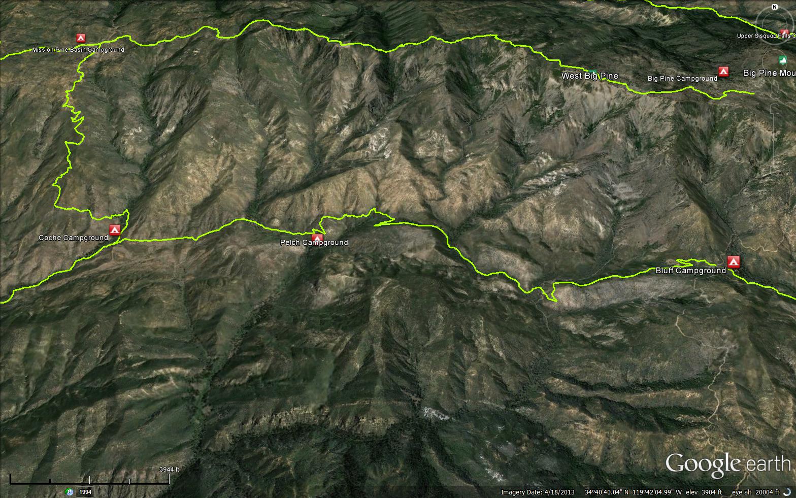
The Grapevine Trail is located in the southern San Rafael Wilderness and connects the Santa Cruz Trail to the Buckhorn Road at Bluff Cabin. There are a few stories as to how the Grapevine Trail got its name. One legend states that it was named after a grapevine plant which once grew at the Murietta Spring along the trail. Another story says it got its name based on how the trail meanders and rolls from drainage to drainage, sort of like a grapevine clings to support, dangles and clings to support.
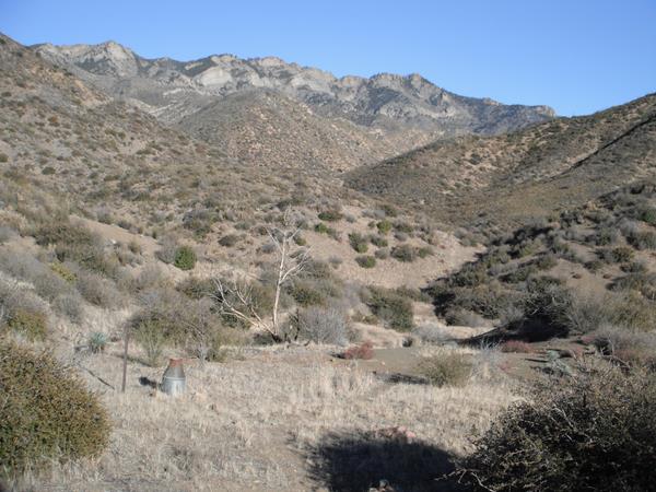
The Grapevine Trail is commonly used as part of a 3-4 day loop involving the Santa Cruz Trail and Poplar Trail (upper Indian Creek) but can also be linked into loops coming down from Mission Pine and Big Pine Mountain. The highlight of the trail are the tremendous views of West Big Pine which towers along the northern horizon of the trail. There is reliable water in Grapevine Creek.
Grapevine Trail Condition
The Grapevine Trail is in relatively great shape at the moment. The trail was worked in 2011 and 2012 as part of an extended LPFA working vacation trail project. It has also seen some CCC activity and a few tree clearing projects over the past few years. While the trail is not frequently backpacked, due to its close proximity to Bluff Cabin it does see a good amount of Volunteer Wilderness Ranger projects.


 Grapevine Trail Survey - 02-05-2022 - by Stephen S
| Link: | Grapevine Trail |
| Date: | 02-05-2022 |
| Surveyor Name: | Stephen S |
| Trail description: | I hiked from Santa Cruz Trail to Bluff Camp. Trail was relatively easy until about Pelch Camp where it was basically bushwhacking and wayfinding and following the line on my GPS until coming out of the East Fork Santa Cruz Creek drainage and ascending to Bluff. That last stretch was cleared well and east to follow. |
| Mode of transport: | Hike |
| Trail condition: | Hard to follow |
Grapevine Trail Survey - 05-30-2020 - by Addison Jerlow| Link: | Grapevine Trail |
| Date: | 05-30-2020 |
| Surveyor Name: | Addison Jerlow |
| Trail description: | easy to follow from intersection with Santa Cruz trail east for a mile or so. lost it somewhere around the seasonal creek crossing north of jackrabbit flat. found again with some bushwhacking in the right direction. trail overgrown but easy to follow from there until just after the spring marked on Conant’s Dick Smith map. good flow at the grapevine creek crossing a half mile or so west of Pelch. could not find Pelch spur trail but wasn’t looking hard for it. trail nice and cleared from the marked spring until Buckhorn road. large trees down on and around both Santa Cruz Creek crossings made for a difficult time. good flow in Santa Cruz Creek. |
| Mode of transport: | Hike |
| Trail condition: | Needs some work |
Grapevine Trail Survey - 02-27-2019 - by Los Padres Forest Association| Link: | Grapevine Trail |
| Date: | 02-27-2019 |
| Surveyor Name: | Los Padres Forest Association |
| Trail description: | Coming from Bluff the trail is in good shape until you get to the second crossing. After that the trail was washed out for about 100 yards followed by a few large downed oaks and then lots of brush. The trail is followable but expect to push through brush until you get to Jackrabbit Flat. |
| Mode of transport: | Hike |
| Trail condition: | Needs some work |
| Images: | And you're off! Snow along the upper north facing slopes One of the large downed trees along the Grapevine Jackrabbit Flat Junction Grapevine and Santa Cruz Trails |
Grapevine Trail Survey - 07-07-2019 - by Los Padres Forest Association| Link: | Grapevine Trail |
| Date: | 07-07-2019 |
| Surveyor Name: | Los Padres Forest Association |
| Trail description: | Trail survey of the Grapevine Trail in advance of the October 2019 LPFA Working Vacation. The trail is pretty brushy but followable down to the first series of creek crossings. At that point there are some large downed trees, a huge washout, more severe brush and a failed old cribwall. We'll hopefully fix all that during the Working Vacation. Lots and LOTS of bear scat all along the trail. Sure hope they appreciate the trail work! |
| Mode of transport: | Hike |
| Trail condition: | Needs some work |
| Images: | Failed cribwall at the bottom of the first descent That IS the trail, quite a mess and the cause of at least two groups getting lost off trail earlier this year. What happens during big rainy years. View from the trail down the upper East Fork Santa Cruz drainage. |
Grapevine Trail Survey - 10-19-2019 - by Los Padres Forest Association| Link: | Grapevine Trail |
| Date: | 10-19-2019 |
| Surveyor Name: | Los Padres Forest Association |
| Trail description: | LPFA Working Vacation spent 8 days working the Grapevine Trail from Bluff towards the Santa Cruz Trail. The trail is to Forest Service standards from Bluff to the bottom of the switchback just east of Grapevine (Murietta) Spring. Beyond that the trail remains brushy but all trees were cleared. We also worked on the spur trail that leads to Pelch Camp. All trees cleared, the failed cribwall repaired - trail is in great shape until it isn't. |
| Mode of transport: | Hike |
| Trail condition: | Needs some work |
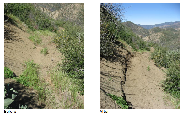
| Images: | Newly worked section of trail, very clear now! |
Grapevine Trail Survey - 11-21-2018 - by Los Padres Forest Assocation| Link: | Grapevine Trail |
| Date: | 11-21-2018 |
| Surveyor Name: | Los Padres Forest Assocation |
| Trail description: | Two separate crews (ACE & SCA) supported by LPFA spent a total of 18 days brushing the beginning 3.5 miles of the Grapevine trail from Bluff cabin. There are a number of trees still down across the trail, but can be maneuvered past on foot. Crew reports that there is water in the spring. The remaining 2 miles of Grapevine connecting to Santa Cruz trail have not been worked. Conditions are expected to be brushy and at times, hard to follow. |
| Mode of transport: | Hike |
| Trail condition: | Needs some work |
| Images: | The ACE crew! Brushing And more brushing Downed tree around mile 2 |
Grapevine Trail Survey - 05-09-2014 - by Los Padres Forest Association| Link: | Grapevine Trail |
| Date: | 05-09-2014 |
| Surveyor Name: | Los Padres Forest Association |
| Trail description: | LPFA Working Vacation on the Grapevine Trail in May 2014. The trail was cleared from Bluff Cabin to Kellogg Camp. |
| Mode of transport: | Hike |
| Trail condition: | Good shape and easy to follow |
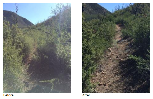
| Images: | The work crew at Bluff Cabin, the base for the week. Grapevine Sign Before and After, photo Beckstrand |
Grapevine Trail Survey - 05-10-2015 - by Los Padres Forest Association| Link: | Grapevine Trail |
| Date: | 05-10-2015 |
| Surveyor Name: | Los Padres Forest Association |
| Trail description: | LPFA led a quick project to clear the first mile of the Grapevine Trail from the Buckhorn Rd down to the first creek crossing. Â Looking good! |
| Mode of transport: | Array |
| Trail condition: | Good shape and easy to follow |
| Images: | |
 Survey / Report Form - Please click this box to open the form.