 Use Marker Groups
 Wolf 2002
Piru 2003
Day 2006
Zaca 2007
Gap 2008
La Brea 2009

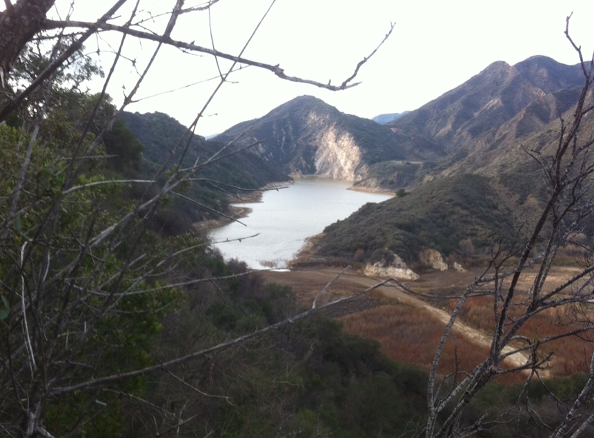
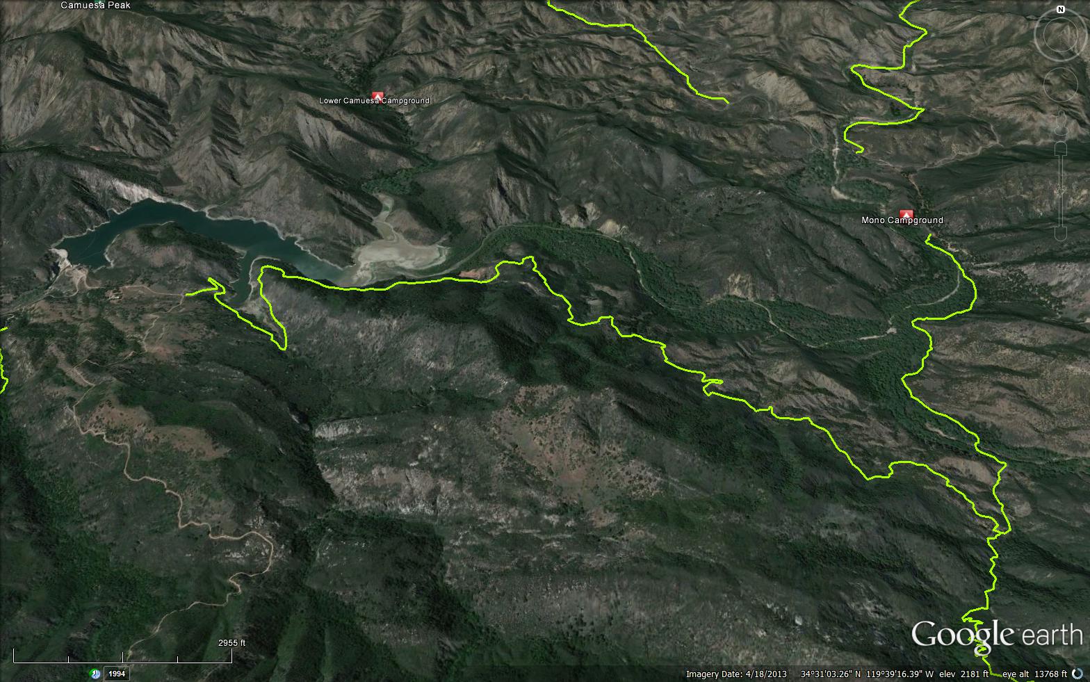
A short 5.18 miles connector trail between the Gibraltar Resivour and the Cold Spring Trail. This trail makes for a great mountain bike ride or day hike. A very large rock formation of Temblor Sandstone was called The Rock of Gibraltar. When Santa Barbara needed more drinking water, they constructed the dam backing up the river water to form the Gibraltar Reservoir. A short distance down stream from the dam a tunnel was dug under the Santa Ynez Mountains to Mission Canyon to provide river water to the city. Over the years a large part of the upper portion of the reservoir has filled in with sand and silt. It now supports a dense stand of willow and cottonwood trees..
The dam was raised to increase its holding capacity and was recently strengthened to protect it from a possible earthquake action. It is located just south of the Little Pine Fault that crosses the center portion of the lake.


 Gibraltar Trail Survey - 02-26-2022 - by Joe S
| Link: | Gibraltar Trail |
| Date: | 02-26-2022 |
| Surveyor Name: | Joe S |
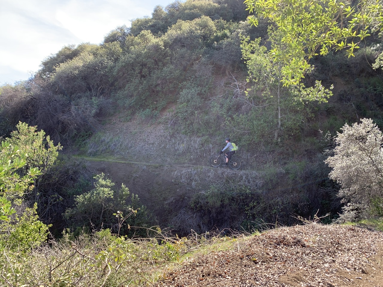
| Trail description: | Sage Trail Alliance did some excellent work clearing the trail. Looks great, rides well, good brushing and excellent benching. Clear all the way through. |
| Mode of transport: | Bicycle |
| Trail condition: | Good shape and easy to follow |
| Images: | Smooth sailing. Keep an eye out for the incredible fossils everywhere! |
Gibraltar Trail Survey - 12-04-2020 - by John OConnell| Link: | Gibraltar Trail |
| Date: | 12-04-2020 |
| Surveyor Name: | John OConnell |
| Trail description: | The Trail was still easy to follow but sections were very eroded away and there was a lot of overgrown brush and California oak on trail. It would be nice if a crew could come out and do some brush clearing and widen the trail corridor. |
| Mode of transport: | Hike |
| Trail condition: | Needs some work |
| Condition details: | Section from Cold Springs Trail to Gibraltar F.S. Road |
| Images: | erosion on trail |
Gibraltar Trail Survey - 11-22-2020 - by Kevin Lafferty| Link: | Gibraltar Trail |
| Date: | 11-22-2020 |
| Surveyor Name: | Kevin Lafferty |
| Trail description: | The Gibralter trail is easy to find from Angostura pass to the Cold Springs trail, but slides and overgrowth means biking starts to become difficult about a mile or so east of the Sunbird Mine. Specifically, the trail gets crowded by poison oak, scrub oak, and ceanothus, etc. so dress accordingly. A few slides are passable, but not bikeable. I did about 30 dismounts along that stretch. But more than made up for by the colorful cottonwoods in the upper Santa Ynez. |
| Mode of transport: | Bicycle |
| Trail condition: | Needs some work |
Gibraltar Trail Survey - 05-20-2020 - by rich scholl| Link: | Gibraltar Trail |
| Date: | 05-20-2020 |
| Surveyor Name: | rich scholl |
| Trail description: | brush is pretty bad-mostly scrub oak- and several shale slides difficult to dangerous to cross, easy to follow tread except one place in heavy brush. this trail should get work since it is one of the best ways by foot or bike into the mono area. |
| Mode of transport: | Hike |
| Trail condition: | Needs some work |
Gibraltar Trail Survey - 04-14-2019 - by Mark G| Link: | Gibraltar Trail |
| Date: | 04-14-2019 |
| Surveyor Name: | Mark G |
| Trail description: | Did a bike loop from top Tunnel, east and down Cold Spring North, back Gibraltar and up Angostura. The Gibraltar portion from Cold Spring to about 1/2 mile east of Sunbird was really tough going. It is getting very overgrown, the landslides are worse, and parts are now really a slog. There is less poison oak on Gibraltar than lower Cold Spring below Forbush, but you still will be pushing through some nice thickets of the 3 leaf devil.  Given that the Gibraltar trail used to be a road it is still pretty easy to follow, we got sidetracked only once and for less than 5 minutes. Still, i would say my 14 year old and i were riding only 1/3 the time, the rest was spent pushing though brush. Better riders will get more saddle time. Wish this trail was more open as it links so many potential great rides, but its tough going now. |
| Mode of transport: | Bicycle |
| Trail condition: | Needs some work |
| Condition details: | Trail easy to follow buy getting overgrown east of Sunbird Mine. |
Gibraltar Trail Survey - 05-29-2017 - by Rob Guzzon| Link: | Gibraltar Trail |
| Date: | 05-29-2017 |
| Surveyor Name: | Rob Guzzon |
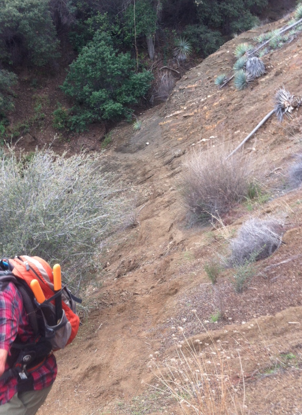
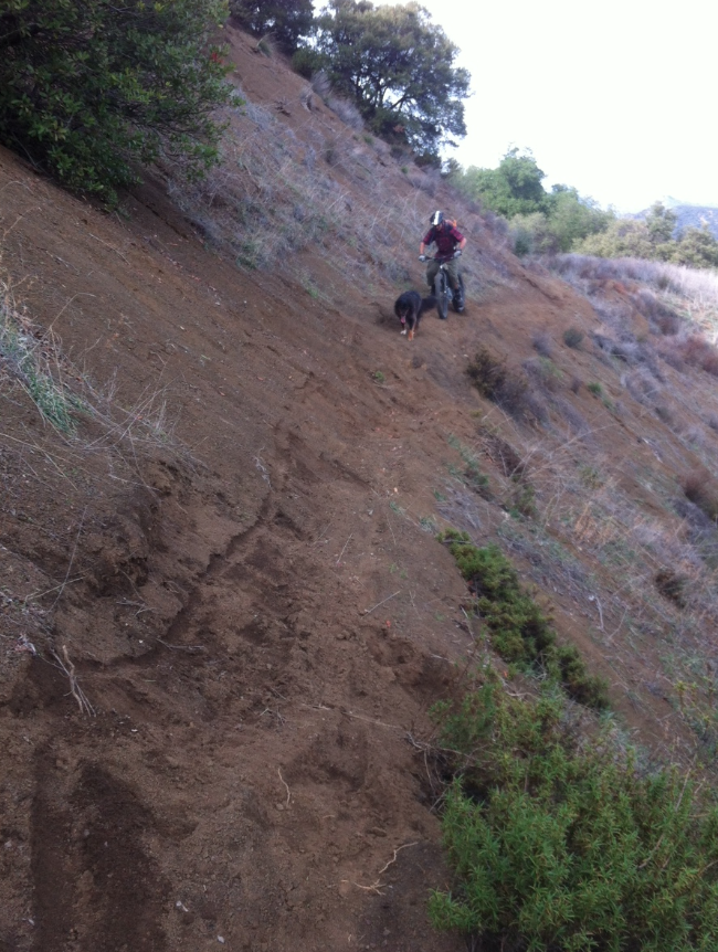
| Trail description: | This past winter took its toll, and much of the trail is grown in with very tall grass and other undergrowth including lots of poison oak. Maybe a half mile from the Junction with Cold Spring Trail there is a large section of washout where the trail has disappeared into a steep slope of loose gravel. There is also a very large landslide just west of the old mine, but it is easily passable. There were only a few instances where we were confused for a moment as to where the trail went, but without any work and another winter like this last one, this trail could quickly become very tough to follow. |
| Mode of transport: | Bicycle |
| Trail condition: | Needs some work |
| Condition details: | Didn't have too much trouble following the trail, but some landslides, washouts, and growth made it an adventure |
| Images: | trail disappeared into a gravel slope beautiful view into Mono creek some sections were very overgrown large landslide just west of the mine |
Gibraltar Trail Survey - 02-28-2017 - by Los Padres Forest Association| Link: | Gibraltar Trail |
| Date: | 02-28-2017 |
| Surveyor Name: | Los Padres Forest Association |
| Trail description: | Slide on the Gibraltar Trail, reported by Trail Runner George! |
| Mode of transport: | Array |
| Trail condition: | Needs some work |
| Images: | Large landslide across the road between the Mercury Mine and Gidney Creek. Probably 6~8ft high. Not too difficult to cross though. N34.5233338, W119.6625103 |
Gibraltar Trail Survey - 06-06-2015 - by Los Padres Forest Association| Link: | Gibraltar Trail |
| Date: | 06-06-2015 |
| Surveyor Name: | Los Padres Forest Association |
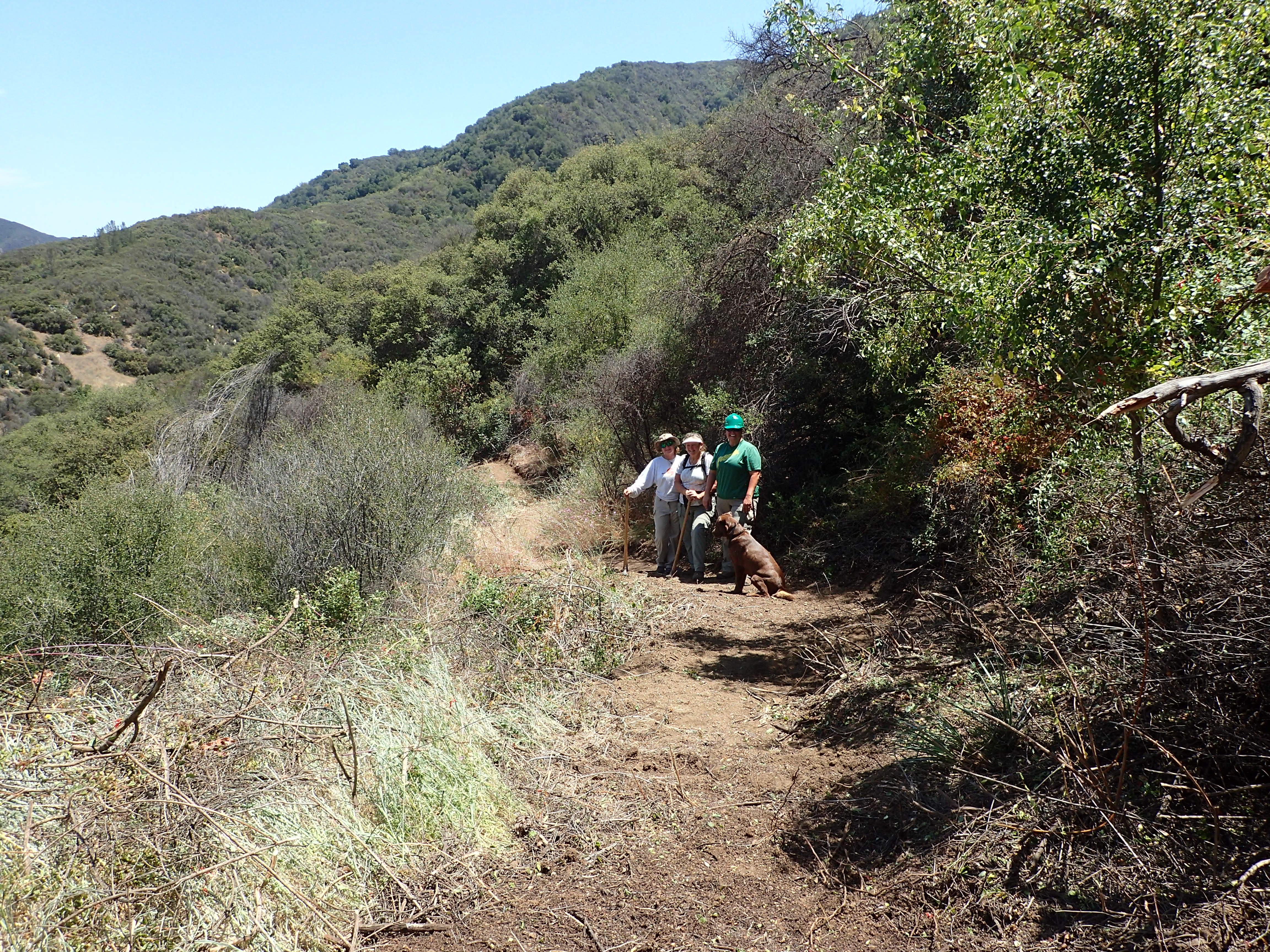
| Trail description: | As part of the LPFA National Trails Day project a crew of 5 volunteers worked the Gibraltar Trail about a mile west from the junction with the Cold Spring Trail. Â We brushed the trail and fixed 2-3 of the slide sections. Â Still work to be done out towards the mine. |
| Mode of transport: | Array |
| Trail condition: | Needs some work |
| Images: | Brushing well done. |
Gibraltar Trail Survey - 05-07-2015 - by Jeff B.| Link: | Gibraltar Trail |
| Date: | 05-07-2015 |
| Surveyor Name: | Jeff B. |
| Trail description: | Rode this from the mine out to Cold Springs Trail: it's in very good shape right now, and is very easy to follow. |
| Mode of transport: | Bicycle |
| Trail condition: | Good shape and easy to follow |
Gibraltar Trail Survey - 01-22-2015 - by Los Padres Forest Association| Link: | Gibraltar Trail |
| Date: | 01-22-2015 |
| Surveyor Name: | Los Padres Forest Association |
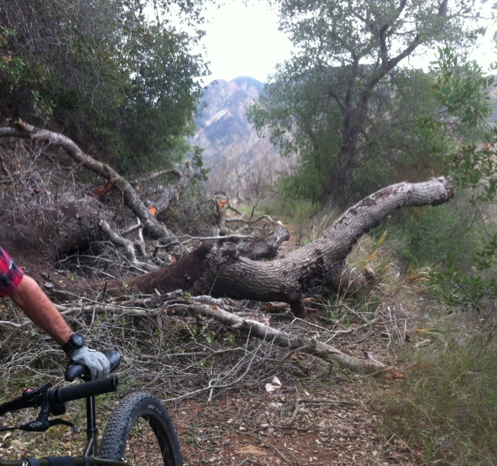
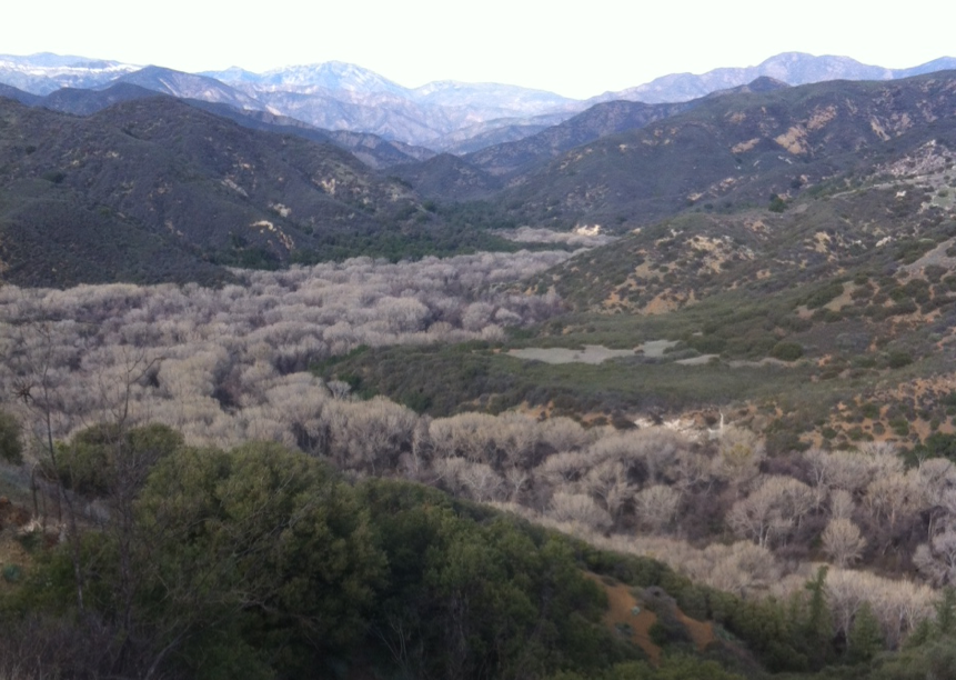
| Trail description: | There is a large downed oak about halfway between the mine and the dam keepers house. Â Also a series of slides as you get closer to the Cold Spring Trail (see photos). Â Gibraltar is very very low. Â The trail is ridable for all sections other than the few slides and the downed tree. Â Great trail! |
| Mode of transport: | Bicycle |
| Trail condition: | Needs some work |
| Images: | Mono Jungle View |
 Survey / Report Form - Please click this box to open the form.