 Use Marker Groups
 Wolf 2002
Piru 2003
Day 2006
Zaca 2007
Gap 2008
La Brea 2009

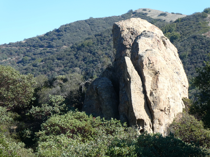
The Fremont Trail connects East Camino Cielo Road with Fremont Campground on Paradise Road. The Fremont trail has beautiful view of the Santa Ynez River Valley.
The Fremont camp was constructed by the CCC in 1935. It is named for John C. Fremont who in 1846, led an armed force near this camp as he crossed San Marcos Pass. Fremont's goal was to engage the Mexican Army in the vicinity of Los Angeles. Crossing the pass on Christmas, the group was drenched by a strong storm. They captured Santa Barbara without opposition as all the men of the town were down in the Los Angeles area.
John Charles Frémont or Fremont (January 21, 1813 – July 13, 1890) was an American military officer, explorer, and politician who became the first candidate of the anti-slavery Republican Party for the office of President of the United States. During the 1840s, when he led four expeditions into the American West, that era's penny press and admiring historians accorded Frémont the sobriquet The Pathfinder.
During the Mexican–American War, Frémont, a major in the U.S. Army, took control of California from the Bear Flag Republic in 1846. Frémont then proclaimed himself military Governor of California; however, for that he was convicted in court martial for mutiny and insubordination. After President Polk commuted his sentence, Frémont led a fourth expedition, which cost ten lives, seeking a rail route over the mountains around the 38th parallel in the winter of 1849. He retired from military service and settled in California. Frémont acquired massive wealth during the California Gold Rush, but he was soon bogged down with lawsuits over land claims, between the dispossession of various land owners during the Mexican–American War and the explosion of Forty-Niners immigrating during the California Gold Rush. These cases were settled by the U.S. Supreme Court allowing Frémont to keep his property. Frémont became one of the first two U.S. senators elected from the new state of California in 1850. He was the first presidential candidate of the new Republican Party, carrying most of the North. He lost the 1856 presidential election to Democrat James Buchanan when Know-Nothings split the vote and Democrats warned his election would lead to civil war.
During the American Civil War, he was given command of Department of the West by President Abraham Lincoln. Although Frémont had successes during his brief tenure as Commander of the Western Armies, he ran his department autocratically, and made hasty decisions without consulting Washington D.C. or President Lincoln. After Frémont's emancipation edict that freed slaves in his district, he was relieved of his command by President Lincoln for insubordination. In 1861, Frémont was the first commanding Union general who recognized an "iron will" to fight in Brigadier General Ulysses S. Grant and promoted him commander at the strategic base near Cairo, Illinois. After the Civil War, Frémont's wealth declined after investing heavily and purchasing an unsuccessful Pacific Railroad in 1866. Frémont served as Governor of Arizona appointed by President Rutherford B. Hayes and served from 1878 to 1881. Frémont, retired from politics and financially destitute, died in New York City in 1890.
Historians portray Frémont as controversial, impetuous, and contradictory. Some scholars regard him as a military hero of significant accomplishment, while others view him as a failure who repeatedly defeated his own best purposes. The keys to Frémont's character and personality may lie in his being born illegitimately, his ambitious drive for success, self-justification, and passive-aggressive behavior.


 Fremont Trail Survey - 03-17-2024 - by ECduzit
| Link: | Fremont Trail |
| Date: | 03-17-2024 |
| Surveyor Name: | ECduzit |
| Trail description: | I think this trail gets overlooked and doesn’t get much use. Started hiking from Fremont campground. The trail has no trailhead sign, it would be hard to find without a GPS. The trail starts off nice then we encountered a few downed oak trees. Someone has started to clear them, but more trees need to be cleared. The trail goes through private land but I assume the trail has an easement? After a creek crossing and a meadow. The trail becomes a dirt road. The dirt road is fine but steep in some sections. We only made it about 65% up the trail and had to turn around due to time constraints so I don’t have a report for the upper portion of the trail. |
| Mode of transport: | Hike |
| Trail condition: | Needs some work |
| Condition details: | Singletrack needs work dirt road is fine |
| Images: | |
Fremont Trail Survey - 11-10-2021 - by Alex Lowe| Link: | Fremont Trail |
| Date: | 11-10-2021 |
| Surveyor Name: | Alex Lowe |
| Trail description: | The start of the trail seems to be unsigned. I found it behind campsite 12 in the Fremont Campground. |
| Mode of transport: | Hike |
| Trail condition: | Good shape and easy to follow |
Fremont Trail Survey - 02-21-2021 - by Nikolaus Volgenau| Link: | Fremont Trail |
| Date: | 02-21-2021 |
| Surveyor Name: | Nikolaus Volgenau |
| Trail description: | The ruts in the higher elevation parts of the trail are deeper (8"), probably because of the late-January rains. |
| Mode of transport: | Hike |
| Trail condition: | Good shape and easy to follow |
 Survey / Report Form - Please click this box to open the form.