 Use Marker Groups
 Wolf 2002
Piru 2003
Day 2006
Zaca 2007
Gap 2008
La Brea 2009

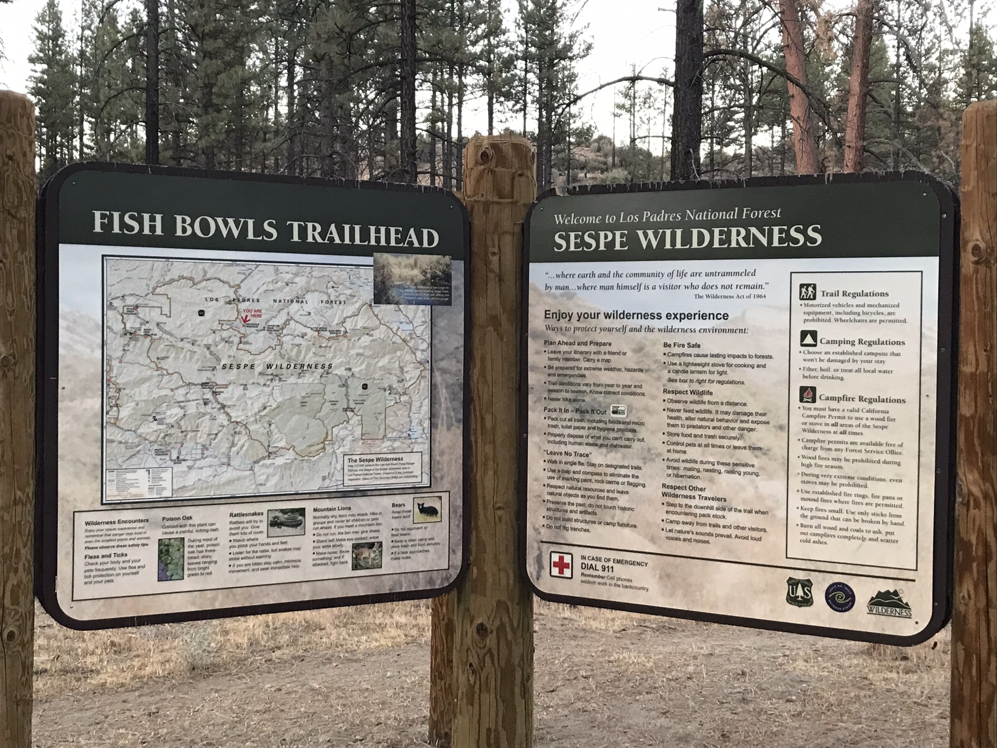
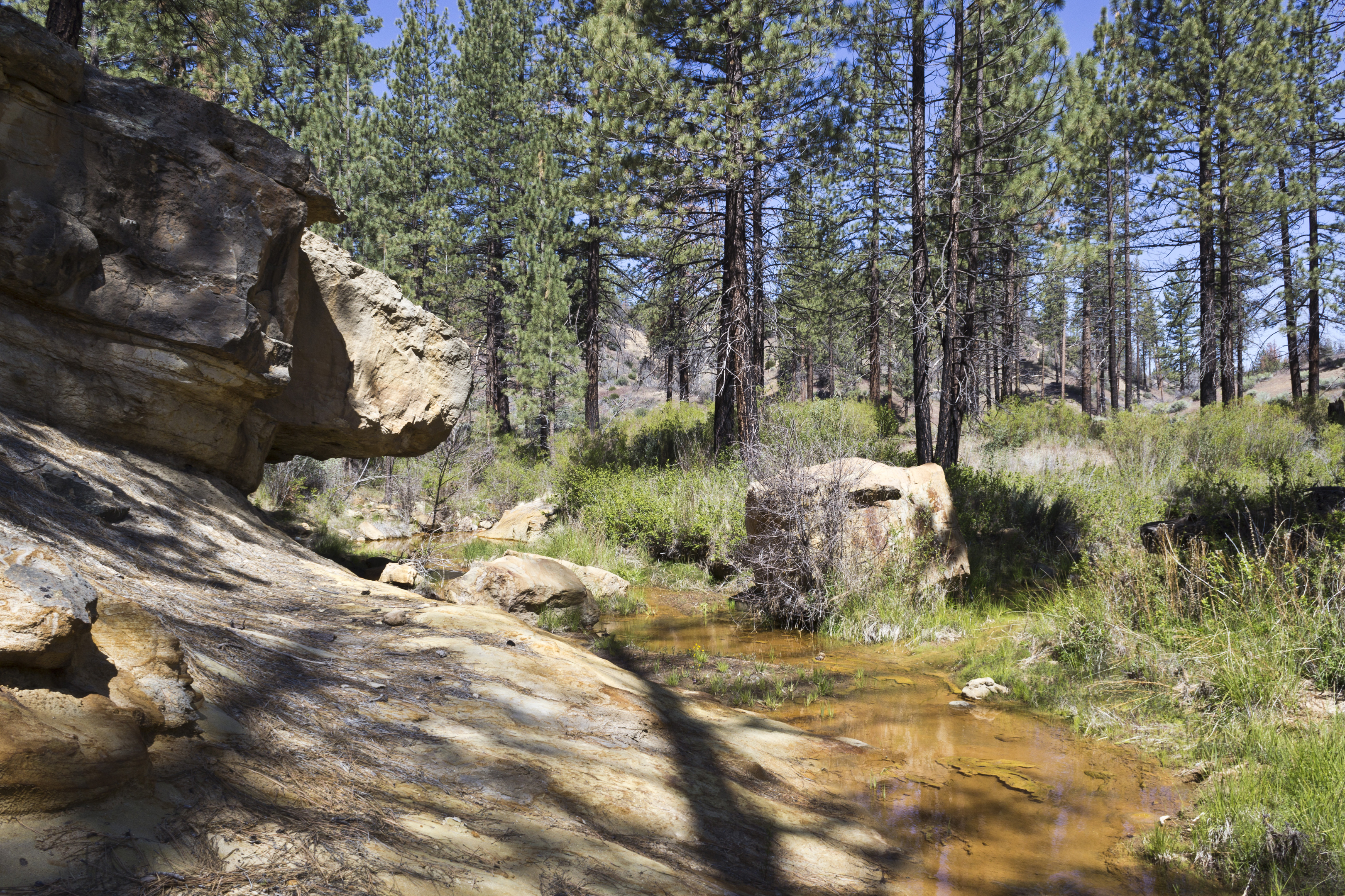
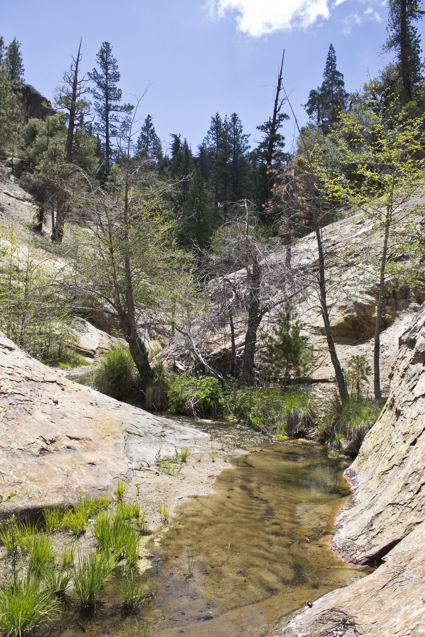
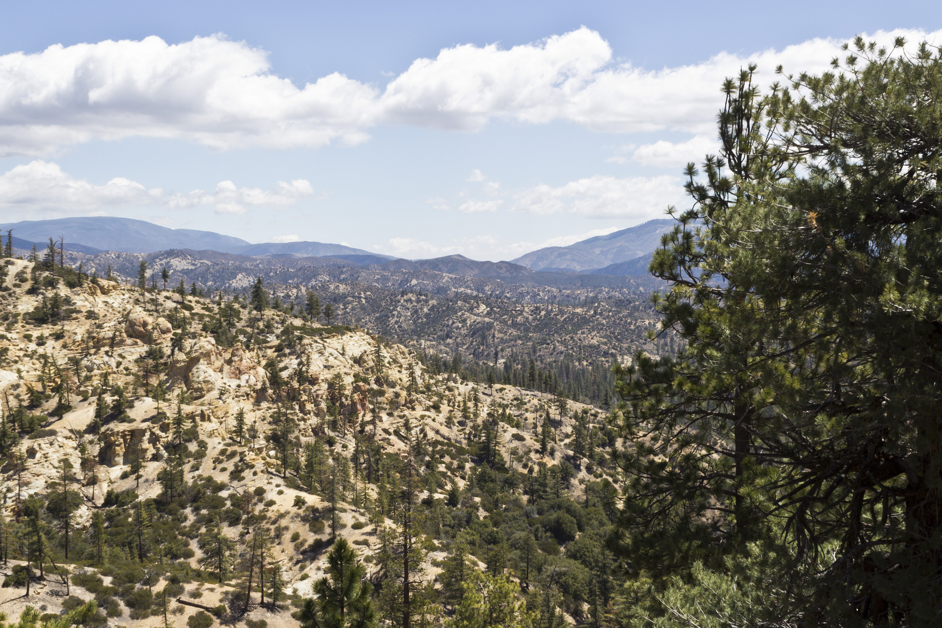
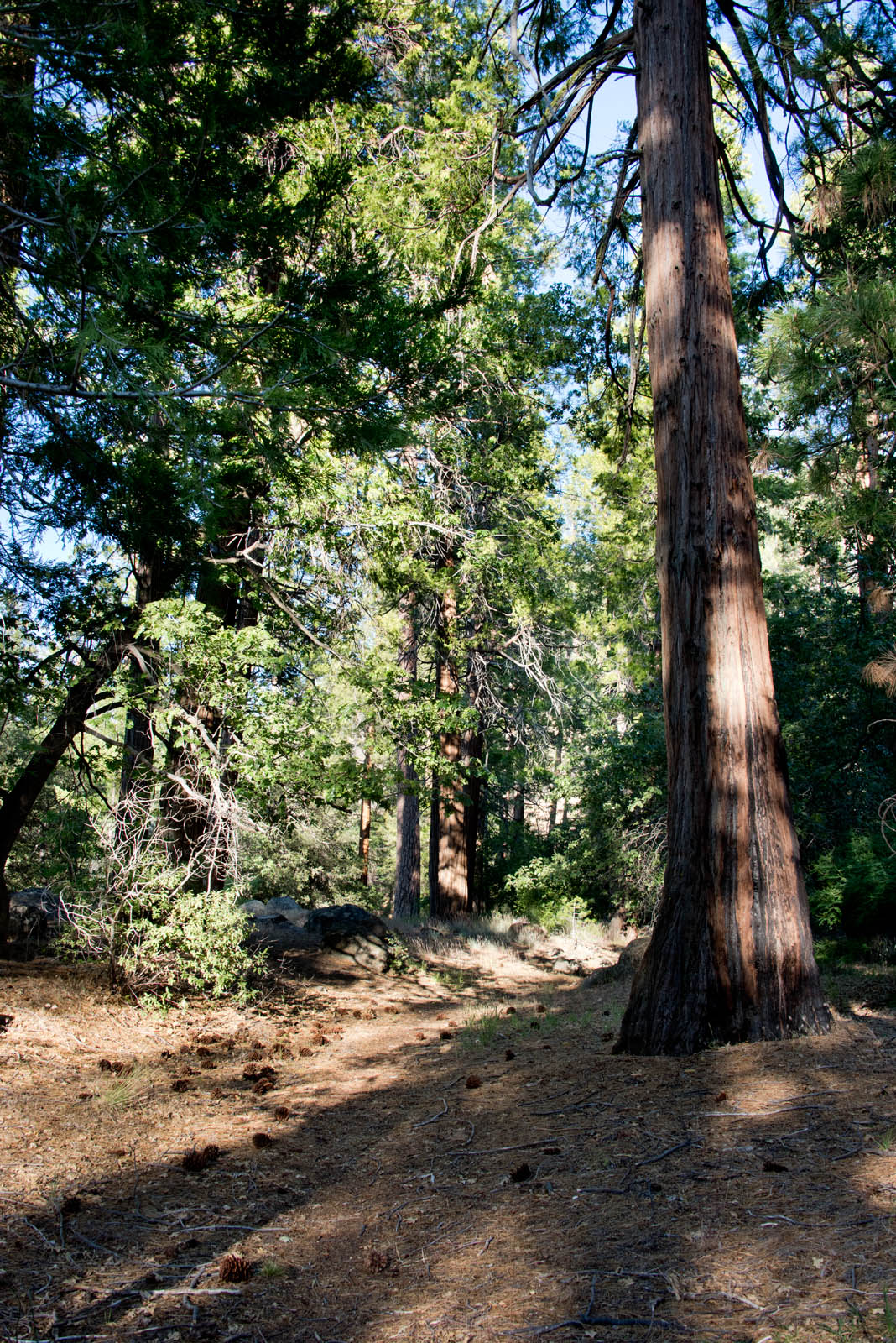
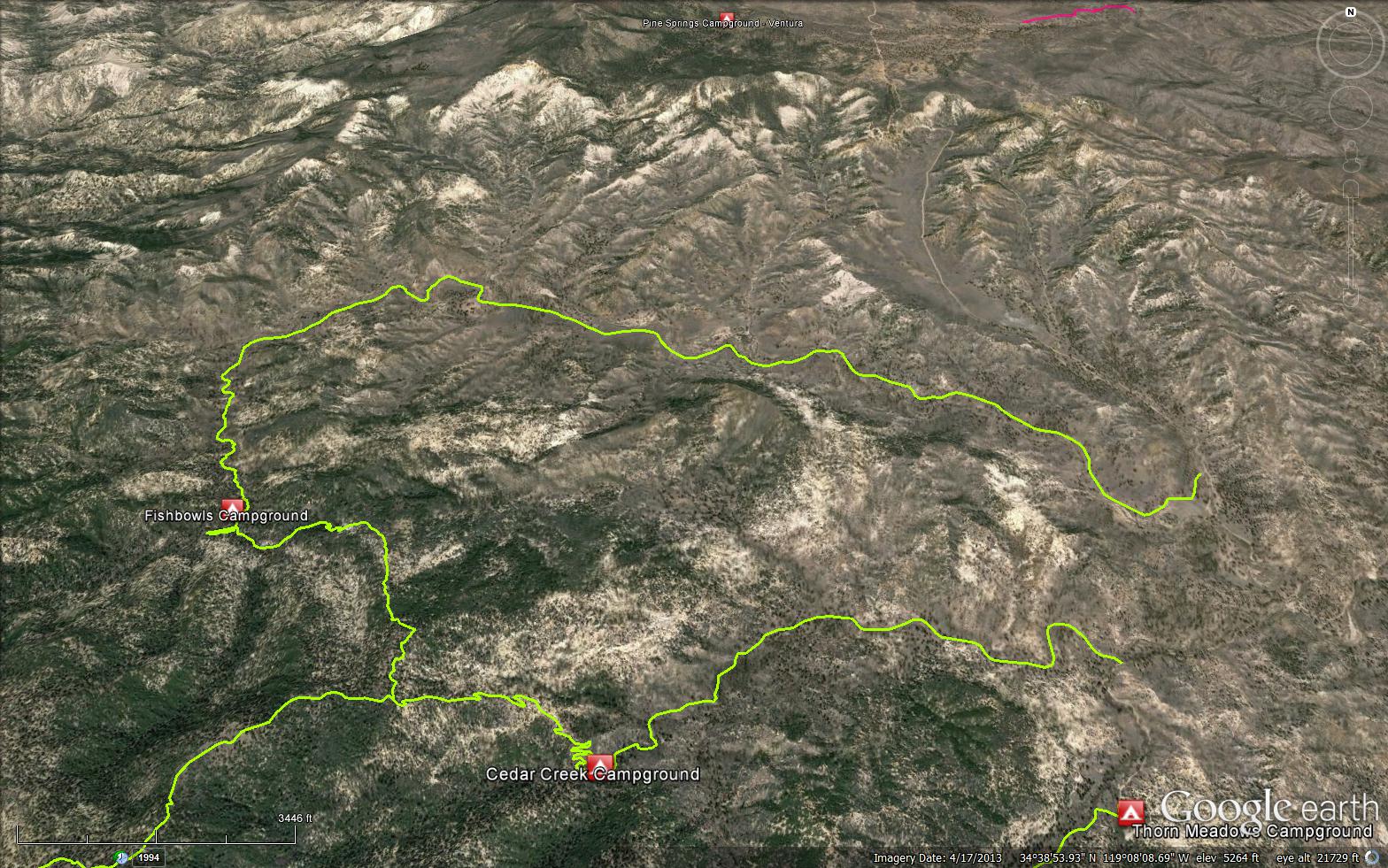
The Fishbowls Trail is a scenic 7.79 mile trail in the Sespe Wilderness in Ventura County County. The trailhead is located off Grade Valley Road (Mutah OHV Road (7N03.2)) at 34.64659, -119.1037. The trail connects the Grade Valley Road (Mutah OHV Road (7N03.2)) to the Cedar Creek Trail (21W10). Once you arrive to the Cedar Creek Trail (21W10), you have two options, if you go left you can make a nice loop trip back to the road and then hike the road back to the car. If you take a right at the Cedar Creek Trail (21W10), you make for a longer exploration of the Gene Marshall-Piedra Blanca Trail (22W03). The Fishbowls Trail follows the Upper most portions of Piru Creek, the canyon is heavily laden with pine trees. Fishbowls Trail is named after a series of bowl shaped pools in the upper part of Piru Creek.


 Fishbowls Trail Survey - 04-29-2025 - by Tom Fritz
| Link: | Fishbowls Trail |
| Date: | 04-29-2025 |
| Surveyor Name: | Tom Fritz |
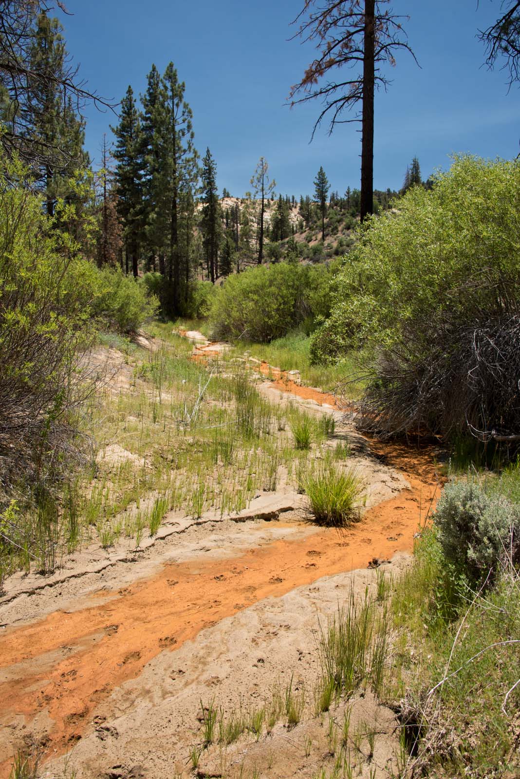
| Trail description: | Hiked the entire length of the Fishbowl trail from the Pine Mountain Lodge/Cedar Creek intersection to the Trailhead at Grade Valley Rd. No blowdowns to report. Water was flowing well at Fishbowls Camp. Although some of the crossings have been "rearranged" with all the water flow in the past couple years, they pretty much follow the course and aren't difficult to navigate. |
| Mode of transport: | Hike |
| Trail condition: | Good shape and easy to follow |
Fishbowls Trail Survey - 05-11-2024 - by Anonymous Surveyor| Link: | Fishbowls Trail |
| Date: | 05-11-2024 |
| Surveyor Name: | Anonymous Surveyor |
| Trail description: | Lots of water in the creeks with many crossings. Trail near fishbowl trail head is a little tricky where it merges with the creek/wash but very manageable. |
| Mode of transport: | Hike |
| Trail condition: | Good shape and easy to follow |
| Images: | |
Fishbowls Trail Survey - 05-21-2022 - by Anonymous Surveyor| Link: | Fishbowls Trail |
| Date: | 05-21-2022 |
| Surveyor Name: | Anonymous Surveyor |
| Trail description: | Without maintenance, multiple spur trails are getting more and more defined by hikers and illegal motorcycle dirt bikes, esp. nearer to creek bottoms and around the many downed logs. This will take more and more work to keep the main trail defined when work is eventually performed. Report made to Forest Service about 3 of the motorcycle dirt bikes on their way, and close to, Fishbowls camp ILLEGALLY USING TRAIL. THIS IS THE SESPE WILDERNESS. If the Forest Service doesn't start enforcing wilderness rules, it will get worse and worse. If there's plenty of money for all the ridiculous Pine Mountain and Mt. Pinos tree removal studies, planning, work, and legal costs, there's plenty of money for trail work and enforcement. |
| Mode of transport: | Hike |
| Trail condition: | Needs some work |
Fishbowls Trail Survey - 11-04-2021 - by Los Padres Forest Association| Link: | Fishbowls Trail |
| Date: | 11-04-2021 |
| Surveyor Name: | Los Padres Forest Association |
| Trail description: | LPFA Trail Survey Trail is clear and followable other than a few random downed trees. Lots of moto damage along trail with dirtbikes going off trail here and there. Another lovely trail to explore. Enjoy! |
| Mode of transport: | Array |
| Trail condition: | Needs some work |
Fishbowls Trail Survey - 11-11-2021 - by Dirk Farner| Link: | Fishbowls Trail |
| Date: | 11-11-2021 |
| Surveyor Name: | Dirk Farner |
| Trail description: | Hiked Fishbowls Trail, continued to Pine Mountain Lodge and returned via Cedar Creek Trail and Grade Valley Road to Fishbowls trailhead. The trail was generally in good condition and easy to follow with the exception of the portion of Cedar Creek Trail descending towards Pine Mountain Lodge. Note that there are two trailheads for Fishbowls Trail on Grade Valley Road. One is indicated by signage, has parking spurs, a vault toilet, etc. The other one is mostly undeveloped and a little further south. The USDA Forest Service Topo Map shows the trail starting out at the one further south. Parking at the developed trailhead results in your GPS locating you roughly 1/4 mile north of the trail against this map. The trail starting here soon merges with the one indicated on the map. Doing the loop, upon return, your GPS locates you at the trailhead on the map but the developed trailhead will be a little further north along Grade Valley Road. |
| Mode of transport: | Hike |
| Trail condition: | Needs some work |
Fishbowls Trail Survey - 04-19-2021 - by Tom Fritz| Link: | Fishbowls Trail |
| Date: | 04-19-2021 |
| Surveyor Name: | Tom Fritz |
| Trail description: | Hiked the trail from the Fishbowls TH to Fishbowls, spent the night, then proceeded on the trail towards Cedar Creek, where I split off and headed to Pine Mtn. Lodge. I was early in the season as all the gates were still locked (I was doing my version of a Sespe Loop). The only sign I followed in was a couple dirtbikes which one could tell had torn up the trail soon after the last rain (a month prior?). The tire prints were firmly set in hard mud the entire way. In a few areas, the only footprints I could discern ahead of me were a momma and baby bear I followed for a while. The trail is pretty clear until you get to the cable/wilderness sign, then from there it gets lost in brushier areas. The dirtbikes, in searching for their way up the trail, tore up the surrounding areas quite a bit as they searched for the trail – however, if a hiker is new to the hike, this could be beneficial as the bikes sort of created "new trails" and approaches, busted some brush, circumventing downed trees, etc. The Fishbowls camp itself (on both sides of the Piru) was in great shape considering it was early season (meaning the grounds were littered with lots of downed branches/twigs for firewood), water was flowing albeit slowly. The first "fishbowl" was totally silted-in a few years back and is now about 5' deep. Next morning, I followed the mud-imprinted dirtbike tracks all the way to the Cedar Creek/Pine Mtn Lodge/Fishbowls three-way trail intersection, where they headed off down-canyon toward Cedar Creek. The trail tread between Fishbowls and this intersection was a breeze, cleared of all downed trees. |
| Mode of transport: | Hike |
| Trail condition: | Needs some work |
| Condition details: | Dirt bikes... love em or hate em. |
Fishbowls Trail Survey - 11-28-2020 - by Molly Troup| Link: | Fishbowls Trail |
| Date: | 11-28-2020 |
| Surveyor Name: | Molly Troup |
| Trail description: | Did a 15 mile loop from Cedar Creek Trail to Fishbowls and back along the road. Both trails in great shape, easy to follow, and plenty of flowing water along the Fishbowls. |
| Mode of transport: | Hike |
| Trail condition: | Good shape and easy to follow |
Fishbowls Trail Survey - 10-24-2020 - by Nancy| Link: | Fishbowls Trail |
| Date: | 10-24-2020 |
| Surveyor Name: | Nancy |
| Trail description: | Great shape. We found the waterholes and stopped there for a bite because it was so beautiful. The scenery gets better as you start climbing out of Fishbowls. Amazing views. |
| Mode of transport: | Hike |
| Trail condition: | Good shape and easy to follow |
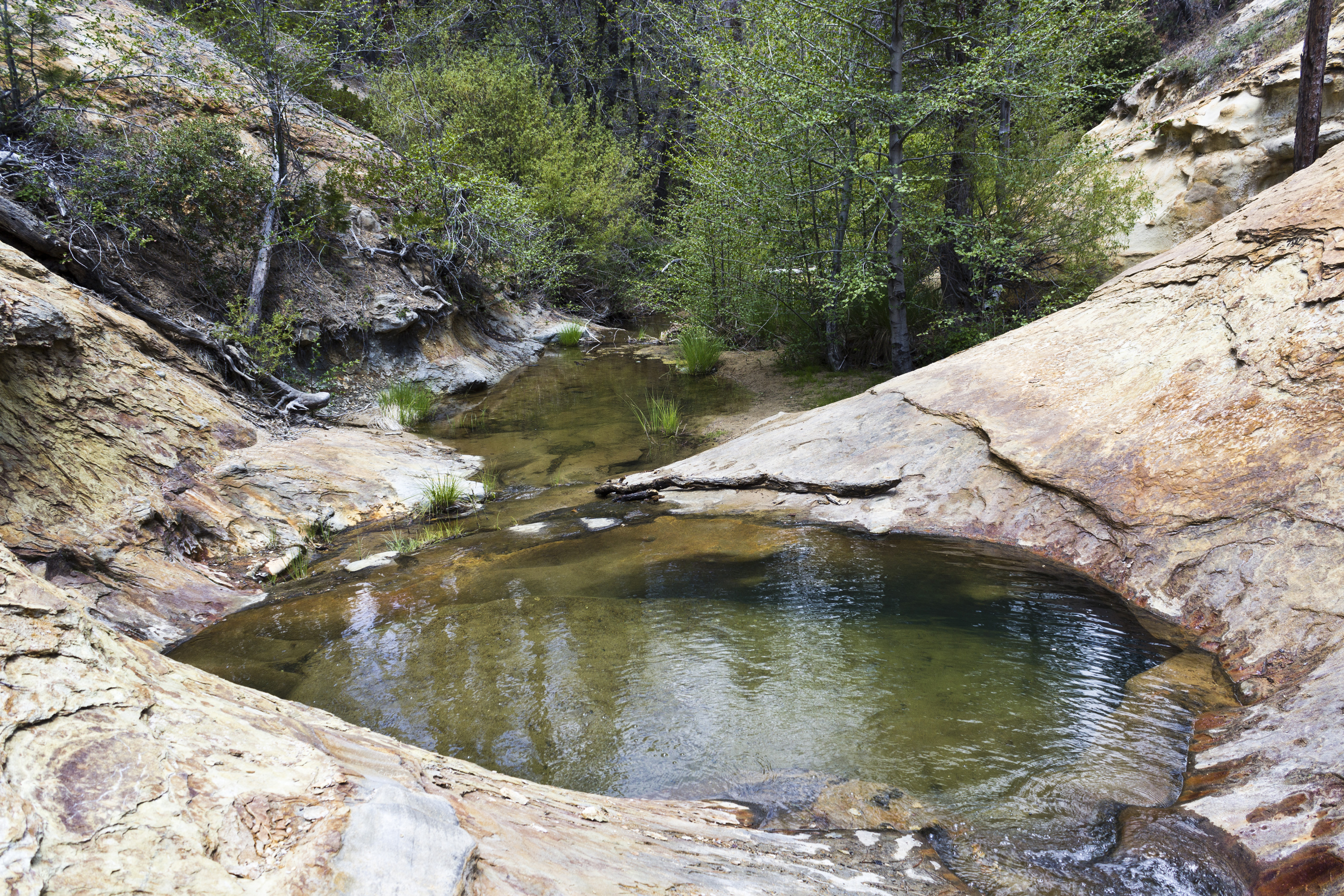
| Images: | Waterhole |
Fishbowls Trail Survey - 06-19-2020 - by David Leoncavallo| Link: | Fishbowls Trail |
| Date: | 06-19-2020 |
| Surveyor Name: | David Leoncavallo |
| Trail description: | Hot, but still plenty of water. Did the Cedar Creek Fishbowls loop counterclockwise. Great overnight trip. |
| Mode of transport: | Hike |
| Trail condition: | Good shape and easy to follow |
| Images: | |
Fishbowls Trail Survey - 06-06-2020 - by Antonio Calderon| Link: | Fishbowls Trail |
| Date: | 06-06-2020 |
| Surveyor Name: | Antonio Calderon |
| Trail description: | Trail is in fine shape all the way to cedar creek trail. Good water flow throughout the whole stretch. |
| Mode of transport: | Hike |
| Trail condition: | Good shape and easy to follow |
| Images: | |
Fishbowls Trail Survey - 05-24-2020 - by Anonymous Surveyor| Link: | Fishbowls Trail |
| Date: | 05-24-2020 |
| Surveyor Name: | Anonymous Surveyor |
| Trail description: | Trail is in good condition. Some areas are tricky to follow after the stream crossings or in the riverbed. If in doubt just follow the creek. A handful of down trees along the entire length of trail. Came across an old camp that was washed out by a flash flood. Remnants of the tent and other camping belongings are downstream of the first crossing after the sespe wilderness sign. |
| Mode of transport: | Hike |
| Trail condition: | Good shape and easy to follow |
Fishbowls Trail Survey - 05-13-2020 - by Matt| Link: | Fishbowls Trail |
| Date: | 05-13-2020 |
| Surveyor Name: | Matt |
| Trail description: | Trail is in good shape. The first few miles up Piru Creek are a bit overgrown but still easy enough to follow. Once you turn up Fishbowls Creek the trail is in great shape all the way to Cedar Creek Trail. |
| Mode of transport: | Hike |
| Trail condition: | Needs some work |
| Condition details: | Trail in Good Shape |
Fishbowls Trail Survey - 10-22-2019 - by Everett Amburn| Link: | Fishbowls Trail |
| Date: | 10-22-2019 |
| Surveyor Name: | Everett Amburn |
| Trail description: | The trail is easy-ish to follow with a few blow downs and some erosion near creeks. This is not surprising consider the amount of rain from winter 2019. |
| Mode of transport: | Hike |
| Trail condition: | Needs some work |
| Condition details: | Few blow downs and erosion. |
Fishbowls Trail Survey - 06-15-2019 - by msubbotin| Link: | Fishbowls Trail |
| Date: | 06-15-2019 |
| Surveyor Name: | msubbotin |
| Trail description: | |
| Mode of transport: | Hike |
| Trail condition: | Needs some work |
| Condition details: | Hiked from Fishbowls TH to Fishbowls camp. Trail brushy in many places and several downed trees. Steep drop off at one creek crossing and several creek crossings require bushwhacking through willows to find trail on other side. logged out 3 trees. Fishbowls 8ft deep and Piru Creek flowing along entire length. |
Fishbowls Trail Survey - 10-08-2018 - by Christopher P. Lord| Link: | Fishbowls Trail |
| Date: | 10-08-2018 |
| Surveyor Name: | Christopher P. Lord |
| Trail description: | As of this writing the trail is in great condition. There are a few downed trees and some minor overgrowth along the trail in only a handful of places. If I had my loppers I would have spruced up those spots. Over all though nothing to complain about. Water was dry along most of Piru Creek except for a few places near Fishbowls Camp. I had another great day lost in the Los Padres. http://christopherplord.blogspot.com/2018/10/fishbowls-to-cedar-creek-loop.html |
| Mode of transport: | Hike |
| Trail condition: | Good shape and easy to follow |
| Images: | |
Fishbowls Trail Survey - 05-26-2018 - by Craig R. Carey| Link: | Fishbowls Trail |
| Date: | 05-26-2018 |
| Surveyor Name: | Craig R. Carey |
| Trail description: | As part of their final pre-summer training trip, Troop 111 Scouts (Ventura) backpacked the length of the Fishbowls trail. A few downed trees, but nothing unmanageable. Lots of creek crossings but all can be managed with dry feet. Great conditions right now. |
| Mode of transport: | Hike |
| Trail condition: | Good shape and easy to follow |
| Images: | |
Fishbowls Trail Survey - 06-30-2017 - by Anonymous Surveyor| Link: | Fishbowls Trail |
| Date: | 06-30-2017 |
| Surveyor Name: | Anonymous Surveyor |
| Trail description: | Stayed there overnight on a 8 day journey...all good till a group of college age group showed up.....terrible at best....pools were great |
| Mode of transport: | Array |
| Trail condition: | Good shape and easy to follow |
Fishbowls Trail Survey - 05-09-2017 - by Dave Burnett| Link: | Fishbowls Trail |
| Date: | 05-09-2017 |
| Surveyor Name: | Dave Burnett |
| Trail description: | Excellent day for a hike from Fishbowls Trailhead to Cedar Creek Trailhead. Â Total distance about 11.5 miles. Â Time about 6 hours. Â Trails are in excellent condition. Â Some trees down as noted. Â None are significant impediments. Â Cool start at around 7:45 am. Â Warmed a bit by noon which we spent on the ridge near junction of Fishbowls trail with Cedar Creek trail. Â Two vehicles allowed avoiding ~2 mile walk along the road. Â Fun hike with three friends. |
| Mode of transport: | Hike |
| Trail condition: | Needs some work |
| Condition details: | Trees across the trail in about a dozen places on Fishbowls and Cedar Creek trails. None are difficult to step over or go around. |
| Images: | Lunch stop. At Fishbowls Camp Cedar Creek crossing near end of hike Snow Flower. We saw several of these on both trails. |
Fishbowls Trail Survey - 11-17-2016 - by Dave Burnett| Link: | Fishbowls Trail |
| Date: | 11-17-2016 |
| Surveyor Name: | Dave Burnett |
| Trail description: | Â Â Â Â Â Â Â Â Our
hike started about 7:45 am. It was a
cool, crisp day with temperature 37 degrees at the start. Very sunny and completely clear. We saw nothing in the sky all day other than
birds, the nearly full moon and an occasional high flying aircraft. Our plan was to hike at least to Fishbowls Campsite. In fact we hiked about 0.6 miles past the
campsite to a high sunny ridge for lunch.Â
Total one way distance was 6.4 miles of the 7.8 mile length of the
trail. Returned to the trailhead at
about 2:30, still clear, sunny and warmed to 65 degrees. Â Â Â Â Â Â Â Â Â Â Â Â Â Â Â No
difficulty following the trail except at one point about 3.25 miles from the
trailhead. The trail descends a steep, three
foot bank towards the creek bed. One
path stays on the south side of the creek, which we took. The correct path crosses the creek. So we had a short detour around a small hill,
but soon got back on track. Â Â Â Â Â Â Â Â Â Â Â Â Â Â Â We
noted a couple of obstacles on the path.Â
One was a 2 foot diameter tree lying across the trail about 100 yards
beyond the Sespe Wilderness boundary.Â
The other was a fallen tree about ¼ mile before the Fishbowls
campsite. More details on both of these
in the images. Â Â Â Â Â Â Â Â Â Â Â Â Â Â Â All-in-all
a great hike. Trail appears to be
lightly used. However, we saw no one
from the time we left the Lockwood Valley Road until our return there except
one person in a pickup truck driving near the trailhead. There was also very little trash along the
trail. |
| Mode of transport: | Hike |
| Trail condition: | Good shape and easy to follow |
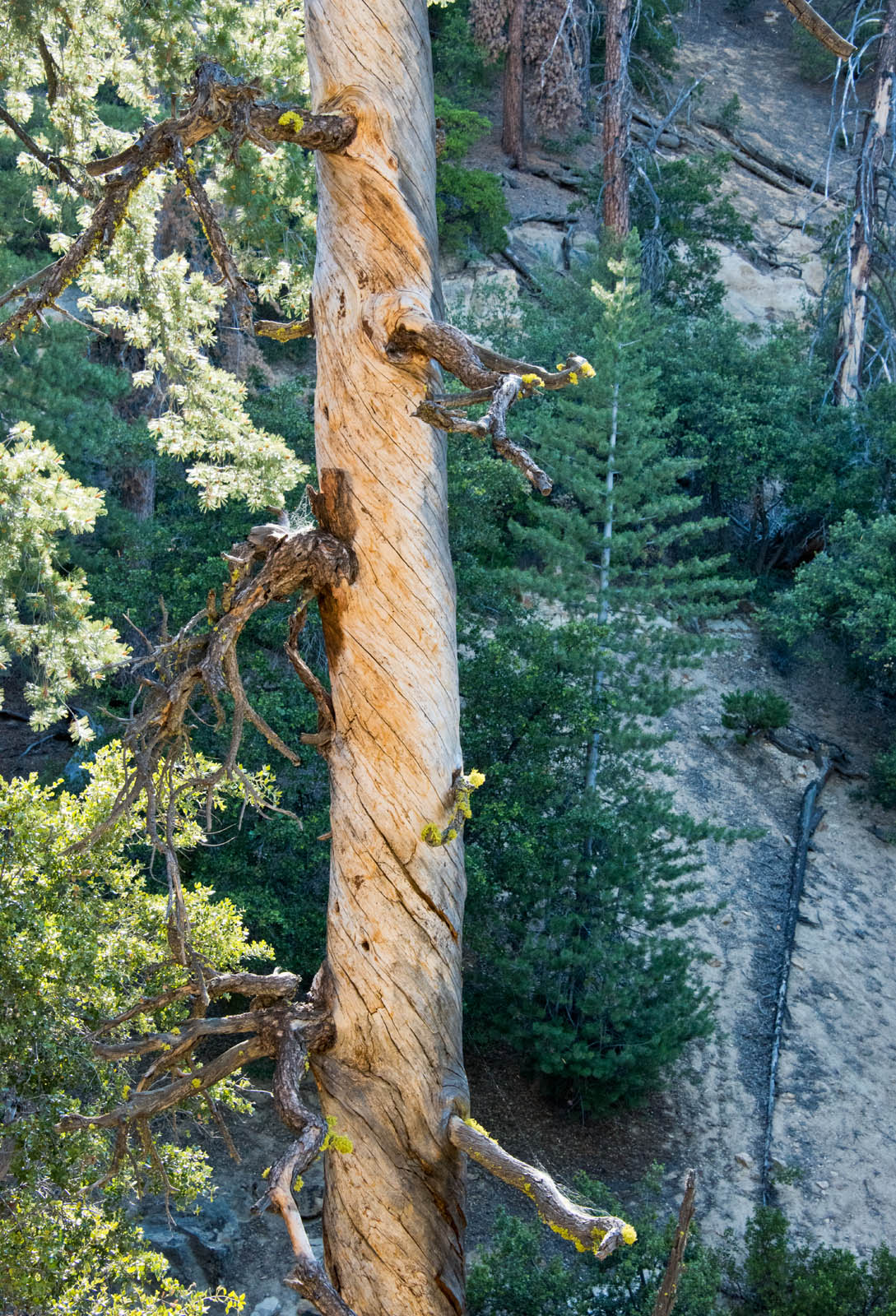
| Images: | The trail beyond our lunch spot. Great views all around from this ridge. An ancient signpost. The post has bolts in it that apparently held a sign. Remnants of the sign are scattered on the ground, but we were unable to determine what it may have once said. Speculating that perhaps this was once the boundary of the Sespe Wilderness. Does anyone know the real answer? Two foot diameter pine log fallen across the trail. Image was taken on our return trip from the west side of the log. Location is N34° 39.514', W119° 8.646', about 100 yards inside the Sespe Wilderness. Fallen pine tree about ¼ mile before Fishbowls Campground. Location is N34° 38.749', W119° 9.873'. This tree apparently fell very recently based on the fresh cedar branches from the tree it fell through. Cleaning up the fallen pine tree. Many branches were broken off by the fall. We moved all the larger branches off the trail and were able to break most of the other obstructing branches off the trunk. Trail is easily passable. |
Fishbowls Trail Survey - 06-25-2015 - by Donna Spencer| Link: | Fishbowls Trail |
| Date: | 06-25-2015 |
| Surveyor Name: | Donna Spencer |
| Trail description: |   If you like serenity and solitude, you will love this hike. Once you finish the small climb up and over into the watershed. You will treated to island of pine forest and oak tress. While navigating the creek area be mindful of (pink or yellow) tape for trail directions. Two areas of trail has been washed out, however easily found tape shows you the way. The Fishbowls Campground is an excellent site, graced with beautiful rock formation and forest. However depending on water levels (the day that I went) was disappointing. However great hike I did it as a loop to Cedar Creek Trail Head and was picked-up by my DAD. |
| Mode of transport: | Hike |
| Trail condition: | Good shape and easy to follow |
Fishbowls Trail Survey - 01-06-2015 - by Anonymous Surveyor| Link: | Fishbowls Trail |
| Date: | 01-06-2015 |
| Surveyor Name: | Anonymous Surveyor |
| Trail description: | This loop (Fish Bowls to Cedar Creek) is a good overview of the Sespe Wilderness. Â It follows the Piru creek to it's headwaters (North facing drainage) then follows a ridge that divides the North and South drainage systems, then drops down into Cedar Creek on the North side of the range. Â Surprisingly big Cedars that look a lot like Redwoods in the stream valleys in both drainages. One can walk about a mile on the Forest road connecting both camps to complete the loop (approx 9 miles). Â Hard to find the "Fishbowls" from the camp. |
| Mode of transport: | Hike |
| Trail condition: | Needs some work |
| Condition details: | Hard to pick up trail in some areas where it crosses Piru Creek |
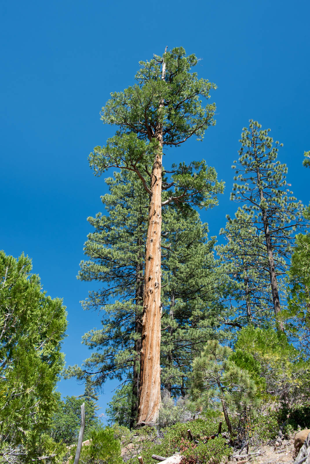
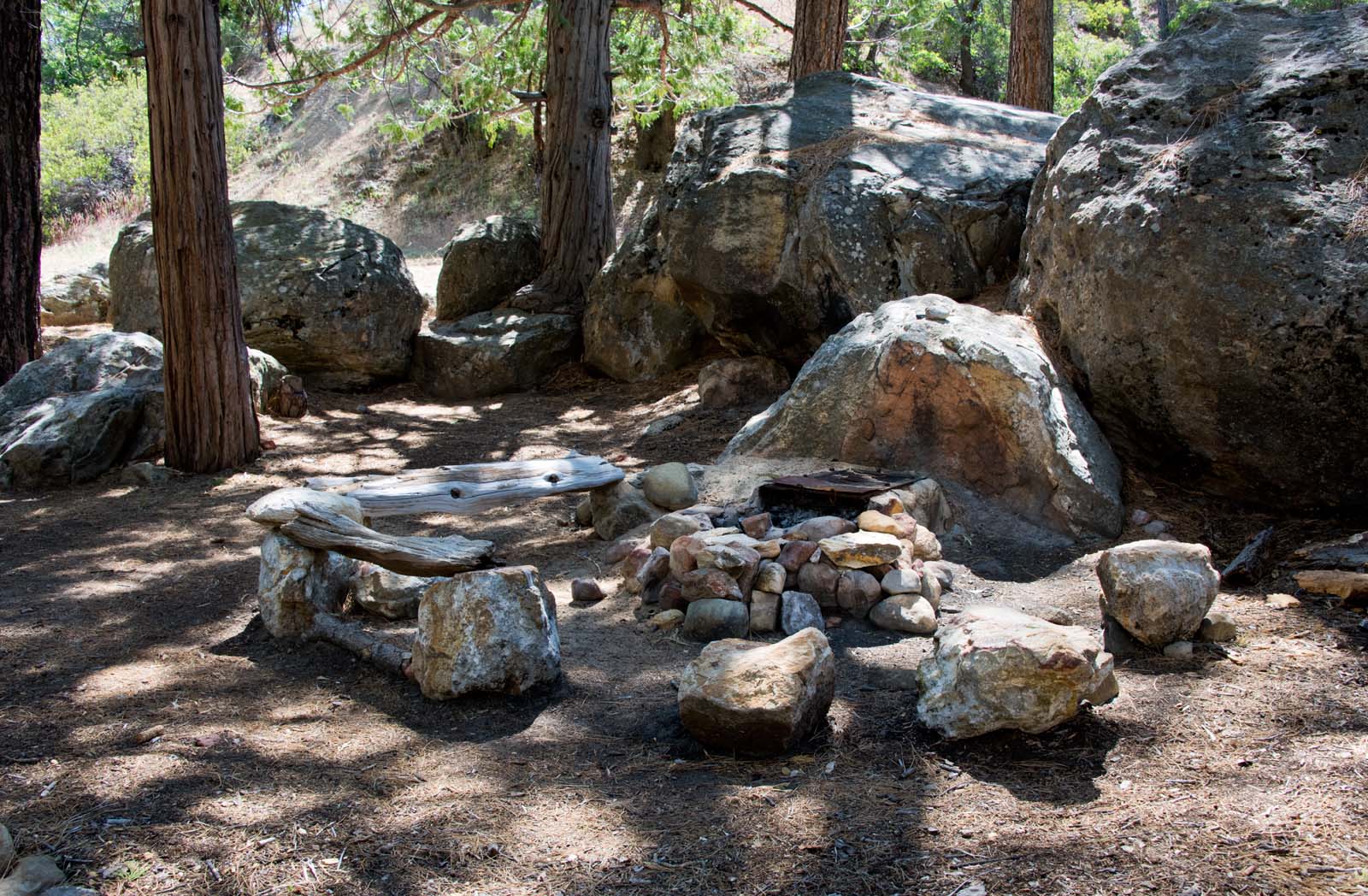
| Images: | A stately Cedar near Fish Bowls camp. The Piru creek at a low flow point. The switchbacks from the ridge down into Cedar Creek Nice, stately Cedar Very nice camp at Fishbowls |
Fishbowls Trail Survey - 05-24-2015 - by Anonymous Surveyor| Link: | Fishbowls Trail |
| Date: | 05-24-2015 |
| Surveyor Name: | Anonymous Surveyor |
| Trail description: | The trail was in good shape. I walked the entire loop and came across plenty of water in all of the expected locations. It had rained the day before I arrived so that may have accounted for the abundance of water. Cedar Camp and Fishbowl Camp were both in good condition. The fishbowls were flowing well. |
| Mode of transport: | Hike |
| Trail condition: | Good shape and easy to follow |
| Images: | The first fishbowl Cedar Creek Piru Creek Overlooking the Sespe Wilderness |
Fishbowls Trail Survey - 05-24-2014 - by Los Padres Forest Association| Link: | Fishbowls Trail |
| Date: | 05-24-2014 |
| Surveyor Name: | Los Padres Forest Association |
| Trail description: | Information gathered by James Wapotich while on a VWR Patrol. Â You can follow James on his blog:Â http://songsofthewilderness.wordpress.com/ |
| Mode of transport: | Hike |
| Trail condition: | Needs some work |
| Condition details: | Lots of downed trees but the trail is very followable. |
| Number of trees down: | 10 |
 Survey / Report Form - Please click this box to open the form.