 Use Marker Groups
 Wolf 2002
Piru 2003
Day 2006
Zaca 2007
Gap 2008
La Brea 2009

| Date | Surveyor | Water Report |
| 01-18-2020 | Christopher P. Lord | Stagnant |
| 04-09-2019 | Los Padres Forest Association | Flowing |
| 11-17-2018 | Los Padres Forest Association | Dry |
| 12-19-2016 | Menso de Jong | Dry |
| 07-19-2014 | Los Padres Forest Association | Dry |
A small and very remote trail camp located off the Loma Victor Road (7N05), the Don Victor Trail starts here. The camp was once an old homestead owned by Don Victor in the 1920's, you can find the ruins of his old cabin near by.


 Don Victor Camp Survey - 01-18-2020 - by Christopher P. Lord
| Link: | Don Victor Camp |
| Date: | 01-18-2020 |
| Surveyor Name: | Christopher P. Lord |
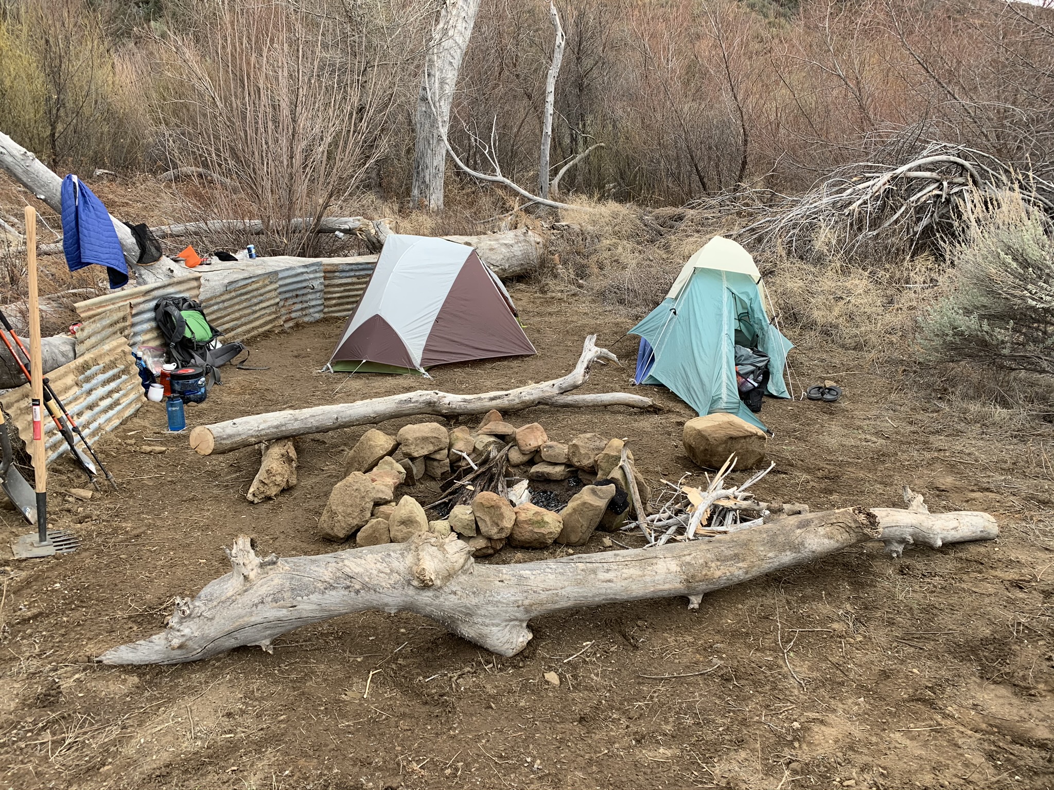
| Camp Description: | Don Victor is back, spent Martin Luther king weekend fully rehabilitating the camp. Cleared a large portion of the flat, rebuilt a bigger much nicer fire ring, cut large deadwood tree portions to create nice benches around the fire pit and inch by inch rolled a large rock up from near the creek crossing that makes for a hell of a great seat. I would say this is now once again a damn fine place to spend the night. Water was dry in the Mono directly behind Camp, however 200 feet back along the road at the crossing a stagnant pool kept our beers cold and us hydrated. Camp got a new shovel, McLeod and an REI gift card for the next lucky visitor to enjoy. Read the full trip report on my blog at the link below. |
| Water Source: | Stagnant |
| Water Source Details: | |
| Weather Conditions: | comfortable during the day very cold at night |
| Images: | Before we arrived After we finished water/ice chest pond at the crossing before camp |
Don Victor Camp Survey - 04-09-2019 - by Los Padres Forest Association| Link: | Don Victor Camp |
| Date: | 04-09-2019 |
| Surveyor Name: | Los Padres Forest Association |
| Camp Description: | The road goes right past the camp and you'll know you are there when you see the red reflector and some cut pieces of wood. Not much else at camp.  |
| Water Source: | Flowing |
| Water Source Details: | Water coming out of both Pine Canyon and Mono Creeks. |
| Weather Conditions: | |
| Images: | View up the "trail" near the wilderness boundary above the camp. |
Don Victor Camp Survey - 11-17-2018 - by Los Padres Forest Association| Link: | Don Victor Camp |
| Date: | 11-17-2018 |
| Surveyor Name: | Los Padres Forest Association |
| Camp Description: | Don Victor Camp continues to underwhelm. The valley is quite nice but the camp not so much. But great place for bird watching and solitude. |
| Water Source: | Dry |
| Water Source Details: | No water anywhere in site or in sight! |
| Weather Conditions: | |
| Images: | At least it has some shade. |
Don Victor Camp Survey - 12-19-2016 - by Menso de Jong| Link: | Don Victor Camp |
| Date: | 12-19-2016 |
| Surveyor Name: | Menso de Jong |
| Camp Description: | I rode through on a back country epic mtb ride via Monte Arido. The stovepipe well thing had some water in the bottom but the spigot was stuck and broke off when I tried to open it. The bottom was completely plugged with sediment so no water came out. Continued on Don Victor (completely overgrown) to Alamar, which was the first water of the day. |
| Water Source: | Dry |
| Water Source Details: | |
| Weather Conditions: | |
| Images: | Navigating to the remains of Don Victor Road |
Don Victor Camp Survey - 07-19-2014 - by Los Padres Forest Association| Link: | Don Victor Camp |
| Date: | 07-19-2014 |
| Surveyor Name: | Los Padres Forest Association |
| Camp Description: | |
| Water Source: | Dry |
| Water Source Details: | |
| Weather Conditions: |
 Survey / Report Form