 Use Marker Groups
 Wolf 2002
Piru 2003
Day 2006
Zaca 2007
Gap 2008
La Brea 2009

| Date | Surveyor | Water Report |
| 04-25-2020 | Antonio Calderon | Dry |
| 01-09-2020 | Valerie Norton | Dry |
| 04-14-2017 | Mike Maki | Dry |
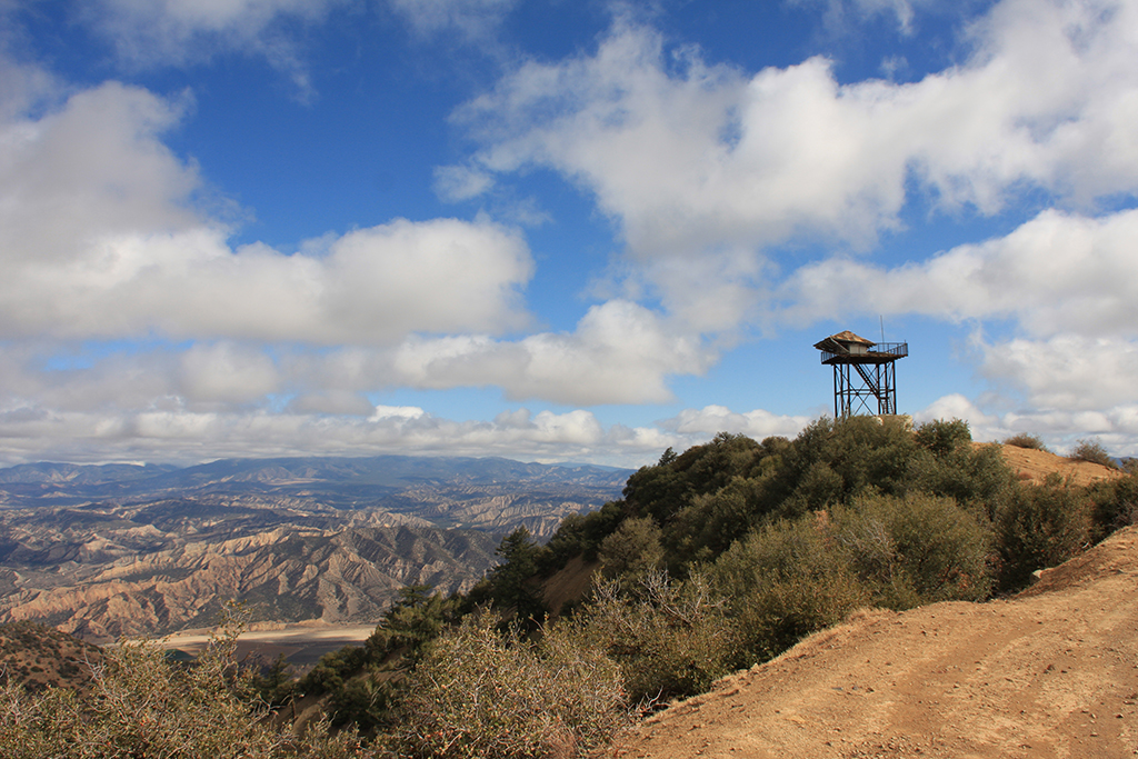
In the Los Padres National Forest. This is an abandoned lookout at 5978 feet.


 Cuyama Peak Survey - 04-25-2020 - by Antonio Calderon
| Link: | Cuyama Peak |
| Date: | 04-25-2020 |
| Surveyor Name: | Antonio Calderon |
| Camp Description: | Drove up through dry canyon rd which is in good condition except at about mile three where there is a washout which we filled it up with boulders to get through. View from the tower is amazing. |
| Water Source: | Dry |
| Water Source Details: | |
| Weather Conditions: | 70 F cloudy and windy |
| Images: | |
Cuyama Peak Survey - 01-09-2020 - by Valerie Norton| Link: | Cuyama Peak |
| Date: | 01-09-2020 |
| Surveyor Name: | Valerie Norton |
| Camp Description: | I hiked up Tinta to the Brubaker junction, then followed the ridge up. I followed the road down to Tinta, then along Tinta to finish. Well, not finish. The gates were locked and I wouldn't trust my car to get across the river anyway, so I had almost three miles of road to hike back too. It's surprising how much of the lookout has vanished. |
| Water Source: | Dry |
| Water Source Details: | Plenty floating around in the air and a little falling in frozen from. |
| Weather Conditions: |
Cuyama Peak Survey - 04-14-2017 - by Mike Maki| Link: | Cuyama Peak |
| Date: | 04-14-2017 |
| Surveyor Name: | Mike Maki |
| Camp Description: | Bagged Cuyama on a hike up Tinta Canyon and down Dry Canyon. Tower was covered in rime ice from previous night's windy cold weather. Some video. |
| Water Source: | Dry |
| Water Source Details: | Tower was covered in rime ice ;) |
| Weather Conditions: | Cold and windy. 40's. |
| Images: | Old tower Half the old tower on south slope Stariway View down Tinta Canyon toward Pine Mountain Rime ice on north side tower |

 Survey / Report Form - Please click this box to open the form.