 Use Marker Groups
 Wolf 2002
Piru 2003
Day 2006
Zaca 2007
Gap 2008
La Brea 2009

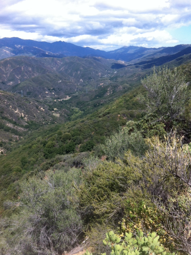
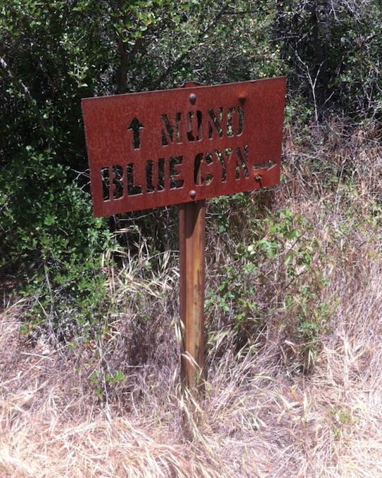
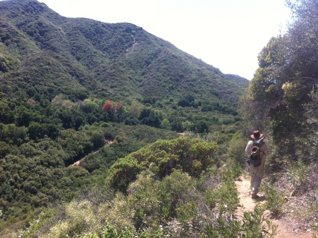
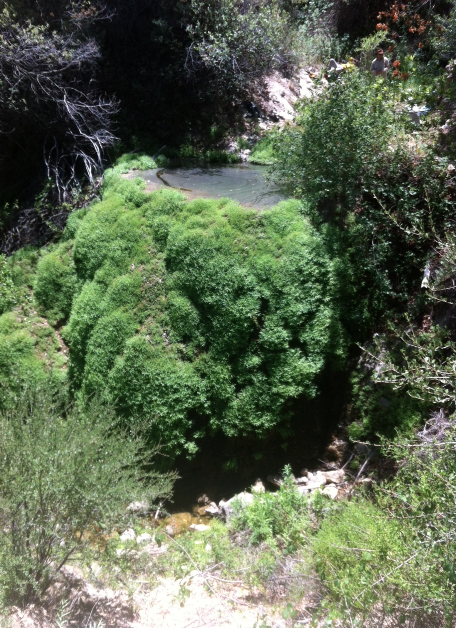
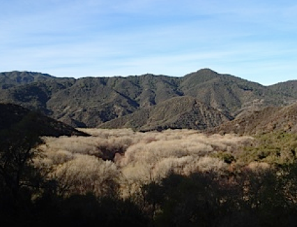
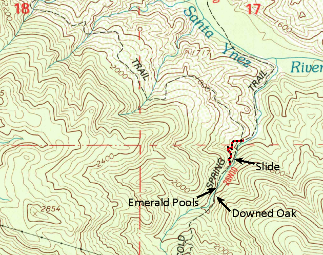
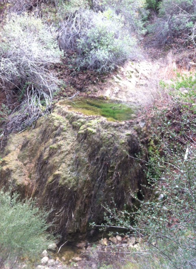
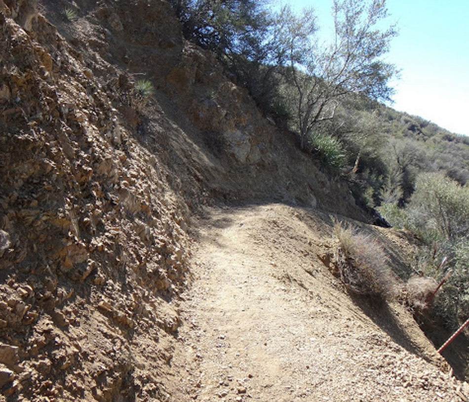
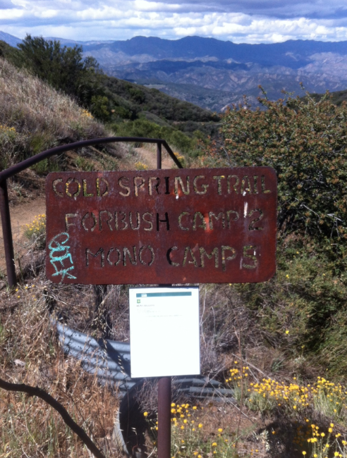
The northern trail is more of a backpackers route used to access the assortment of backcountry camps on the northern Santa Ynez Mountains or Upper Santa Ynez drainage. The majority of backpackers start from the Cold Spring Saddle Trailhead along East Camino Cielo. The trail drops steeply to Forbush Camp and then continues down to the Santa Ynez River. From there it crosses a silted in portion of Gibraltar Reservoir called the Mono Jungle and ultimately ends at Mono Campground along the Romero Camuesa Rd. The trail is in good shape other than one slide section just up-canyon from the junction with the Gibraltar Trail. While the trail does have quite a bit of poison oak, most of it can be avoided and the views of the backcountry are spectacular. There is a beautiful section called the Emerald Pools that are worth checking out as well.


 Cold Spring Trail - North Survey - 05-24-2024 - by Piper
| Link: | Cold Spring Trail - North |
| Date: | 05-24-2024 |
| Surveyor Name: | Piper |
| Trail description: | Hiked from Cold Spring trail to Little Caliente. The new high trail was in great condition. The whole trail was in good condition. Some poison oak. Little Caliente was a nice temperature and clean. There was a small cold seep with a collectable pool nearby to the hot spring. The dirt road the last mile to the hot spring from Mono was washed out by a creek that was flowing well. I could not tell if you can even get to Mono camp. Looked like a wall of brush in the way. I also continued to Big Caliente. The dirt road, Romero Camuesa, was washed out in numerous places. Some washouts were pretty sketchy for a hiker, probably very difficult for someone with a heavy bicycle. |
| Mode of transport: | Hike |
| Trail condition: | Good shape and easy to follow |
Cold Spring Trail - North Survey - 07-02-2023 - by mwb| Link: | Cold Spring Trail - North |
| Date: | 07-02-2023 |
| Surveyor Name: | mwb |
| Trail description: | Trail is in decent shape from E Camino Cielo to Santa Ynez River, I didn't go any farther. Plenty of water along that stretch. Poison oak and pokey plants are starting to encroach, I recommend wearing long pants but the trail is easily navigable. Bug spray also a good idea for the sections near water. One small section of the trail near Gibralter trail junction has been blown out along with its retaining wall, it's passable but slippery so be careful! |
| Mode of transport: | Hike |
| Trail condition: | Good shape and easy to follow |
Cold Spring Trail - North Survey - 04-03-2022 - by Addison Jerlow| Link: | Cold Spring Trail - North |
| Date: | 04-03-2022 |
| Surveyor Name: | Addison Jerlow |
| Trail description: | Open and easy to follow the whole way. Good water in creek most of the way to the river crossing. |
| Mode of transport: | Hike |
| Trail condition: | Good shape and easy to follow |
Cold Spring Trail - North Survey - 03-17-2022 - by Susie T| Link: | Cold Spring Trail - North |
| Date: | 03-17-2022 |
| Surveyor Name: | Susie T |
| Trail description: | Good water flowing. Entire trail in great shape. Rerouted trail through mono jungle is excellent. |
| Mode of transport: | Hike |
| Trail condition: | Good shape and easy to follow |
Cold Spring Trail - North Survey - 11-06-2021 - by Los Padres Forest Association| Link: | Cold Spring Trail - North |
| Date: | 11-06-2021 |
| Surveyor Name: | Los Padres Forest Association |
| Trail description: | The LPFA Trail Crew spent two days fixing the Infamous Cold Spring Slide. This slide was last worked as part of a 2015 National Trails Day event you can check out here: https://www.youtube.com/watch?v=PNQhRkexUT0 Photos from the 2022 work can be seen here: https://www.instagram.com/p/CWJQv8APNCE/ Enjoy..... |
| Mode of transport: | Array |
| Trail condition: | Good shape and easy to follow |
Cold Spring Trail - North Survey - 06-01-2021 - by Los Padres Forest Association| Link: | Cold Spring Trail - North |
| Date: | 06-01-2021 |
| Surveyor Name: | Los Padres Forest Association |
| Trail description: | June 2021, the LPFA wrapped up months of work spent restoring the North Cold Spring Trail from East Camino down to the Santa Ynez River. Efforts included multiple volunteer weekends and three weeks of work from the LPFA Trail Crew. We were able to brush just about the entire trail and improve tread and water drainage along the way. All that remains is some additional work on the Infamous Slide and about a quarter mile of brushing just above the river. Enjoy! |
| Mode of transport: | Array |
| Trail condition: | Good shape and easy to follow |
Cold Spring Trail - North Survey - 01-30-2021 - by Antonio Calderon| Link: | Cold Spring Trail - North |
| Date: | 01-30-2021 |
| Surveyor Name: | Antonio Calderon |
| Trail description: | Made my way down from cold springs saddle down to forbush campground. Camp was is fine shape and water was flowing good here. Continued downward towards the Emerald pools. Plenty of water flow here and such a beautiful area. Then continued towards the Santa Ynez crossing and got the new mono jungle reroute. This section of the trail is in great condition. I then visited mono campground and the mono dam. I then continued to little caliente hot springs where I soaked in the luke warm water for awhile taking in the views. I headed back out the same way I came in. Great and beautiful trail overall. The trail is in great shape . |
| Mode of transport: | Hike |
| Trail condition: | Good shape and easy to follow |
Cold Spring Trail - North Survey - 01-07-2021 - by John O'Connell| Link: | Cold Spring Trail - North |
| Date: | 01-07-2021 |
| Surveyor Name: | John O'Connell |
| Trail description: | mono reroute looks great! much easier to find the new trail now than it was in December |
| Mode of transport: | Hike |
| Trail condition: | Good shape and easy to follow |
Cold Spring Trail - North Survey - 11-25-2020 - by John Doe| Link: | Cold Spring Trail - North |
| Date: | 11-25-2020 |
| Surveyor Name: | John Doe |
| Trail description: | E Camino to SY river is good by backcountry standards. Once the trail reaches the trees ahead of river crossing, it forks into several routes. The old route through the mono jungle (as it appears on all maps) is doable but an exercise in route finding and bushwhacking. Fun in the right context, but not efficient and a lot could go wrong. The new route around the jungle is more or less clear. Finding it on the other side of the river is the challenge, not obvious until you’re right on top of it. In my case, it was a few hundred feet west of where I first reached the river. It is worth mentioning that the reroute was flagged before it was built, ran into some folks in the summer who gave up after following the flags into a thicket of poison oak. Not the case anymore, one can make good time all the way to the old road. |
| Mode of transport: | Hike |
| Trail condition: | Needs some work |
| Condition details: | Unstable tread on switchbacks in reroute |
Cold Spring Trail - North Survey - 11-22-2020 - by Louis Tremblay| Link: | Cold Spring Trail - North |
| Date: | 11-22-2020 |
| Surveyor Name: | Louis Tremblay |
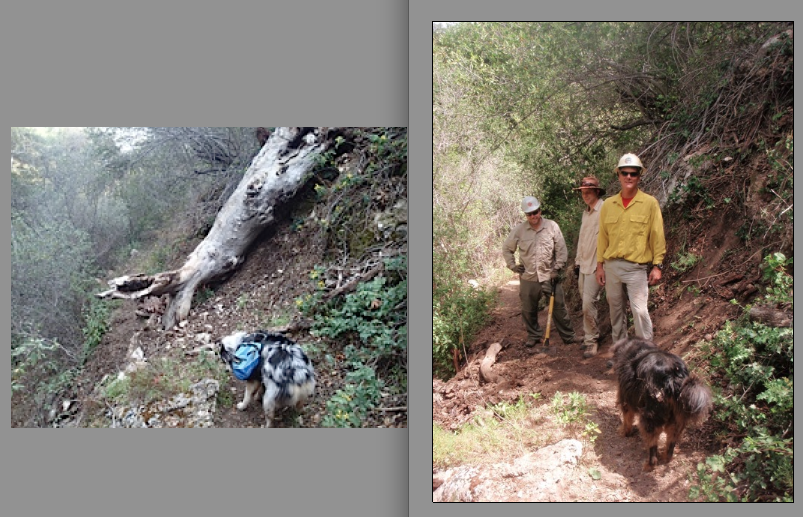
| Trail description: | Team Chopped Vegetables made it out to Mono. Found trail to be in good shape, easy to follow, tons of water at emerald pool. We cleared the reported tree above Forbush, and did some minor loping. It's now clear all the way from east camino to mono camp. The re-route has some minor slides due to the loose soil, but otherwise it's a great re-route. |
| Mode of transport: | Hike |
| Trail condition: | Good shape and easy to follow |
Cold Spring Trail - North Survey - 11-06-2020 - by Dogger| Link: | Cold Spring Trail - North |
| Date: | 11-06-2020 |
| Surveyor Name: | Dogger |
| Trail description: | Trail is in good shape though overgrown - lots of poison oak - in many spots between Forbush Camp and the river. Water flowing in creek near emerald pools. Route on other side of river (totally dry) heading toward Mono is not obvious and time restrictions caused me to turn around before adequately exploring the route into and through the jungle. There is a downed tree about a 1/4 mile above Forbush Camp. |
| Mode of transport: | Hike |
| Trail condition: | Needs some work |
| Images: | First river crossing before the jungle Downed tree above Forbush Camp |
Cold Spring Trail - North Survey - 05-20-2020 - by rich scholl| Link: | Cold Spring Trail - North |
| Date: | 05-20-2020 |
| Surveyor Name: | rich scholl |
| Trail description: | several narrow slide sections-not too difficult but should be worked soon, lots of brush crowding and poison oak, emerald pools beautiful. water flowing well. |
| Mode of transport: | Hike |
| Trail condition: | Needs some work |
Cold Spring Trail - North Survey - 05-09-2020 - by M Schless| Link: | Cold Spring Trail - North |
| Date: | 05-09-2020 |
| Surveyor Name: | M Schless |
| Trail description: | Sorry didn't realize the trail extended across the SY up to Mono. Upper part of the trail from Camino Cielo to SY River is easy to follow as I said in previous post. But once reaching the river, the rest of the way to Mono is extremely hard to follow/nonexistent. Ended up abandoning the trail pretty quickly and just following the SY river for a ways and using GPS to hop up on a hill to cross over to Mono Creek. Followed Mono creek up tot the campsite and dam. Tape sort of helped at times, but would disappear with the trail. |
| Mode of transport: | Hike |
| Trail condition: | Hard to follow |
| Condition details: | From SY River to Mono it was nonexistent. |
Cold Spring Trail - North Survey - 05-09-2020 - by M Schless| Link: | Cold Spring Trail - North |
| Date: | 05-09-2020 |
| Surveyor Name: | M Schless |
| Trail description: | Trail was easy to follow albeit with a lot of poison oak. Long sleeves and pants a must since the PO is unavoidable. Trail washout right after the "infinity pool" is getting worse and was happy to have poles just for peace of mind. Water flowing really well in the creek all the way down to the Santa Ynez River. |
| Mode of transport: | Hike |
| Trail condition: | Good shape and easy to follow |
Cold Spring Trail - North Survey - 04-27-2020 - by Noah Nydam| Link: | Cold Spring Trail - North |
| Date: | 04-27-2020 |
| Surveyor Name: | Noah Nydam |
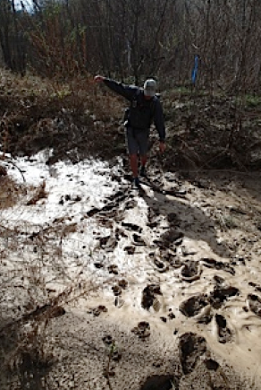
| Trail description: | Went down this as part of a trip to big pine mountain via the mono-alamar and alamar trails. Compared to these trails, cold springs trail north was in great shape. The first part from cold springs saddle to forbush camp was in wonderful shape almost as good as the front country portion of the trail. After forbush, the trail got a little overgrown but was still easily followable. Once it got down to the Santa Ynez river and it crossed it became harder to follow and search for tape was necessary. On some maps (USGS topo) it shows the trail winding through this mono jungle area but this is no longer the case. The trail has been rerouted up the side of the hill to avoid this overgrown area. It then crests a ridge and drops down to join the dirt road road that passes by mono camp. |
| Mode of transport: | Hike |
| Trail condition: | Good shape and easy to follow |
| Images: | This is the slide area, a little sketchy but not bad. The trail does get a little overgrown soon after the slide, but still easily followable. The tape directs to a trail up and along the hill instead of through the mono jungle. The trail runs along this hill, search for tape is important (this one is pretty obvious!). Santa Ynez river, footprints show that others have been down here. |
Cold Spring Trail - North Survey - 12-30-2019 - by Jack R| Link: | Cold Spring Trail - North |
| Date: | 12-30-2019 |
| Surveyor Name: | Jack R |
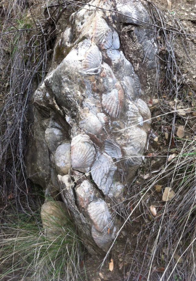
| Trail description: | We hiked from Cold Spring Saddle down to Mono Dam/Camp and on to Little Caliente. The trail was very easy to follow all the way to the first river crossing after which it is nothing more than a series of weathered flag markers spaced frustratingly far apart in a thick bed of poison oak ridden growth. Perhaps foolishly we persevered, following the river until the confluence with Mono creek, and hiked up Mono creek to the dam. This would have been impossible with higher water levels, but once we made it to the Mono creek bed it was not so bad. The “Jungle†is not for the faint of heart. GPS navigation is recommended, and I would highly suggest taking the Blue Canyon trail to Camuesa Rd to get to Mono/Little Caliente. We did this on the way back and enjoyed every minute of it. The best parts of this trail are the Emerald pools and all the fossils along the way! |
| Mode of transport: | Hike |
| Trail condition: | Needs some work |
| Condition details: | Good until Mono Jungle |
Cold Spring Trail - North Survey - 05-27-2019 - by Jonathan Rocque| Link: | Cold Spring Trail - North |
| Date: | 05-27-2019 |
| Surveyor Name: | Jonathan Rocque |
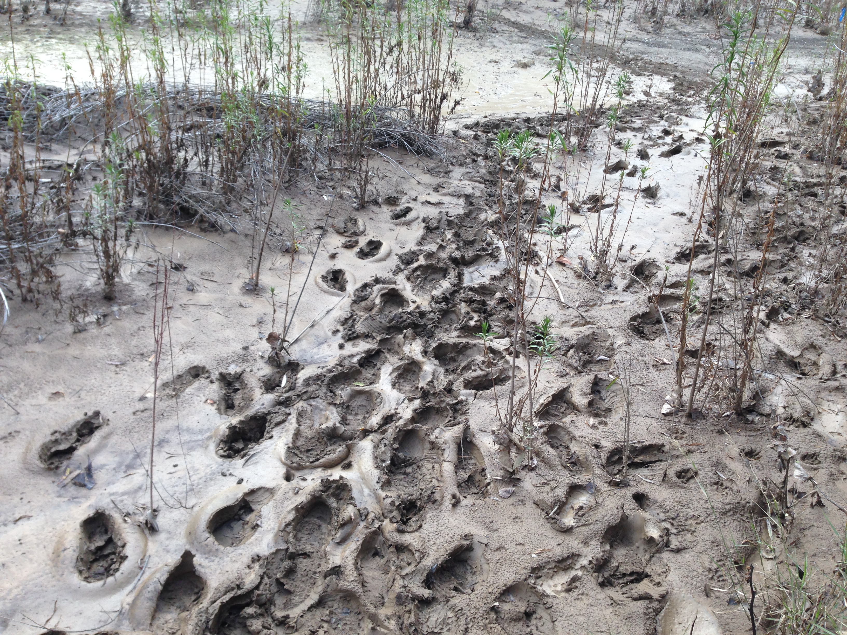
| Trail description: | The emerald pools were absolutely spectacular and well worth the hike. About a half mile after we crossed the Santa Ynez river we were unable to find the trail, after the flag tape ran out, and got stuck in the mud. I stayed on trail according to Google Maps, however, the mud was too much and we were forced to turn around. Overall a beautiful hike up until the mud. |
| Mode of transport: | Hike |
| Trail condition: | Hard to follow |
| Images: | Pools |
Cold Spring Trail - North Survey - 04-28-2019 - by Diane| Link: | Cold Spring Trail - North |
| Date: | 04-28-2019 |
| Surveyor Name: | Diane |
| Trail description: | The river bed section was always difficult but now it's impossible. The river bed has been decimated with silt from the winter rains. You can see how high the water got from bathtub rings visible in the silt. The bed is full of silt that is wet enough to be like quicksand. I lost my shoe and had to have friends rush over to help me, bringing me sticks to stand on while I dug my shoe out of the mud 9 inches deep with my bare hands. The trail is covered in silt and you can follow it where people have marked it with tape. You can follow footprints and bear prints. Every now and then it rises above the creek on small trails. At one point it rises quite a bit in its attempt to avoid the mud. Then it brings you back to the river where it is under water. With so much deep silt, we abandoned our efforts when it became clear we would have to walk in the water. Things may improve once it's all dried up, but for now it's pretty treacherous. |
| Mode of transport: | Hike |
| Trail condition: | Hard to follow |
| Condition details: | The trail from the Santa Ynez River toward Mono is mostly non-existent |
Cold Spring Trail - North Survey - 02-17-2018 - by Los Padres Forest Association| Link: | Cold Spring Trail - North |
| Date: | 02-17-2018 |
| Surveyor Name: | Los Padres Forest Association |
| Trail description: | LPFA volunteers continued work on the North Cold Spring Trail as part of a growing LPFA effort to work trails not closed by the Thomas Fire. On this day we worked the top 0.5 miles from Cold Spring Saddle down towards Forbush. The emphasis of the project was to clear brush with the hopes that we won't have to go back for another 5 years = we brushed it real good. More follow up projects and volunteer opportunities will be upcoming. Stay tuned! |
| Mode of transport: | Hike |
| Trail condition: | Needs some work |
Cold Spring Trail - North Survey - 02-10-2018 - by Anonymous Surveyor| Link: | Cold Spring Trail - North |
| Date: | 02-10-2018 |
| Surveyor Name: | Anonymous Surveyor |
| Trail description: | Trail good until mono jungle. Â Multiple flags turning back and forth with no visible trail. Â Much easier to hike the silted river bed 6 inch's to 2 ft worth of muddy silt highly suggest a reroutd above the jungle. I did however see tracks of bear and lion that looked to be stalking a previous hikers route. Â ERie and awesome. Â Fun times in the lp |
| Mode of transport: | Hike |
| Trail condition: | Needs some work |
| Condition details: | cold spring to mono camp |
Cold Spring Trail - North Survey - 12-03-2017 - by Los Padres Forest Association| Link: | Cold Spring Trail - North |
| Date: | 12-03-2017 |
| Surveyor Name: | Los Padres Forest Association |
| Trail description: | Nice article by ValHikes showing some of the sites along the North Cold Spring Trail: http://valhikes.blogspot.com/2017/12/travertine-pools-along-cold-spring-trail.html?utm_source=feedburner&utm_medium=email&utm_campaign=Feed%3A+MomentsInDirtAndInk+%28Moments+in+Dirt+and+Ink%29 |
| Mode of transport: | Hike |
| Trail condition: | Good shape and easy to follow |
Cold Spring Trail - North Survey - 08-07-2017 - by Los Padres Forest Association| Link: | Cold Spring Trail - North |
| Date: | 08-07-2017 |
| Surveyor Name: | Los Padres Forest Association |
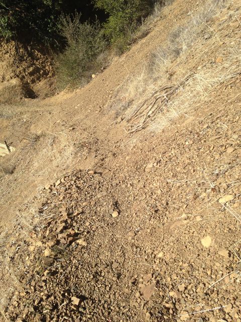
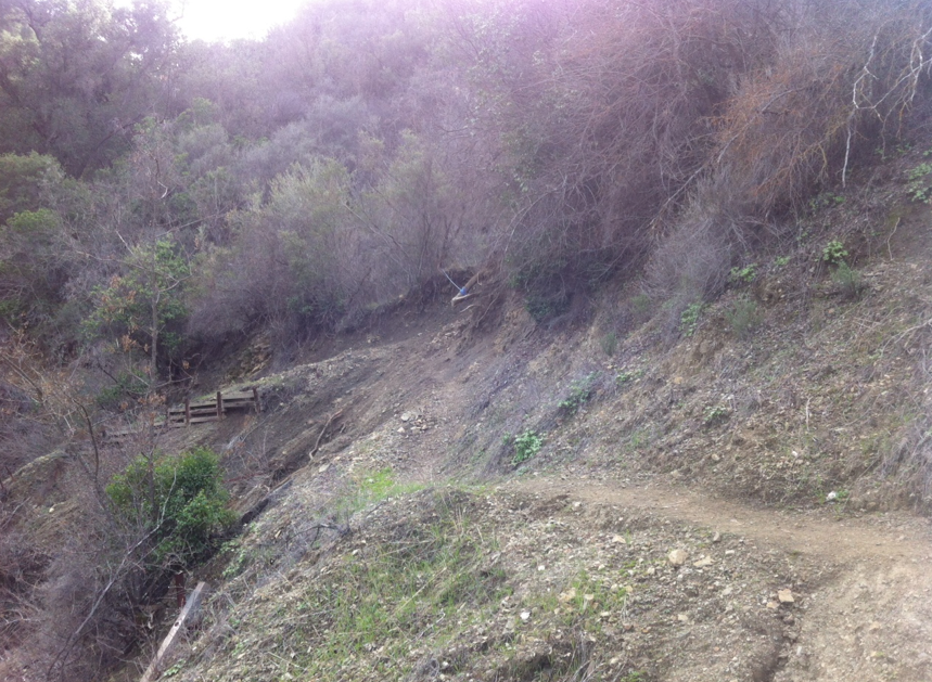
| Trail description: | REPORT FROM HIKER: There is a bad slide area just above the Gibraltar Trail junction with little tread where a crib wall has failed (see 2 photos below). Not far north of the slide the junction with the Gibraltar dam trail is poorly signed for south bound hikers. There is a carsonite sign lying flat with the paper sign weathered off. For north bound hikers there is no problem. There is an erect carsonite sign with "MONO" written on it in paint or marker ink. Heading towards Mono I found no sign of a trail on either bank of the dry Santa Ynez river. |
| Mode of transport: | Hike |
| Trail condition: | Needs some work |
| Images: | Infamous Cold Spring Slide - 2017 Edition Infamous Cold Spring Slide - 2017 Edition |
Cold Spring Trail - North Survey - 10-31-2016 - by Los Padres Forest Association| Link: | Cold Spring Trail - North |
| Date: | 10-31-2016 |
| Surveyor Name: | Los Padres Forest Association |
| Trail description: | Local Santa Barbara author James Wapotich wrote a great article about the long lost Mono Adobe along the Cold Spring Trail in the Mono Jungle. Â You can read about it on his blog here. Â Enjoy: https://songsofthewilderness.com/2016/10/31/trail-quest-the-search-for-mono-adobe-2/ |
| Mode of transport: | Hike |
| Trail condition: | Needs some work |
Cold Spring Trail - North Survey - 02-28-2017 - by Los Padres Forest Association| Link: | Cold Spring Trail - North |
| Date: | 02-28-2017 |
| Surveyor Name: | Los Padres Forest Association |
| Trail description: | Photos by Trail Runner George showing the Cold Spring Trail damage. |
| Mode of transport: | Array |
| Trail condition: | Needs some work |
| Images: | N34.4956021, W119.6362334 This is just coming out of Forbush Canyon on the way to the Grotto. A bit trickier. N34.4980263, W119.6354316 This is the worst, it's just below the Grotto, where there used to be a landslide a couple of years ago. (looking North) N34.5076619, W119.6321773 Same slide, looking from South: N34.5076619, W119.6321773 |
Cold Spring Trail - North Survey - 02-25-2017 - by Veronique Lisi| Link: | Cold Spring Trail - North |
| Date: | 02-25-2017 |
| Surveyor Name: | Veronique Lisi |
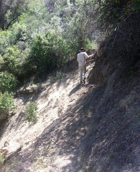
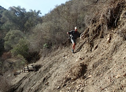
| Trail description: | Took a hike down from Camino Cielo. Trail is generally in good condition with some area needing some work:Â Cold spring trail from Camino Cielo to Forbush Good shape, one slide right before Forbush camp that is passable at position:Â 34.495632,-119.636147 Cold Spring Trail after forbush, up to mono Good shape, one passable slide at this position: 34.498072,-119.635311 Farther, right after the emerald pools, almost at the junction with Gibraltar trail, there is a slide that I consider not passable but I think some people would be able to fix it. You would need to cut some trees and shovel some loose rocks. Some trail supports are missing |
| Mode of transport: | Hike |
| Trail condition: | Needs some work |
| Images: | passable slide right after forbush camp Slide near the gibraltar trail fork another view of the slide near gibraltar trail fork Slide right before Forbush |
Cold Spring Trail - North Survey - 02-07-2013 - by Los Padres Forest Association| Link: | Cold Spring Trail - North |
| Date: | 02-07-2013 |
| Surveyor Name: | Los Padres Forest Association |
| Trail description: | In February 2013 the Forest Service was able to get some off-duty fire personnel to work on the Mono Jungle section of Cold Spring Trail. Â They were able to make it about 0.6miles of the total 1.6miles of trail going from Mono Campground towards the Santa Ynez River. Â Additional work was done later in the spring but the Mono Jungle remains a complicated section to hike. |
| Mode of transport: | Array |
| Trail condition: | Needs some work |
| Images: | Shades of Guns N' Roses |
Cold Spring Trail - North Survey - 02-06-2017 - by Josh Isaac| Link: | Cold Spring Trail - North |
| Date: | 02-06-2017 |
| Surveyor Name: | Josh Isaac |
| Trail description: | We hiked out from Cold Spring trailhead on Camino Cielo at around 3pm. At ~4 miles we encountered our first river crossing. At somewhere around 4.5 miles we spotted trail markers but couldn't see the trail due to the large amount of water flow directly over and around the trail. As it got dark (around 5:30), we were unable to find where the trail was at all, and started relying on the Avenza PDF map I had on my phone. With "only" a mile left, we decided to push forward, though by this point the Mono Jungle was in full force, the river fully swollen. We stumbled around picking our way through for ~2 more hours before finally breaking through into Mono campground (~730pm). The trail was completely covered in 2-3 feet of water and knee-deep mud, which forces us to proceed barefoot - which the branches and thorns made painful. Heading to higher ground wasn't possible due to yuccas, berry vines, and impassable brush. Not recommended if it has rained recently! |
| Mode of transport: | Hike |
| Trail condition: | Non existent |
| Condition details: | Mono Jungle fully flooded - trail completely under water |
Cold Spring Trail - North Survey - 02-15-2016 - by Los Padres Forest Association| Link: | Cold Spring Trail - North |
| Date: | 02-15-2016 |
| Surveyor Name: | Los Padres Forest Association |
| Trail description: | Recent report from Val Hikes about her exploration of North Cold Spring Trail. Â Good read with some great photos: http://valhikes.blogspot.com/2016/02/gorilla-rock.html?utm_source=feedburner&utm_medium=email&utm_campaign=Feed%3A+MomentsInDirtAndInk+%28Moments+in+Dirt+and+Ink%29 |
| Mode of transport: | Hike |
| Trail condition: | Needs some work |
Cold Spring Trail - North Survey - 09-26-2015 - by Los Padres Forest Association| Link: | Cold Spring Trail - North |
| Date: | 09-26-2015 |
| Surveyor Name: | Los Padres Forest Association |
| Trail description: | National Public Lands Day project along Cold Spring Trail above Santa Barbara. Â Photo stream below from the Santa Barbara Multiuse Trails Coalition: |
| Mode of transport: | Array |
| Trail condition: | Good shape and easy to follow |
| Images: | Photo Santa Barbara Multiuse Trails Coalition |
Cold Spring Trail - North Survey - 05-16-2015 - by Fred L| Link: | Cold Spring Trail - North |
| Date: | 05-16-2015 |
| Surveyor Name: | Fred L |
| Trail description: | Started at the head on Mount.rd. Hard to follow trail due to lack of signs/marking. Ended up getting lost and hiking Santa Ynez trail. Goal was Mono Camp, but Gibraltar Reservoir and River dried out. Some pockets of murky water, so water filter highly recommended. |
| Mode of transport: | Hike |
| Trail condition: | Needs some work |
| Condition details: | Lack of signs |
Cold Spring Trail - North Survey - 05-5-2015 - by Jeff B.| Link: | Cold Spring Trail - North |
| Date: | 05-5-2015 |
| Surveyor Name: | Jeff B. |
| Trail description: | Water sufficient to filter at Emerald Pools. Quite a bit of poison oak, but trail generally in very good shape. |
| Mode of transport: | Bicycle |
| Trail condition: | Good shape and easy to follow |
Cold Spring Trail - North Survey - 02-03-2015 - by Los Padres Forest Association| Link: | Cold Spring Trail - North |
| Date: | 02-03-2015 |
| Surveyor Name: | Los Padres Forest Association |
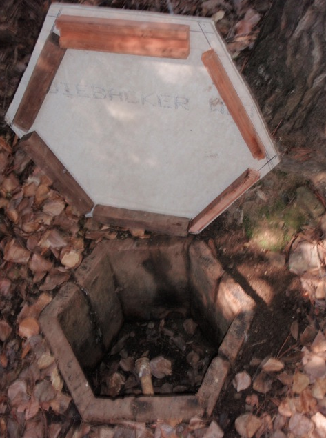
| Trail description: | About half a mile down the north side of the Cold Spring Trail off of Camino Cielo is an old spring called the Bulkley Spring. Â Bulkley is not perennial and tends to flow only when we're coming off a wet season. Â A few of the Volunteer Wilderness Rangers have unofficially adopted this stretch of trail and over the past few years have been keeping an eye on good old Bulkley. Â Unfortunately the spring box has taken a hit at the hands of Mother Nature and Father Time and was in dire need of some help. In the words of Ranger Rik: "I
really didn't think there was much urgency .....it's been dry since the
start of the last drought.  Then I thought of the movie  "Field Of Dreams"....."Build it and (it) will come."  Here's hoping the rain follows." |
| Mode of transport: | Array |
| Trail condition: | Good shape and easy to follow |
| Images: | The old cover, or what was left of it. New cover. New cover in place. |
Cold Spring Trail - North Survey - 01-22-2015 - by Los Padres Forest Association| Link: | Cold Spring Trail - North |
| Date: | 01-22-2015 |
| Surveyor Name: | Los Padres Forest Association |
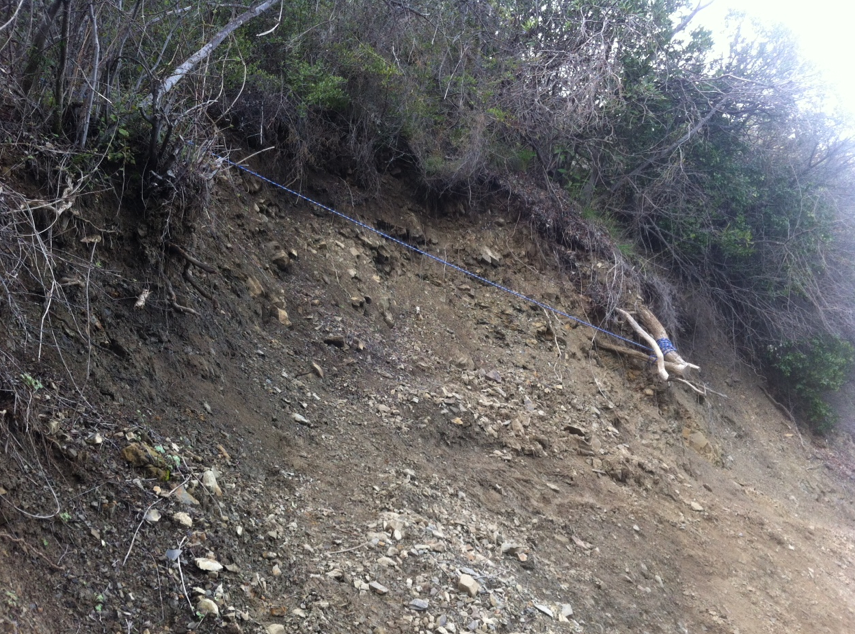
| Trail description: | LPFA headed out to the Cold Spring slide to scope it for a future work project. Â Someone has installed a very useful rope across the slide. Â It helps but is not a permanent solution. Â We will be organizing a project to fix the slide in May. |
| Mode of transport: | Array |
| Trail condition: | Needs some work |
| Images: | View from below of the slide section. Trail - No Trail - Trail Rope across the slide section Cool stuff around this area Emerald Pool looking nice! |
Cold Spring Trail - North Survey - 02-01-2015 - by Los Padres Forest Association| Link: | Cold Spring Trail - North |
| Date: | 02-01-2015 |
| Surveyor Name: | Los Padres Forest Association |
| Trail description: | Downed trees at following coordinates: N34.5268012,W119.6276674 N34.5220387,W119.6271746 N34.5204971,W119.6312852 N34.5198205,W119.6308657 N34.5192776,W119.6309106 N34.5179193,W119.6319208 N34.5142417,W119.6314706 N34.5126986,W119.6295808 |
| Mode of transport: | Array |
| Trail condition: | Needs some work |
Cold Spring Trail - North Survey - 12-21-2014 - by Anonymous Surveyor| Link: | Cold Spring Trail - North |
| Date: | 12-21-2014 |
| Surveyor Name: | Anonymous Surveyor |
| Trail description: | Very muddy sections on Cold Springs Trail--even the new sections--as it contours around the Mono drainage in the area known as the "Mono Jungle". |
| Mode of transport: | Hike |
| Trail condition: | Good shape and easy to follow |
| Images: | |
Cold Spring Trail - North Survey - 05-20-2014 - by Hike Los Padres| Link: | Cold Spring Trail - North |
| Date: | 05-20-2014 |
| Surveyor Name: | Hike Los Padres |
| Trail description: | The LPFA headed down Cold Spring North to remove a large fallen oak that had been blocking the trail for the past couple years. Â There were 5 of us and it took us almost 2hrs to remove, but we got the job done. Â We then spent about an hour clearing the slide section below the Emerald Pools. Â It's sketchy but safe to pass. Â We scouted a potential reroute around the slide and will be working with the Forest Service to create that route over the coming year. Other than the occasional poison oak branch, the trail is in great shape. Â There is good water flowing along the lower section of the trail. Â The Buckley Spring is dry. |
| Mode of transport: | Hike |
| Trail condition: | Needs some work |
| Number of trees down: | 0 |
| People Seen: | 0 |
| Images: | |
Cold Spring Trail - North Survey - 03-07-2014 - by Bryan Conant| Link: | Cold Spring Trail - North |
| Date: | 03-07-2014 |
| Surveyor Name: | Bryan Conant |
| Trail description: | The trail is great outside of one large downed oak near the Emerald Pools on the north side and then a slide section just above the junction with the Gibraltar Trail. Â The Mono Jungle, which is the section of trail between the canyon and the Camuesa Rd, used to go just above the water level of Gibraltar Reservoir. Â The trail is now along the banks of the cottonwood jungle and can be very hard to traverse and quite muddy. |
| Mode of transport: | Hike |
| Trail condition: | Needs some work |
| Number of trees down: | 1 |
| Images: | |
Cold Spring Trail - North Survey - 02-22-2014 - by The Beeman| Link: | Cold Spring Trail - North |
| Date: | 02-22-2014 |
| Surveyor Name: | The Beeman |
| Trail description: | Rik and I walked down from Cold Springs Saddle/E. Camino Cielo parking lot to Forbush Camp and back. Failed waterbars need to be cleaned out. Upper shale section needs to be cleared.According to my Walkmeter program, the trail is 1.75 miles and drops approx. 1000 feet from the road to the campsite. |
| Mode of transport: | Hike |
| Trail condition: | Good shape and easy to follow |
| People Seen: | 2 |
| Images: | |
 Survey / Report Form - Please click this box to open the form.