 Use Marker Groups
 Wolf 2002
Piru 2003
Day 2006
Zaca 2007
Gap 2008
La Brea 2009

| Date | Surveyor | Water Report |
| 09-25-2021 | Brock Bushrod | Dry |
| 03-09-2019 | Christopher P. Lord | Flowing |
Chief Peak is located behind Ojai, you can access this peak off of the Nordoff Ridge Road. Park at Rose Valley Falls Campround and go up the Rose Valley Lake Road for 2.5 miles then turn left onto Nordoff Ridge Rd and go for another 2.5 miles or so. Cheif Peak is on the right hand side of the road, look for a fire clearing , this is the easiest way to the top.


 Chief Peak Survey - 09-25-2021 - by Brock Bushrod
| Link: | Chief Peak |
| Date: | 09-25-2021 |
| Surveyor Name: | Brock Bushrod |
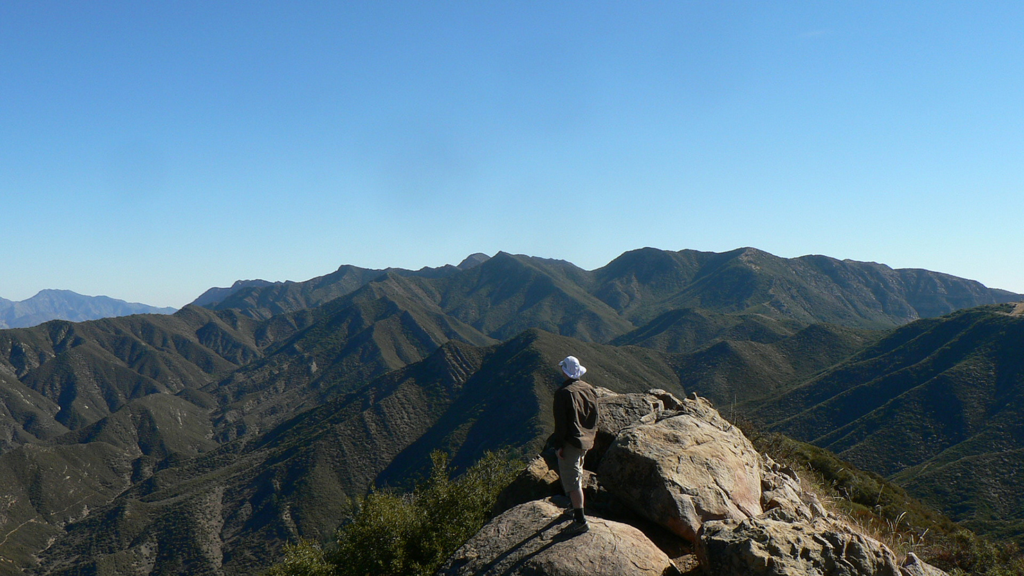
| Camp Description: | Got a later start up Horn Canyon around 11. The temperature wasn't extreme, but the constant exposure on this one is tough; there's nearly zero substantial shade between the lower canyon and the shadow of the peak nine miles away (and over 4000 ft. up). It's easy to follow, but parts of the upper trail, especially between Pines Camp and Sisar Cyn Rd, are overgrown with enough dry brush to batter exposed shins pretty good. It gets way easier once you reach the forest roads up on the ridge though. At the very top, be prepared to clamber over and around a ~30 ft. stretch of fairly exposed, possibly loose rocks and boulders to make the peak. Totally worth it though; killer views of Piedra Blanca, Thorn Point, Topatopa Bluff, Mt. Boney, and Anacapa and Santa Cruz Islands. Rolled down the same path in about two-thirds the time the climb took, and clocked the round trip at 19 miles on the nose. |
| Water Source: | Dry |
| Water Source Details: | Last accessible spring/creek water in lower Horn Cyn, bring plenty! |
| Weather Conditions: | Clear skies, mid 70s |
| Images: | Still about 3 miles from the peak, Piedra Blanca visible to lower right. Last scramble to the summit. Best path is up over the ridge to the right, about 60 ft. below the peak. The hill below it is a lot steeper than it looks, so be careful. Topatopa Bluff and Sisar Peak from the summit. Stay meta, my friends. (But pack it out, don't be trashy!) |
Chief Peak Survey - 03-09-2019 - by Christopher P. Lord| Link: | Chief Peak |
| Date: | 03-09-2019 |
| Surveyor Name: | Christopher P. Lord |
| Camp Description: | Bagged Chief Peak Via Horn Canyon on Saturday. Water was available in the spring pond below the peak and from the south side tributary under the summit. USGS Survey markers in tact. Peak needs new register can as it appears something chewed small holes in the current plastic one. All the old entry's are now soaking wet. Full details available at the link below. https://christopherplord.blogspot.com/2019/03/chief-peak-by-way-of-horn-canyon.html |
| Water Source: | Flowing |
| Water Source Details: | |
| Weather Conditions: | |
| Images: | Current plastic register can needs replacing |

 Survey / Report Form - Please click this box to open the form.