 Use Marker Groups
 Wolf 2002
Piru 2003
Day 2006
Zaca 2007
Gap 2008
La Brea 2009

| Date | Surveyor | Water Report |
| 08-02-2021 | Oh Three | Flowing |
| 03-07-2021 | Oh Three | Flowing |
Located above Cuddy Valley near Frazier Park in the Mt. Pinos Area, this is a car camp located at the end of Chery Creek Road (20W20) which should only be used by four wheel drive capable vehicles.


 030621.jpg)


 Cherry Creek Campground Survey - 08-02-2021 - by Oh Three
| Link: | Cherry Creek Campground |
| Date: | 08-02-2021 |
| Surveyor Name: | Oh Three |
| Camp Description: | As Christopher Lord observed, on his recent adventure in Pleito Creek, the drainage just west of Salt and Cherry Creeks, if you're hiking Los Padres in the summer, you are wishing there were fewer people at the higher cooler elevations, especially those few sites that still have water. Well, Cherry Creek is one of those few sites. The trail ranges from 6,400' to 4,200'. The CG is 5,400'. It has water. The water trough is still flowing like the tap at home. And no people. On my last trip two groups of motorcycle yahoos passed me, this trip - nobody. .I did share the OHV guerrilla trail north of Cherry Creek CG down towards the junction with the Salt Creek road with a bear who was just ahead of me. I saw constant bear foot prints, fresh bear poop, but no bear, which is fine by me in a narrow steep ravine. For the Scout leaders amongst us, if you want a teachable moment for your boys to learn the difference between V's and U's pointing downhill on a topo map, this hike is for you! The eponymous cherries are down in the flats near the junction with the Salt Creek road. Remember, all three of these trails, Pleito, Salt, and Cherry Creeks are REVERSE profile trails. You're not coasting downhill to your car at the end of day 2, you're climbing steeply back uphill. |
| Water Source: | Flowing |
| Water Source Details: | Water Trough is still awesome |
| Weather Conditions: | 58 at night, 85 daytime. Very nice for August. |
| Images: | Cherry Creek CG 080121 Cherry Creek Bear Prints 080121 |
Cherry Creek Campground Survey - 03-07-2021 - by Oh Three| Link: | Cherry Creek Campground |
| Date: | 03-07-2021 |
| Surveyor Name: | Oh Three |
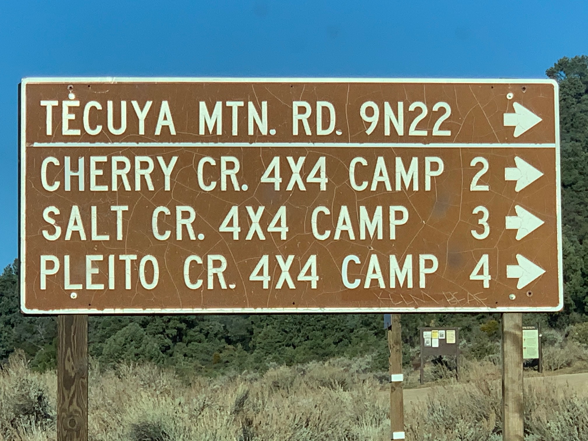
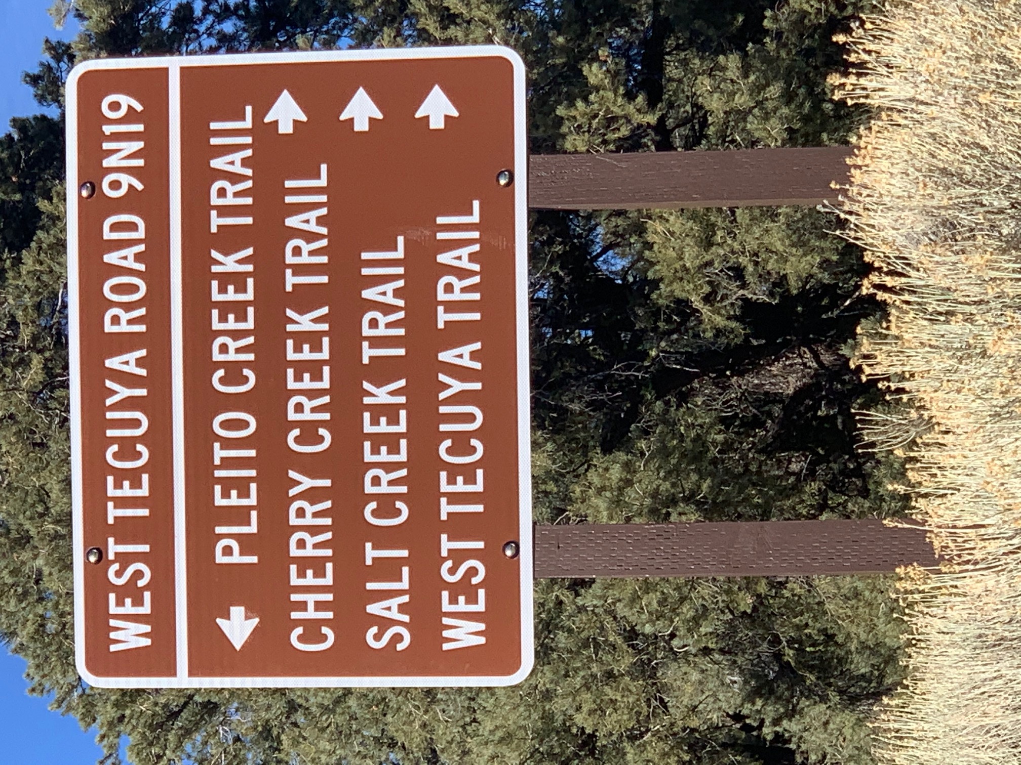
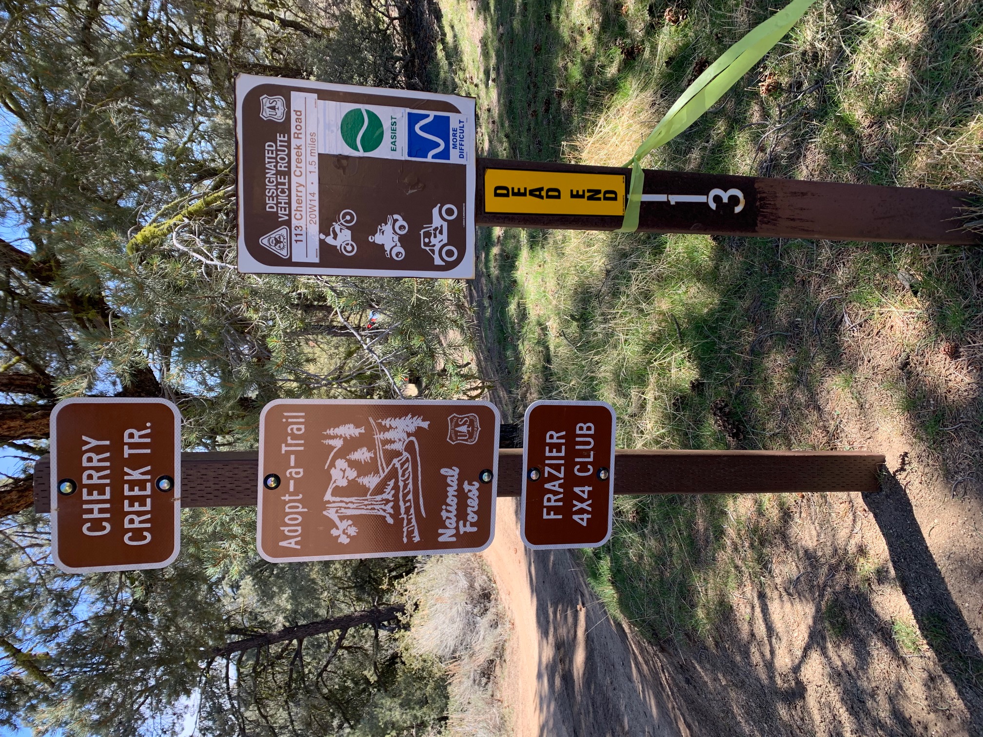
| Camp Description: | Forest Service Road 9N22 is on Cuddy Valley Road 11.0 miles from I-5 Frazier Park exit. Hike a little over 1 mile and 500 feet elevation up to the Tecuya Ridge Road sign. 6,200 elevation. Turn right (east), ignore all the gypsy roads, and hike to Cherry Creek Trailhead. Yes, I saw a OHV tow truck way back in the wilderness. $$$. Cherry Creek Trail is a STEEP descent into is a north drainage leading ultimately into Wind Wolves Preserve. Cherry Creek Trail is 20W14 and OHV Trail 113. I buy OHV trail maps (CTUC, etc) because OHV trails make great winter hikes when motorbikes are nominally banned. Cherry Creek CG has two sites each with picnic table and metal firepit. The east site is up on a slope like the roof of a house, so maybe not too usable. Water was flowing nicely from the hose into the trough. Hopefully water will continue after the snow has melted. The map says the road stops at the CG, but motorbikes have carved a very nice use trail downstream (north) to Salt Creek Road, which allows an awesome loop, going down Cherry Creek and coming up Salt Creek Road back to Tecuya Ridge. Tecuya Ridge is 6,200, Cherry Creek CG is 5,400, and the intersection with Salt Creek is 4280, so there is some elevation to negotiate. |
| Water Source: | Flowing |
| Water Source Details: | Water Trough is Flowing Nicely |
| Weather Conditions: | Clouds and brisk day, freezing at night |
| Images: | Cherry Creek CG Sign Cherry Creek CG Water Trough OHV Tow Truck (Cherry Creek Trail) |
 Survey / Report Form