 Use Marker Groups
 Wolf 2002
Piru 2003
Day 2006
Zaca 2007
Gap 2008
La Brea 2009

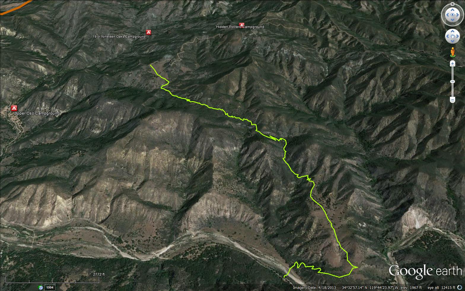
Trail crosses the Santa Ynez River and meanders four miles up the south slope of the river canyon to tie into Romero Camuesa Rd. Directions: From Santa Barbara Hwy 101, 10 miles NW on Hwy 154, 9 miles East on Paradise.


 Camuesa Connector Trail Survey - 02-01-2022 - by Stan A
| Link: | Camuesa Connector Trail |
| Date: | 02-01-2022 |
| Surveyor Name: | Stan A |
| Trail description: | Started from Paradise Rd and ran to Camuesa Rd. Trail is in great shape. From mile 3 to Camuesa Rd there are several water crossings with running water, although easy to hop across. Many ticks on the dog. Lots of green up. Beautiful trail. |
| Mode of transport: | Hike |
| Trail condition: | Good shape and easy to follow |
Camuesa Connector Trail Survey - 01-26-2022 - by Stan A| Link: | Camuesa Connector Trail |
| Date: | 01-26-2022 |
| Surveyor Name: | Stan A |
| Trail description: | Hiked from Paradise Rd up to the Stephen Masto Memorial Trail. Trail is in great condition and everything is green, green, green. Saw four Blacktail does. Beautiful day. |
| Mode of transport: | Hike |
| Trail condition: | Good shape and easy to follow |
| Images: | |
Camuesa Connector Trail Survey - 11-02-2017 - by Fede| Link: | Camuesa Connector Trail |
| Date: | 11-02-2017 |
| Surveyor Name: | Fede |
| Trail description: | The Camuesa Connector trail is in relatively good condition. It has a fallen tree close to the southern trailhead (near the Santa Ynex river) that needs to be cleared, a few areas are a little overgrown, and the water has carved a deep trench in other sections, but none of these are major obstacles to complete your hike. |
| Mode of transport: | Hike |
| Trail condition: | Needs some work |
| Condition details: | Relatively good condition/ needs a little work |
| Images: | View from Camuesa Rd, looking North. |
Camuesa Connector Trail Survey - 11-02-2017 - by Fede| Link: | Camuesa Connector Trail |
| Date: | 11-02-2017 |
| Surveyor Name: | Fede |
| Trail description: | The Camuesa Connector trail is in relatively good condition. It has a fallen tree close to the southern trailhead (near the Santa Ynex river) that needs to be cleared, a few areas are a little overgrow, and the water has carved a deep trench in other sections, but none of these are major obstacles to complete your hike. |
| Mode of transport: | Hike |
| Trail condition: | Needs some work |
| Condition details: | Relatively good condition/ needs a little work |
| Images: | View from Camuesa Rd, looking North. |
Camuesa Connector Trail Survey - 09-19-2017 - by Gerry Ching| Link: | Camuesa Connector Trail |
| Date: | 09-19-2017 |
| Surveyor Name: | Gerry Ching |
| Trail description: | This is a partial survey from the Santa Ynez River trailhead to the first lookout point 1.4 miles from the trailhead. Although this section of the trail is easy to follow, there are some sections that could stand a little clearing. At this time of year, the river is usually dry making the initial crossing easy. Heavy rains this spring erased the nice rock-lined pathway across the river, but the crossing is short and easy to follow. The first mile up to the point where the trail starts up the small canyon is in good shape, but virtually all water bars are gone. The next 0.1 mile into the canyon is also in good shape, but the grass is at least waist-high on either side of the trail. The segment starting a 1.1 mile to 1.2 mile is fine for hikers, but a little difficult for bikers as the trail is fairly deeply incised into the ground. Cutting the sides down to make it wider and installing some water bars would make it a lot easier for bikers. The remainder of the distance to the lookout area is in good, but slightly eroded shape. |
| Mode of transport: | Hike |
| Trail condition: | Good shape and easy to follow |
Camuesa Connector Trail Survey - 03-20-2017 - by Arliss Crow| Link: | Camuesa Connector Trail |
| Date: | 03-20-2017 |
| Surveyor Name: | Arliss Crow |
| Trail description: | The trail is in surprisingly good condition after the Rey fire and the heavy rains we have had. Â There is one small section of trail that has slumped away but it is easy enough to get around. |
| Mode of transport: | Array |
| Trail condition: | Needs some work |
Camuesa Connector Trail Survey - 12-18-2016 - by Anonymous Surveyor| Link: | Camuesa Connector Trail |
| Date: | 12-18-2016 |
| Surveyor Name: | Anonymous Surveyor |
| Mode of transport: | Bicycle |
| Trail condition: | Good shape and easy to follow |
| Images: | |
Camuesa Connector Trail Survey - 01-10-2015 - by FP| Link: | Camuesa Connector Trail |
| Date: | 01-10-2015 |
| Surveyor Name: | FP |
| Trail description: | This is a nice, little-used trail. I pushed my bike up this trail from Paradise Road to the Romero Camuesa Road, from there I biked downhill all the way to Upper Oso campground and back to the Camuesa Connector trailhead, where I had left my car. But in order to save yourself pushing your bike uphill, it's best to leave the bike at Upper Oso campground, and drive to the Camuesa Connector trailhead, along Paradise Road. Then hike the Camuesa Connector trail to the road, and walk along the road to Upper Oso, where your bike will be waiting. From there, it is an easy, mostly downhill bike ride back to the car. |
| Mode of transport: | Hike |
| Trail condition: | Good shape and easy to follow |
 Survey / Report Form - Please click this box to open the form.