 Use Marker Groups
 Wolf 2002
Piru 2003
Day 2006
Zaca 2007
Gap 2008
La Brea 2009

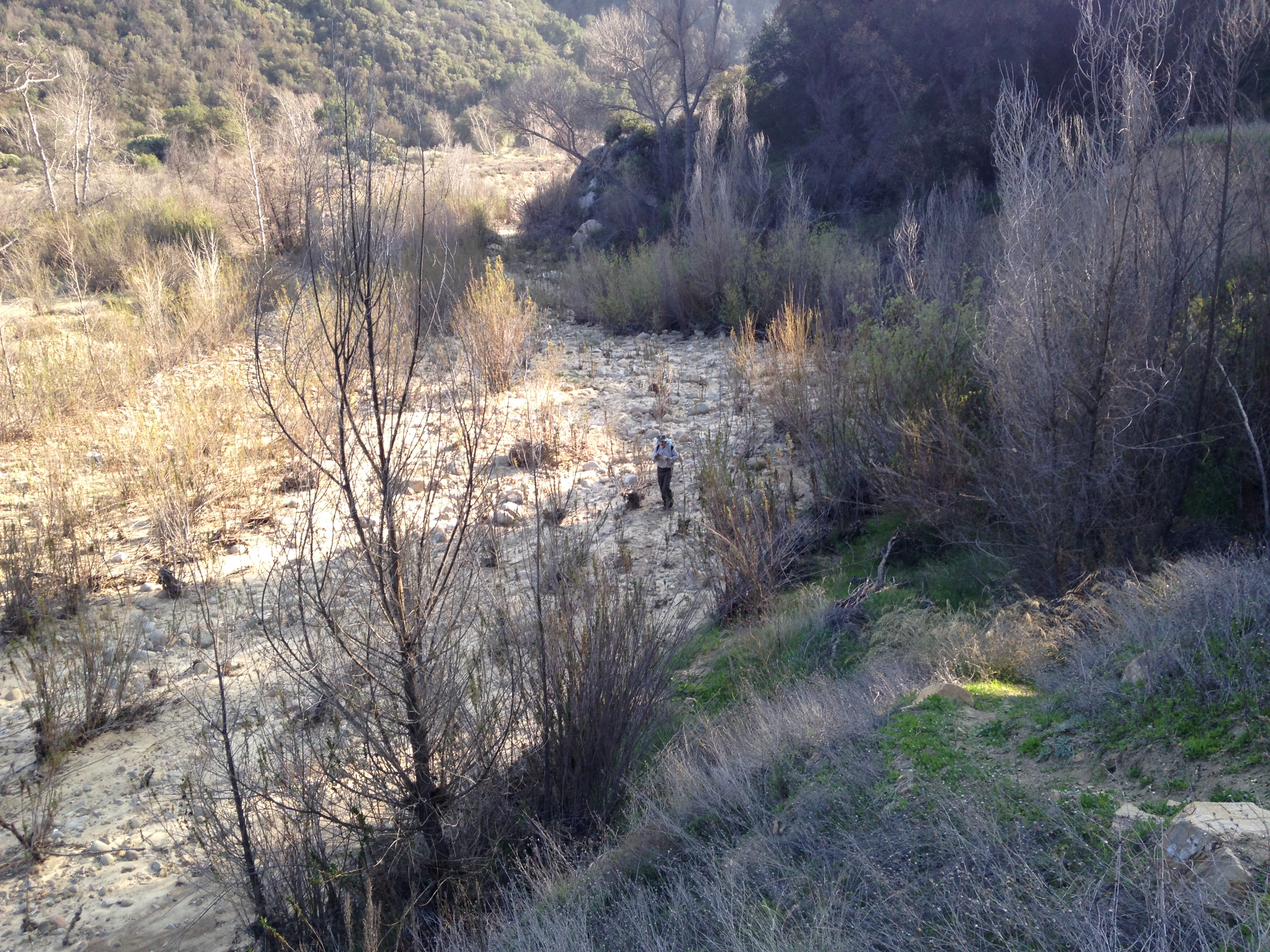
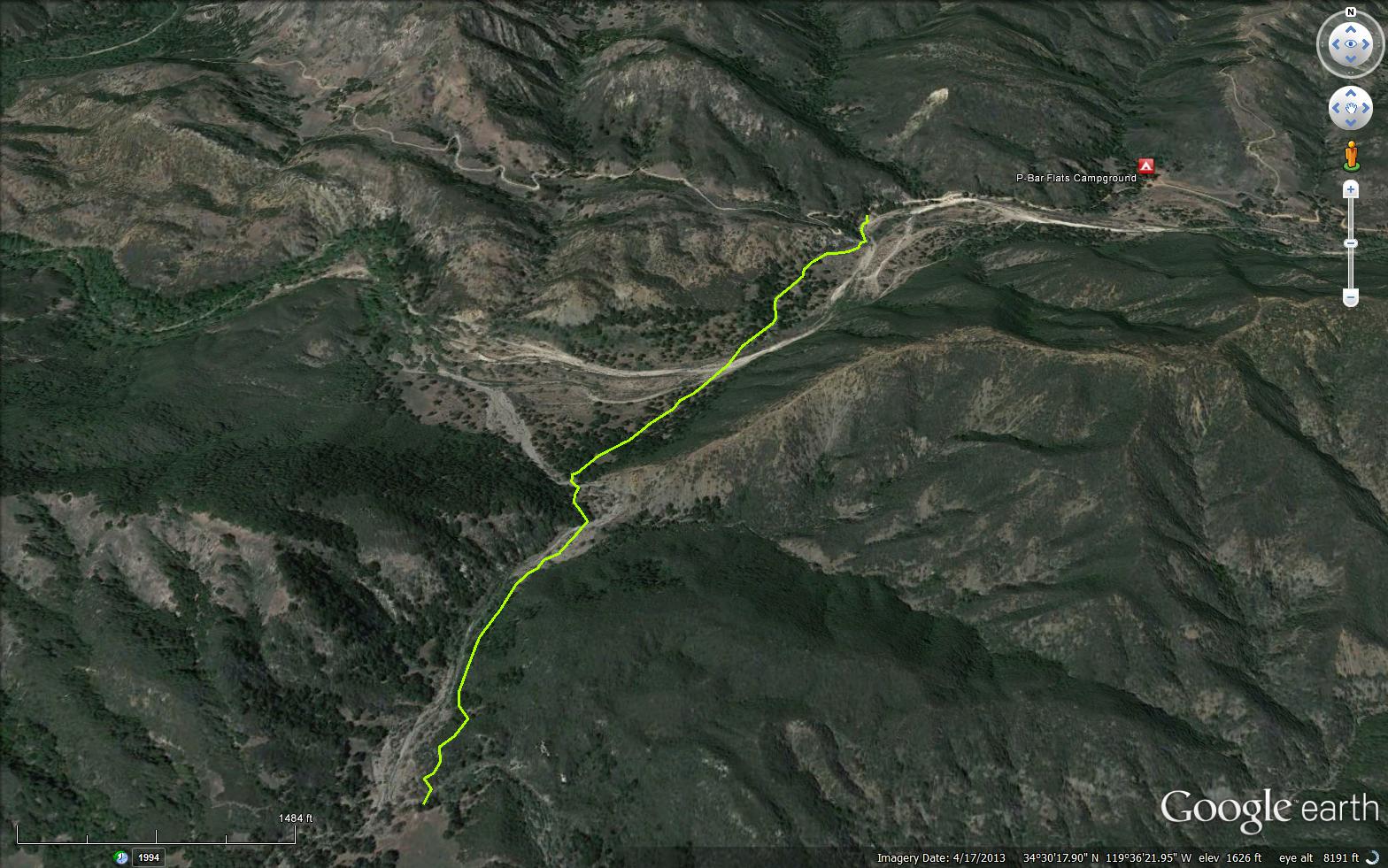
Blue Canyon gets its name from the blue-green serpentine formations found along its 5 mile length. The canyon runs directly along the Santa Ynez Fault. This is a relatively narrow canyon with several overnight camps along it and a stream that flows year round. Beyond Cottam Camp a number of options are available. You can walk to the car camps at P-Bar Flats and Mid-Santa Ynez, continue down the Santa Ynez River to the Mono Trail and Mono Debris Dam, or make your way up to Forbush Flat.


 Blue Canyon Connector Trail Survey - 05-24-2024 - by Piper
| Link: | Blue Canyon Connector Trail |
| Date: | 05-24-2024 |
| Surveyor Name: | Piper |
| Trail description: | I had to climb down a large washout on Romero Camuesa road to get to the connector. In the washout debris was the forest service sign buried in dried mud. The trail was easy to follow once I saw flagging and crossed the river. When I got in view of Cottam the trail appeared to be cliffed out at the creek. I didn't walk close enough to verify but decided to turn back and just walk in the creek to Cottam. |
| Mode of transport: | Hike |
| Trail condition: | Needs some work |
| Condition details: | Washed out at Romero Camuesa road. Appeared washed out at Cottam. |
| Images: | Trail appears cliffed out here but I did not go to the edge to verify. |
Blue Canyon Connector Trail Survey - 10-01-2022 - by Los Padres Forest Association| Link: | Blue Canyon Connector Trail |
| Date: | 10-01-2022 |
| Surveyor Name: | Los Padres Forest Association |
| Trail description: | LPFA and Scout Troop 4 performed trail work along the Blue Canyon Trail from P-Bar to Cottam Camp. The trail is in good shape but look out for cairns at the crossings. |
| Mode of transport: | Array |
| Trail condition: | Good shape and easy to follow |
Blue Canyon Connector Trail Survey - 03-30-2022 - by Addison Jerlow| Link: | Blue Canyon Connector Trail |
| Date: | 03-30-2022 |
| Surveyor Name: | Addison Jerlow |
| Trail description: | Look across the creek, up and to the right for a trail marker when continuing from Cottam. You go up and over the hill, not down either creek. I managed to miss this and took a walk down the far creek a ways before turning back and finding it. |
| Mode of transport: | Hike |
| Trail condition: | Good shape and easy to follow |
Blue Canyon Connector Trail Survey - 03-06-2021 - by Anonymous Surveyor| Link: | Blue Canyon Connector Trail |
| Date: | 03-06-2021 |
| Surveyor Name: | Anonymous Surveyor |
| Trail description: | |
| Mode of transport: | Hike |
| Trail condition: | Needs some work |
| Condition details: | just confusing around the creek crossings |
Blue Canyon Connector Trail Survey - 12-14-2019 - by Troop 26| Link: | Blue Canyon Connector Trail |
| Date: | 12-14-2019 |
| Surveyor Name: | Troop 26 |
| Trail description: | Trail is clear and in good shape from Cottam camp down to Santa Ynez river. One or two spots through the streambed, you have to follow cairns. |
| Mode of transport: | Hike |
| Trail condition: | Good shape and easy to follow |
Blue Canyon Connector Trail Survey - 06-03-2019 - by Steve Schott| Link: | Blue Canyon Connector Trail |
| Date: | 06-03-2019 |
| Surveyor Name: | Steve Schott |
| Trail description: | Very heavily overgrown and difficult to follow for first quarter mile heading north from Cottam. Thereafter, the trail improves. |
| Mode of transport: | Bicycle |
| Trail condition: | Hard to follow |
Blue Canyon Connector Trail Survey - 01-20-2019 - by Craig R. Carey| Link: | Blue Canyon Connector Trail |
| Date: | 01-20-2019 |
| Surveyor Name: | Craig R. Carey |
| Trail description: | Troop 111 (Ventura) backpacked the length of the Blue Cyn Connector from Rowe's/Rose Gulch to Cottam (north to south) on Sunday, 1/20/19. Trail is in okay shape, but could stand some brushing and the landmark oak at the trailhead at Romero-Camuesa Road has fallen and so the trail's a bit trickier to find if you haven't been there before. Recent rains have washed away the very start of the trail; just stay close to the northern bank until you reach the flats around that first bend. A few trees down along the way; all the crossings were deep enough to get one's boots wet. Great times. |
| Mode of transport: | Hike |
| Trail condition: | Needs some work |
| Images: | |
Blue Canyon Connector Trail Survey - 02-21-2015 - by Paul Cronshaw| Link: | Blue Canyon Connector Trail |
| Date: | 02-21-2015 |
| Surveyor Name: | Paul Cronshaw |
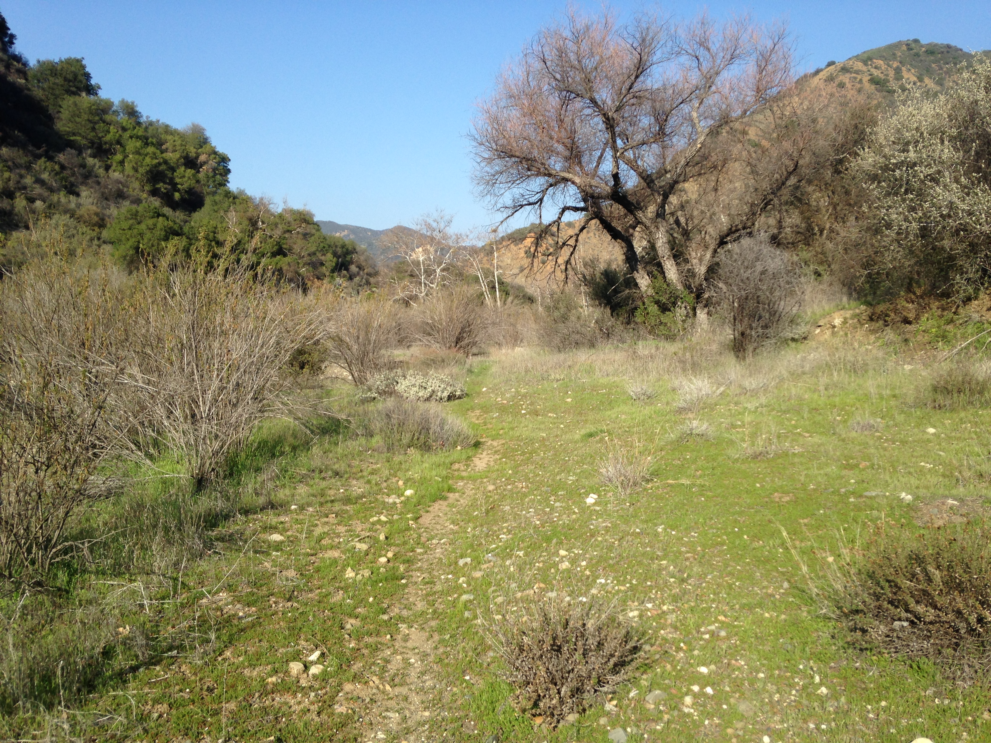
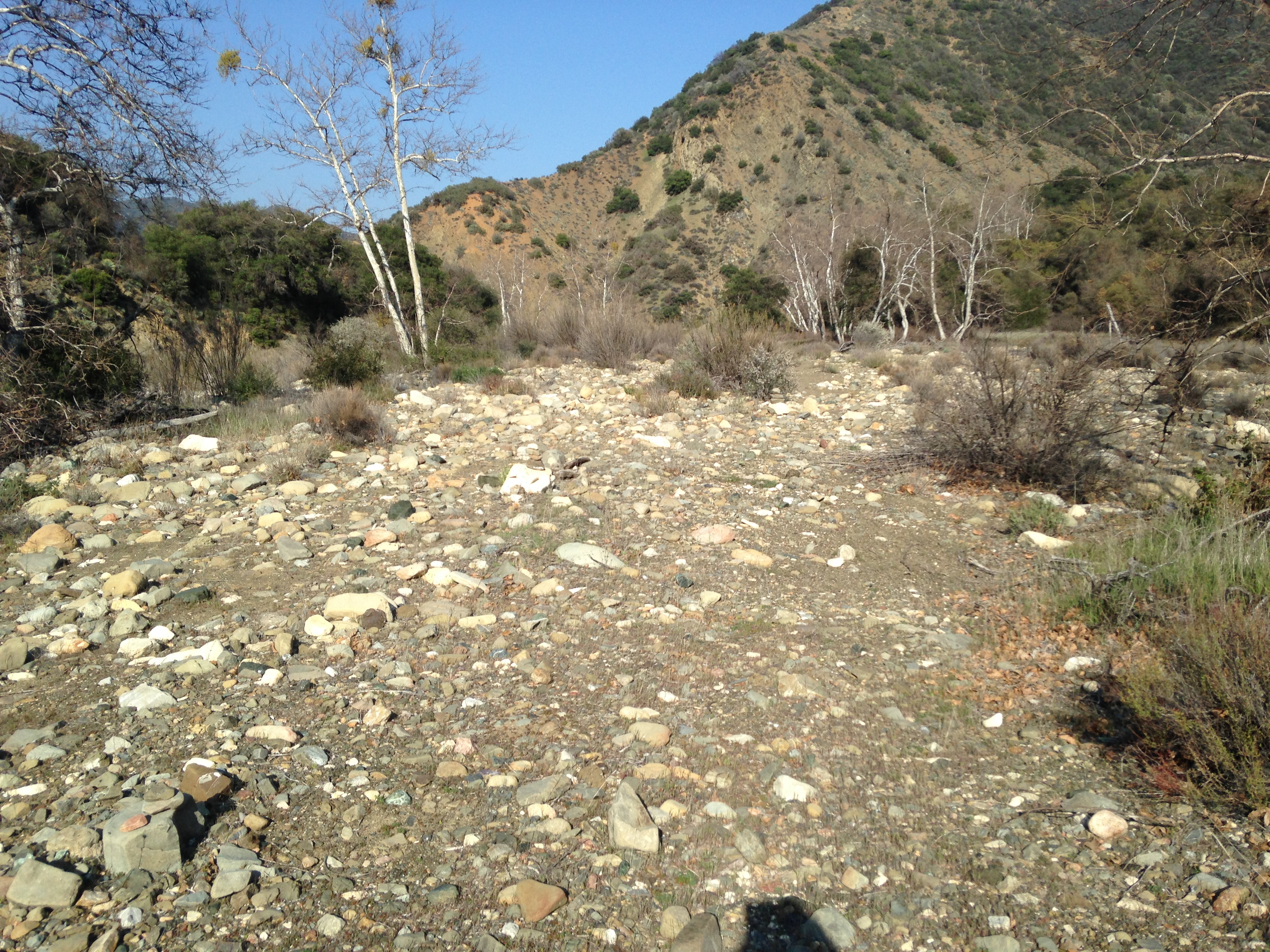
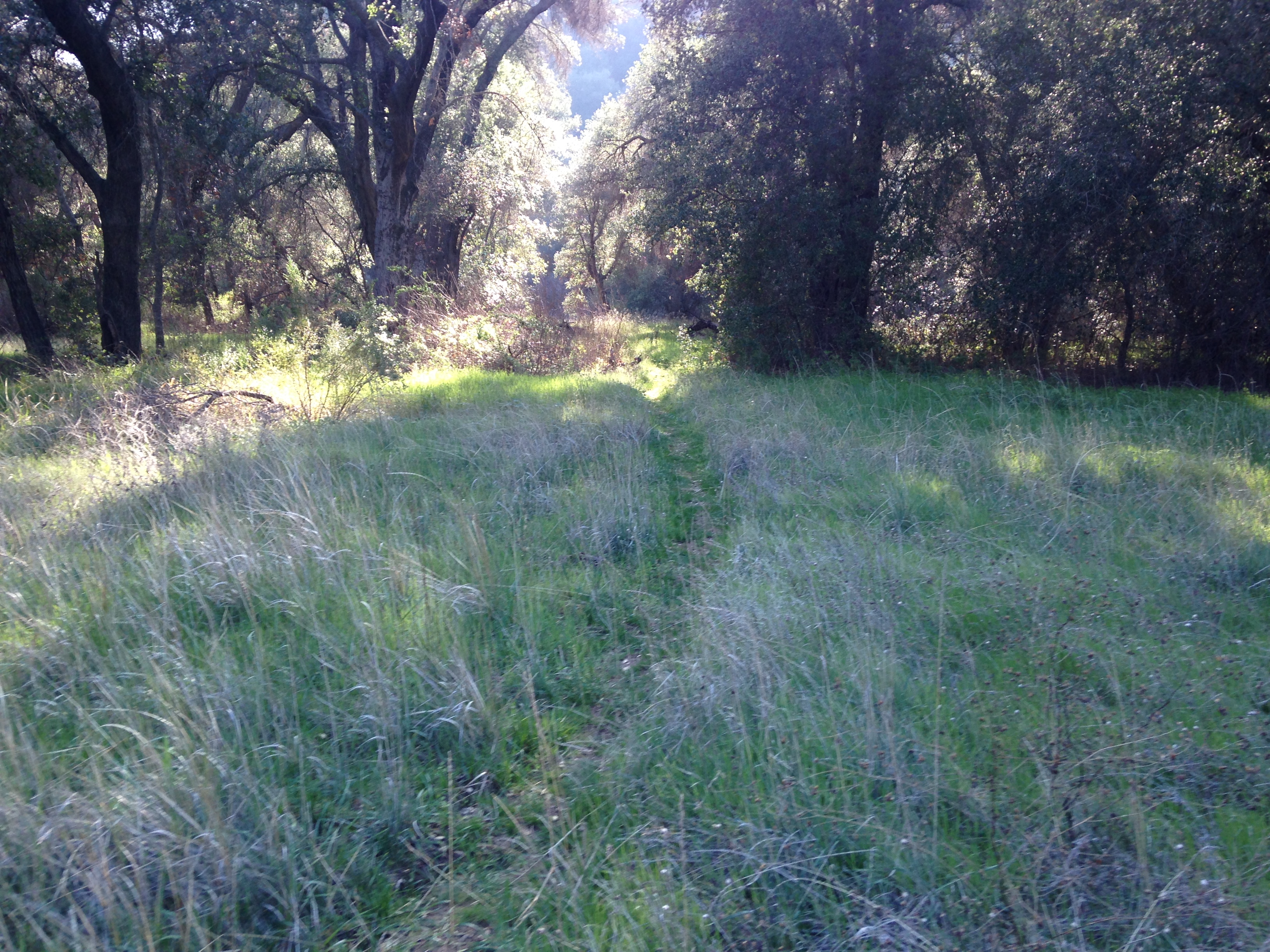
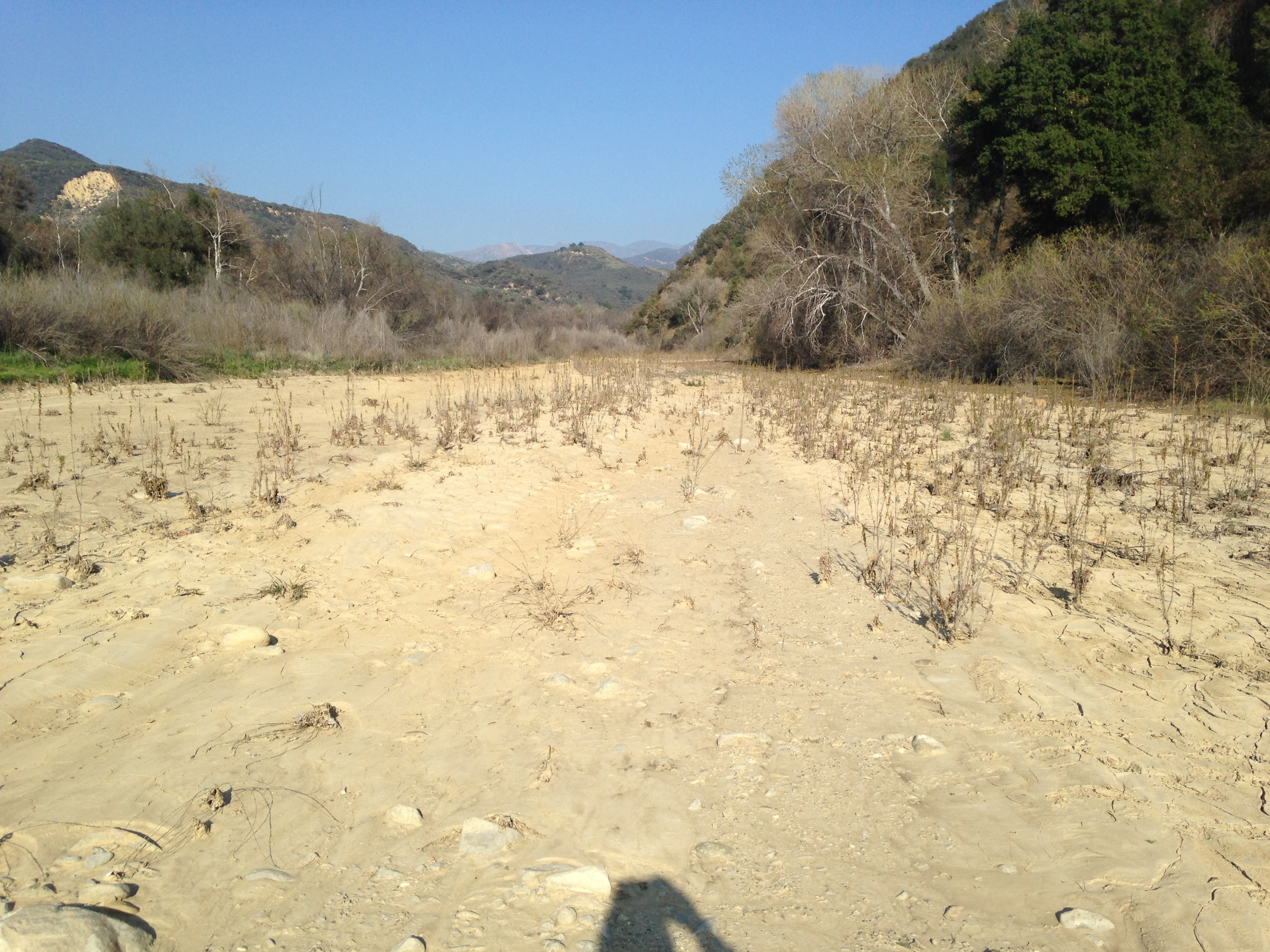
| Trail description: | A nice level hike from Cottam Camp to the dirt road passes through some oak grasslands.  There was no water in the sections of this trail that cross the Blue Canyon Creek and Santa Ynez River. The last section of trail is a little hard to find; it follows the SYRiver before a steep ascent up the bank to the dirt road. |
| Mode of transport: | Hike |
| Trail condition: | Good shape and easy to follow |
| Images: | Trail section about 1/4 mile north of Cottam Camp The trail follows this wash in Blue Canyon Creek Oak grassland Santa Ynez River crossing Trail passes through the Santa Ynez river before climbing the bank to the road |
Blue Canyon Connector Trail Survey - 01-11-2015 - by Los Padres Forest Association| Link: | Blue Canyon Connector Trail |
| Date: | 01-11-2015 |
| Surveyor Name: | Los Padres Forest Association |
| Trail description: | Downed tree here: N34.5110589,W119.6027835 |
| Mode of transport: | Hike |
| Trail condition: | Needs some work |
 Survey / Report Form - Please click this box to open the form.