 Use Marker Groups
 Wolf 2002
Piru 2003
Day 2006
Zaca 2007
Gap 2008
La Brea 2009

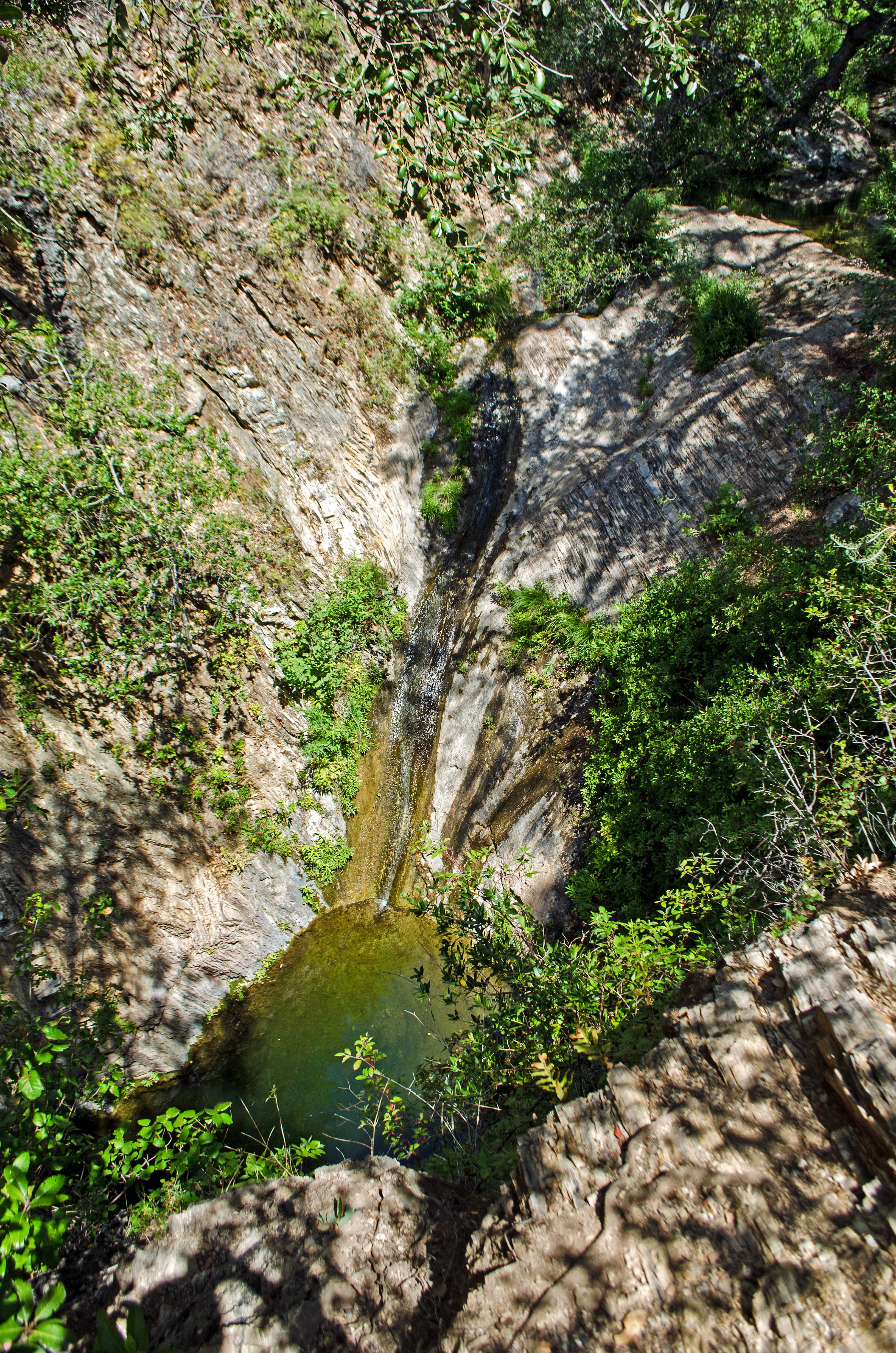
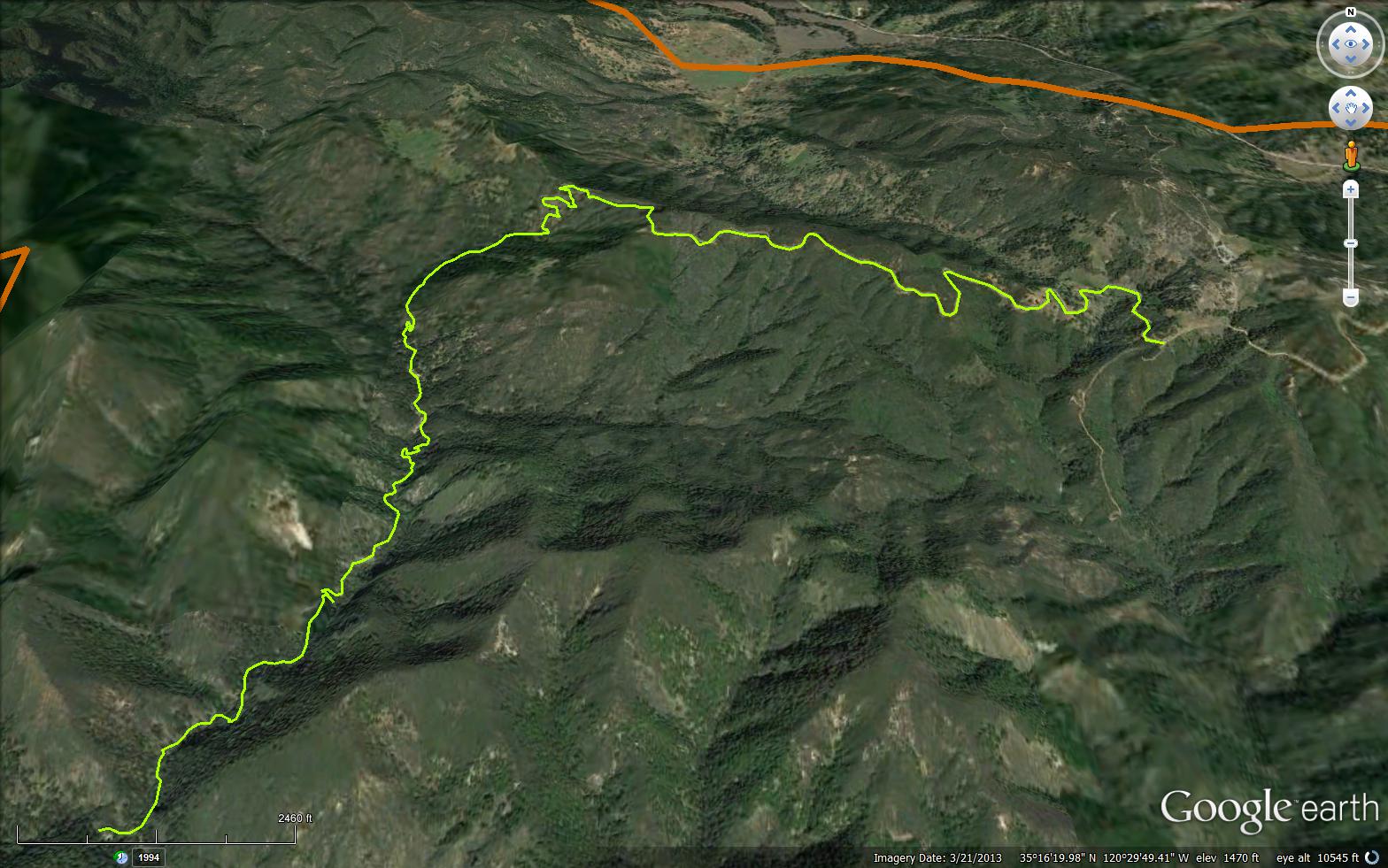
Three water falls are within this 1.5 mile hike, near Arroyo Grande. The hike is relatively easy with a couple spots being a little more challenging; with short, steep climbs. The setting is within Big Canyon and Santa Lucia Wilderness. You will follow Big Creek and will easily find Lower, Middle Big Falls. It will be a little more challenging to reach Upper Big Fall, an 80 foot water fall; due to the steep climb.


 Big Falls Trail Survey - 04-23-2026 - by Anonymous Surveyor
| Link: | Big Falls Trail |
| Date: | 04-23-2026 |
| Surveyor Name: | Anonymous Surveyor |
| Trail description: | |
| Mode of transport: | Hike |
| Trail condition: | Needs some work |
| Images: | |
Big Falls Trail Survey - 03-16-2025 - by DMajor| Link: | Big Falls Trail |
| Date: | 03-16-2025 |
| Surveyor Name: | DMajor |
| Trail description: | Did some trail clearing up to the main waterfall Some challenges crossing the river many times All the poison oak is cut back so good tread amd a clear pathway with just a few blowdowns and easy crossing Newts are out in force, and the falls are roaring No trash, no people on the trail in the afternoon Impressive canyon after a trek to the trailhead |
| Mode of transport: | Hike |
| Trail condition: | Good shape and easy to follow |
Big Falls Trail Survey - 12-28-2020 - by J| Link: | Big Falls Trail |
| Date: | 12-28-2020 |
| Surveyor Name: | J |
| Trail description: | Currently the waterfall is not flowing and the creek is low but still flowing |
| Mode of transport: | Hike |
| Trail condition: | Good shape and easy to follow |
| Images: | The BIG FALL The water slide. The valley. |
Big Falls Trail Survey - 05-21-2018 - by Los Padres Forest Assocation| Link: | Big Falls Trail |
| Date: | 05-21-2018 |
| Surveyor Name: | Los Padres Forest Assocation |
| Trail description: | Read more for information on hiking to Big and Little Falls: Trail Quest: Santa Lucia Wilderness |
| Mode of transport: | Hike |
| Trail condition: | Good shape and easy to follow |
Big Falls Trail Survey - 03-05-2018 - by Mike Maki| Link: | Big Falls Trail |
| Date: | 03-05-2018 |
| Surveyor Name: | Mike Maki |
| Trail description: | Hiked this downstream from Little Falls TH. Water was flowing but not much. For the most part I thought this trail was in good shape. Hiked as part of a section hike of the Condor Trail from Hwy 166 to 101. There was some poison oaks encroachment and ticks. I forgot to treat my pants with Permethrin and was constantly flicking them off as I passed by encroaching veg. |
| Mode of transport: | Hike |
| Trail condition: | Good shape and easy to follow |
| Images: | Trail sign at bottom Lower Falls Good section of trail Infamous "Pool" First crossing at the top |
Big Falls Trail Survey - 05-18-2017 - by Ryan Luis| Link: | Big Falls Trail |
| Date: | 05-18-2017 |
| Surveyor Name: | Ryan Luis |
| Trail description: | Trail is in pretty good condition all the way to Big Falls. Creeks are very crossable without getting wet with a little rock hopping. Trail is overgrown with poison oak in areas from little falls to big falls and moderately overgrown from the bottom of Big Falls to the upper pools. |
| Mode of transport: | Hike |
| Trail condition: | Needs some work |
| Condition details: | Pretty good condition to Big Falls, overgrown in areas |
Big Falls Trail Survey - 02-11-2017 - by Timmy Puerling| Link: | Big Falls Trail |
| Date: | 02-11-2017 |
| Surveyor Name: | Timmy Puerling |
| Trail description: | We took the Rinconada Trail to Big Falls Trail. All the streams were gushing with water, making the multiple creek crossings difficult. |
| Mode of transport: | Hike |
| Trail condition: | Good shape and easy to follow |
| Images: | |
Big Falls Trail Survey - 10-17-2016 - by Mike Splain| Link: | Big Falls Trail |
| Date: | 10-17-2016 |
| Surveyor Name: | Mike Splain |
| Trail description: | Section- Trailhead on Lopez Creek Road to upper falls- There's some graffiti, trash & evidence of drunken gun play (sign damage, etc.) at the trailhead, the entire flat area near the gate could use a clean-up. Between the trailhead and the upper falls, there's a good amount of bottles, cans & scattered trash (including toilet paper) that needs cleaning up. The trail appears well-used with very little brushing or tread work needed, however, users have created "shortcuts" around 2 switchbacks that need to be decommissioned, a small amount of work would help to repair damaged tread and back slopes. Section- Upper falls to Hi Mountain Road-end- This section needs varying degrees of brushing, but tread is generally in good shape. There is evidence of recent motorcycle trespass near the Santa Lucia Wilderness sign & gun damage to the carsonite sign at the road-end. A metal reinforced gate, tank-traps, etc. at the road-end could be helpful in keeping motorcyclists off the trail. |
| Mode of transport: | Hike |
| Trail condition: | Good shape and easy to follow |
Big Falls Trail Survey - 05-25-2015 - by Frank Kehl| Link: | Big Falls Trail |
| Date: | 05-25-2015 |
| Surveyor Name: | Frank Kehl |
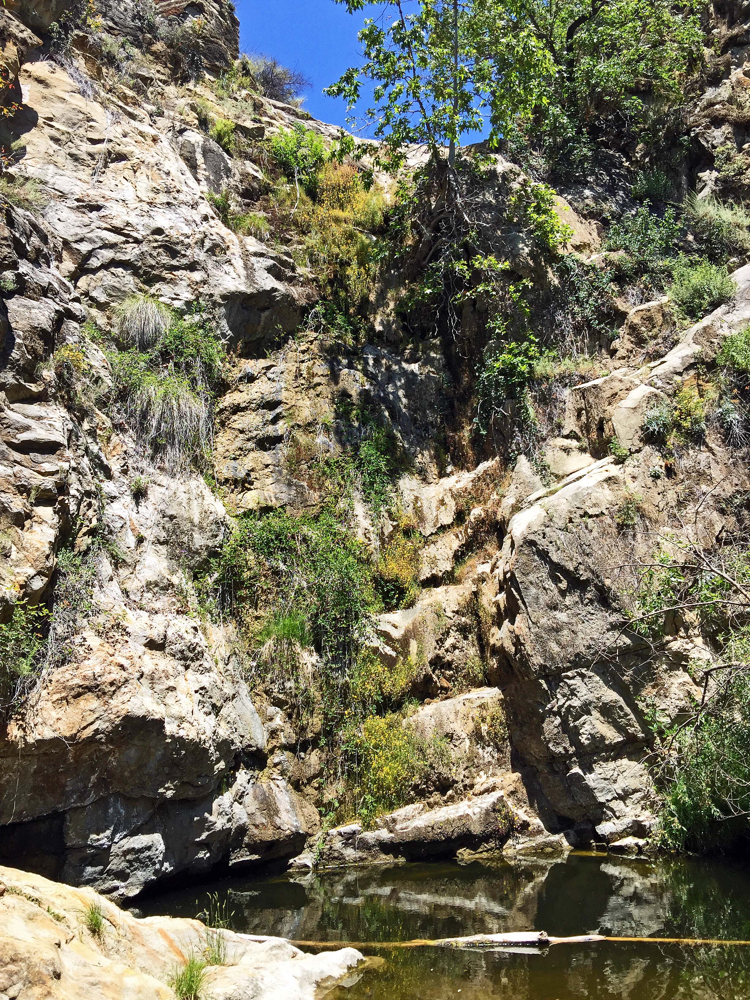
| Trail description: | We hiked this trail on Memorial Day, going as far as Upper Big Falls. This segment of the trail is clear and in excellent shape. Poison oak lines both sides of the trail in most places, but is easily avoided. Lower Big Falls is still flowing - barely. Upper Big Falls has stopped flowing altogether, although the pool at the base of the falls still has plenty of water. |
| Mode of transport: | Hike |
| Trail condition: | Good shape and easy to follow |
| Images: | Lower Big Falls from on the trail Pool at the base of Upper Big Falls (currently not flowing) |
Big Falls Trail Survey - 05-02-2015 - by Los Padres Forest Association| Link: | Big Falls Trail |
| Date: | 05-02-2015 |
| Surveyor Name: | Los Padres Forest Association |
| Trail description: | VWR patrol report of the Big Falls trail. Â Trail brushy and hard to follow. Â Reports of recent hiker needing to be rescued. Â Also reports of trash at the falls. Would be nice to have a more official report complete with photos and then organize a project to fix the trail. |
| Mode of transport: | Array |
| Trail condition: | Hard to follow |
Big Falls Trail Survey - 03-21-2015 - by Nathan Claud| Link: | Big Falls Trail |
| Date: | 03-21-2015 |
| Surveyor Name: | Nathan Claud |
| Trail description: | Came down on trip from Rinconada to top of grade. Trail was well maintained and poison oak was beat back pretty well. The poison oak was a little harder to avoid at the top of the trail, but it can be done. The water is mostly clear, but the flow is very low. |
| Mode of transport: | Hike |
| Trail condition: | Good shape and easy to follow |
 Survey / Report Form - Please click this box to open the form.