 Use Marker Groups
 Wolf 2002
Piru 2003
Day 2006
Zaca 2007
Gap 2008
La Brea 2009

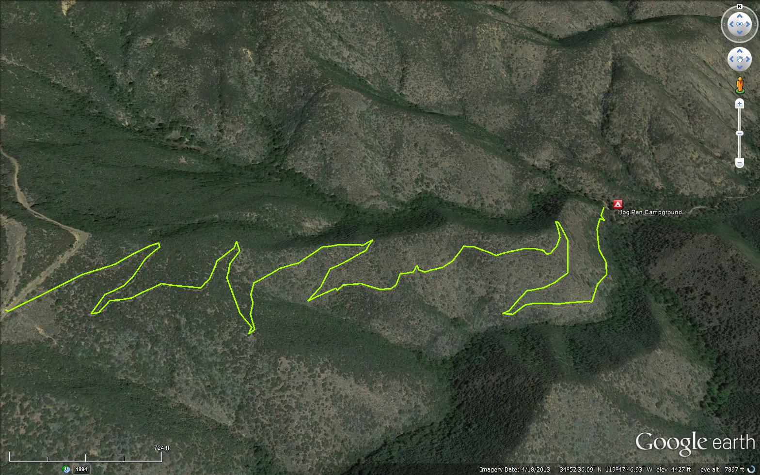
Aliso Trail connects the Seirra Madre Road (32S13) to Hog Pen Spring Road (10N04) and Hog Pen Campground and Hog Pen Spring. This trail starts at Aliso Peak as a 4-wheel drive road to Hog pen Spring then on up to Sierra Madre Road 32513. Continue on this road to the top of McPherson Peak. Near the communication facility the Messenger Canyon Trail starts to descent the north face of the mountain. Keep to the right at a junction and the trail will come out at Aliso Park. It is a hard, all day trip.
Hog Pen Campground - Car Camp


 Aliso Trail Survey - 04-05-2025 - by Dave Bourgeois
| Link: | Aliso Trail |
| Date: | 04-05-2025 |
| Surveyor Name: | Dave Bourgeois |
| Trail description: | Met LPFA volunteers performing maintenance. Trail is in excellent shape for hiking and biking. |
| Mode of transport: | Hike |
| Trail condition: | Good shape and easy to follow |
Aliso Trail Survey - 03-29-2025 - by Casey Horgan| Link: | Aliso Trail |
| Date: | 03-29-2025 |
| Surveyor Name: | Casey Horgan |
| Trail description: | Trail is narrow and easy to follow. Mostly rideable with some areas of minor overgrowth and off camber. |
| Mode of transport: | Bicycle |
| Trail condition: | Needs some work |
| Condition details: | Out and back bike outing to Painted Rock |
| Images: | |
Aliso Trail Survey - 06-21-2024 - by Anonymous Surveyor| Link: | Aliso Trail |
| Date: | 06-21-2024 |
| Surveyor Name: | Anonymous Surveyor |
| Trail description: | A bit overgrown, but no problems following the path. |
| Mode of transport: | Hike |
| Trail condition: | Good shape and easy to follow |
Aliso Trail Survey - 04-10-2022 - by Erin C.| Link: | Aliso Trail |
| Date: | 04-10-2022 |
| Surveyor Name: | Erin C. |
| Trail description: | This trail is in OK shape, but it could be so much better if the tread were widened a little bit! The native Buckwheat (Eriogonum fasciculatum) shrubs are encroaching into the tread. I suppose the best tool for these would be a heavy duty weedwacker. Most of the tread work is needed on the upper part of the the trail. A minor amount of brushing work is needed too. |
| Mode of transport: | Bicycle |
| Trail condition: | Needs some work |
| Images: | |
Aliso Trail Survey - 05-24-2020 - by Los Padres Forest Association| Link: | Aliso Trail |
| Date: | 05-24-2020 |
| Surveyor Name: | Los Padres Forest Association |
| Trail description: | Trail very passable but a bit brushy in spots. Lots of lovely flowers..... |
| Mode of transport: | Hike |
| Trail condition: | Needs some work |
| Images: | Photo MSplain Photo MSplain |
Aliso Trail Survey - 01-04-2020 - by Valerie Norton| Link: | Aliso Trail |
| Date: | 01-04-2020 |
| Surveyor Name: | Valerie Norton |
| Trail description: | I hiked down as it started to get dark. The brush is hugging in a little tightly and the tread is narrow, but it's mostly keeping the motorcycles off. It needs some motorcycle blocks. The hundreds of ticks I found almost exactly two years ago were nearly no shows this time. I did see two. Weather and season seems to be more important to a tick bloom than location. Some locations just get associated with them because people like going to those places in prime tick conditions. |
| Mode of transport: | Hike |
| Trail condition: | Good shape and easy to follow |
Aliso Trail Survey - 01-11-2018 - by Valerie Norton| Link: | Aliso Trail |
| Date: | 01-11-2018 |
| Surveyor Name: | Valerie Norton |
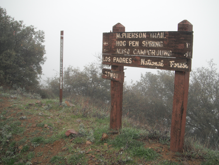
| Trail description: | Hiked up it to grab a couple peaks. The tread is a little narrow, but very easy to follow and the open grassy country leaves very little brushing to do. There is a sign (calls this McPherson Trail) at the top, but none at the bottom. Someone has put a big rock arrow at the bottom to direct traffic. I found ticks by the dozen on those grasses and sage and buckwheat even though it is January. I think the other comments about scrub oak belong with the trail up the mountain that goes along the ridge, marked as McPherson Trail here. |
| Mode of transport: | Hike |
| Trail condition: | Good shape and easy to follow |
Aliso Trail Survey - 01-13-2018 - by Erin C.| Link: | Aliso Trail |
| Date: | 01-13-2018 |
| Surveyor Name: | Erin C. |
| Trail description: | Bryan's survey from 2015 is pretty accurate. This trail needs work, but is not too bad. The upper most section of trail needs the most brushing work (mostly scrub oak encroaching into the trail). Chainsaws would be the most efficient tool in that section of trail. The bottom part of the trail is just too narrow and needs to be widened a little bit. Hedge trimmers would be the best tool there to cut back low growing chaparral plants. If you decide to ride a bike on this trail, the upper section will scrape you. Other than that it would be rideable in the downhill direction.  With a 10 to 15 person volunteer crew, this trail would be a pretty easy weekend project to get it in tip top condition. |
| Mode of transport: | Hike |
| Trail condition: | Needs some work |
| Images: | |
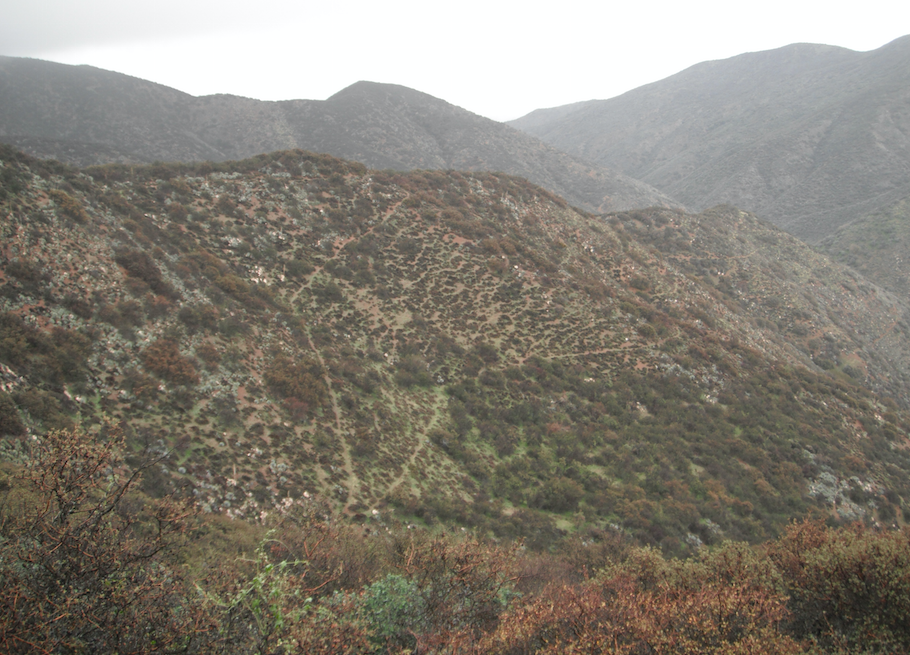
Aliso Trail Survey - 02-27-2015 - by Bryan Conant| Link: | Aliso Trail |
| Date: | 02-27-2015 |
| Surveyor Name: | Bryan Conant |
| Trail description: | Trail was in good shape and easy to follow. Â Of course, some work is needed, but compared to other nearby trails this trail is in good shape. Â Mostly needs brushing and some light tread work. |
| Mode of transport: | Hike |
| Trail condition: | Good shape and easy to follow |
| Images: | Looking down at the switch backs Upper trailhead lists the trail as McPherson Trail |
Aliso Trail Survey - 05-18-2014 - by Los Padres Forest Association| Link: | Aliso Trail |
| Date: | 05-18-2014 |
| Surveyor Name: | Los Padres Forest Association |
| Trail description: | trough was full, steady trickle from the spring |
| Mode of transport: | Bicycle |
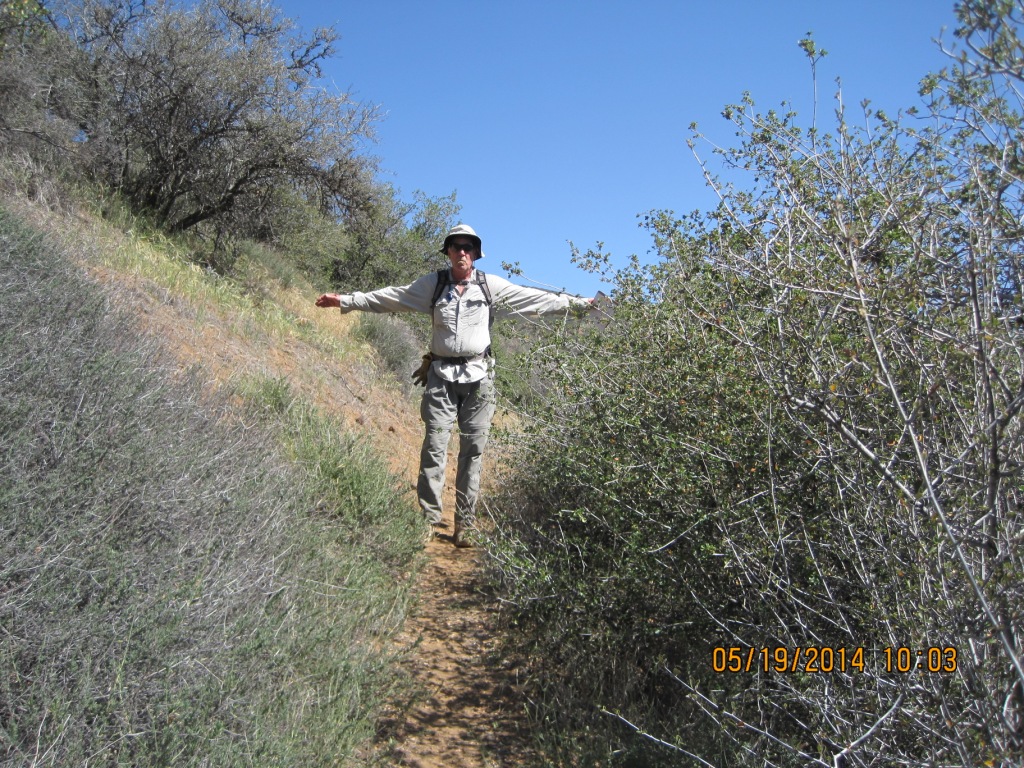
Aliso Trail Survey - 05-19-2014 - by Subbotin| Link: | Aliso Trail |
| Date: | 05-19-2014 |
| Surveyor Name: | Subbotin |
| Trail description: | 8 members of Thatcher School Mtn Bike Club on multi day trip pushing heavily loaded mtn bikes up the trail, headed for 19 Pines. |
| Mode of transport: | Hike |
| Trail condition: | Needs some work |
| Condition details: | narrow tread and some brushing needed, but generally easy to follow |
| Number of trees down: | 0 |
| People Seen: | 8 |
| Images: | |
 Survey / Report Form - Please click this box to open the form.