 Use Marker Groups
 Wolf 2002
Piru 2003
Day 2006
Zaca 2007
Gap 2008
La Brea 2009

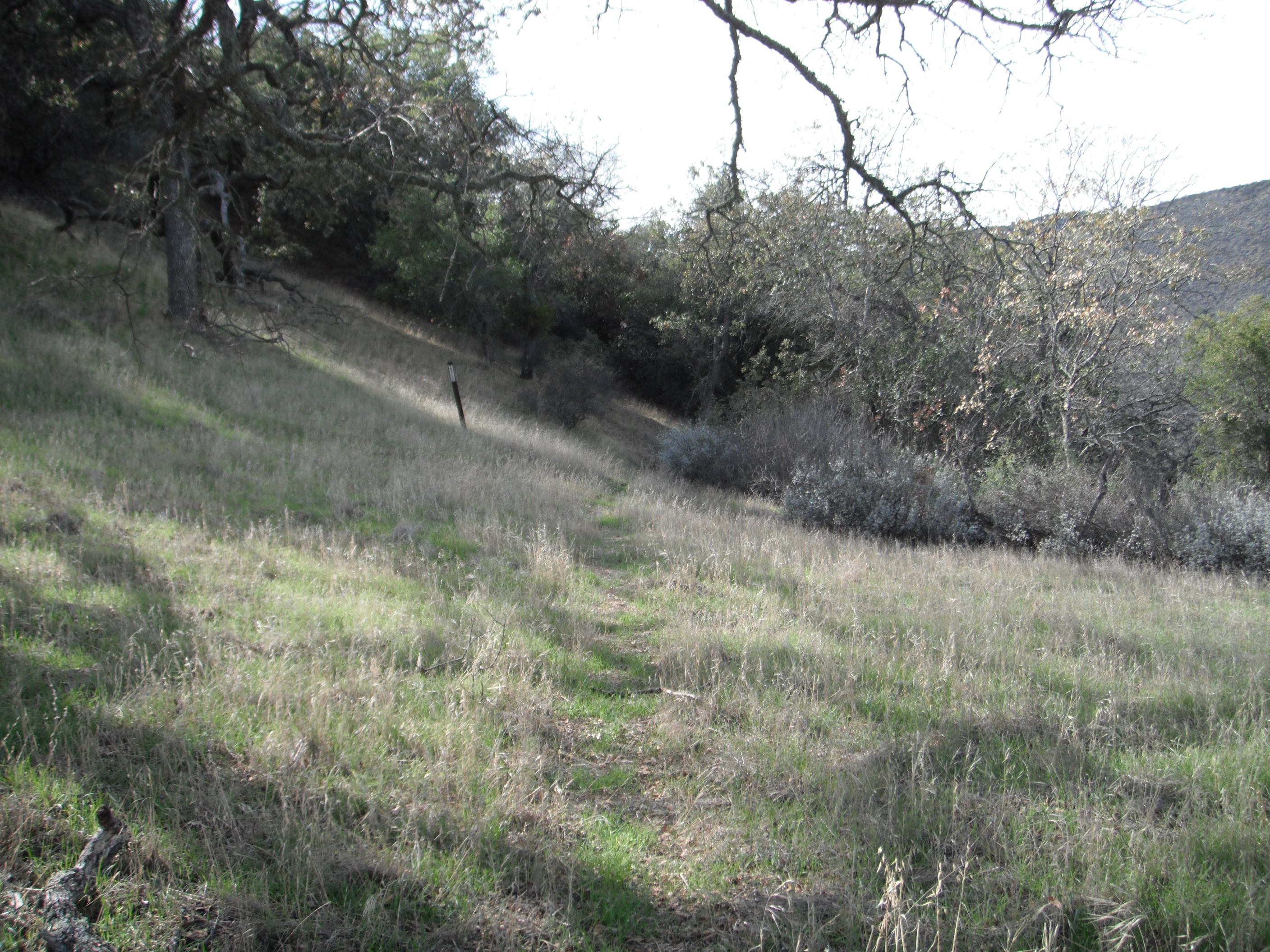
The Alejandro Trail is located in the Santa Maria area up the Colson Canyon Road (11N04), the trail starts at the second gate/road junction on Colson Canyon Road (34.9343, -120.1641), Look for the trail to the right of the locked gate, The trail quickly climbs up and over a small ridge, then continues to follow the ridge for about a half mile or so, along the ridge line trial is very wide and easy to follow. The trail surface is composed of loose rocks which makes for loose footing and makes it a bit hard to hike over without sliding a little. You will then come to a set of small switchbacks that lead the hiker down hill and straight into the mouth of Alejandro Canyon, a very tranquil canyon abundant with extremely large oaks trees.
The trail gentle follows the Alejandro creek, meandering from side to side of the creek for approximately 2 miles until arriving at Alejandro Camp. The camp is positioned under some old oaks and is enclosed in a fence or horse coral of some sort. After the camp, you will gradually ascend up and out of the canyon weaving trough more oaks and grass cover, just before your reach the top of the ridge, the trial heads left into in the directions of lower section of the saddle. Once you have crossed up and over the saddle, the trail will then steeply drop downhill, ending at the Horse Canyon Labrea Trail. Side note - Barrel Springs Camp is just up the road from here and also the Barrel Spring which the camp named after.
Alejandro Camp - 3 Miles from Colson Canyon Road


 Alejandro Trail Survey - 01-21-2026 - by Rick Hayes
| Link: | Alejandro Trail |
| Date: | 01-21-2026 |
| Surveyor Name: | Rick Hayes |
| Trail description: | Hiked from top to bottom. Road back up. 8/10 horrendous bushwacking and crawling the bottom half. Old pot grow remnants from Alejandro camp to the top. Did with daypack. |
| Mode of transport: | Hike |
| Trail condition: | Hard to follow |
Alejandro Trail Survey - 01-20-2018 - by Colby Dixon| Link: | Alejandro Trail |
| Date: | 01-20-2018 |
| Surveyor Name: | Colby Dixon |
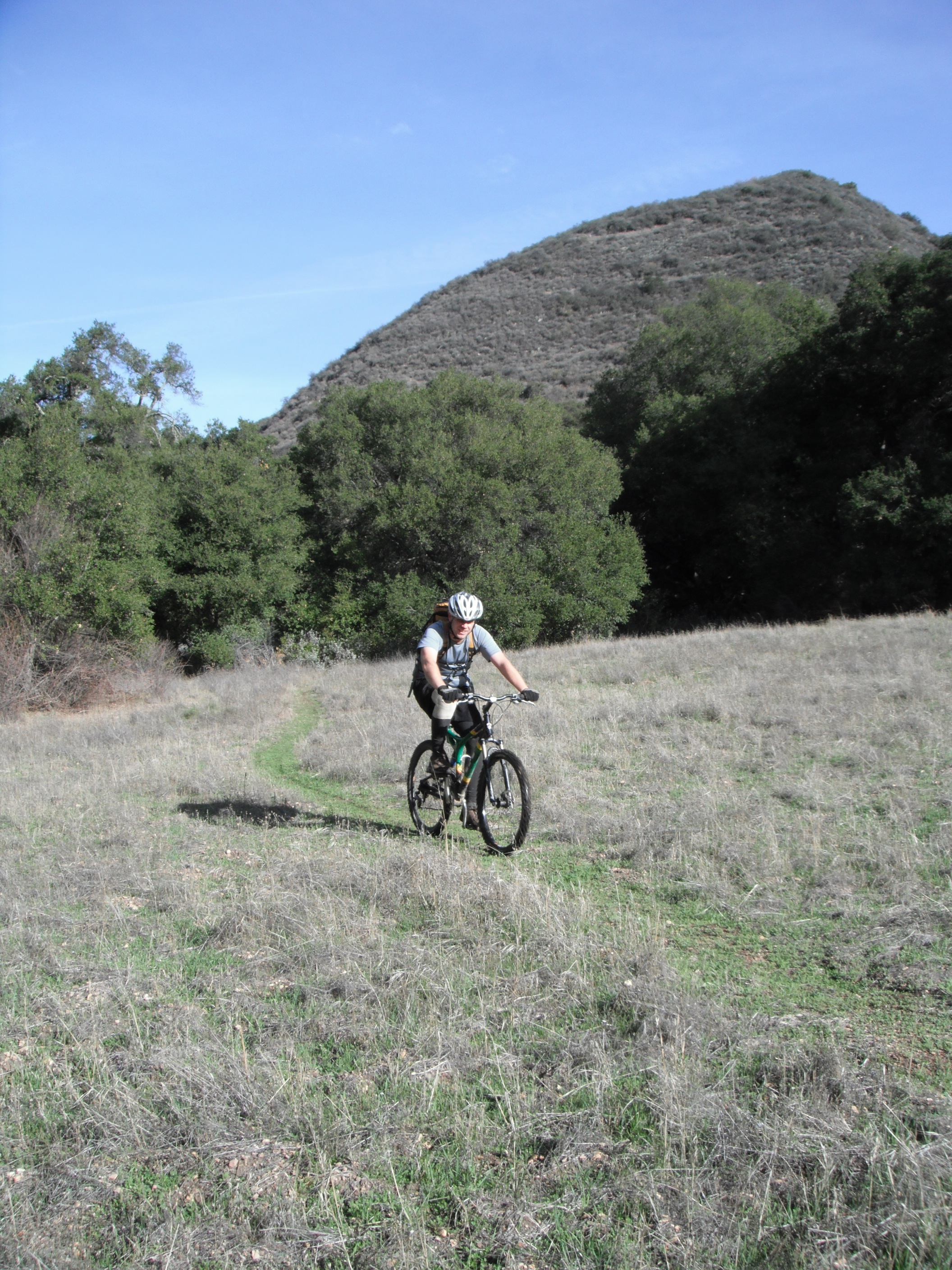
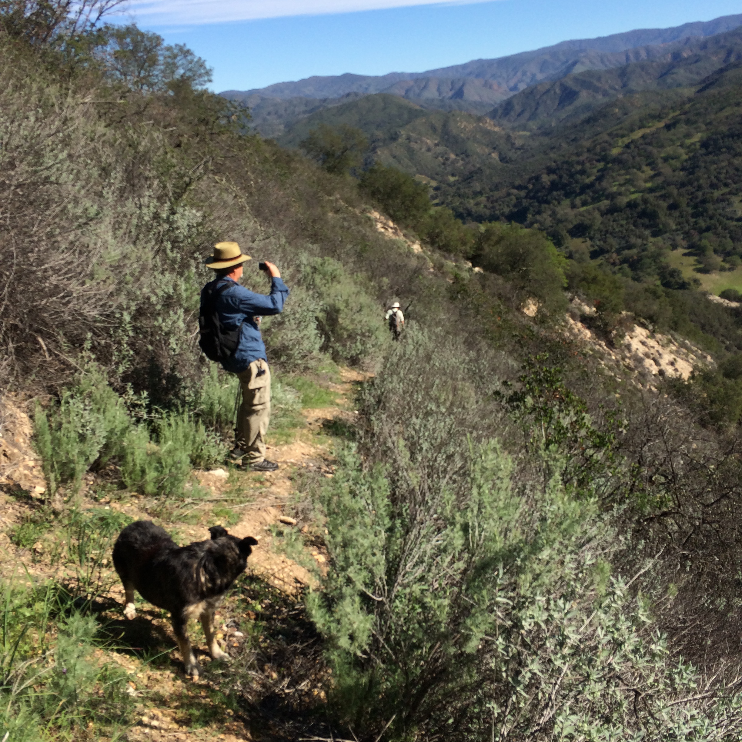
| Trail description: | Went out to Alejandro with my bike today to get out into the backcountry. This loop does not disappoint. Alejandro canyon is lush and very remote feeling. Starting from the Colson saddle, the trail has recently been worked and is in very good shape until just before the campground. The creek is flowing nicely. The campground is inviting, I'll have to come back soon with overnight gear. The trail out of the canyon is a steep hike-a-bike, but fairly easy to follow. However, both times I've been on this loop I've ended up in the same pickle that has tricked other trail users, topping out on the grassy ridgeline to the south of the saddle, with no trail. Dropping directly off the ridge from up there works pretty well, and the old road cut parallel to the ridge is obvious and easy to find. I picked up quite a few ticks on this middle portion of the loop. The Weber trail is still marked but is in pretty bad shape. Lots of downed trees and brush, and the trail is falling away in the short exposed traverse. If only we could drive into La Brea canyon to work this trail more easily! There's one large tree at the bottom that would definitely take chainsaws to clear. Overall, the tread is pretty good, and it made for an exciting descent. La Brea and the road up Rattlesnake cyn are both in very good shape and have recently been plowed. There's some new-ish looking forest service signs at the intersection that get my hopes up that the forest service may be gearing up to increase access. Perhaps this is the result of the forest service's public La Brea discussions last spring. |
| Mode of transport: | Bicycle |
| Trail condition: | Needs some work |
| Images: | Alejandro Cyn Alejandro Cyn brushwork Alejandro Camp Colson Cyn Road up Rattlesnake |
Alejandro Trail Survey - 11-05-2016 - by Matt Grant| Link: | Alejandro Trail |
| Date: | 11-05-2016 |
| Surveyor Name: | Matt Grant |
| Trail description: | I did this hike November 5, 2016 one week after a decent amount of rain. Throughout the 5.6 mile hike, I encountered 4 fallen trees (3 badly blocking the trail) and a number of areas where I couldn't find the trail at all. Overall, the trail is in good shape but anytime I came to a field, the trail was pretty much non-existent. A number of times, I had to bushwhack my way back using my GPS and a couple of times, I was off the trail for a good 30 minutes or so looking for it. A couple of the fallen trees were easy to get around, but 2 of them had to be crossed climbing over trunks and branches. Since the rainfall, there was a small trickle of water in the creek about 1.5 miles into the hike but I wouldn't plan on that being there for very long unless we continue to get rain. Overall, it was a good day hike. The trail definitely needs some work to clean it up and mark the trail better. |
| Mode of transport: | Hike |
| Trail condition: | Needs some work |
| Condition details: | Fallen Trees and Overgrown Fields creates challenges |
| Images: | Fallen Tree blocking trail Another Fallen Tree |
Alejandro Trail Survey - 11-28-2015 - by Steve Cypher| Link: | Alejandro Trail |
| Date: | 11-28-2015 |
| Surveyor Name: | Steve Cypher |
| Trail description: | The trail is in pretty good shape for a remote trail that sees a few bikes and fewer hikers. Some evidence of clearing along the creek in the canyon. Past the camp it was not hard to find where the trail leaves the creek and heads to the ridge. I got suckered by the cow/bike trail at the downed tree mentioned by James Wapotich. I got to the ridge too high, and not at the saddle to the left as the real trail does. Knew I was in the wrong place when there was no road. The bike trail vanished in the woods and I bushwhacked a little way down the La Brea side until I hit the road and found the carsonite "TRAIL" sign marking the top of the Weber Trail. Weber Trail was skinny but obvious all the way to La Brea Creek. Heed the warning to follow the signs & flagging past the camp and head towards the ridge, go left and not right at the downed tree, and the trail is pretty easy to follow. |
| Mode of transport: | Hike |
| Trail condition: | Needs some work |
Alejandro Trail Survey - 06-06-2015 - by Anonymous Surveyor| Link: | Alejandro Trail |
| Date: | 06-06-2015 |
| Surveyor Name: | Anonymous Surveyor |
| Trail description: | Started from Colson Canyon Road and was able to follow trail easily to Alejandro Camp. There were lots of briars and brambles along the trail and would recommend gators to keep them out of your boots. As I was eating at Alejandro Camp a large brown bear started toward the camp from the steep slope across the creek. I was able to scare it away by making noise, but he came back later that night. I tied my food in a tree about 100 yards from camp and he was not able to get to it. In the mourning I started out for Chuchudas Camp. About a mile or so after leaving Alejandro Camp the trail became non existent and I was unable to follow it to the next camp. This forced me to turn around and cut my trip short. |
| Mode of transport: | Hike |
| Trail condition: | Non existent |
Alejandro Trail Survey - 03-21-2015 - by James Wapotich| Link: | Alejandro Trail |
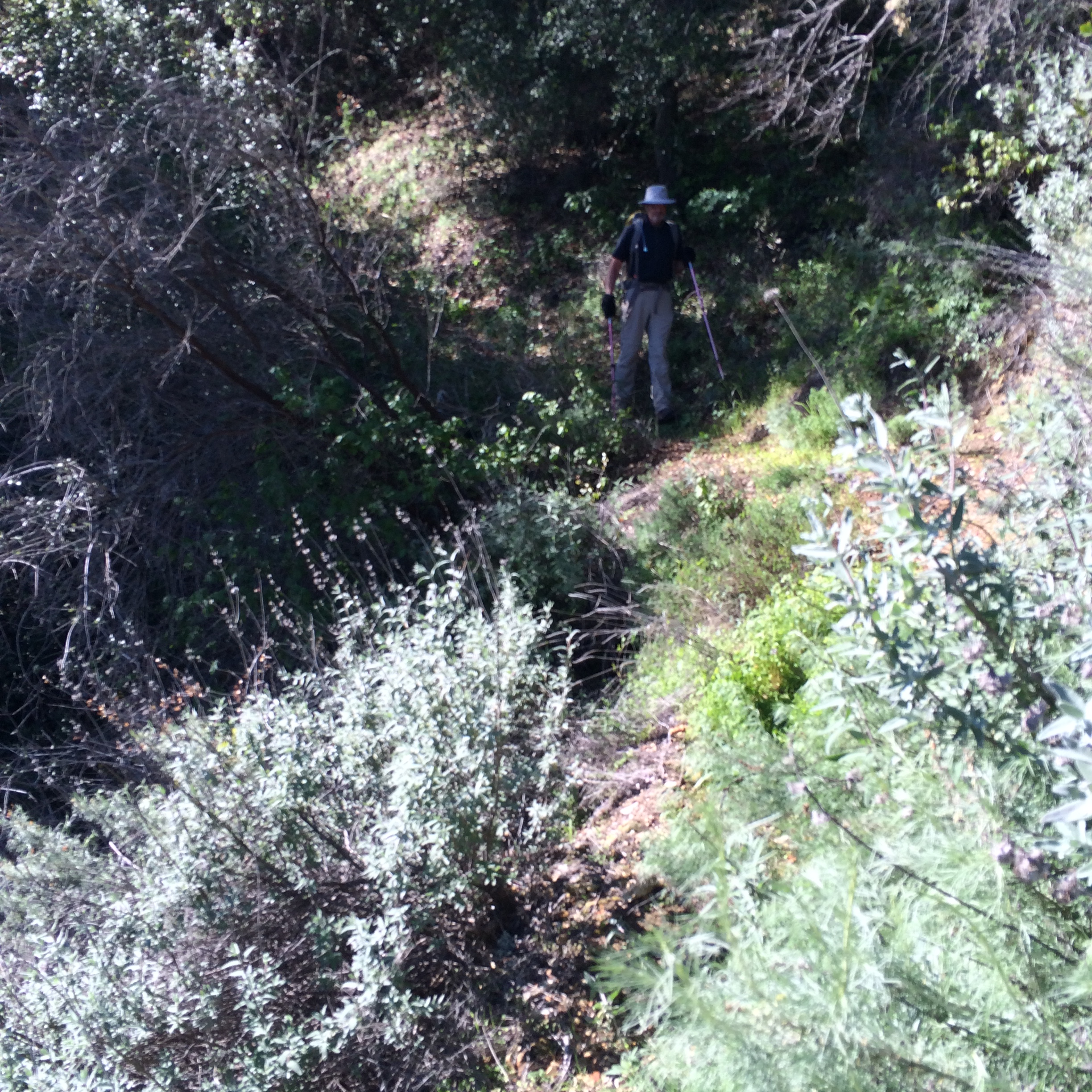
| Date: | 03-21-2015 |
| Surveyor Name: | James Wapotich |
| Trail description: | From the trailhead, the trail is slight overgrown. Where it arrives at the ridge separating Colson and Alejandro Canyons it opens up, and remains open as it travels along the ridge between Rattlesnake and Alejandro Canyons. The trail the drops down a side canyon towards Alejandro Creek. From here all the way to the Alejandro Camp the trail is overgrown. The trail is easy enough to follow as it follows the creek, and does't require any real route-finding, but there is plenty of poison oak to be avoided. Alejandro Camp is in fair shape with two sites close to each other inside a corral, supposedly to keep free range cattle from visiting. There is water intermittently flowing in Alejandro Creek, as well as just below Alejandro Camp. Past the camp, the trail starts away from the creek and does require some route-finding. However, once it starts heading up towards the ridge between Alejandro Canyon and North Fork La Brea Creek that route becomes more evident, although still overgrown. About two-thirds of the way up there is a large oak deadfall obscuring the trail. At this transition, there is a cattle trail leading off to the right that can be misleading. Instead, work your way past the oak tree and refind the trail, which actually starts to head back up Alejandro Canyon before top the ridge. This last section is perhaps the most overgrown. At the saddle the trail becomes much improved and it is easy to continue and locate the top of Weber Trail. |
| Mode of transport: | Hike |
| Trail condition: | Needs some work |
Alejandro Trail Survey - 02-26-2015 - by SteveM| Link: | Alejandro Trail |
| Date: | 02-26-2015 |
| Surveyor Name: | SteveM |
| Trail description: | Four of us camped for one night at Alejandro Camp and spent a day and a half trimming poison oak and other shrubbery, which overhangs the trail from Colson TH to Alejandro Camp, and the connector trail from the camp to LaBrea Canyon. Â The trail needs work here and there, including more brush clearing, but is generally easy to follow. Â There are a few spots along the connector trail where gps guidance is helpful due to a lack of a clear path and/or flags. Â There is one old major tree fall requiring a detour. Â The trail drops steeply into LaBrea and is very narrow and eroded in a few places. Â This entire route does not get much use, but is an excellent hiking area. |
| Mode of transport: | Hike |
| Trail condition: | Needs some work |
| Images: | along the connector trail along the connector trail |
Alejandro Trail Survey - 02-25-2015 - by Anonymous Surveyor| Link: | Alejandro Trail |
| Date: | 02-25-2015 |
| Surveyor Name: | Anonymous Surveyor |
| Trail description: | One old tree fall. Hiked from colson to camp. volunteers were trimming the day we went, trail was easy to follow. |
| Mode of transport: | Hike |
| Trail condition: | Needs some work |
Alejandro Trail Survey - 01-10-2015 - by SteveM| Link: | Alejandro Trail |
| Date: | 01-10-2015 |
| Surveyor Name: | SteveM |
| Trail description: | Three of us hiked from Colson Canyon TH to Alejandro Camp. Â Although little used, the trail is easy to follow. Â Brush is beginning to encroach and there are at least two tree falls that required small detours. Â Shortly beyond the campground, the trail becomes more difficult to follow and is overgrown with poison oak. Â We decided to turn around rather than continue through to La Brea Canyon Rd. Â There is running water here and there in Alejandro Creek, but only stagnant water in small pools at the campground. |
| Mode of transport: | Hike |
| Trail condition: | Needs some work |
| Condition details: | brush starting to encroach, tree falls |
Alejandro Trail Survey - 12-07-2014 - by Hike Los Padres| Link: | Alejandro Trail |
| Date: | 12-07-2014 |
| Surveyor Name: | Hike Los Padres |
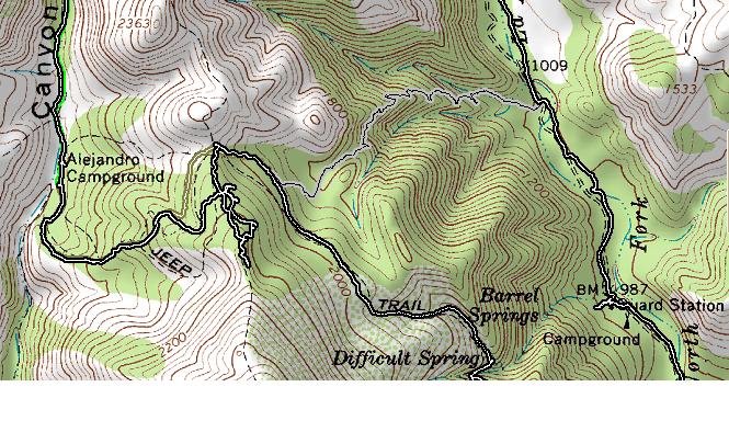
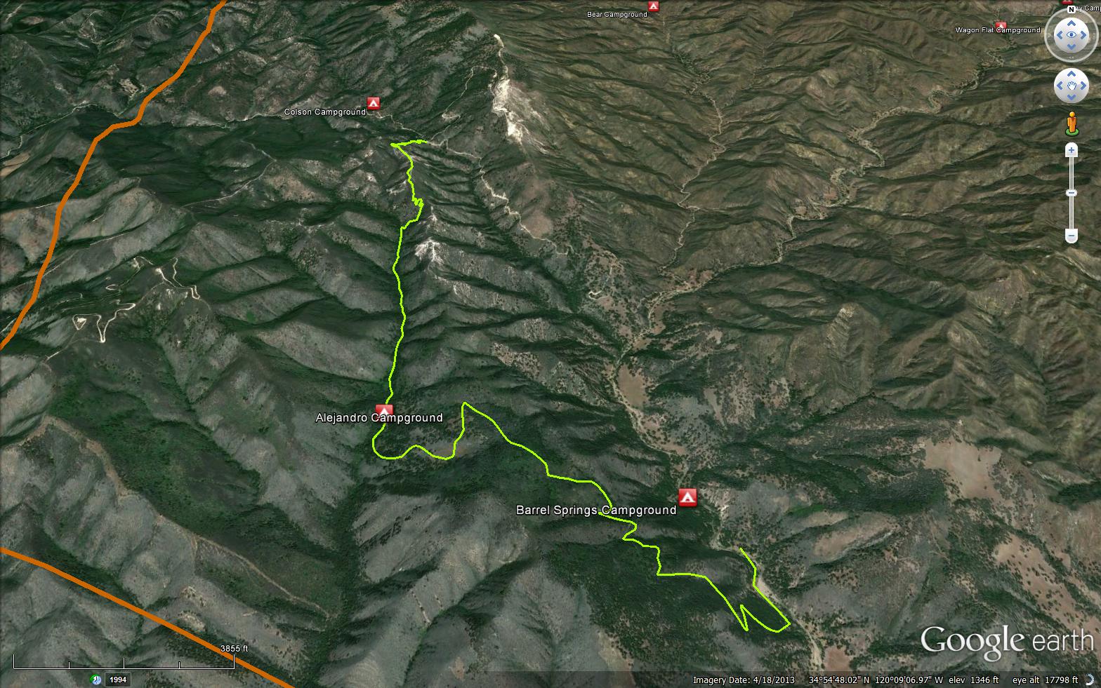
| Trail description: | From the trailhead to Alejandro Camp is in fair shape, passable and easy to follow. Â There are some downfalls, narrow tread, steep crumbly sections and poison oak that you need to dance around but you'll make it. We got a little lost after leaving the camp and heading up and over towards the Weber Trail and La Brea Canyon. Â Look at the map attachment, it will show you where we went wrong. Â We followed the cattle trail high up towards an oak grove and ended up in the wrong place. Â The trail passes the lowest saddle, keep heading down the ridgeline and you'll see the trail sign. Â Our route is in Black, the right trail is in greenish, Weber Trail is in gray. |
| Mode of transport: | Bicycle |
| Trail condition: | Needs some work |
| Condition details: | A little bit brushing could be done in a few places, but the trail is in good shape. |
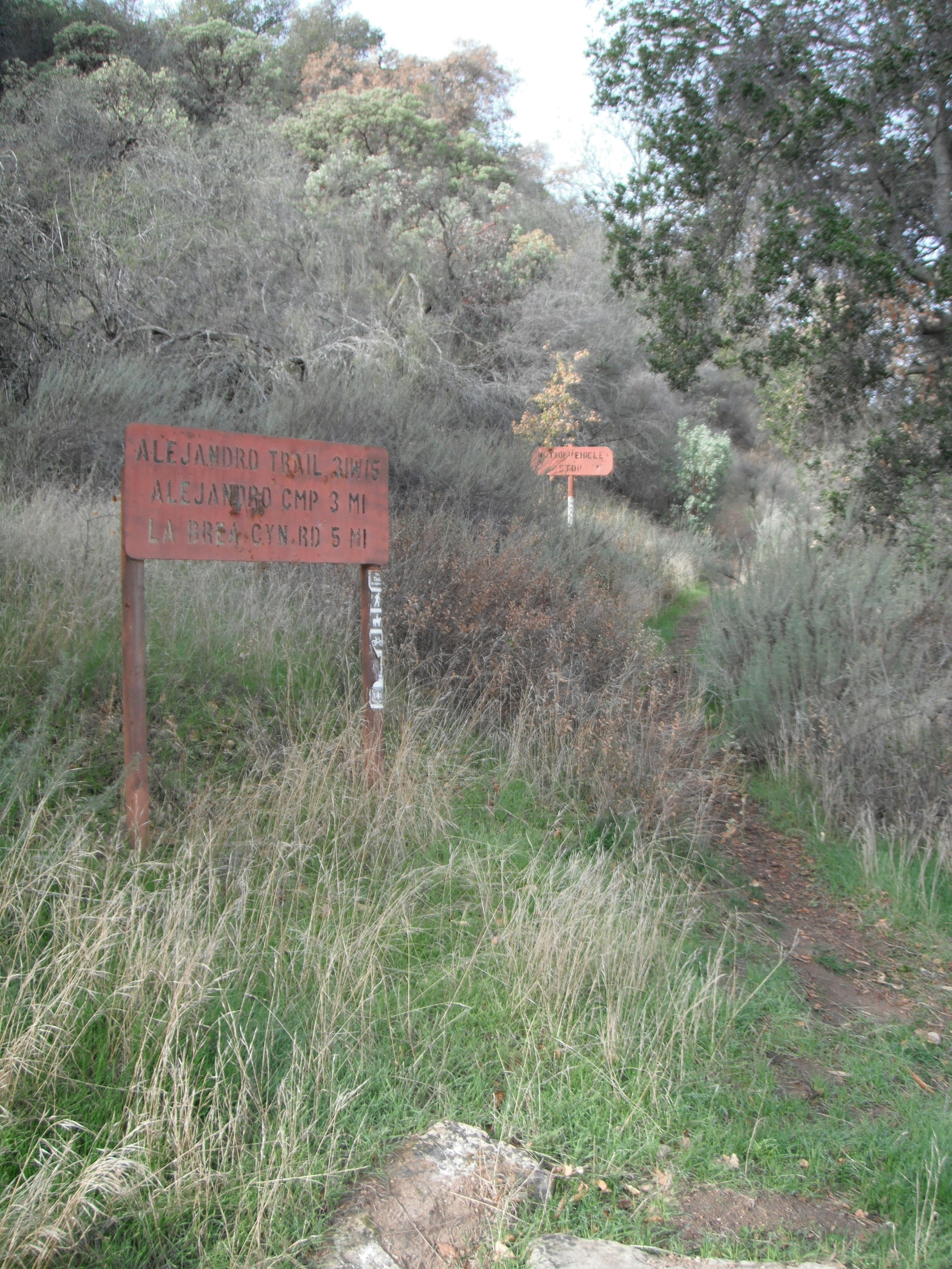
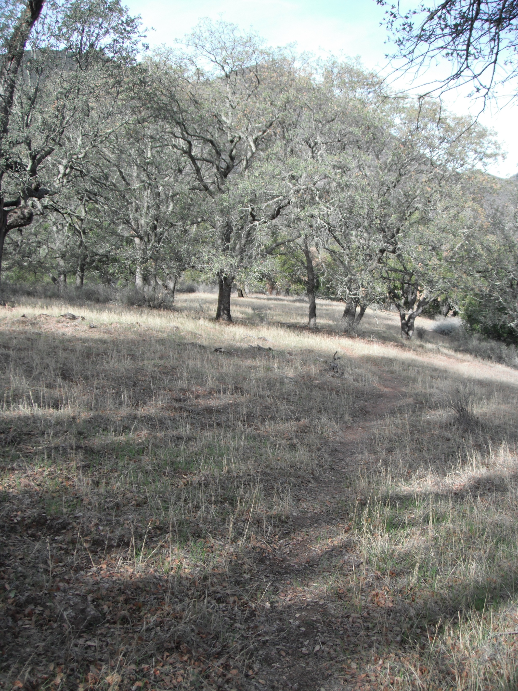
| Images: | Showing our confused route heading from Alejandro over to La Brea Alejandro Trailhead Alejandro Meadow Alejandro Trail Oaks Sign at Alejandro Saddle |
 Survey / Report Form - Please click this box to open the form.