 Use Marker Groups
 Wolf 2002
Piru 2003
Day 2006
Zaca 2007
Gap 2008
La Brea 2009

| Date | Surveyor | Water Report |
| 10-06-2023 | Marcus I | Trickle |
| 09-16-2023 | OL MARTO | Flowing |
| 11-12-2022 | Marcus | Stagnant |
| 10-16-2022 | Menso de Jong | Flowing |
| 05-20-2022 | Anonymous Surveyor | Flowing |
| 05-01-2022 | The Lost Padre | Flowing |
| 04-01-2022 | Tim | Flowing |
| 11-04-2021 | Los Padres Forest Association | Dry |
| 05-28-2021 | Anonymous Surveyor | Trickle |
| 05-01-2021 | Anonymous Surveyor | Flowing |
| 11-22-2020 | Shaddus Maximus | Stagnant |
| 07-26-2020 | Adam Olivares | Trickle |
| 06-28-2020 | Addison Jerlow | Flowing |
| 06-06-2020 | Antonio Calderon | Flowing |
| 05-25-2020 | Anonymous Surveyor | Flowing |
| 05-14-2020 | Arliss Crow | Flowing |
| 11-10-2019 | MSubbotin | Stagnant |
| 10-05-2019 | Anonymous Surveyor | Stagnant |
| 07-05-2019 | Christopher P. Lord | Flowing |
| 06-29-2019 | The Lost Padre | Flowing |
| 04-15-2019 | Johnathan Keilman | Flowing |
| 11-24-2018 | Christopher P. Lord | Dry |
| 10-08-2018 | Christopher P. Lord | Dry |
| 09-29-2018 | Kevin Hall | Stagnant |
| 05-26-2018 | Craig R. Carey | Flowing |
| 05-12-2018 | Laura | Flowing |
| 11-18-2017 | Anonymous Surveyor | Stagnant |
| 11-10-2017 | Anonymous Surveyor | Dry |
| 08-20-2017 | Anonymous Surveyor | Trickle |
| 08-11-2017 | Anonymous Surveyor | Trickle |
| 07-03-2017 | H. Ketchum | Trickle |
| 05-28-2017 | Bryant Koger | Flowing |
| 05-23-2017 | Lightningrod | Flowing |
| 09-10-2016 | M Subbotin | Dry |
| 07-16-2016 | Anonymous Surveyor | Trickle |
| 05-10-2016 | Anonymous Surveyor | Flowing |
| 04-23-2016 | M Subbotin | Flowing |
| 03-29-2016 | Shaddus Maximus | Flowing |
| 01-30-2016 | Howard Cohen | Dry |
| 09-12-2015 | Los Padres Forest Association | Flowing |
| 07-03-2015 | Joshua Isaac | Flowing |
| 05-16-2015 | Michael S. | Flowing |
| 04-30-2015 | Mark S | Flowing |
| 03-30-2015 | Norman93001 | Trickle |
| 05-24-2014 | Los Padres Forest Association | Flowing |
| 05-1-2021 | Anonymous Surveyor | Flowing |
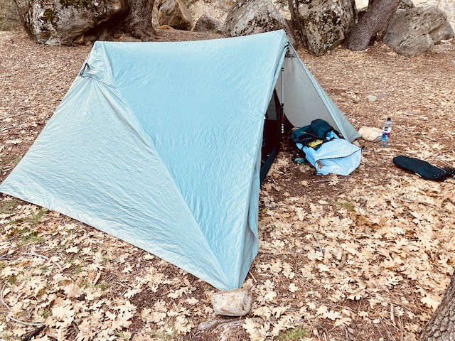
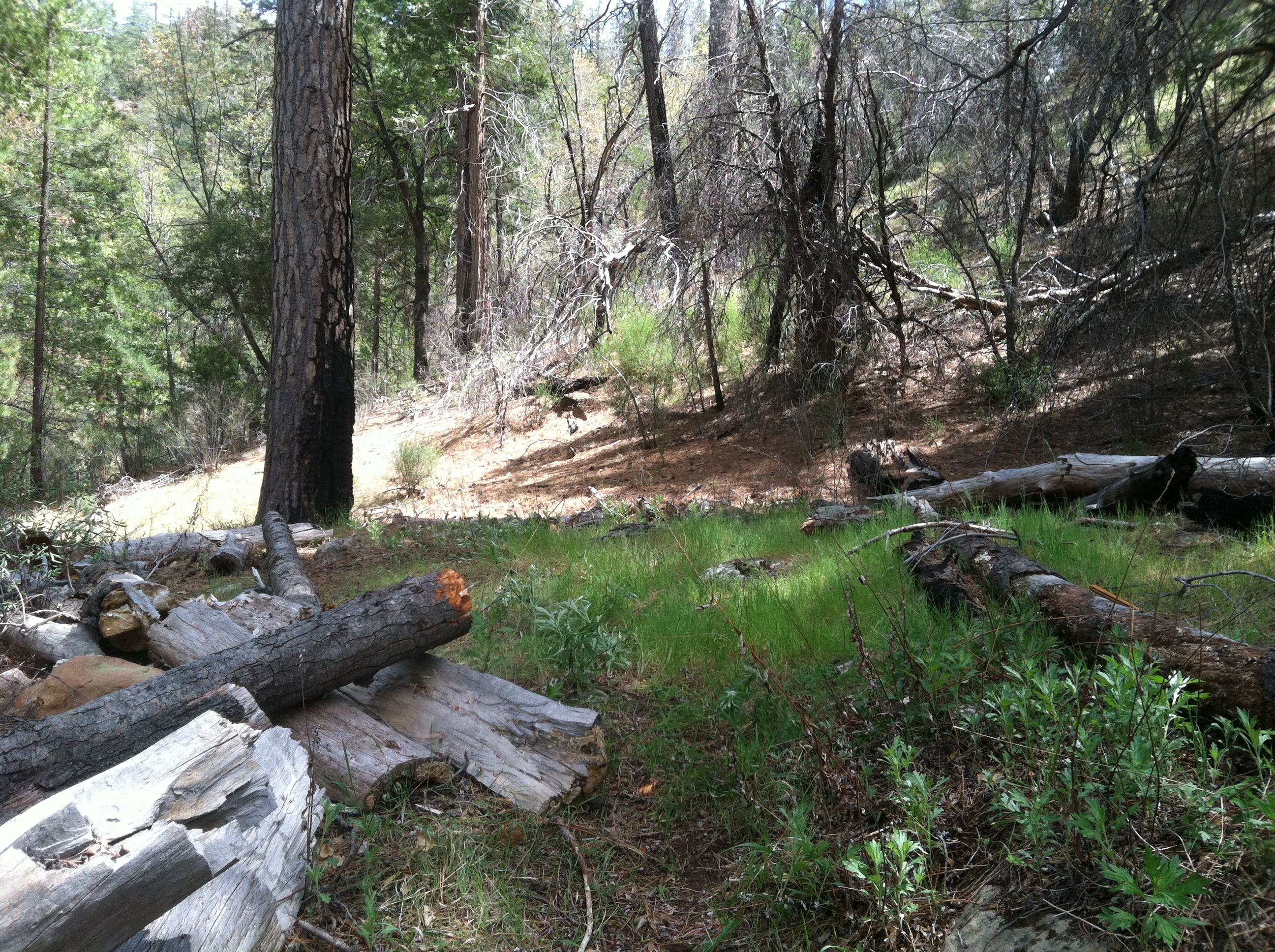
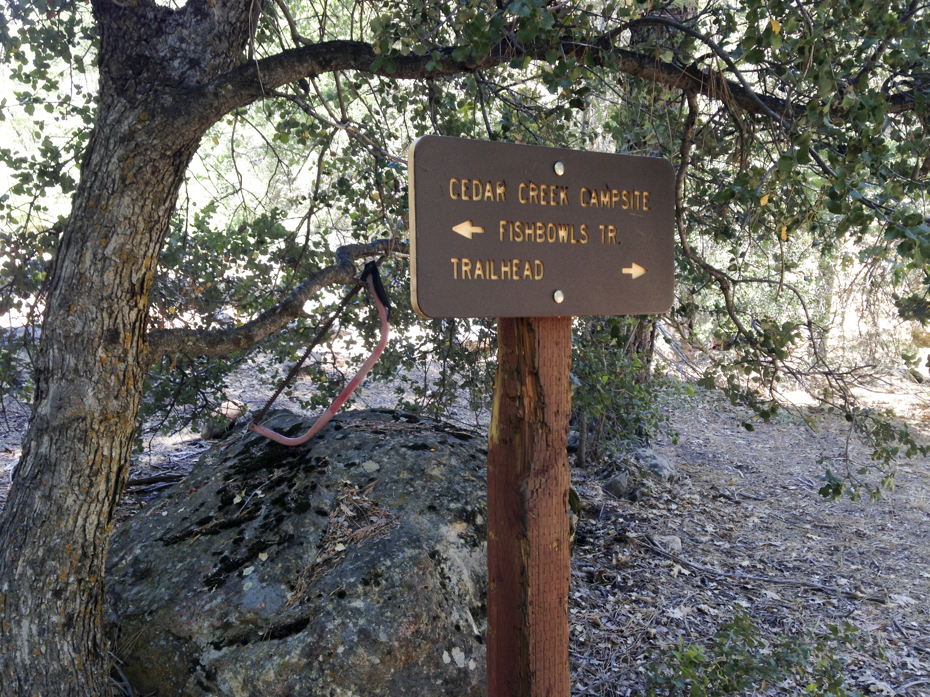
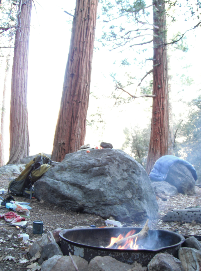
Located on a bench between the South Fork Cedar Creek and an unnamed drainage, Cedar Creek is a fantastic camp under a lush forest of incense cedar and ponderosa pines.
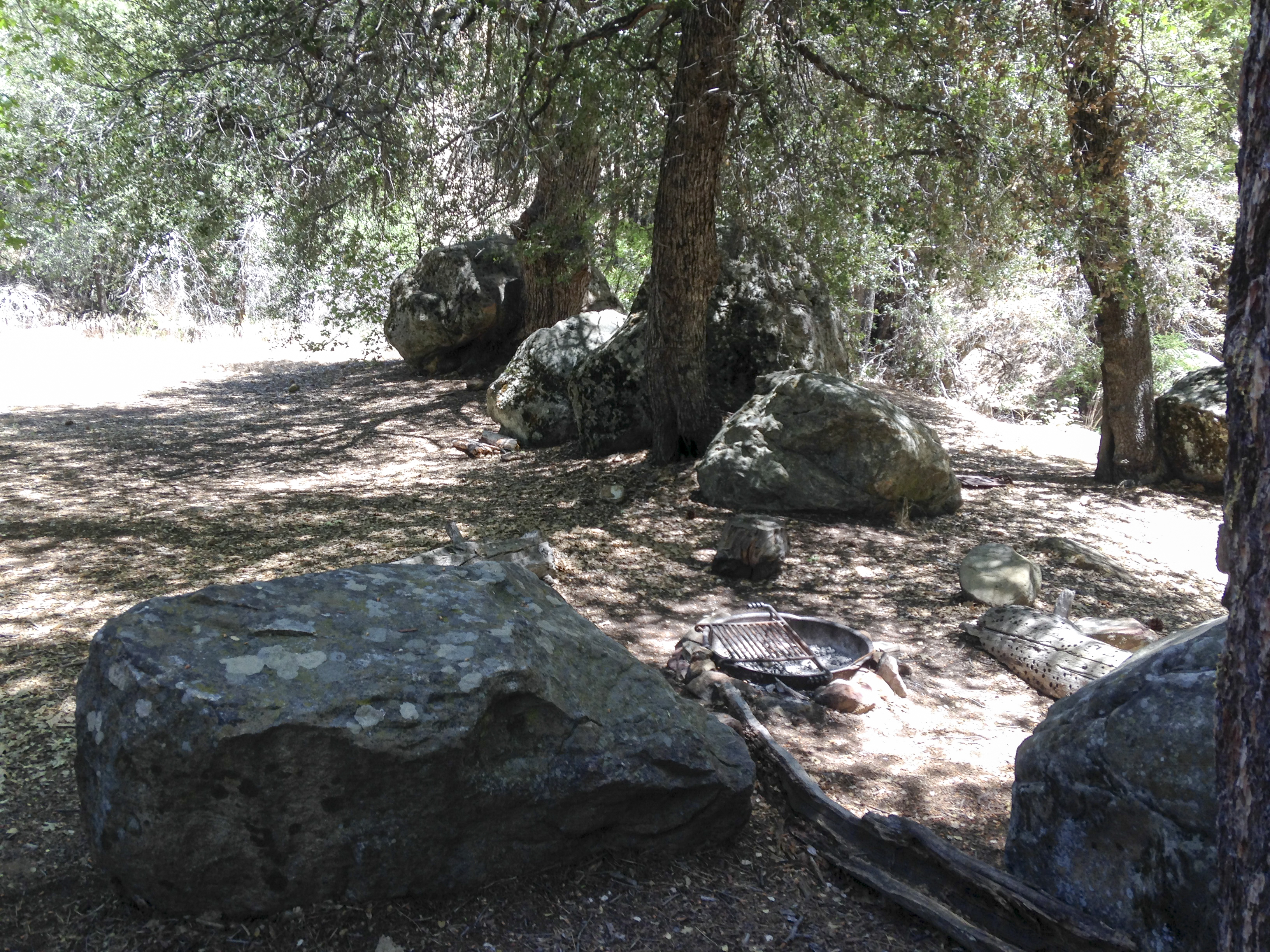
There are three fire-rings within the camp and enough room to play some frisbee or spread out should you have a larger group.
Being at over 5,000ft, the camp will have snow for some of the winter months and remain cooler in the summer as compared to some of its lower elevation cousin camps.
There are no tables and no Forest Service facilities outside of the fire-rings and camp sign. There is an old Klamath Stove near one of the camps although it is no longer in working condition.
Great camp, very beautiful and well worth the short hike to enjoy a night under the large trees.


 Cedar Creek Camp Survey - 10-06-2023 - by Marcus I
| Link: | Cedar Creek Camp |
| Date: | 10-06-2023 |
| Surveyor Name: | Marcus I |
| Camp Description: | Temps were low of 40, shade temp around 70, and around 80 in the sun. The road to the trailhead is closed at the Johnston Ridge/Thorn point road junction about 1 mile past Fishbowls. This makes it approximately 4 miles to Cedar Creek camp, and an additional 3.5 up the hill to Pine Mountain Lodge. Trail is in pretty good condition. Beautiful views as usual |
| Water Source: | Trickle |
| Water Source Details: | Nice cold, clean water flowing right next to camp, to the right as you walk up hill. |
| Weather Conditions: | Mostly sunny. 40 low, 70 shade high, 80 sun high |
Cedar Creek Camp Survey - 09-16-2023 - by OL MARTO| Link: | Cedar Creek Camp |
| Date: | 09-16-2023 |
| Surveyor Name: | OL MARTO |
| Camp Description: | Hiked in from Fishbowls Trailhead. Was happy to see water was still flowing, however barely. Not sure how much longer the creek will flow. Only one couple at camp. Nice and peaceful area. Decent amount of flies/mosquitos but not too bad. |
| Water Source: | Flowing |
| Water Source Details: | Water was flowing but almost to a trickle. |
| Weather Conditions: | Clear / Warm in day. Cool at night. |
| Images: | Cedar Creek Camp |
Cedar Creek Camp Survey - 11-12-2022 - by Marcus| Link: | Cedar Creek Camp |
| Date: | 11-12-2022 |
| Surveyor Name: | Marcus |
| Camp Description: | Technically there is water at camp, but I would not drink it unless I was desperate. Very shallow pool. barely trickling. I would not consider it a legit water source in general. |
| Water Source: | Stagnant |
| Water Source Details: | Slow seep, pretty gross, not drinkable unless desperate. |
| Weather Conditions: | 28 low 60 high |
Cedar Creek Camp Survey - 10-16-2022 - by Menso de Jong| Link: | Cedar Creek Camp |
| Date: | 10-16-2022 |
| Surveyor Name: | Menso de Jong |
| Camp Description: | Car camped at Thorn Meadow the weekend of 10/15/22 and ran the Cedar/Fishbowls Loop. Trails were standard LPNF backcountry: brushy, a few slides, a few downed trees, but altogether easy to follow and passable. The creeks were dry virtually everywhere, except at the well-placed backcountry campgrounds, where they were still flowing between a few reasonably deep pools. |
| Water Source: | Flowing |
| Water Source Details: | Flowing, but only near camp, not along the trail |
| Weather Conditions: |
Cedar Creek Camp Survey - 05-20-2022 - by Anonymous Surveyor| Link: | Cedar Creek Camp |
| Date: | 05-20-2022 |
| Surveyor Name: | Anonymous Surveyor |
| Camp Description: | |
| Water Source: | Flowing |
| Water Source Details: | |
| Weather Conditions: |
Cedar Creek Camp Survey - 05-01-2022 - by The Lost Padre| Link: | Cedar Creek Camp |
| Date: | 05-01-2022 |
| Surveyor Name: | The Lost Padre |
| Camp Description: | The west side drainage coming into camp has good flow, other side is dry near the campsites but has a some flow above camp. |
| Water Source: | Flowing |
| Water Source Details: | Good flow from west side of creek/spring |
| Weather Conditions: | 70 day / 38 night |
| Images: | |
Cedar Creek Camp Survey - 04-01-2022 - by Tim| Link: | Cedar Creek Camp |
| Date: | 04-01-2022 |
| Surveyor Name: | Tim |
| Camp Description: | Creek was clean and clear; had just rained and snowed the day before. |
| Water Source: | Flowing |
| Water Source Details: | Creeks on both sides of camp were flowing |
| Weather Conditions: |
Cedar Creek Camp Survey - 11-04-2021 - by Los Padres Forest Association| Link: | Cedar Creek Camp |
| Date: | 11-04-2021 |
| Surveyor Name: | Los Padres Forest Association |
| Camp Description: | LPFA Trail Survey Camp was beautiful as always, no water was to be found but didn't dig around or search too deep. Winter 2020-2021 was very dry. Enjoy.... |
| Water Source: | Dry |
| Water Source Details: | |
| Weather Conditions: |
Cedar Creek Camp Survey - 05-28-2021 - by Anonymous Surveyor| Link: | Cedar Creek Camp |
| Date: | 05-28-2021 |
| Surveyor Name: | Anonymous Surveyor |
| Camp Description: | |
| Water Source: | Trickle |
| Water Source Details: | Stagnant pools above the camp, but water can be found across the main camp. It’s clear and tastes good, although a trickle. |
| Weather Conditions: |
Cedar Creek Camp Survey - 05-01-2021 - by Anonymous Surveyor| Link: | Cedar Creek Camp |
| Date: | 05-01-2021 |
| Surveyor Name: | Anonymous Surveyor |
| Camp Description: | |
| Water Source: | Flowing |
| Water Source Details: | |
| Weather Conditions: |
Cedar Creek Camp Survey - 11-22-2020 - by Shaddus Maximus | Link: | Cedar Creek Camp |
| Date: | 11-22-2020 |
| Surveyor Name: | Shaddus Maximus |
| Camp Description: | |
| Water Source: | Stagnant |
| Water Source Details: | Couple of stagnant, dark pools just below camp. |
| Weather Conditions: |
Cedar Creek Camp Survey - 07-26-2020 - by Adam Olivares| Link: | Cedar Creek Camp |
| Date: | 07-26-2020 |
| Surveyor Name: | Adam Olivares |
| Camp Description: | |
| Water Source: | Trickle |
| Water Source Details: | |
| Weather Conditions: |
Cedar Creek Camp Survey - 06-28-2020 - by Addison Jerlow| Link: | Cedar Creek Camp |
| Date: | 06-28-2020 |
| Surveyor Name: | Addison Jerlow |
| Camp Description: | just an all around really nice camp. tons of flat options and mature pine, spruce and oaks. |
| Water Source: | Flowing |
| Water Source Details: | a few good spots to fill up. still cold but slow, shallow flow. |
| Weather Conditions: |
Cedar Creek Camp Survey - 06-06-2020 - by Antonio Calderon | Link: | Cedar Creek Camp |
| Date: | 06-06-2020 |
| Surveyor Name: | Antonio Calderon |
| Camp Description: | Camp is in great shape with good water flow. |
| Water Source: | Flowing |
| Water Source Details: | Good flow |
| Weather Conditions: | Mid 60s sunny and windy |
| Images: | |
Cedar Creek Camp Survey - 05-25-2020 - by Anonymous Surveyor| Link: | Cedar Creek Camp |
| Date: | 05-25-2020 |
| Surveyor Name: | Anonymous Surveyor |
| Camp Description: | 3 campsites are in good shape. creek is flowing |
| Water Source: | Flowing |
| Water Source Details: | |
| Weather Conditions: |
Cedar Creek Camp Survey - 05-14-2020 - by Arliss Crow| Link: | Cedar Creek Camp |
| Date: | 05-14-2020 |
| Surveyor Name: | Arliss Crow |
| Camp Description: | |
| Water Source: | Flowing |
| Water Source Details: | |
| Weather Conditions: |
Cedar Creek Camp Survey - 11-10-2019 - by MSubbotin| Link: | Cedar Creek Camp |
| Date: | 11-10-2019 |
| Surveyor Name: | MSubbotin |
| Camp Description: | |
| Water Source: | Stagnant |
| Water Source Details: | no flow at camp or at creek crossing heading up switchbacks; shallow stagnant pools at first creek crossing below camp; barely enough to pump |
| Weather Conditions: | clear, sunny, 70F |
Cedar Creek Camp Survey - 10-05-2019 - by Anonymous Surveyor| Link: | Cedar Creek Camp |
| Date: | 10-05-2019 |
| Surveyor Name: | Anonymous Surveyor |
| Camp Description: | |
| Water Source: | Stagnant |
| Water Source Details: | |
| Weather Conditions: |
Cedar Creek Camp Survey - 07-05-2019 - by Christopher P. Lord| Link: | Cedar Creek Camp |
| Date: | 07-05-2019 |
| Surveyor Name: | Christopher P. Lord |
| Camp Description: | Passed through Friday and the place is looking wonderful as always. Water is still flowing from Cedar Creek and readily available from camp. More details below |
| Water Source: | Flowing |
| Water Source Details: | dwindling flow but still going |
| Weather Conditions: | Sunny with temps in the 80's |
| Images: | |
Cedar Creek Camp Survey - 06-29-2019 - by The Lost Padre| Link: | Cedar Creek Camp |
| Date: | 06-29-2019 |
| Surveyor Name: | The Lost Padre |
| Camp Description: | Camp is in good shape |
| Water Source: | Flowing |
| Water Source Details: | Creek is flowing well |
| Weather Conditions: |
Cedar Creek Camp Survey - 04-15-2019 - by Johnathan Keilman| Link: | Cedar Creek Camp |
| Date: | 04-15-2019 |
| Surveyor Name: | Johnathan Keilman |
| Camp Description: | The trail was definitely washed out and easy to lose. The road connecting the Cedar creek and johnston ridge trailhead was covered in downed trees. We started our hike from ghe Piedra Blanca trailhead and finished the Sespe Hot springd loop with a total of 42 miles 4800 ft (+) and 4400 feet (-). |
| Water Source: | Flowing |
| Water Source Details: | Creek was flowing all the way to Mutau Flats. There was water even at Half Moon campground. |
| Weather Conditions: |
Cedar Creek Camp Survey - 11-24-2018 - by Christopher P. Lord| Link: | Cedar Creek Camp |
| Date: | 11-24-2018 |
| Surveyor Name: | Christopher P. Lord |
| Camp Description: | Was doing a wilderness Camp survey of Cedar Creek Camp this morning. Water was dry directly adjacent to Camp, However standing pools could be found downstream at the immediate creek crossing and at less than a mile below was a rather large pool. Camp is in good shape with what appears to be only minor changes since the last survey in 2012. Obviously the Grade Valley gate is still open but who knows for how much longer. Piru creek road crossing was flooded and would be very risky for low clearance vehicles, I parked just before it. Cedar creek Camp has 3 fire rings with grates and plenty of tent space. Mature Pines and Cedars shade the site well. Cedar Creek Trail is well maintained and very easy to follow from Grade Valley at the Cedar Creek Trailhead. I saw only 1 downed tree on the way in. |
| Water Source: | Dry |
| Water Source Details: | |
| Weather Conditions: | overcast, cold and windy |
| Images: | Camp site #1 Tent area adjacent to site #1 camp site #2 Tent area adjacent to site #2 Camp site #3 |
Cedar Creek Camp Survey - 10-08-2018 - by Christopher P. Lord| Link: | Cedar Creek Camp |
| Date: | 10-08-2018 |
| Surveyor Name: | Christopher P. Lord |
| Camp Description: | Cedar Creek Camp is situated in a sublime setting. Huge Incense Cedars and Pines tower overhead. The camp has 3 fire rings and is adjacent to Cedar Creek. Water was pretty dry here, however just downstream of camp I did find a few very small pools of standing water that could be filtered if absolutely needed. Watch out poison oak is in places along the trail before making your way into the camp. You can read the full write up below http://christopherplord.blogspot.com/2018/10/fishbowls-to-cedar-creek-loop.html |
| Water Source: | Dry |
| Water Source Details: | |
| Weather Conditions: | Sunny and 67* by Noon |
| Images: | |
Cedar Creek Camp Survey - 09-29-2018 - by Kevin Hall| Link: | Cedar Creek Camp |
| Date: | 09-29-2018 |
| Surveyor Name: | Kevin Hall |
| Camp Description: | Filtered and boiled the puddle water.  |
| Water Source: | Stagnant |
| Water Source Details: | A very few small, bug-ridden, stagnant puddles. |
| Weather Conditions: |
Cedar Creek Camp Survey - 05-26-2018 - by Craig R. Carey| Link: | Cedar Creek Camp |
| Date: | 05-26-2018 |
| Surveyor Name: | Craig R. Carey |
| Camp Description: | As part of their final pre-summer training trip, Troop 111 Scouts (Ventura) camped at Cedar Creek this past week. Great conditions; plenty of water.  |
| Water Source: | Flowing |
| Water Source Details: | Cold and clear |
| Weather Conditions: | Cool |
| Images: | |
Cedar Creek Camp Survey - 05-12-2018 - by Laura| Link: | Cedar Creek Camp |
| Date: | 05-12-2018 |
| Surveyor Name: | Laura |
| Camp Description: | |
| Water Source: | Flowing |
| Water Source Details: | |
| Weather Conditions: |
Cedar Creek Camp Survey - 11-18-2017 - by Anonymous Surveyor| Link: | Cedar Creek Camp |
| Date: | 11-18-2017 |
| Surveyor Name: | Anonymous Surveyor |
| Camp Description: | Packed in enough water to make it to Fishbowls without getting water here but you could if you had to. |
| Water Source: | Stagnant |
| Water Source Details: | A couple stagnant pools would be enough to fill bottles |
| Weather Conditions: | Cold at night. Perfect during the day |
Cedar Creek Camp Survey - 11-10-2017 - by Anonymous Surveyor| Link: | Cedar Creek Camp |
| Date: | 11-10-2017 |
| Surveyor Name: | Anonymous Surveyor |
| Camp Description: | |
| Water Source: | Dry |
| Water Source Details: | I saw 1 tiny puddle... |
| Weather Conditions: |
Cedar Creek Camp Survey - 08-20-2017 - by Anonymous Surveyor| Link: | Cedar Creek Camp |
| Date: | 08-20-2017 |
| Surveyor Name: | Anonymous Surveyor |
| Camp Description: | |
| Water Source: | Trickle |
| Water Source Details: | |
| Weather Conditions: |
Cedar Creek Camp Survey - 08-11-2017 - by Anonymous Surveyor| Link: | Cedar Creek Camp |
| Date: | 08-11-2017 |
| Surveyor Name: | Anonymous Surveyor |
| Camp Description: | |
| Water Source: | Trickle |
| Water Source Details: | |
| Weather Conditions: |
Cedar Creek Camp Survey - 07-03-2017 - by H. Ketchum| Link: | Cedar Creek Camp |
| Date: | 07-03-2017 |
| Surveyor Name: | H. Ketchum |
| Camp Description: | Lovely open camp.  There are three fire rings, one for each camp site. Lots of rocks to use as cooking surfaces but no tables.  Plenty of dry wood to burn, mostly small sticks, had to hunt for larger logs. Wish we had gone in late May or June with more water in the creek. There were lots small black flies and mosquitoes. Prepare to get bitten.  Not crowded at all. Just us and one other small party. Didn't see anyone hike through. |
| Water Source: | Trickle |
| Water Source Details: | Two pools with a trickle between them. It's down a steep little hill on the edge of the Camp. |
| Weather Conditions: | Hot and Sunny. 85 degrees during day, 58 at night. |
| Images: | Sign at Cedar Creek Camp. If you see this sign, you made it! Small pools connected with a trickle. Down steep hill on edge of camp. Enough to filter and drink. Camp Site Fire Ring |
Cedar Creek Camp Survey - 05-28-2017 - by Bryant Koger| Link: | Cedar Creek Camp |
| Date: | 05-28-2017 |
| Surveyor Name: | Bryant Koger |
| Camp Description: | Plenty of water for filtration. Plenty of fallen trees for fire. |
| Water Source: | Flowing |
| Water Source Details: | |
| Weather Conditions: | Weather was ideal in the mid 70's |
| Images: | |
Cedar Creek Camp Survey - 05-23-2017 - by Lightningrod| Link: | Cedar Creek Camp |
| Date: | 05-23-2017 |
| Surveyor Name: | Lightningrod |
| Camp Description: | Made a day hike over to Cedar Creek camp from Fishbowls. Â Camp is really nice with plenty of shade from the big trees. Â No one camping there. Â Plenty of water in the creek. |
| Water Source: | Flowing |
| Water Source Details: | Creek has a nice flow at the present time. |
| Weather Conditions: | Clear and 80 plus degrees |
Cedar Creek Camp Survey - 09-10-2016 - by M Subbotin| Link: | Cedar Creek Camp |
| Date: | 09-10-2016 |
| Surveyor Name: | M Subbotin |
| Camp Description: | No fires or gas stoves allowed due to Level 4 fire restrictions on Forest. |
| Water Source: | Dry |
| Water Source Details: | |
| Weather Conditions: |
Cedar Creek Camp Survey - 07-16-2016 - by Anonymous Surveyor| Link: | Cedar Creek Camp |
| Date: | 07-16-2016 |
| Surveyor Name: | Anonymous Surveyor |
| Camp Description: | Campsites in good condition. Bear tracks on trail NE of camp |
| Water Source: | Trickle |
| Water Source Details: | Low water |
| Weather Conditions: | Sunny, 85 degrees F |
| Images: | Creek crossing NW of camp Creek to NE of camp |
Cedar Creek Camp Survey - 05-10-2016 - by Anonymous Surveyor| Link: | Cedar Creek Camp |
| Date: | 05-10-2016 |
| Surveyor Name: | Anonymous Surveyor |
| Camp Description: | |
| Water Source: | Flowing |
| Water Source Details: | |
| Weather Conditions: |
Cedar Creek Camp Survey - 04-23-2016 - by M Subbotin| Link: | Cedar Creek Camp |
| Date: | 04-23-2016 |
| Surveyor Name: | M Subbotin |
| Camp Description: | |
| Water Source: | Flowing |
| Water Source Details: | 6" deep pool at camp; water flowing at trailhead too! |
| Weather Conditions: | sunny, high 50's |
| Images: | Clear pool deep enough to fully submerge Nalgene bottle right at camp |
Cedar Creek Camp Survey - 03-29-2016 - by Shaddus Maximus | Link: | Cedar Creek Camp |
| Date: | 03-29-2016 |
| Surveyor Name: | Shaddus Maximus |
| Camp Description: | |
| Water Source: | Flowing |
| Water Source Details: | |
| Weather Conditions: |
Cedar Creek Camp Survey - 01-30-2016 - by Howard Cohen| Link: | Cedar Creek Camp |
| Date: | 01-30-2016 |
| Surveyor Name: | Howard Cohen |
| Camp Description: | I have been to this camp area many times and was surprised to find it dry.  Our destination was Thorn Peak so we continued in that direction and found water that was slow moving and stagnant.  As we followed the trail the water source became cleaner and flowing much better. We pumped water where water flowed over sandstone slabs probably within a mile of the campground. Granted there is water closer but not as clean and flowing as where we stopped to fill up. |
| Water Source: | Dry |
| Water Source Details: | No water in the camping area but some down stream |
| Weather Conditions: | 50-60s and windy |
Cedar Creek Camp Survey - 09-12-2015 - by Los Padres Forest Association| Link: | Cedar Creek Camp |
| Date: | 09-12-2015 |
| Surveyor Name: | Los Padres Forest Association |
| Camp Description: | Water at Cedar Creek Camp. |
| Water Source: | Flowing |
| Water Source Details: | |
| Weather Conditions: |
Cedar Creek Camp Survey - 07-03-2015 - by Joshua Isaac| Link: | Cedar Creek Camp |
| Date: | 07-03-2015 |
| Surveyor Name: | Joshua Isaac |
| Camp Description: | Very buggy. Just stopped for lunch on our way up to Fishbowls. Hot day - upper 80s at least in the sun. |
| Water Source: | Flowing |
| Water Source Details: | There was no water at camp, but there was flowing water close by. The flow wasn't amazing, but it is more than a trickle. |
| Weather Conditions: | |
| Images: | Look at this handy saw |
Cedar Creek Camp Survey - 05-16-2015 - by Michael S.| Link: | Cedar Creek Camp |
| Date: | 05-16-2015 |
| Surveyor Name: | Michael S. |
| Camp Description: | |
| Water Source: | Flowing |
| Water Source Details: | Ample Water...... |
| Weather Conditions: |
Cedar Creek Camp Survey - 04-30-2015 - by Mark S| Link: | Cedar Creek Camp |
| Date: | 04-30-2015 |
| Surveyor Name: | Mark S |
| Camp Description: | |
| Water Source: | Flowing |
| Water Source Details: | shallow flow but deeper pools to 1ft depth |
| Weather Conditions: | sunny and clear, mid 70's |
| Images: | |
Cedar Creek Camp Survey - 03-30-2015 - by Norman93001| Link: | Cedar Creek Camp |
| Date: | 03-30-2015 |
| Surveyor Name: | Norman93001 |
| Camp Description: | |
| Water Source: | Trickle |
| Water Source Details: | Enough flow to fill water bottles |
| Weather Conditions: |
Cedar Creek Camp Survey - 05-24-2014 - by Los Padres Forest Association| Link: | Cedar Creek Camp |
| Date: | 05-24-2014 |
| Surveyor Name: | Los Padres Forest Association |
| Camp Description: | Information gathered by James Wapotich while on a VWR Patrol. You can follow James on his blog: http://songsofthewilderness.wordpress.com |
| Water Source: | Flowing |
| Water Source Details: | Water is flowing at the camp down both side creeks. |
| Weather Conditions: |
Cedar Creek Camp Survey - 05-1-2021 - by Anonymous Surveyor| Link: | Cedar Creek Camp |
| Date: | 05-1-2021 |
| Surveyor Name: | Anonymous Surveyor |
| Camp Description: | We hiked a 2 night loop from Sespe river trailhead to the hot springs, up Johnston ridge to cedar creek and down the Gene Marshal Trail back to the car. By day 2 we were both ill. We shared no food. We filtered our water separately with sawyers. When we got home we tested the water and the dissolved solids were extremely high. Be warned that there might be heavy metals or dissolved solids in some water sources that will make you ill. Our symptoms matched low level heavy metal exposure. |
| Water Source: | Flowing |
| Water Source Details: | |
| Weather Conditions: |

 Survey / Report Form